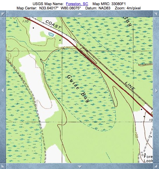
Guise Bay, SC
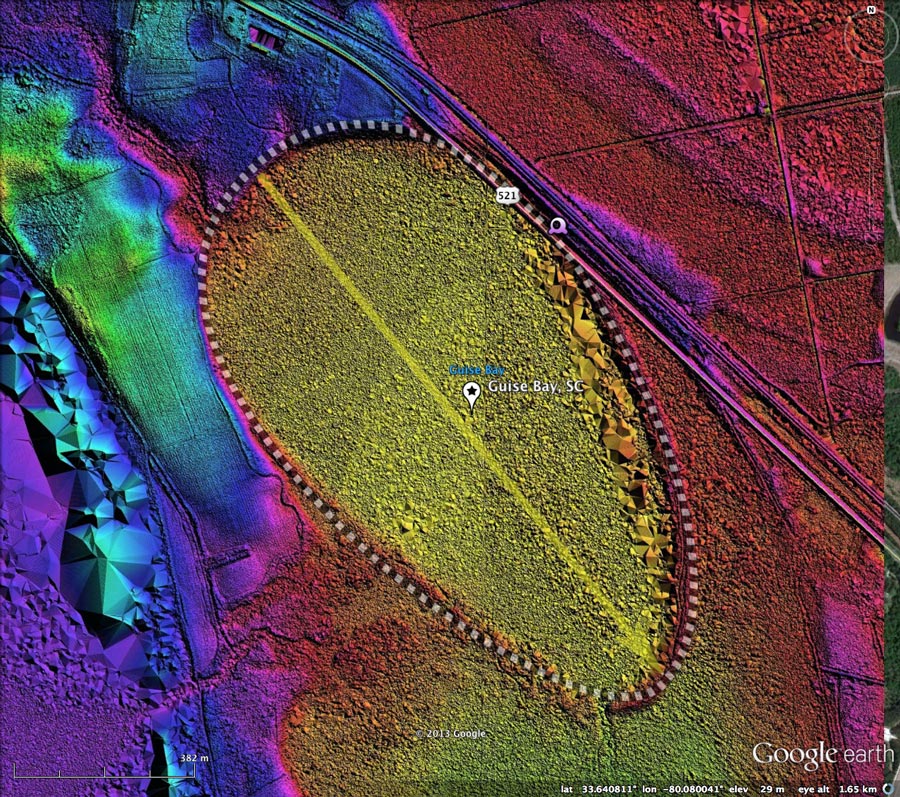
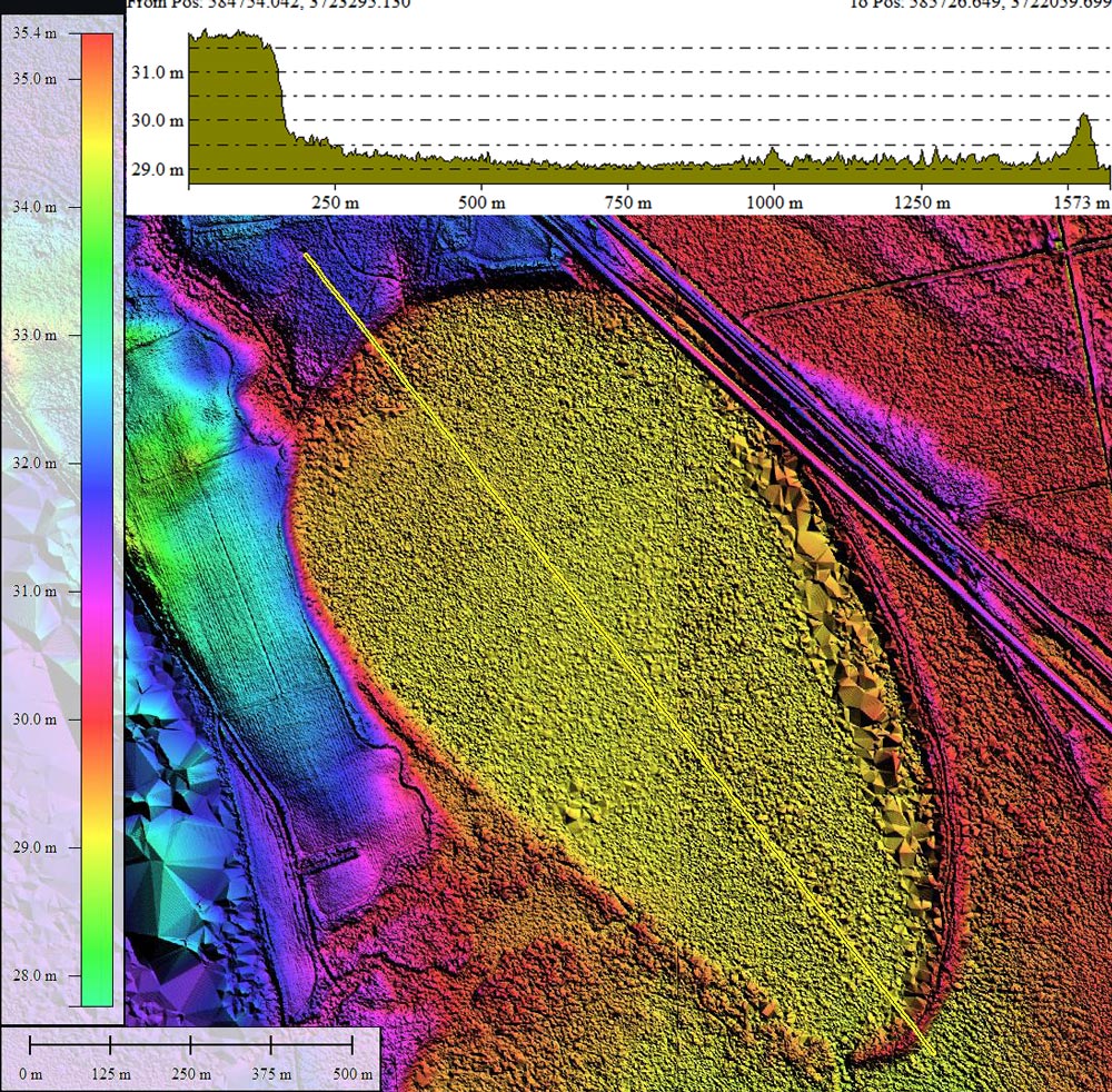
Today's Carolina Bay represents the typical bay in South Carolina, and adheres well to the baySouth archetype shape, The bay's orientation aligned with those of numerous nearby bays.
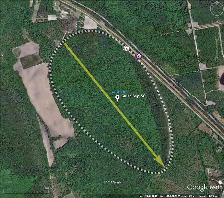
Guise Bay is a neighbor of a larger bay which hosts the Bennett's Bay Heritage Preserve, featured in an earlier CBotD : March 22, 2013 Bennett's Bay Heritage Preserve. Perhaps Guise Bay is also protected, as the bay appears to be very well preserved, excepting a nick in its northeastern rim made by the construction of Rt 521.
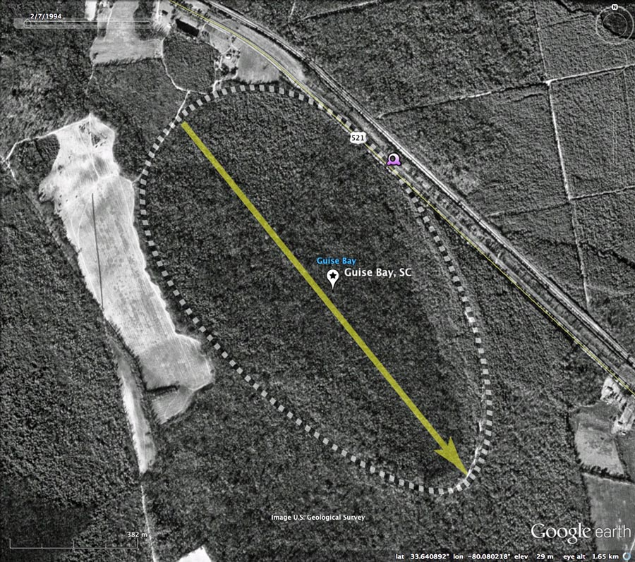
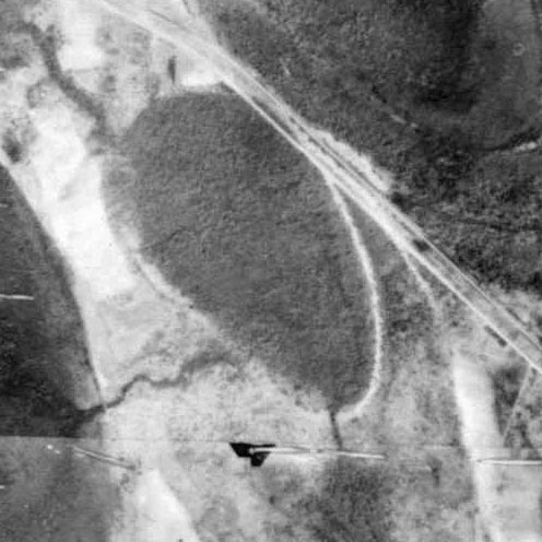
Included in the album is an historical aerial photo from 1948, sourced from the SC University Libraries Digital Collection. In the images, the bay's footprint is visible and there appears to be an artificial drainage channel extending from the south end of the bay down to the nearby drainage. The northeastern rim arc had already been cut by Rt 521's roadbed.
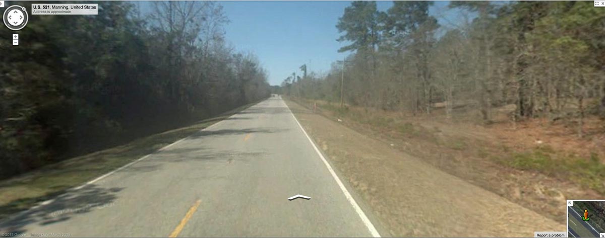
The Google Streetview image in the attached Photo Album (and placemarked in the KMZ)is looking northwest along US 521, showing rim rising on the right, and forested bay floor setting lower on left. In the far distance, there is a slight indication of the road rising out of the bay. Browse interactively in Google maps using: http://goo.gl/maps/hNouH
Guise Bay is a neighbor of a larger bay which hosts the Bennett's Bay Heritage Preserve, featured in an earlier CBotD : March 22, 2013 Bennett's Bay Heritage Preserve. Perhaps Guise Bay is also protected, as the bay appears to be very well preserved, excepting a nick in its northeastern rim made by the construction of Rt 521.
Included in the album is an historical aerial photo from 1948, sourced from the SC University Libraries Digital Collection. In the images, the bay's footprint is visible and there appears to be an artificial drainage channel extending from the south end of the bay down to the nearby drainage. The northeastern rim arc had already been cut by Rt 521's roadbed.
The Google Streetview image in the attached Photo Album (and placemarked in the KMZ)is looking northwest along US 521, showing rim rising on the right, and forested bay floor setting lower on left. In the far distance, there is a slight indication of the road rising out of the bay. Browse interactively in Google maps using: http://goo.gl/maps/hNouH
- Index #: 134320_5632
- Location: 33.64040528352307,-80.0801676688636
- Major: 1.41 km . . . Minor: 0.75 km
- Eccentricity: 0.843
- Area: 83.88 hectares
- Bearing: 141.03º
- Elevation: 29.09 m
- Archetype: baySouth
- Effective Diameter: 1,033.436 m
Copyright 2018 by Michael Davias