Bennett's Bay Heritage Preserve, SC
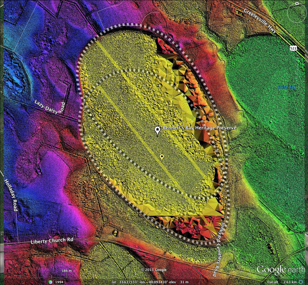
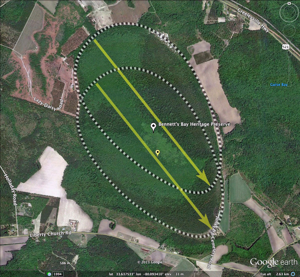
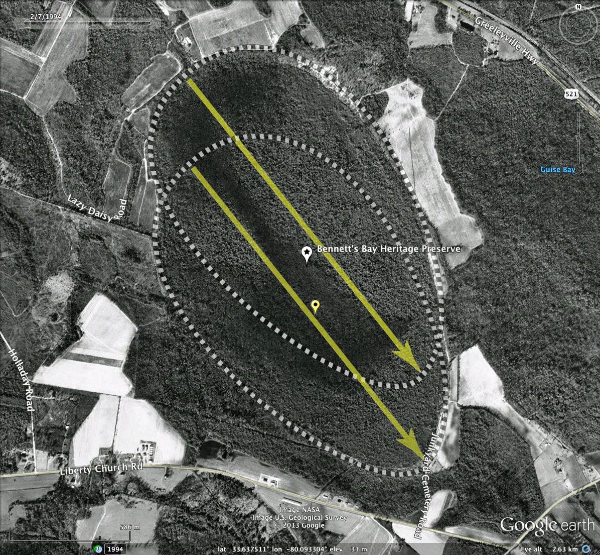
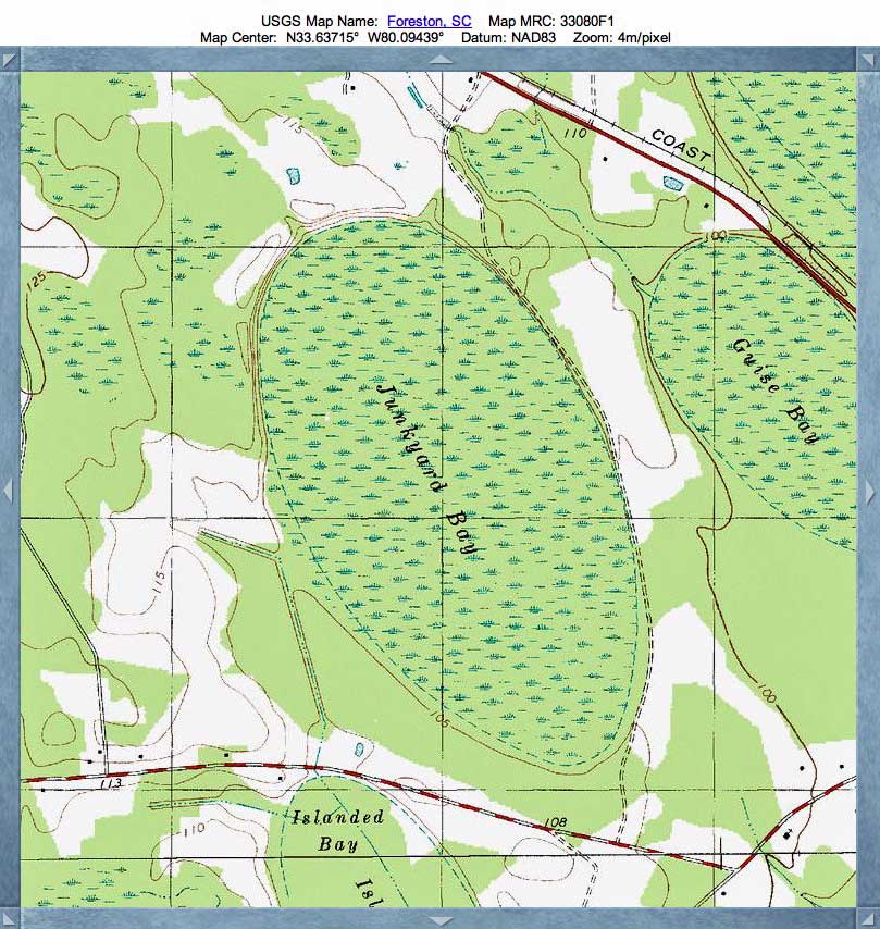
Highlighted today is one of the few large, intact bays remaining in South Carolina. Known today as Bennett's Bay Heritage Preserve, it was formally known as Junkyard Bay, which is how it appears on the USGS Topographic map in the attached album.
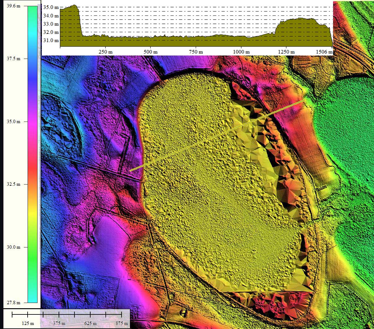
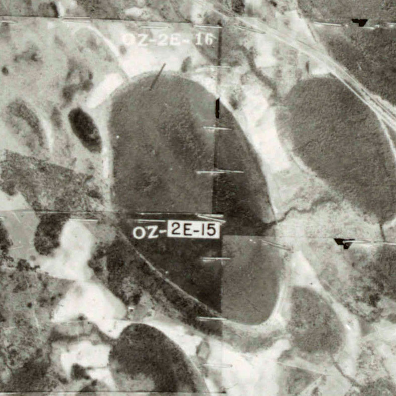
I interpret the bay's shape as being the mash-up of two identically shaped baySouth landforms, both sized (1.8 km) and oriented (141.54º) archetypes, slightly offset N-S and E-W. Seen in numerous other locations, the robust fit of conjoined templates such as these to the actual shape of a bay's rim may be an intriguing clue to their formation.
Many of the Carolina Bays have succumbed to our growing population’s desire to develop additional land. They are being logged, cleared, plowed, sliced up by roads, and built up at an alarming rate. In a recent survey, the South Carolina Department of Natural Resources identified 2,651 Bays, over two acres in area, in the state. It has been estimated that only 36 Bays are still relatively untouched. This bay is being preserved so that future generations will be able to continue to enjoy these unique elliptical shaped "botanical treasure houses" and continue the search for their origin.
Excerpts below from the South Carolina Department of Natural Resources.
Bennett's Bay Heritage Preserve is owned and managed by the S.C. Department of Natural Resources. It was purchased in 1986 from The Nature Conservancy using monies from the Heritage Land Trust Fund.
The major plant communities within Bennett's Bay are pocosin, a thick shrubby vegetation and the related pond-pine woodland bay forest. These three communities are indicative of a thick peat deposit. Peat is formed when plant material, usually deposited in wetlands, does not decompose. Bennett's Bay is unusual because of its location. Most of the peat-filled bays in South Carolina occur in Horry and Marion counties. Bennett's Bay is one of the westernmost peat-filled bays in the state.
The Carolina Bay Survey has identified and measured 792 bays in Octant 134320. Their location and metrics can be referenced through a Fusion Table spatial visualization.
- Index #: 134320_5437
- Location: 33.63517917494997,-80.09286631275855
- Major: 1.89 km . . . Minor: 1.08 km
- Eccentricity: 0.817
- Area: 161.75 hectares
- Bearing: 141.54º
- Elevation: 31.32 m
- Archetype: baySouth
- Effective Diameter: 1,435.082 m
- Index #: 134320_5537
- Location: 33.63902790497425,-80.09308899061931
- Major: 1.89 km . . . Minor: 1.08 km
- Eccentricity: 0.817
- Area: 161.74 hectares
- Bearing: 141.54º
- Elevation: 31.44 m
- Archetype: baySouth
- Effective Diameter: 1,435.038 m
Copyright 2018 by Michael Davias