Horseshoe Lake, NC
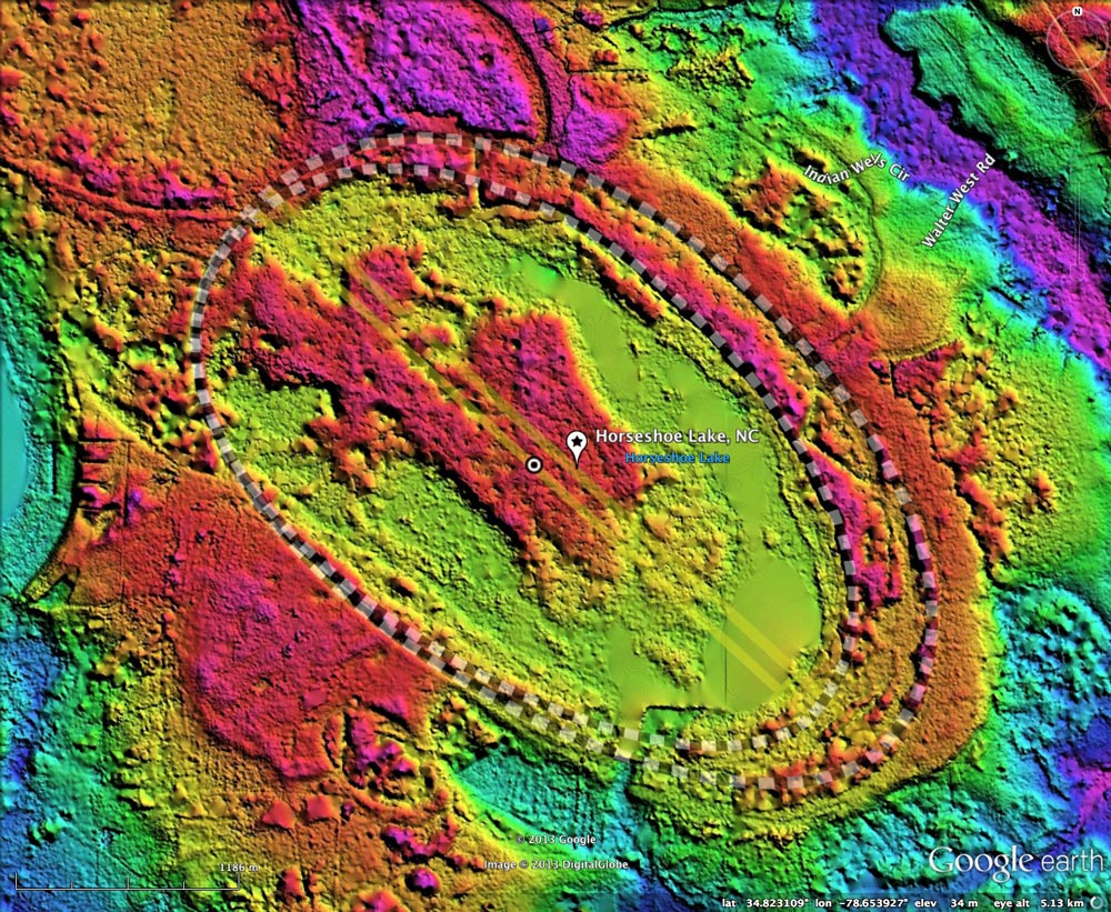
Horseshoe Lake Bay is a well-know Carolina Bay on the terraces of the Cape Fear River, 32 kilometers southeast of Fayetteville, NC. The name is derived from the shape of the open water lake seen within the gentle depression. The remainder of the basin floor is densely forested.
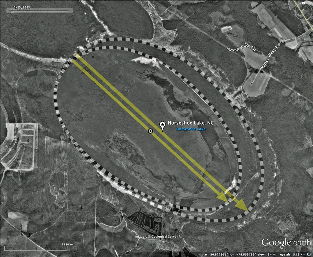
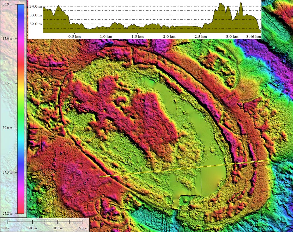
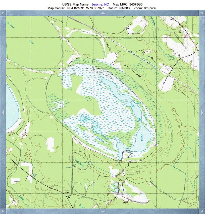
I interpret the shape of this bay as being created by the overlap of two of the most common bayCarolina templates. The two shapes used are almost identical, both having an orientation of 132.38º and with only a slight difference in size. The smaller shape fits fully within the large one, but both are conjoined at the northwestern tip of the bay. This juxtaposition leaves an area between the two rims on the southeastern end, which on several other large bays is filled with small "toe" bays. Toe bays actually may exist here, but the early generation South Carolina LiDAR can't penetrate the dense canopy. The result is tree tops which return as "hills", and un-vegetated sandy rims which are visualized as ditches.
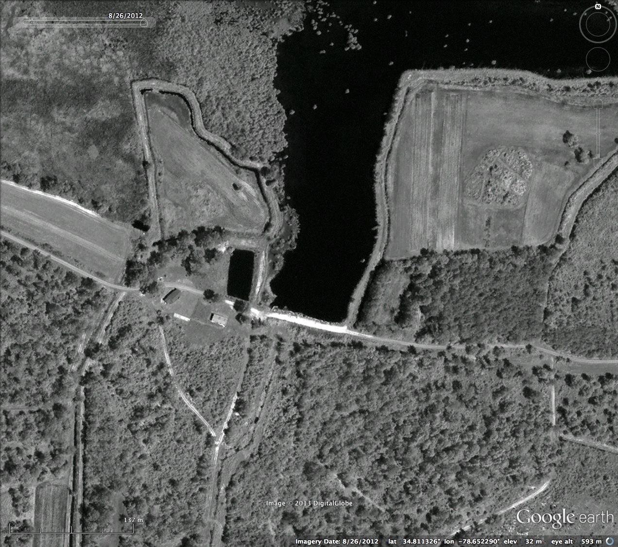
The open water in the bay today is likely supported by a dam located across a man-made opening in the southern rim. A detailed Google satellite image of the dam structure is included in the Photo Album. In the vast majority of bays, this type of rim opening was cut and remains open to drain the depression.
The Nature Conservancy has this to say about Horseshoe Lake [http://goo.gl/cI1t4]:
I interpret the shape of this bay as being created by the overlap of two of the most common bayCarolina templates. The two shapes used are almost identical, both having an orientation of 132.38º and with only a slight difference in size. The smaller shape fits fully within the large one, but both are conjoined at the northwestern tip of the bay. This juxtaposition leaves an area between the two rims on the southeastern end, which on several other large bays is filled with small "toe" bays. Toe bays actually may exist here, but the early generation South Carolina LiDAR can't penetrate the dense canopy. The result is tree tops which return as "hills", and un-vegetated sandy rims which are visualized as ditches.
The open water in the bay today is likely supported by a dam located across a man-made opening in the southern rim. A detailed Google satellite image of the dam structure is included in the Photo Album. In the vast majority of bays, this type of rim opening was cut and remains open to drain the depression.
The Nature Conservancy has this to say about Horseshoe Lake [http://goo.gl/cI1t4]:
In 1998, the State of North Carolina purchased approximately 8,000 acres of the Horseshoe Lake natural area in Bladen and Cumberland Counties from Canal Industries, Inc. The tract is now managed by the N.C. Wildlife Resources Commission as the Bladen County Game Land and is open to the public for hiking, fishing, boating, birding, and special permit hunting. The Nature Conservancy assisted the State with the acquisition of the Horseshoe Lake property. In addition, Dohn Broadwell is donating a series of conservation easements to The Nature Conservancy that will eventually protect 1,915 acres adjacent to the game land.
The expansive, partially water-filled Carolina bay is dominated by unusual vegetation, such as floating and rooted aquatic plant beds, floating bog mats, and pond cypress stands, that may have been created naturally after deep peat fires or possibly developed from beaver ponds. The lands surrounding the bay contain other rare natural communities, including pocosin, Atlantic white cedar forest, and pond pine woodland. The rim of the bay is characterized by pine flatwood, sandhills scrub communities, and an array of rare plants, including populations of Venus flytrap, white wicky, and threadleaf sundew. In addition to the rare anhinga, Horseshoe Lake is home to waterfowl, American alligator, fox squirrel, pine barrens treefrog, and mammals such as black bear and bobcat that require large expanses of land.
The expansive, partially water-filled Carolina bay is dominated by unusual vegetation, such as floating and rooted aquatic plant beds, floating bog mats, and pond cypress stands, that may have been created naturally after deep peat fires or possibly developed from beaver ponds. The lands surrounding the bay contain other rare natural communities, including pocosin, Atlantic white cedar forest, and pond pine woodland. The rim of the bay is characterized by pine flatwood, sandhills scrub communities, and an array of rare plants, including populations of Venus flytrap, white wicky, and threadleaf sundew. In addition to the rare anhinga, Horseshoe Lake is home to waterfowl, American alligator, fox squirrel, pine barrens treefrog, and mammals such as black bear and bobcat that require large expanses of land.
The Nature Conservancy
- 139314_2861
- Location: 34.82182990405309,-78.65379766893656
- Major: 4.47 km . . . Minor: 2.71 km
- Eccentricity: 0.795
- Area: 954.04 hectares
- Bearing: 132.38º
- Elevation: 33.75 m
- Archetype: bay
- Effective Diameter: 3,485.281 m
- 139314_2862
- Location: 34.822056086649184,-78.65621429587513
- Major: 4.04 km . . . Minor: 2.36 km
- Eccentricity: 0.81
- Area: 752.16 hectares
- Bearing: 132.38º
- Elevation: 33.67 m
- Archetype: bay
- Effective Diameter: 3,094.637 m
Copyright 2018 by Michael Davias