Rasmussen Bay, MD
This Carolina Bay has been named by me in honor of William "Wild Bill" C. Rasmussen, a geologist who spent considerable time and intellectual capital trying to understand the gentle depressions seen across New Jersey and the Delmarva Peninsula.
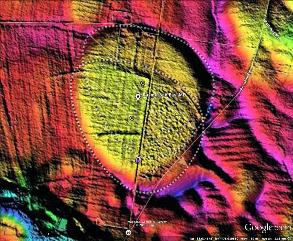
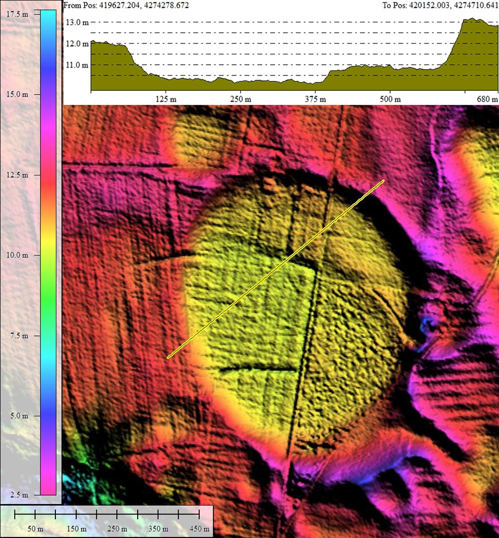
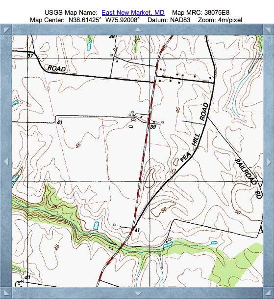
I interpret the shape of this particular bay as being created by the overlap of two of the bayBell archetype shapes so common here. The two templates used are almost identical, both having an orientation of 132.16º and with only a slight difference is size. Close inspection of the bay floor in the LiDAR will demonstrate the slight elevation difference between the two templates areas, with the northern section being between 1/2 meter and a full meter higher; the arc of the rim of the southern template defines the arc of the step. (also reference the elevation profile map in the Photo Album)
While studying at Bryn Mawr College, Dr. Rasmussen wrote his doctor thesis on the subject of bay geomorphology. He continued this research as he conducted his "day job" activities with the USGS, where he was the chief of the Salisbury office. His 1958 paper, Hydrologic budget of the Beaverdam Creek basin, Maryland, was written with G.E. Andreasen. The authors made an extensive effort to provide a historical summary of research on Carolina Bay geomorphology. They provided this observation regarding the landform I have christened as Rasmussen Bay:
In order to demonstrate whether solution of underlying beds containing lime carbonate was the major cause in producing the basins, Rasmussen and Slaughter (1957) had 4 test holes drilled along the long axis of a prominent basin 1 mile north of East New Market, Dorchester County, about 28 miles northwest of the Beaverdam Creek drainage area. This basin has the shape and orientation of a classic "Carolina bay." It is outlined by the hachured 40-foot contour line on the East New Market quadrangle, Maryland (Corps of Engineers, 7i/£-minute series, 1942) and is shown well on aerial photo ANJ-7K 10K of the U. S. Department of Agriculture, 1952. The long axis of this basin is about 2,800 feet long, bearing about N. 35° W. The relief from the center (altitude 35 feet) to the south rim (altitude 52 feet) is 17 feet, and to the north rim (altitude 45 feet), 10 feet. The holes were drilled to depths ranging from 126 to 210 feet. - The section penetrated included about 55 feet of gravelly sand, 55 feet of light-gray silt, 50 feet of gray sandy silt with shell fragments, and 50 feet of gray fine sand. The top of the bed containing shell fragments had a uniform dip of 17 feet to the mile southeastward. The subsurface structure so far as shown by the test holes did not reflect in any manner the pronounced basin on the surface. Consequently, it is concluded that this basin, at least, is not a sinkhole structure produced by solution of underlying artesian beds, or aquicludes.
Continuing on to a broader discussion of the basins, the authors made this observation of bays on the Delmarva coastal plain:
These sandy rims are of low relief: the maximum relief, rim to center, is found in the basin in which the Salisbury airport is situated, where the sandhill on the eastern rim is 22 feet higher than the head of drainage near the airport entrance. The average relief of many basins is slightly less than 10 feet. The rims of the basins are not horizontal, except for those deposited on level ground; most of them lie on the gentle terrace slopes. The rims are highest where two or more basins coalesce.
If these landforms on the Atlantic Coastal Plain are of two modes of origin, then it is necessary to demonstrate wherein they differ, and to draw the lines, geographically, between the bays and basins. It would not be objective to reject some basin forms merely because they did not meet preconceived notions of axial orientation or of perfection in shape. The poorly formed basins must be considered with those of regular or well-defined outline. In fact, the less regular or exceptionally irregular basins might provide clues to origin which otherwise would be overlooked.
[USGS Pubs Link ]
I have made available as a PDF the section of the Rasmussen & Slaughter (1957) text referenced in the quote above above: LINK . The following text is from that document:
To evaluate one of these basins in the subsurface, a basin which has a pronounced topographic expression was selected in Dorchester County, about 1 mile north of East New Market. It is readily discernible by the dip into the basin on State Highway 11.
I must note the reference made above to "SR 11", whereas the bay being discussed here is 1 mile due north of East New Market on what is today SR 16, and there are no other bays of this size nearby.
But most impactful to me was Dr. Rasmussen observation:
“Their very randomness of grouping and scatter demands an explanation.
As a statistical phenomenon, they deserve to be studied statistically.”
W.C. Rasmussen
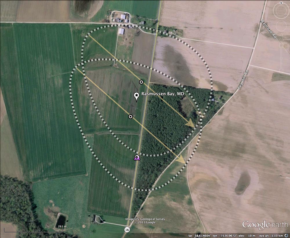
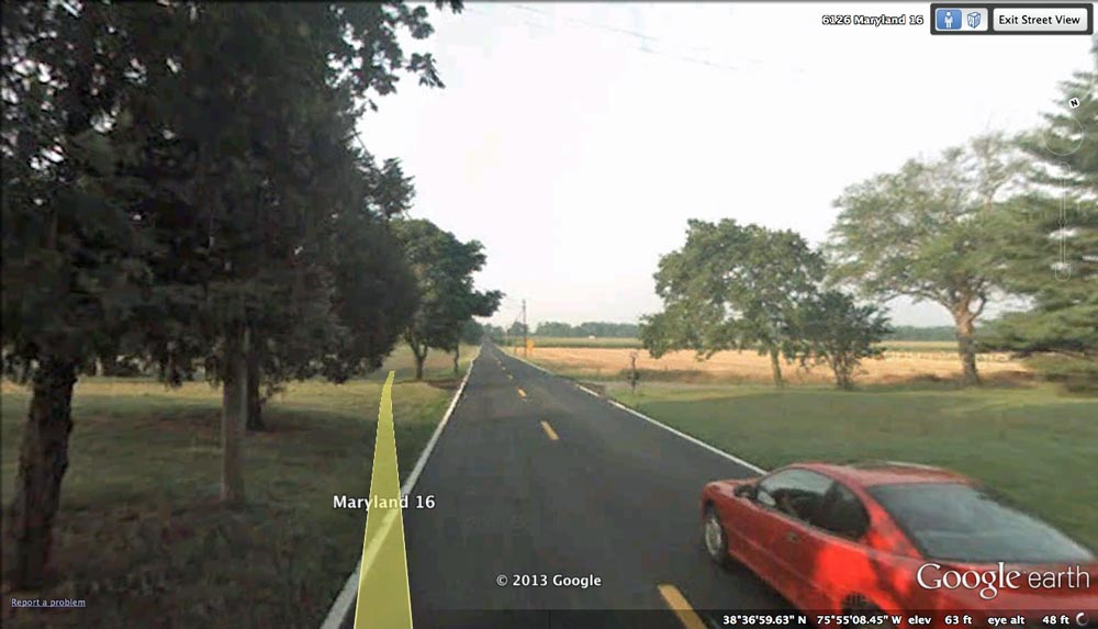
A Google Streetview in the attached Photo Album looks south as the road cuts though the northern rim and into the basin; note the land rises on either side. In the distance, the open field of the basin can be seen rising up onto the rim on the far side of the bay. Browse interactively using the place mark in the referenced KMZ file, or using your web browser in Google maps at this LINK:
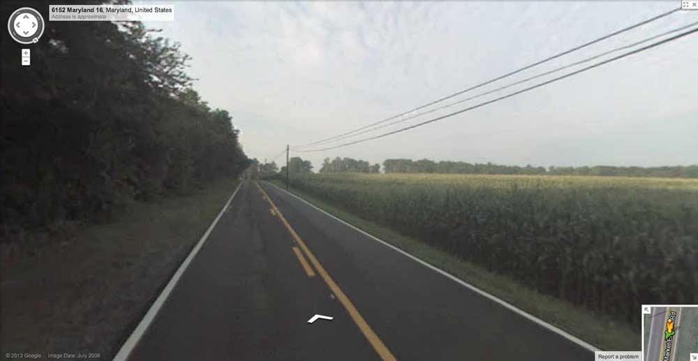
Continuing further south, another Google Streetview image from inside the bay is included It shows a closer view of the road passing towards, up and over the rim, just past the telephone pole. Browse interactively in Google maps starting HERE.
Continuing further south, another Google Streetview image from inside the bay is included It shows a closer view of the road passing towards, up and over the rim, just past the telephone pole. Browse interactively in Google maps starting HERE.
- Index #: 154303_4667
- Location: 38.61518149030742,-75.91938973177929
- Major: 0.64 km . . . Minor: 0.53 km
- Eccentricity: 0.568
- Area: 27.29 hectares
- Bearing: 132.16º
- Elevation: 10.39 m
- Archetype: bayBell
- Effective Diameter: 589.463 m
- Index #: 154303_4567
- Location: 38.613785687719,-75.9199509132689
- Major: 0.67 km . . . Minor: 0.51 km
- Eccentricity: 0.638
- Area: 27.24 hectares
- Bearing: 132.16º
- Elevation: 10.15 m
- Archetype: bayBell
- Effective Diameter: 588.922 m
Copyright 2018 by Michael Davias