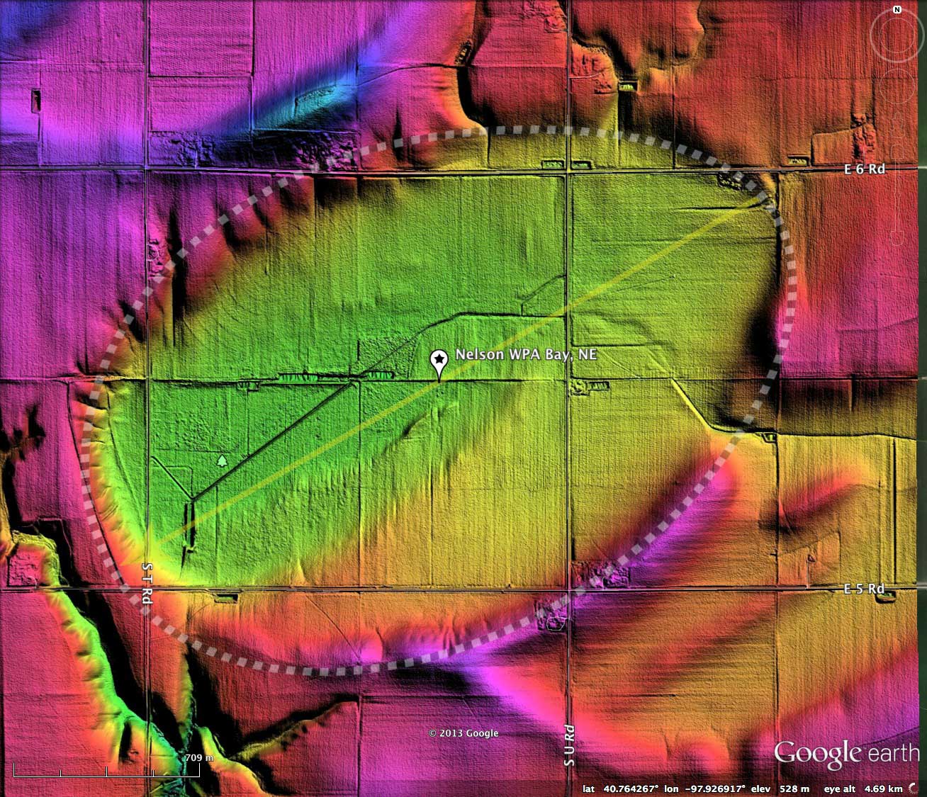
Nelson WPA Bay, NE
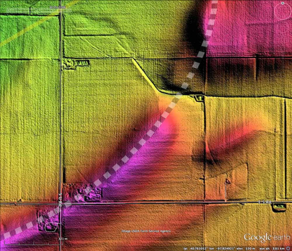
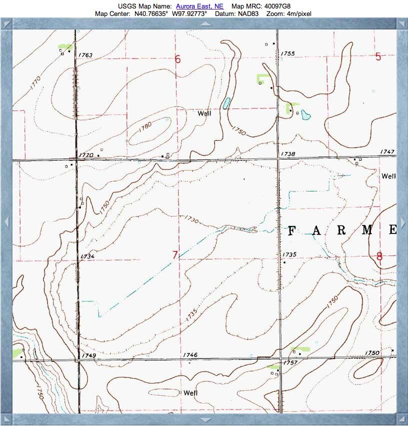
This gentle valley in Nebraska was likely considered fine farmland even prior to artificial drainage channels being dug across the landform, because a naturally-occurring drainage channel is apparent in the LiDAR, and it leads out through the eastern rim. The bay is located in Hamilton County, 4½ miles south and 3 miles east of Aurora exit I-80. It has no formal USGS genome, so I named the bay after the resident WPA park.
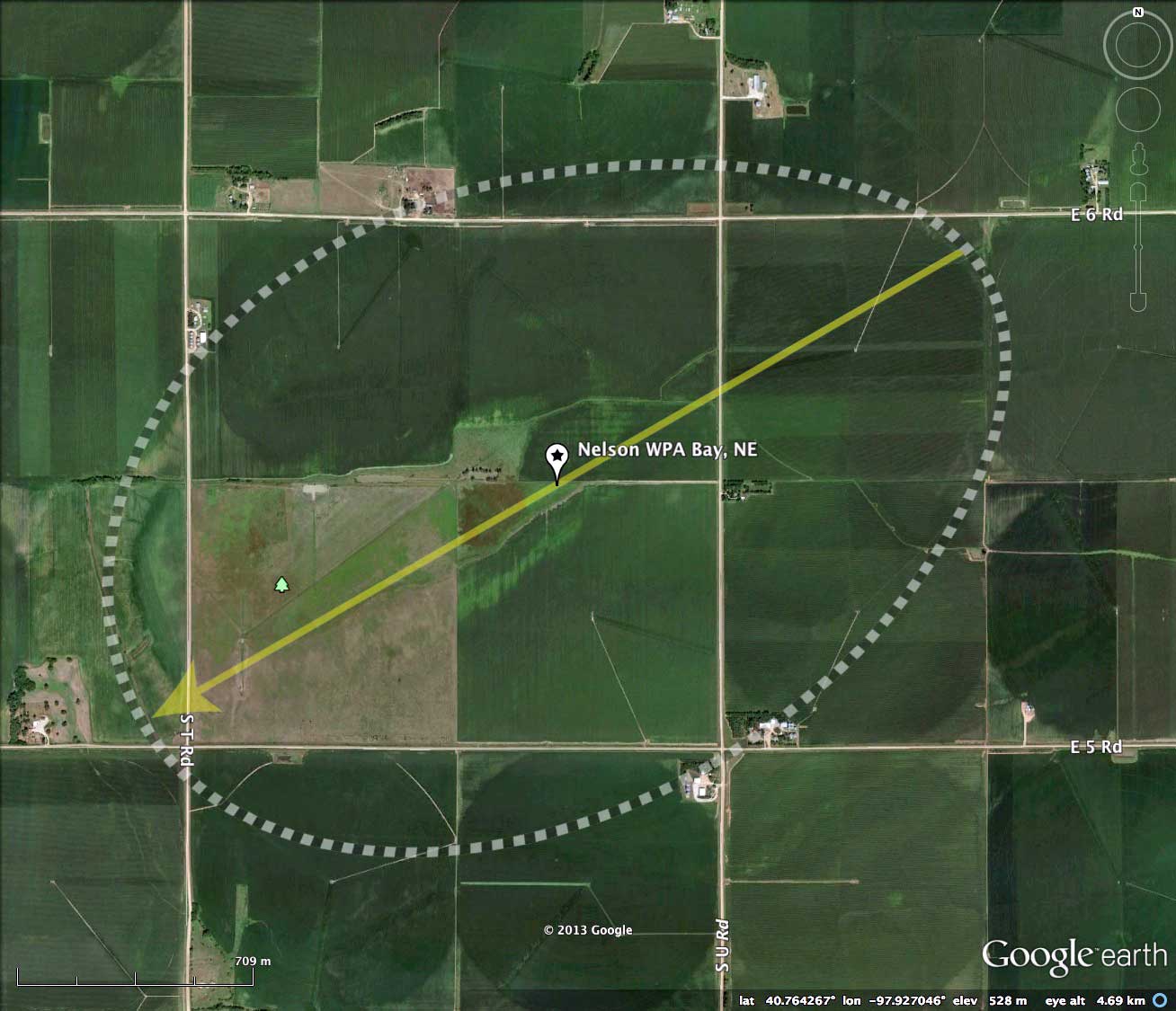
The bay fits the bayWest archetype shape well. Located slightly to the northwest is Bergeson Basis, which was our CBoD for 12/26/2012 [ LINK]. Both basins have an orientation of about 241º. I encourage the reader to open up the two associated KMZ files in Google Earth, and using the edit tools, see how well either overlay works well in both basins.
The area is home to the Nelson Federal Waterfowl Production Area. The habitat supports pheasant and waterfowl; nontoxic shot only allowed. The WPA covers 160 acres.
The U.S. Fish and Wildlife Service offers a PDF (12MB, September 2011) discussing their comprehensive Land Protection Plan for the Rainwater Basin Wetland Management District. LINK From the Introduction:
"The Rainwater Basin was once covered by native prairie and was largely isolated from streams and natural drainages. Heavy rains or snow melts would fill the numerous shallow depressions scattered throughout the region... Today, the landscape is dramatically changed. The expansive grasslands and numerous wetlands have been replaced with fields of corn and soybeans. Roads traverse the landscape at 1-mile intervals, and small rural communities are scattered within a 10-mile radius of one another. Many of the wetlands have been filled or drained, reducing their numbers to only about 16 percent of their historical level."
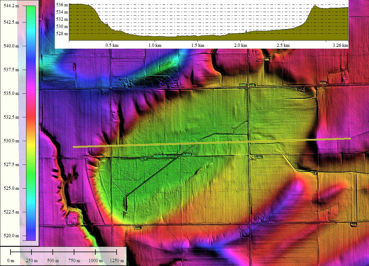
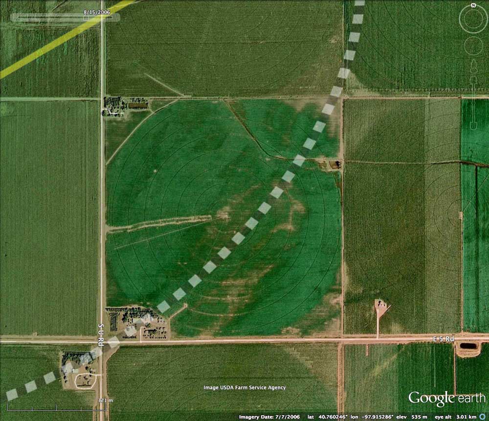
The rims of the Carolina Bays and their western cousins, the Rainwater Basins, are exceedingly gentle and low in relief. The hsv-shaded LiDAR does punch up their visibility, but on the ground they are often invisible to the naked eye. As an example, I have placed two images from the southeastern quadrant of Nelson WPA Bay in the attached album. One is a 2008 Google Satellite image, and the other is the hsv-shaded LiDAR DEM. While the LiDAR makes the rim here look massive, the satellite view suggest that on the ground a rotating irrigation gantry has been traversing the rim (and the drainage outlet through the rim) with no apparent difficulty.
The Carolina Bay Survey has identified and measured ~300 bays in _Octant 163391_. Their location and metrics can be referenced through a Fusion Table spatial visualization.
The bay fits the bayWest archetype shape well. Located slightly to the northwest is Bergeson Basis, which was our CBoD for 12/26/2012 [ LINK]. Both basins have an orientation of about 241º. I encourage the reader to open up the two associated KMZ files in Google Earth, and using the edit tools, see how well either overlay works well in both basins.
The area is home to the Nelson Federal Waterfowl Production Area. The habitat supports pheasant and waterfowl; nontoxic shot only allowed. The WPA covers 160 acres.
The U.S. Fish and Wildlife Service offers a PDF (12MB, September 2011) discussing their comprehensive Land Protection Plan for the Rainwater Basin Wetland Management District. LINK From the Introduction:
"The Rainwater Basin was once covered by native prairie and was largely isolated from streams and natural drainages. Heavy rains or snow melts would fill the numerous shallow depressions scattered throughout the region... Today, the landscape is dramatically changed. The expansive grasslands and numerous wetlands have been replaced with fields of corn and soybeans. Roads traverse the landscape at 1-mile intervals, and small rural communities are scattered within a 10-mile radius of one another. Many of the wetlands have been filled or drained, reducing their numbers to only about 16 percent of their historical level."
The rims of the Carolina Bays and their western cousins, the Rainwater Basins, are exceedingly gentle and low in relief. The hsv-shaded LiDAR does punch up their visibility, but on the ground they are often invisible to the naked eye. As an example, I have placed two images from the southeastern quadrant of Nelson WPA Bay in the attached album. One is a 2008 Google Satellite image, and the other is the hsv-shaded LiDAR DEM. While the LiDAR makes the rim here look massive, the satellite view suggest that on the ground a rotating irrigation gantry has been traversing the rim (and the drainage outlet through the rim) with no apparent difficulty.
The Carolina Bay Survey has identified and measured ~300 bays in _Octant 163391_. Their location and metrics can be referenced through a Fusion Table spatial visualization.
- Index #: 163391_0570
- Location: 40.76352800773517,-97.9268674804149
- Major: 2.92 km . . . Minor: 1.95 km
- Eccentricity: 0.742
- Area: 448.7 hectares
- Bearing: 240.06º
- Elevation: 527.27 m
- Archetype: bayWest
- Effective Diameter: 2,390.191 m

Copyright 2018 by Michael Davias