Kingsburg Bay, SC
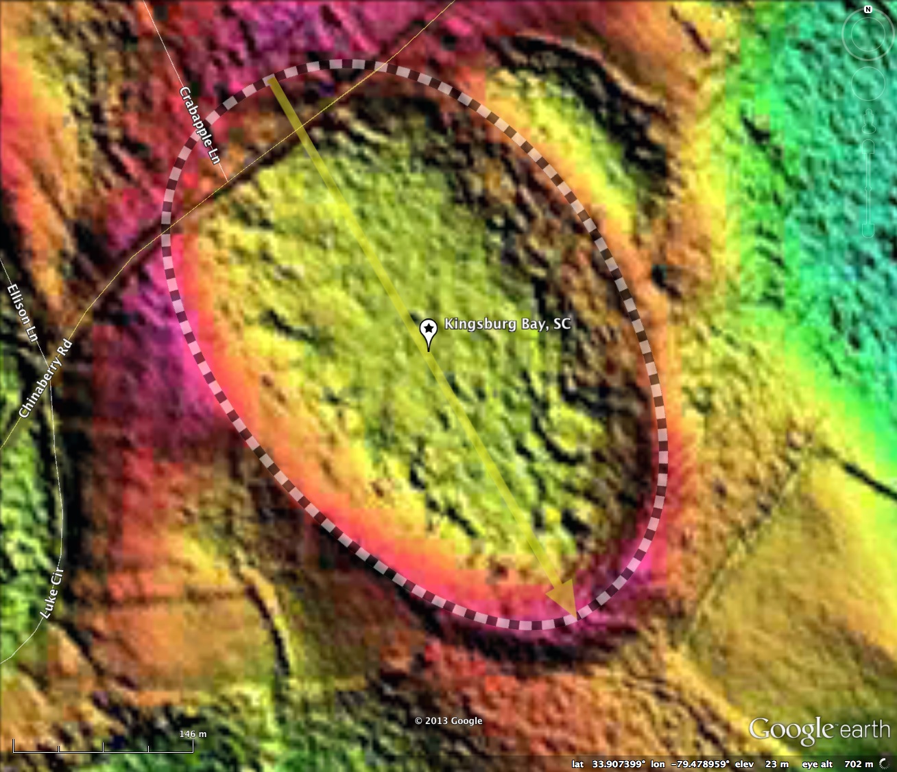
Kingsburg Bay is a very unique Carolina Bay in Kingsburg, Lower Florence County that is being extensively studied for its unique plant and animal communities. The bay presents a classic bayCarolina archetype shape and has an orientation consistent with other bays in the vicinity.
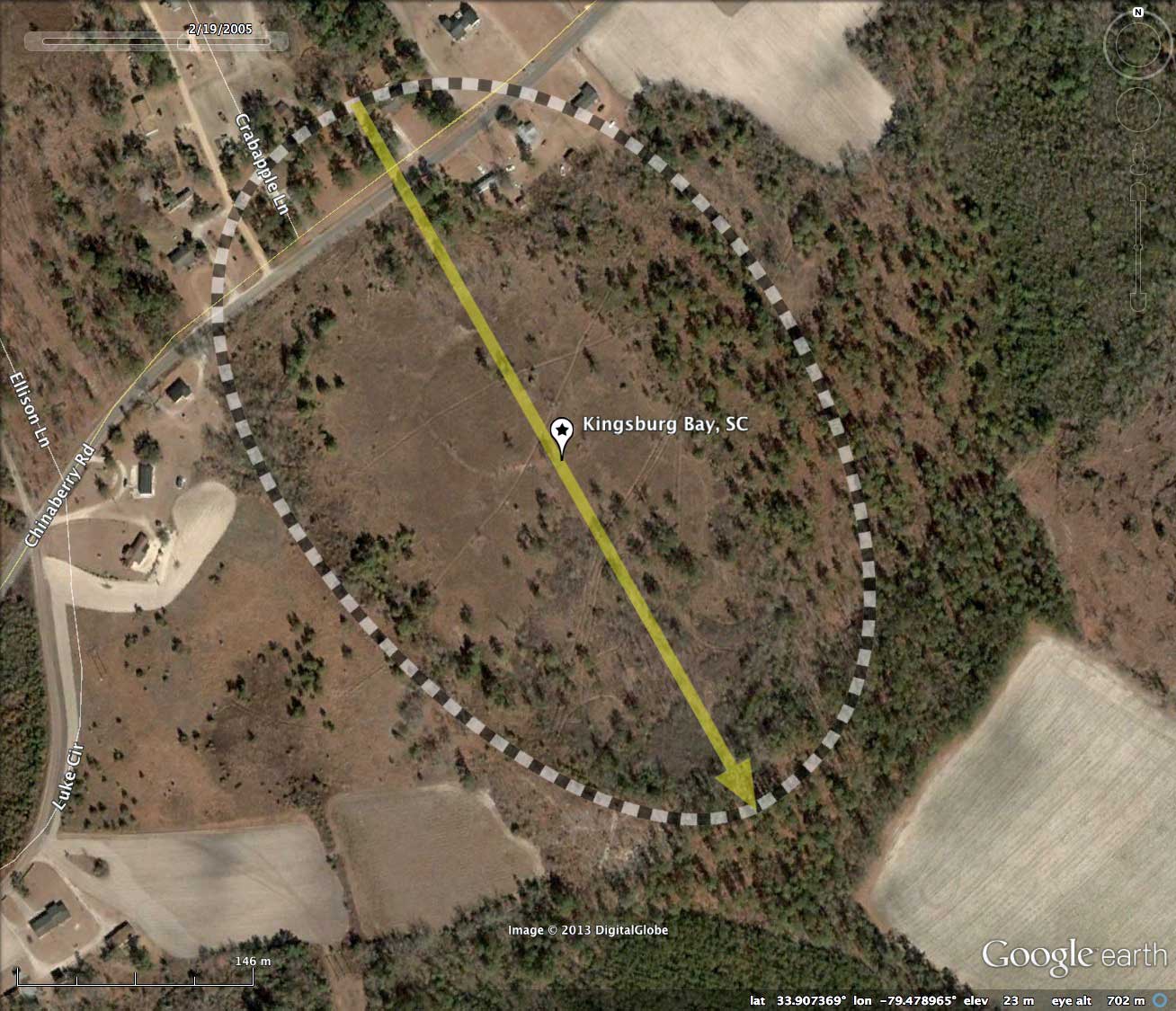
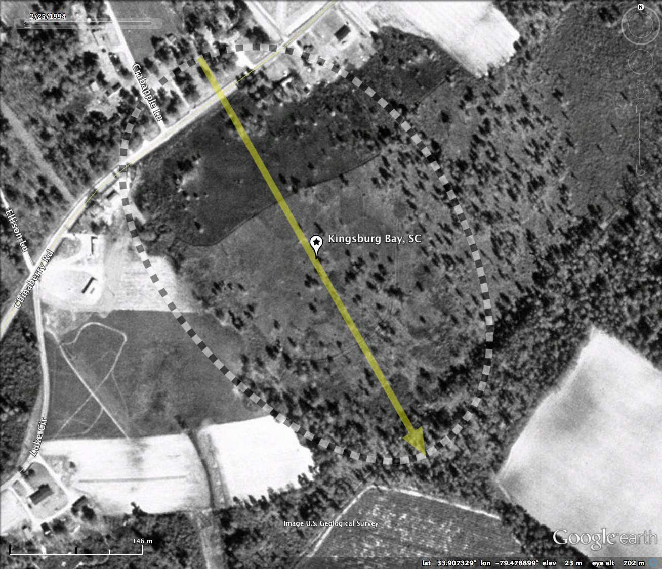
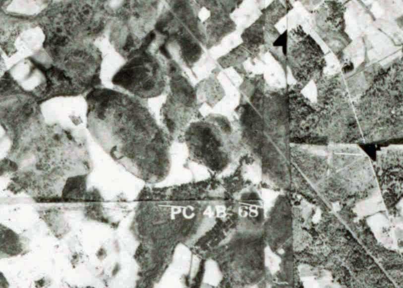
Included in the album are two historical aerial photos (1941 & 1954), sourced from the SC University Libraries Digital Collection. Both images support a finding that the bay has remained in a natural state.
The 2013 Ecological Society of America hosts a comprehensive data set of flora found in this bay on their Vegibank.org web site. LINK
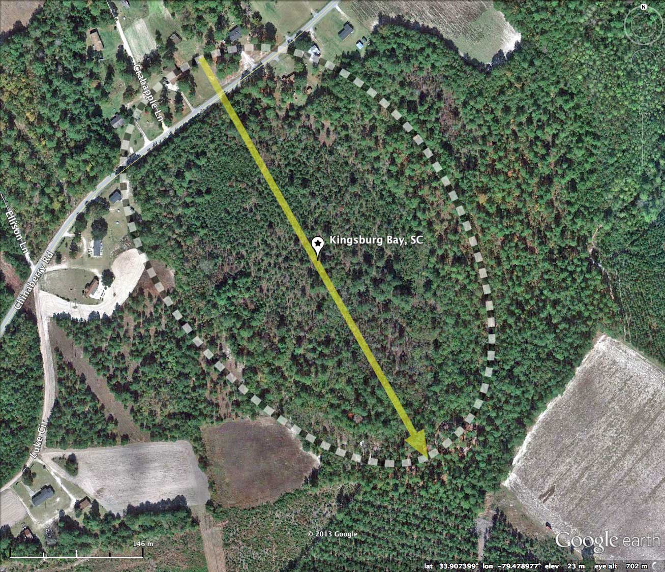
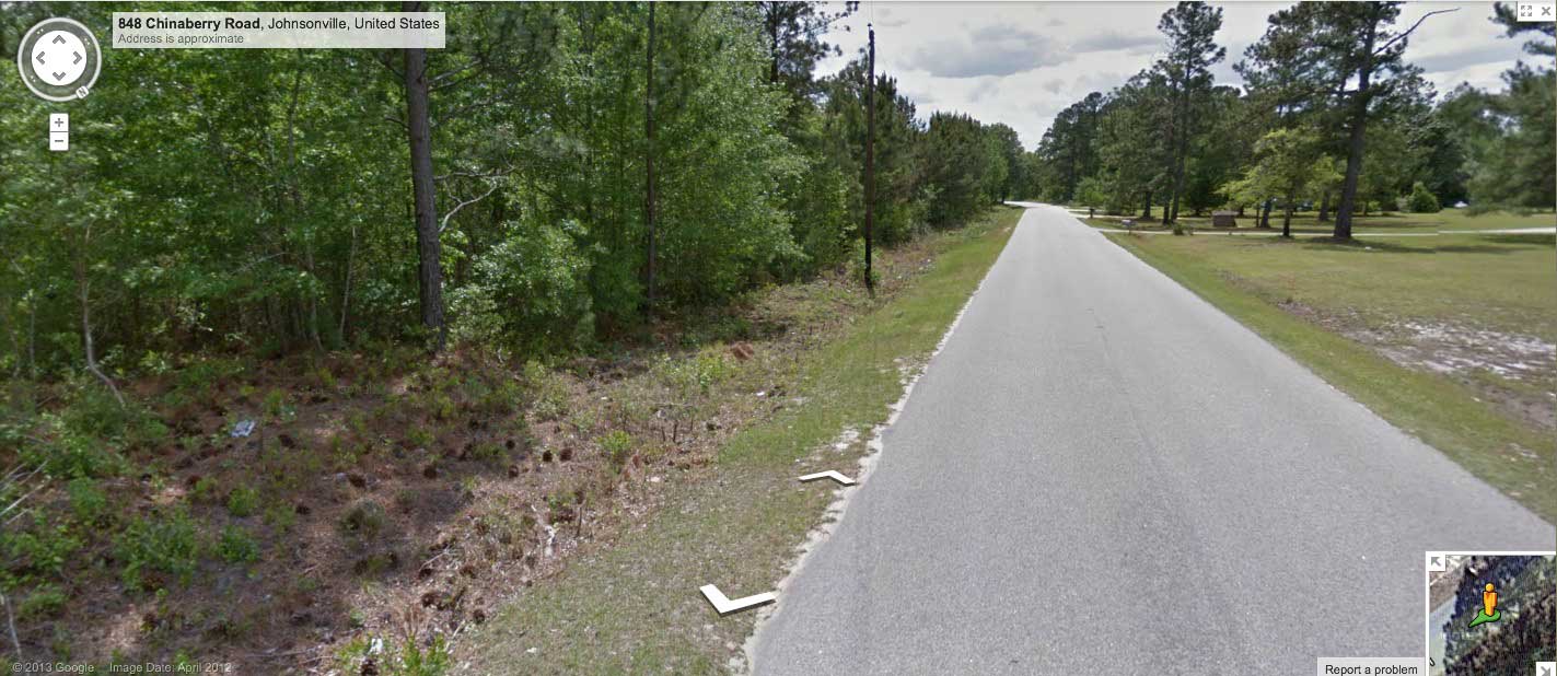
Google Streetview imagery is available along Chinaberry Road as it passes over the rim and across the northern end of the bay. An image in the album and placemarked in the KMZ file shows the elevated rim at the roadbed's level in the foreground, and the bay floor dropping off to the south (left) further down. In the distance, near the curve in the road, the bay floor again rises to meet the rim.
The LiDAR suggest the small area north of the roadway was a filled in to secure the homesites. Explore the Streetview interactively in your browser HERE.
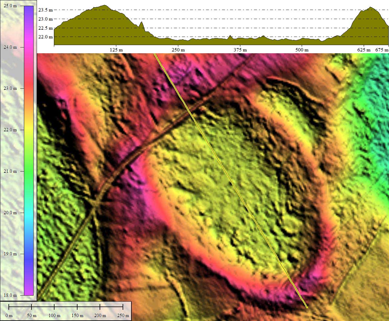
The Carolina Bay Survey has identified and measured ~70 bays in Octant 135317. Their location and metrics can be referenced through a Fusion Table spatial visualization.
Included in the album are two historical aerial photos (1941 & 1954), sourced from the SC University Libraries Digital Collection. Both images support a finding that the bay has remained in a natural state.
The 2013 Ecological Society of America hosts a comprehensive data set of flora found in this bay on their Vegibank.org web site. LINK
Google Streetview imagery is available along Chinaberry Road as it passes over the rim and across the northern end of the bay. An image in the album and placemarked in the KMZ file shows the elevated rim at the roadbed's level in the foreground, and the bay floor dropping off to the south (left) further down. In the distance, near the curve in the road, the bay floor again rises to meet the rim.
The LiDAR suggest the small area north of the roadway was a filled in to secure the homesites. Explore the Streetview interactively in your browser HERE.
The Carolina Bay Survey has identified and measured ~70 bays in Octant 135317. Their location and metrics can be referenced through a Fusion Table spatial visualization.
- Index #: 135317_6291
- Location: 33.90723871797135,-79.47894140604384
- Major: 0.52 km . . . Minor: 0.33 km
- Eccentricity: 0.758
- Area: 13.84 hectares
- Bearing: 147.32º
- Elevation: 21.89 m
- Archetype: bay
- Effective Diameter: 419.781 m

Copyright 2018 by Michael Davias