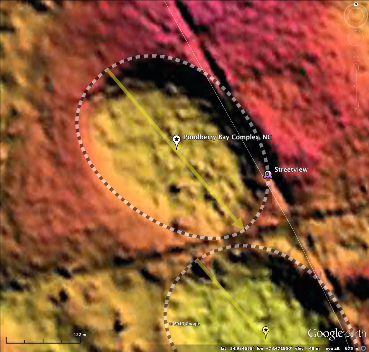
Pondberry Bay Complex, NC
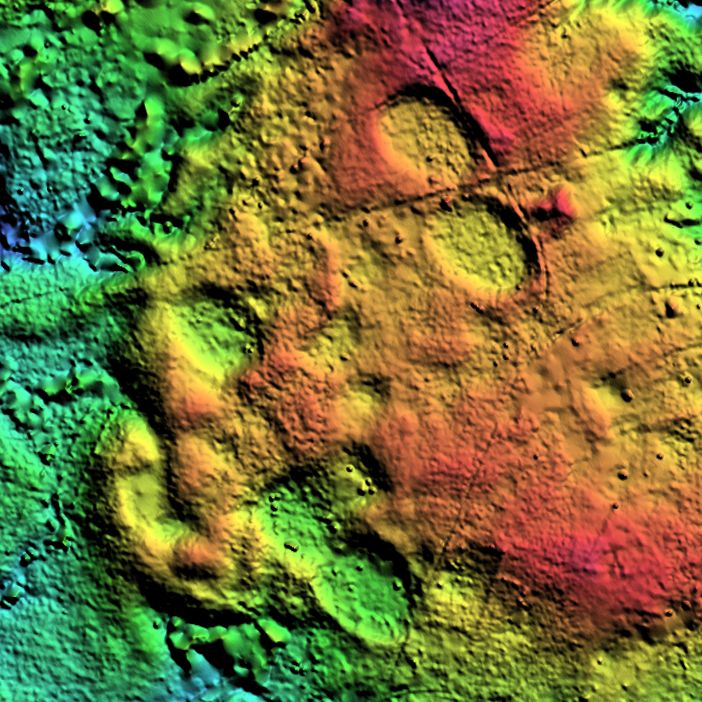
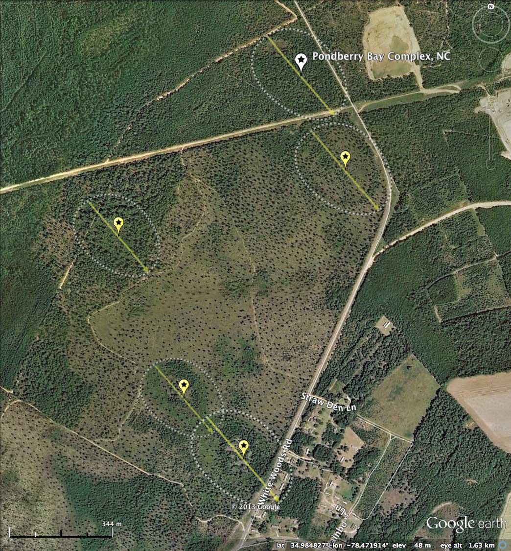
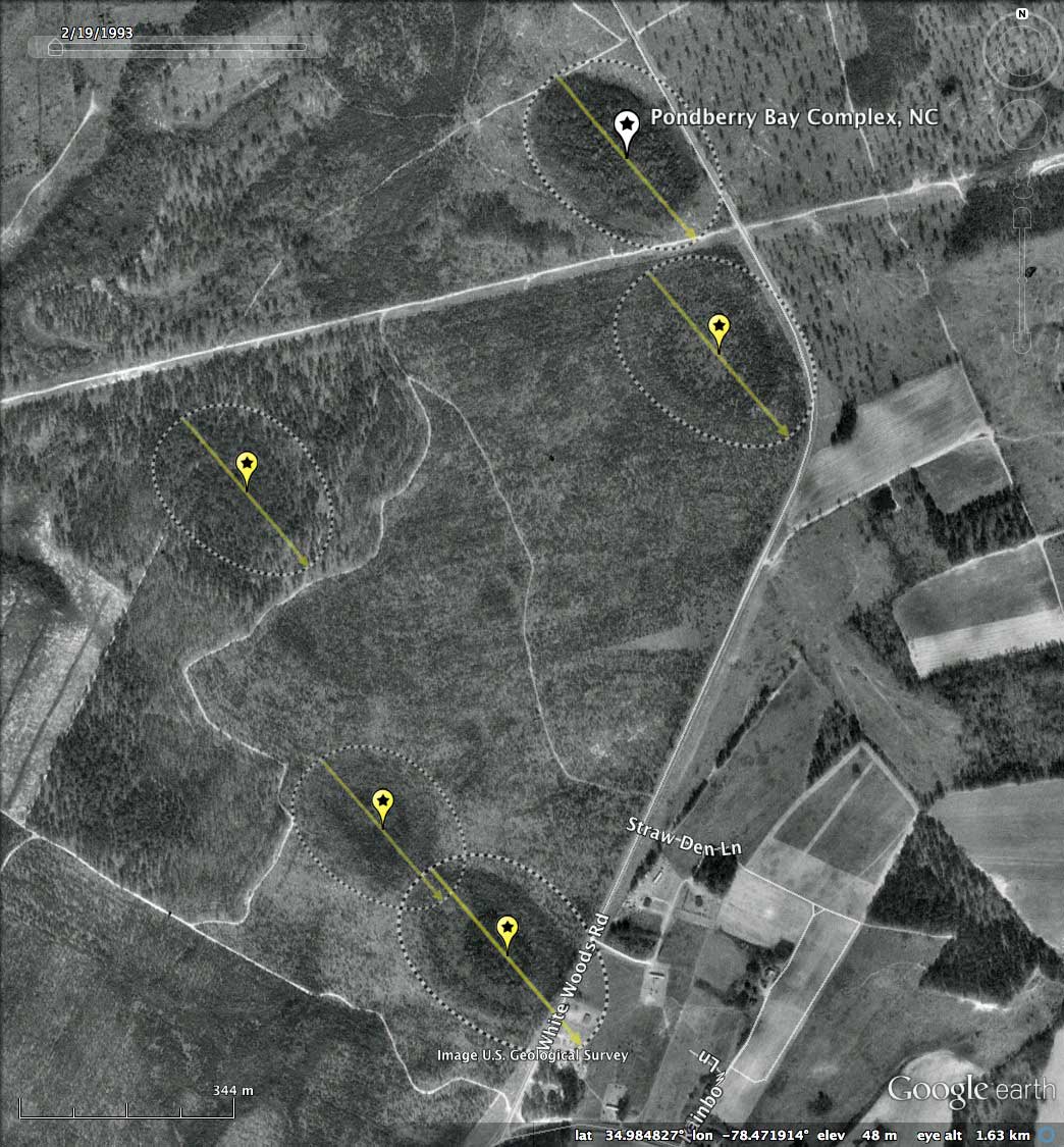
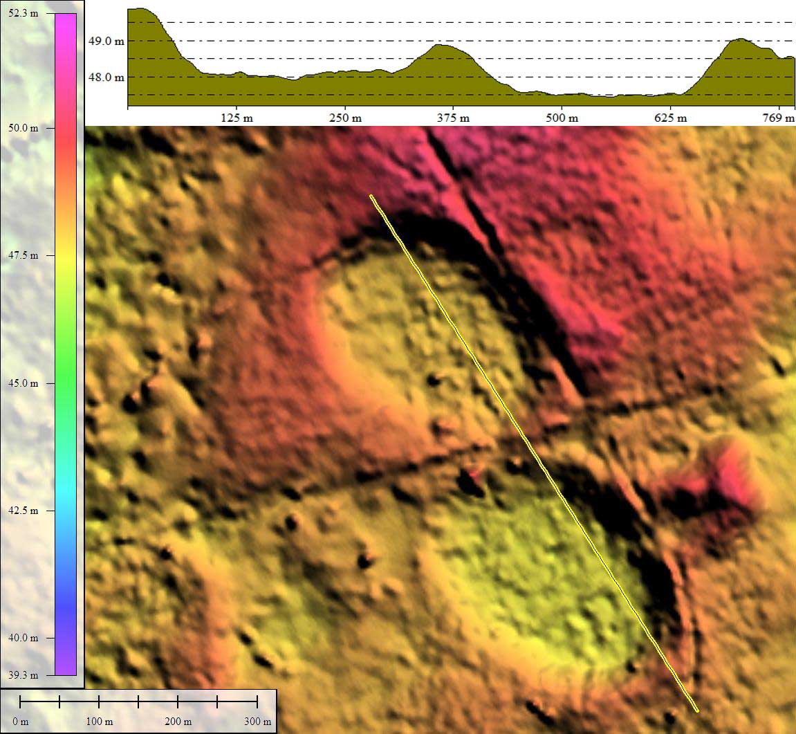
Here are five small bays sharing a common alignment, and having a major axis of between 260 and 306 meters; they look in the LiDAR to be virtually identical, but lie at five slightly different elevations between 45 and 48 meters above sea level (elevation profile map in album demonstrates the northern two bays' relative elevations). The bayCarolina archetype template was used to measure them, and they all fit well into its shape. The complex of bays is located in Sampson County, NC, 3.5 to 5 kilometers northeast of Roseboro, NC. Three of the bays are traversed by White Woods Road, although in all cases it just nicks the eastern side of the bay, and in two of the cases does not represent an outbound drainage channel.
In 2002, the Nature Conservancy purchased a 103-acre parcel which included Pondberry Bay, to protect the pondberry, which is one of the state's rarest endangered plant species. I am not certain which one is actually named "Pondberry Bay", but I assume the northernmost one, as it is located at the lat-lon given in a report by Ryan Robert Unks entitled Environmental Controls of Reproduction and Early Growth of Lindera melissifolia (Lauraceae) (2011), which is available from my archive [ HERE ] Below is an extract from Unks' description of the bay environment:
In 2002, the Nature Conservancy purchased a 103-acre parcel which included Pondberry Bay, to protect the pondberry, which is one of the state's rarest endangered plant species. I am not certain which one is actually named "Pondberry Bay", but I assume the northernmost one, as it is located at the lat-lon given in a report by Ryan Robert Unks entitled Environmental Controls of Reproduction and Early Growth of Lindera melissifolia (Lauraceae) (2011), which is available from my archive [ HERE ] Below is an extract from Unks' description of the bay environment:
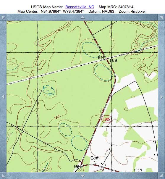
Pondberry Bay is located in Sampson county (34.985355,-78.472645) and is owned by the Plant Conservation Program of the North Carolina Department of Argriculture and Consumer Services. Approximately 1,000 L. melissifolia stems occur here (North Carolina Natural Heritage Program 2010). The soil series is Lynn Haven sand, a typic Alaquod (Soil Survey Staff 2011). Most of the bay is dominated by even-aged P. taeda of ca. thirty-four years, and was formerly managed by a timber company. Remnant cypress knees throughout the site indicate that it was formerly dominated by T. ascendens before being managed for pine. Under the areas of densest canopy, L. melissifolia is one of the few understory species present. Taxodium ascendens, N. biflora, and a number of other species associated with the Small Depression Pocosin (Schafale and Weakley 1990) community type occur sporadically. The highest stem densities of L. melissifolia occur in conditions of varying canopy cover along the edge of a small clearing in the northern half of the bay. Here a number of P. taeda trees were recently killed in a location of the bay, where a higher density of T. ascendens and N. biflora individuals occur, most likely during a three to four month flooding event following Hurricane Floyd in 1999. Observations in early 2009 and 2010 showed standing water only in close proximity to a small ditch at the southeast corner of the clearing in Pondberry Bay that is surrounded by extremely dense numbers of L. melissifolia stems (Krings 2010). This ditch is one of many in a network of ditches presumably installed during timber management, and a large number of female stems occur in close proximity to it. Aerial photos indicate that a road which passes within 50 m of the eastern edge of the bay was built between 1951 and 1958, possibly altering the hydrology. The bay was last observed completely flooded in 1995 (Leonard 1995).
Ryan Robert Unks, 2011
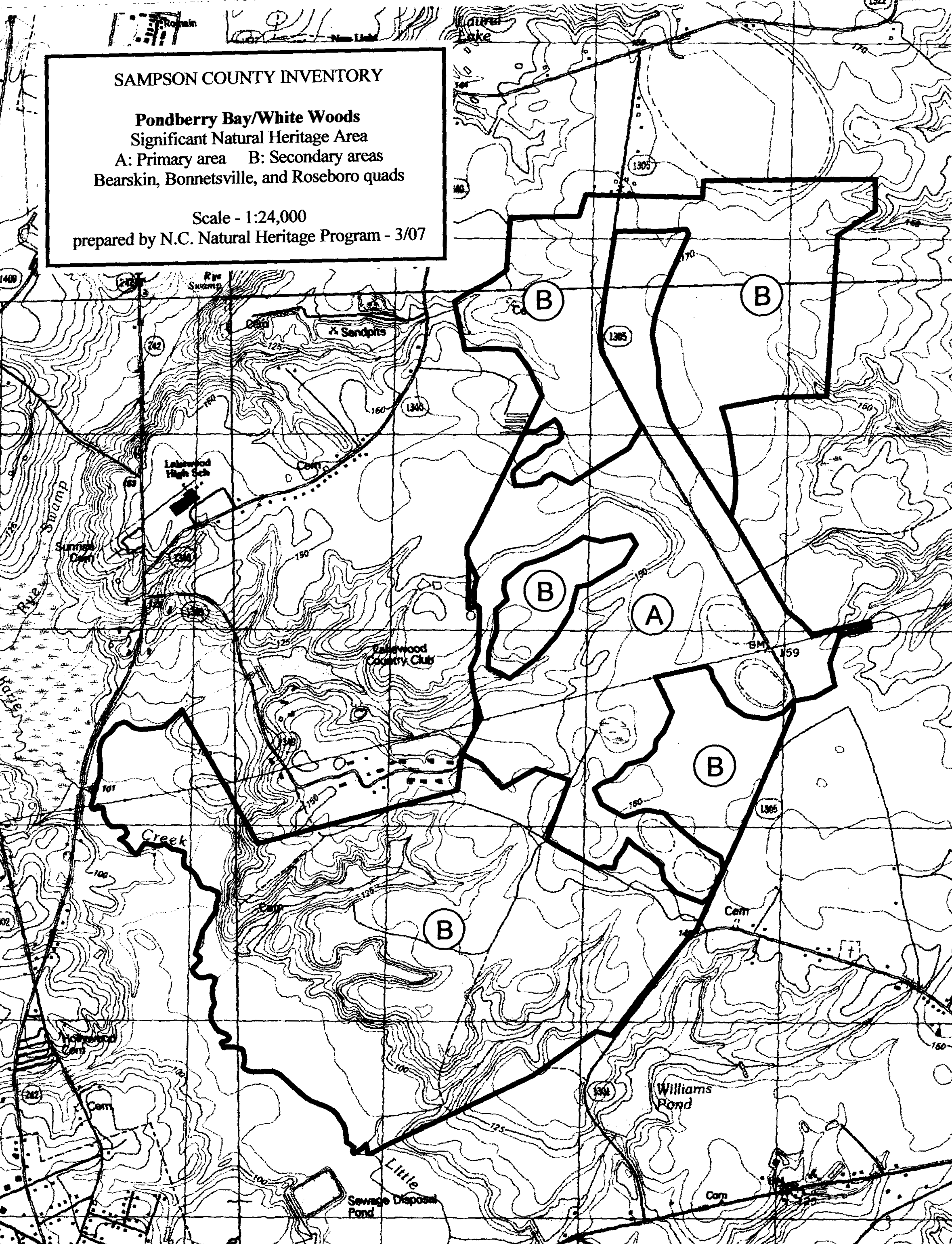
The NC Natural Heritage Program commissioned a study entitled Natural Area Inventory Of Sampson County, NC (2007), which was written written by R. LeBlond and G. Grant . The report included a general map of the preserve showing the five bays in the Primary area ("A"), and is included in the album below. I generated a PDF extract from the report, viewable from this LINK. Here is a brief quote from the paper:
Nestled within the sandhill community are a few small Carolina bays supporting the rare Cypress Savanna natural community. This community occurs in bays with a layer of clay in the soil, and are typically flooded during winter and spring, then become exposed later in the growing season. However, some years they can be flooded year-round. These small basins are characterized by a diverse ground layer of grasses, sedges, and wildflowers, with or without an open canopy of pond cypress (Taxodium ascendens). The Cypress Savanna depressions at this site have few or no cypress, and loblolly pine (Pinus taeda) has seeded in during extended droughts. Higher water levels in more recent years have killed off many of the pines. Prominent in the diverse ground layer are maidencane (Panicum hemitomon), redroot (Lachnanthes caroliniana), and Wright’s witch grass (Dichanthelium wrightianum). The very rare pondberry is an important shrub in one of the bay savannas.
LeBlond & Grant, 2007
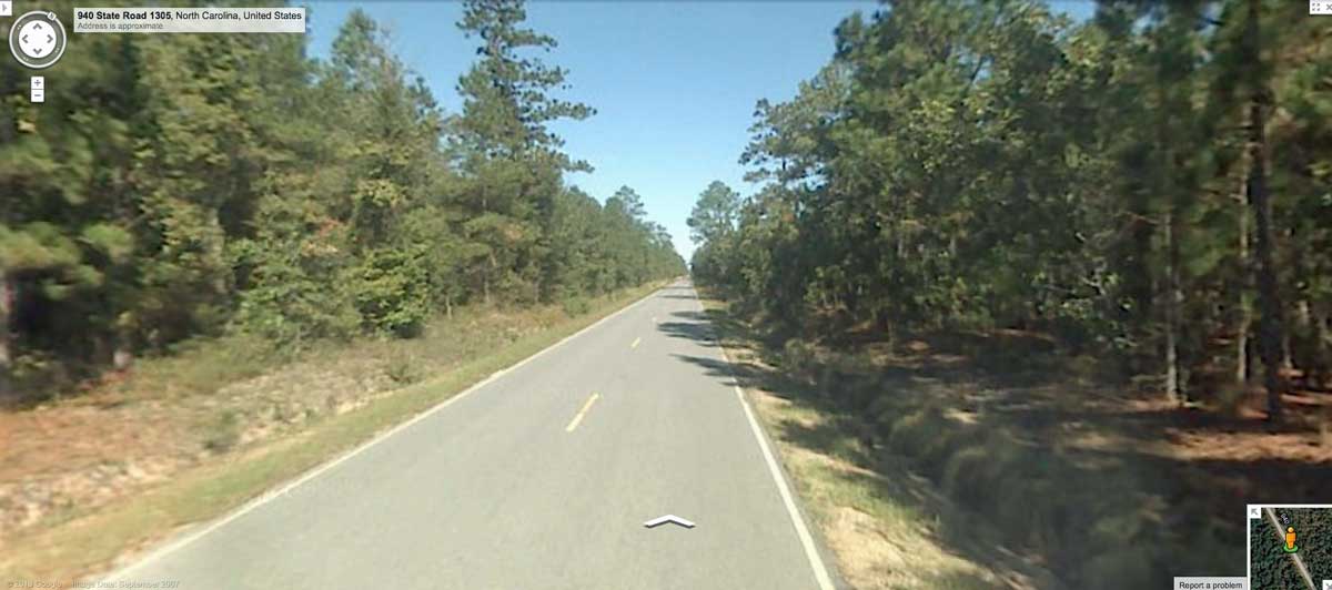
Google Streetview imagery is available along the entire extent of White Woods Road (SR 1305) as it passes through the complex. An image in the album and placemarked in the KMZ file shows the roadway as it rides along the rim of the Pondberry Bay, which to the left in this view, while the raised rim is seen on the right. Explore the Streetview interactively in your browser HERE.
The Carolina Bay Survey has identified and measured ~130 bays in Octant 139313. Their location and metrics can be referenced through a Fusion Table spatial visualization.
The Carolina Bay Survey has identified and measured ~130 bays in Octant 139313. Their location and metrics can be referenced through a Fusion Table spatial visualization.
- Index #: 1393139388
- Location: 34.98451889418958,-78.47196834953135
- Major: 0.35 km . . . Minor: 0.25 km
- Eccentricity: 0.684
- Area: 7.1 hectares
- Bearing: 139.56º
- Elevation: 48.07 m
- Archetype: bay
- Effective Diameter: 300.666 m
- Index #: 1393139288
- Location: 34.981697367570135,-78.47034531600522
- Major: 0.35 km . . . Minor: 0.26 km
- Eccentricity: 0.655
- Area: 7.39 hectares
- Bearing: 139.56º
- Elevation: 47.52 m
- Archetype: bay
- Effective Diameter: 306.744 m
- Index #: 1393139191
- Location: 34.97971882014365,-78.47865695577005
- Major: 0.31 km . . . Minor: 0.23 km
- Eccentricity: 0.667
- Area: 5.96 hectares
- Bearing: 139.56º
- Elevation: 46.29 m
- Archetype: bay
- Effective Diameter: 275.472 m
- Index #: 1393138990
- Location: 34.97484386609469,-78.47626619519639
- Major: 0.3 km . . . Minor: 0.22 km
- Eccentricity: 0.661
- Area: 5.53 hectares
- Bearing: 139.56º
- Elevation: 45.68 m
- Archetype: bay
- Effective Diameter: 265.349 m
- Index #: 1393138989
- Location: 34.97301005286489,-78.47407006162126
- Major: 0.38 km . . . Minor: 0.26 km
- Eccentricity: 0.71
- Area: 8.0 hectares
- Bearing: 139.56º
- Elevation: 45.44 m
- Archetype: bay
- Effective Diameter: 319.153 m
Copyright 2018 by Michael Davias