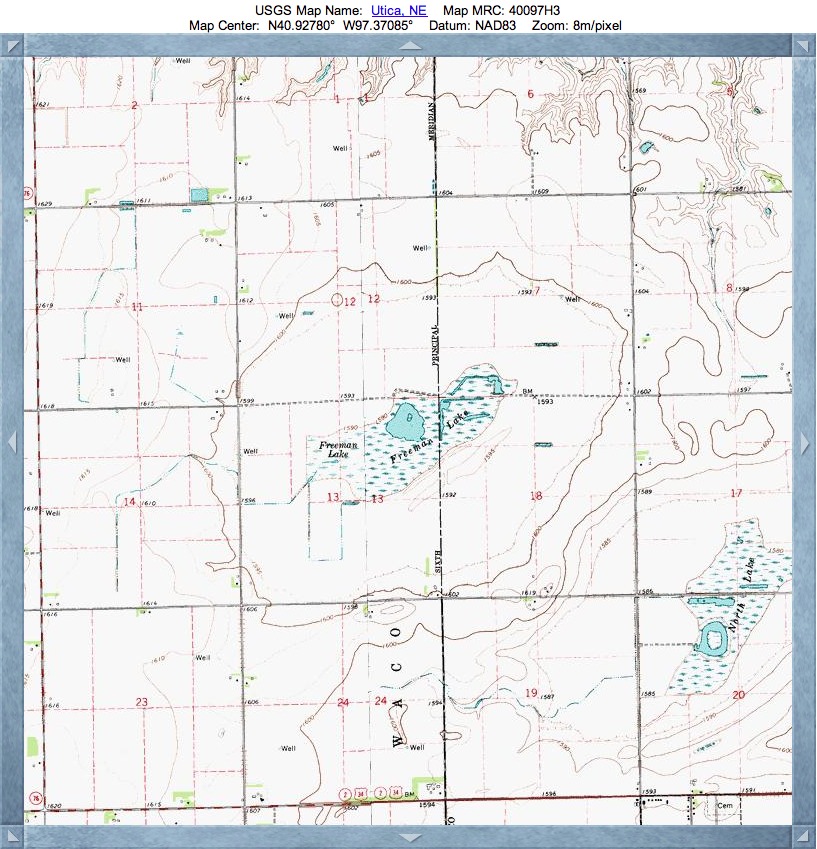
Freeman Lake Basin, NE
Freeman Lake Basin is home to the Freeman Lakes Waterfowl Production Area. Now, for some time now, when I noted the abbreviation WPA, I had assumed Waterfowl Protection Area. Nope, Production.
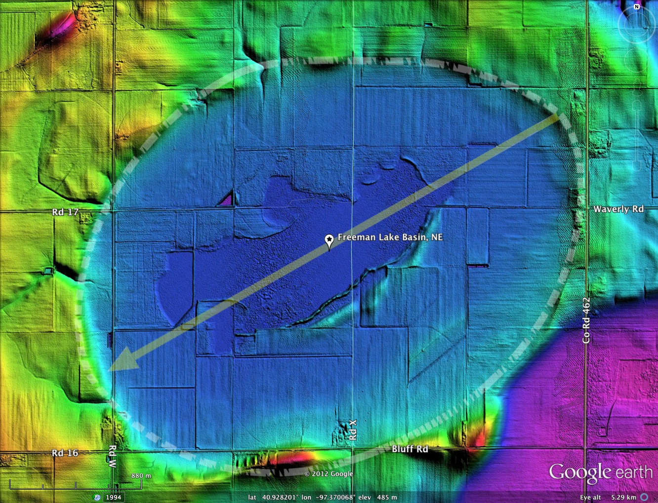
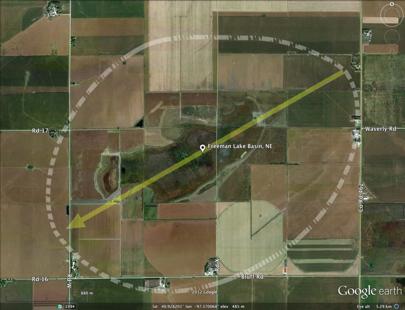
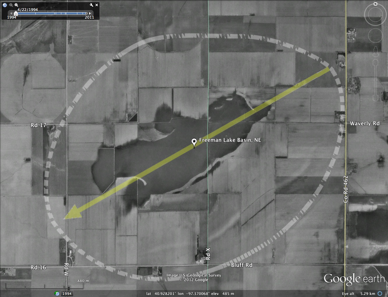
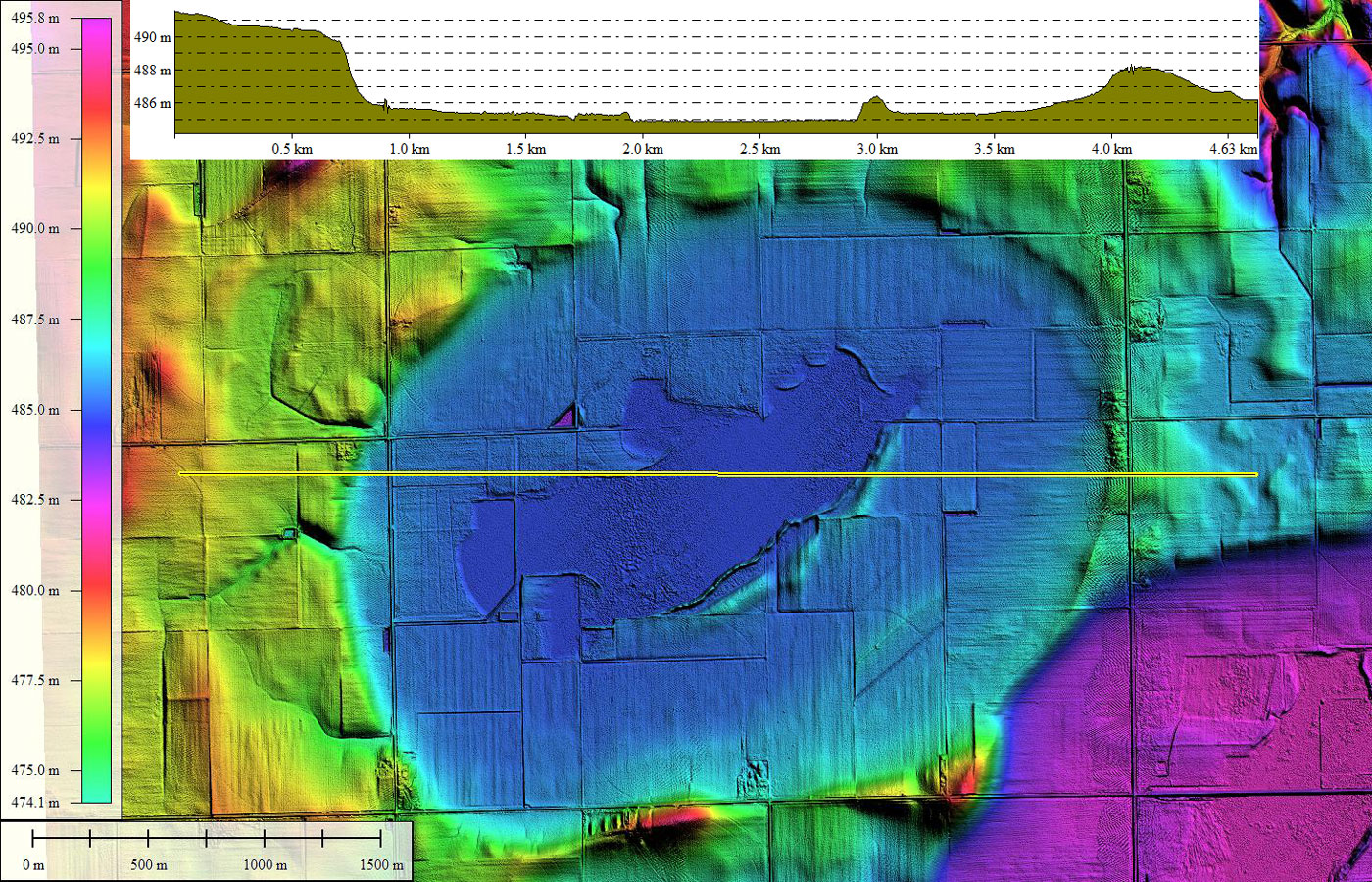
As seen in the LiDAR, the basins rim conforms well to the bayWest archetype, and it is considerably larger than the area generally considered to be "Freeman Lake". At over 3.5 kilometers along the major axis, this is one big landform, as are many of these Rainwater Basins, as they are know in Nebraska. Their propensity to hold water, and therefore attract wildlife, has allowed them to gain much interest from hunters and bird watchers. The US Fish and Wildlife Service has a web page with some pictures from the Freeman Lakes WPA at this LINK.
Over the years, the fine hunting opportunities afforded by these large wetlands, have been challenged by low water levels. Subsequently, the government has installed high volume water wells to re-fill the basins!
From Nebraska Birding Trails: LINK
- Located 1 mile west and 1.5 miles north of Utica in Seward County. Another good, but isolated, large basin. Access is difficult. The more productive portion is private, but can be viewed from the WPA area. This site contains 146 acres of wetland habitat and 42 acres of uplands. Management: The U.S. Fish and Wildlife Service owns only the eastern portion of the wetland. In 2001, the wetland basin was grazed, followed by disking. In 2002, the wetland was again grazed during the drought conditions. A remnant portion of an old two-track road and silt from the southwest portion of the wetland were removed from the wetland in 2002. More renovations are planned for the future.
- • Index #: 163389_7148
- Location: 40.928200974142285,-97.37006806228138
- Major: 3.65 km . . . Minor: 2.74 km
- Eccentricity: 0.661
- Area: 787.82 hectares
- Bearing: 240.45º
- Elevation: 484.9 m
- Planform: bayWest
- Effective Diameter: 3,167.146 m
Copyright 2018 by Michael Davias