Mill Bay, SC
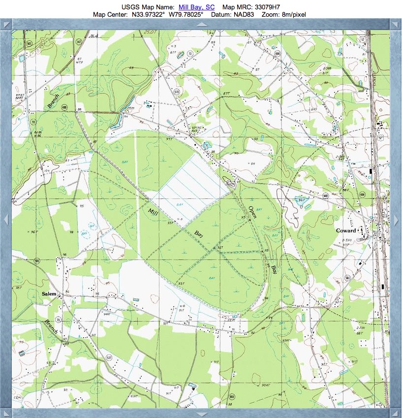
Mill Bay is a large landform in South Carolina located directly to the west of Coward, SC.
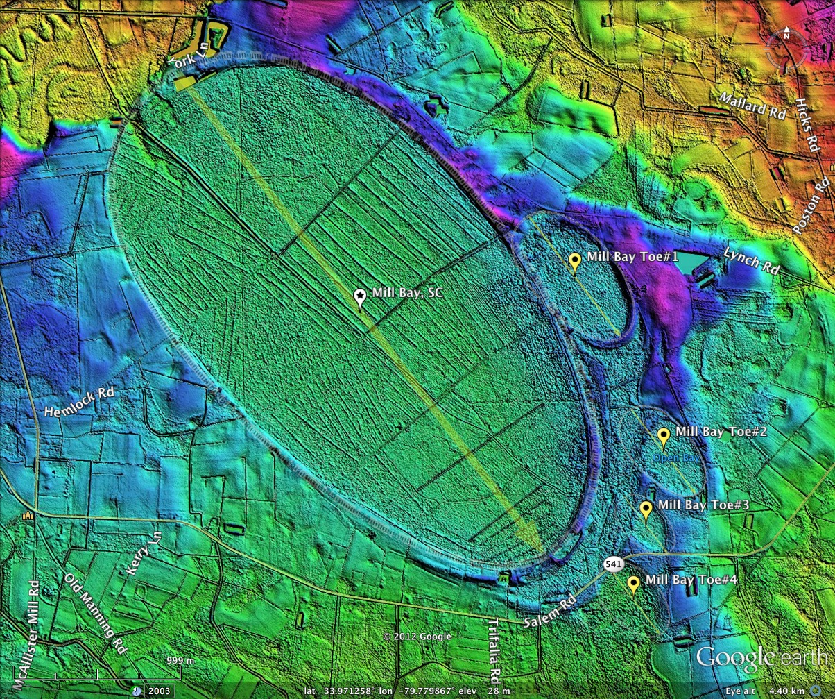
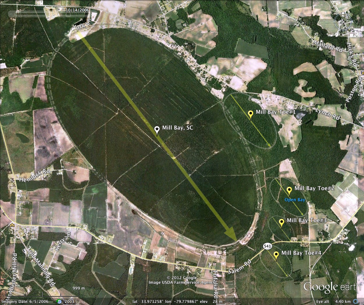
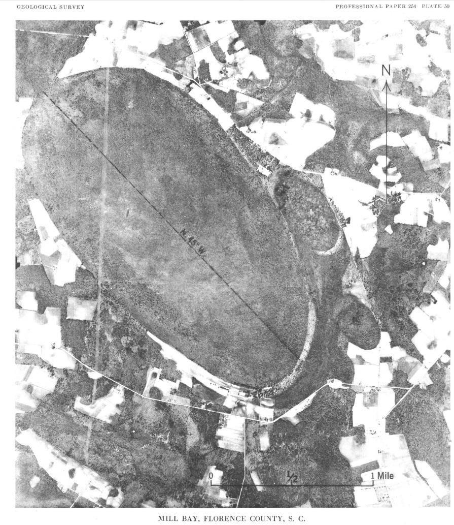
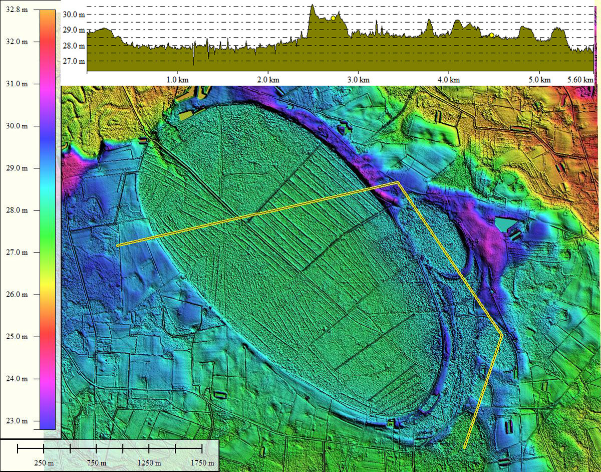
The northern most tip of Mill Bay has been nipped by the Lynches River channel at some time in the past, providing a natural drainage for the basin, and perhaps setting it up early in human occupation to be used as a mill pond. At present, a large infrastructure of drainage channels is present across the bay, although no open farmland is visible. Section of the bay do seem to be supporting commercial forestry stands, as noted in the neat rows of trees.
Like several other bays in the survey, Mill Bay has "toes", in this case three or four depending on your charity. The run of several toe bays on the southeastern side is noted in to topographic database as Open Bay.
The USGS has this pond named in its topographic database, and has actually named its map of this quad Mill Bay.
Survey metrics comprised of five separate basins:
Mill Bay, SC
- Index #: 135319_8812
- Location: 33.973222960660685,-79.78360518199625
- Major: 3.69 km . . . Minor: 2.0 km
- Eccentricity: 0.84
- Area: 581.58 hectares
- Bearing: 142.73º
- Elevation: 27.86 m
- Planform: bayCarolina
- Effective Diameter: 2,721.193 m
- Index #: 135319_8907
- Location: 33.97514786480863,-79.76972163814561
- Major: 0.92 km . . . Minor: 0.5 km
- Eccentricity: 0.837
- Area: 36.95 hectares
- Bearing: 142.73º
- Elevation: 28.74 m
- Planform: bayCarolina
- Effective Diameter: 685.902 m
- Index #: 135319_8605
- Location: 33.96578115468126,-79.7639878974604
- Major: 0.65 km . . . Minor: 0.36 km
- Eccentricity: 0.832
- Area: 18.54 hectares
- Bearing: 142.73º
- Elevation: 28.47 m
- Planform: bayCarolina
- Effective Diameter: 485.858 m
- Index #: 135319_8406
- Location: 33.96184488530926,-79.76512550411957
- Major: 0.43 km . . . Minor: 0.26 km
- Eccentricity: 0.795
- Area: 8.9 hectares
- Bearing: 142.73º
- Elevation: 28.3 m
- Planform: bayCarolina
- Effective Diameter: 336.627 m
- Index #: 135319_8306
- Location: 33.95783497273141,-79.76591611233907
- Major: 0.53 km . . . Minor: 0.33 km
- Eccentricity: 0.781
- Area: 13.78 hectares
- Bearing: 142.73º
- Elevation: 27.82 m
- Planform: bay_prototype
- Effective Diameter: 418.87 m
Copyright 2018 by Michael Davias