Twenty-13 Bay, VA
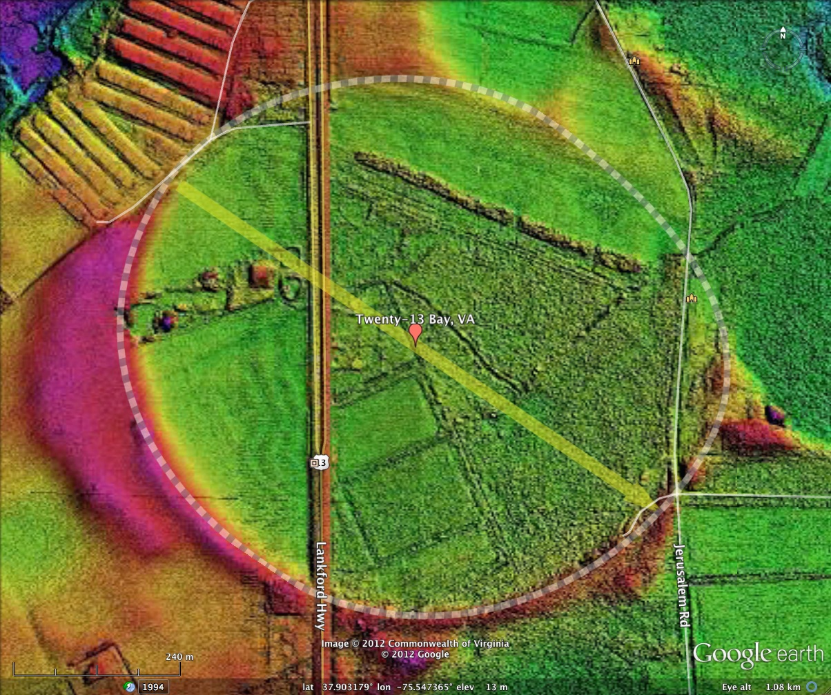
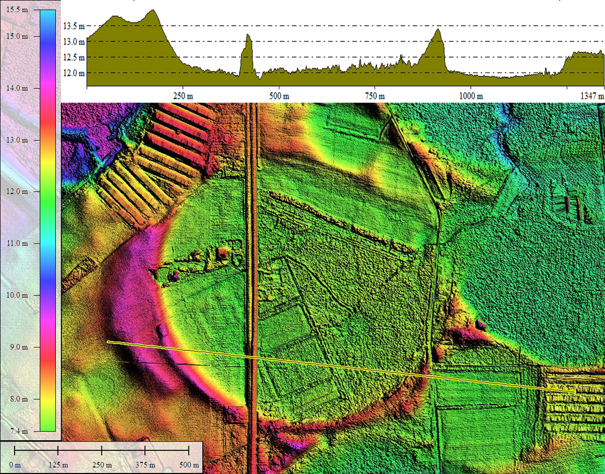
My New Year Day's offering is a bay recently visited along US 13 on the Eastern Shore of Virginia. The western 1/3rd of the bay has been cut off from the eastern 2/3rds by the construction of US 13. Its rim is clearly visible as a broad wave rising up across the agricultural field. The furrow rows and crop stubble seen during the early winter helps to define the gentle rise of terrain up to the crest of the rim, and I visually noted it's presence while driving along on my way to the Eastern Shore GIS User's Group Symposium.
In honor of place as the head of the 2013 class of bay posts, and its serendipitous location skewered by US 13, I have named the bay Twenty-13. There are numerous other bays on the Eastern Shore which are crossed by US 13, so our apologies to those for being usurped by this one.
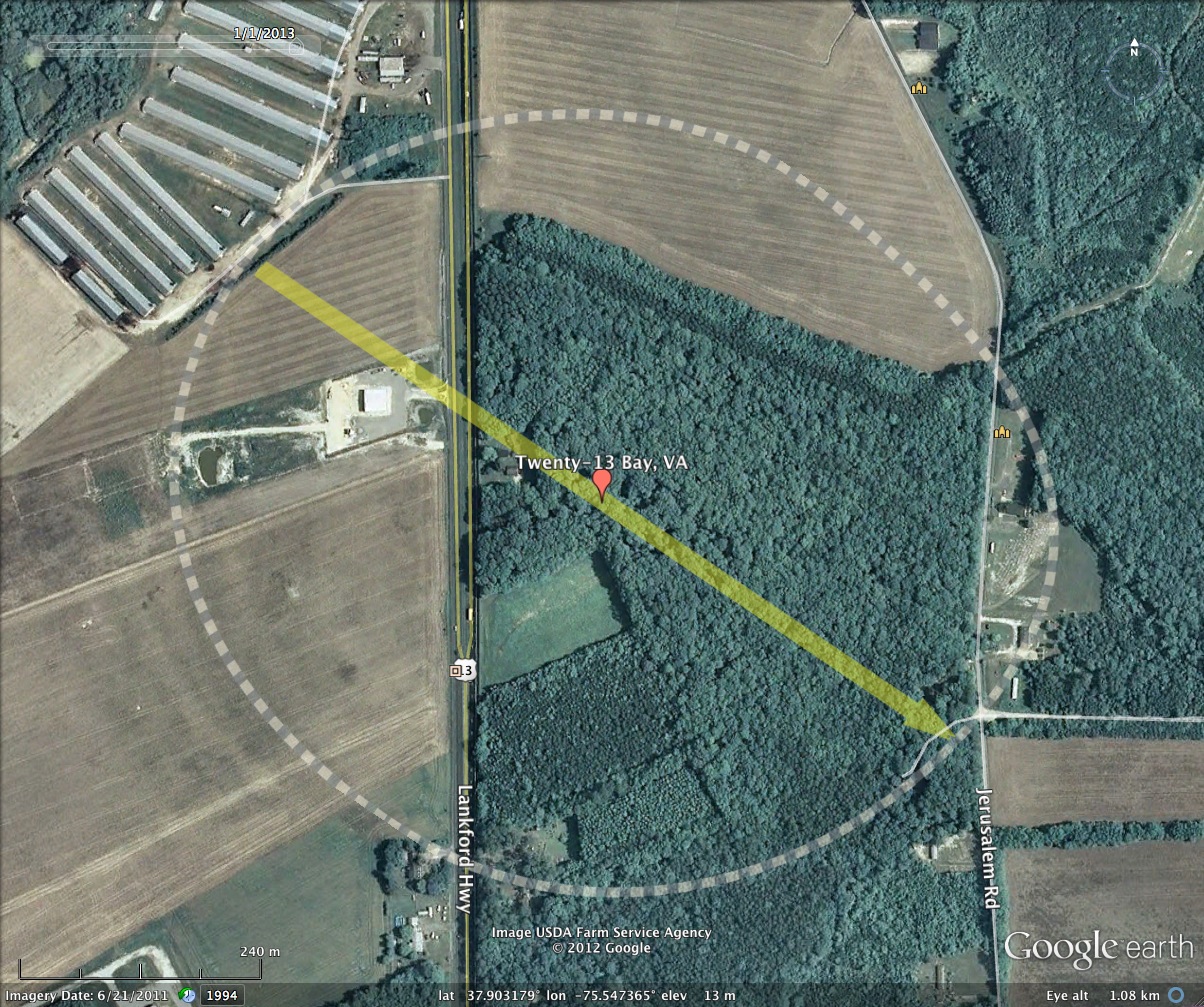
Shown in the attached album is a photo taken by me from within the bay on December 12, 2012. The location is noted on the KMZ file, taken from along the shoulder of US 13 looking west across the field towards the rim, which is just under 1/4 km distant. The photo is a panorama which has a vertical exaggeration of 2x applied to further highlight the "wave" front.
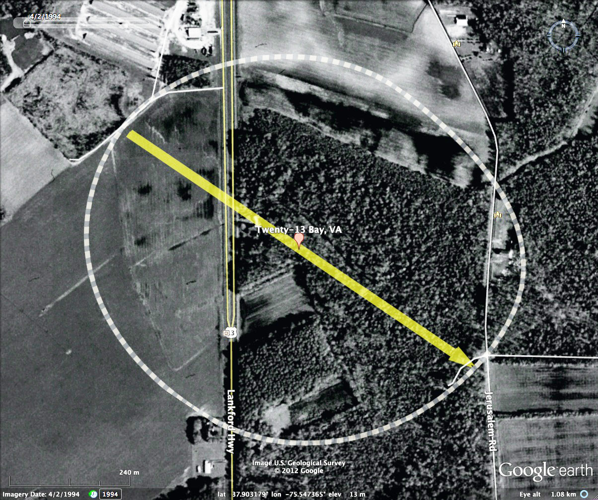
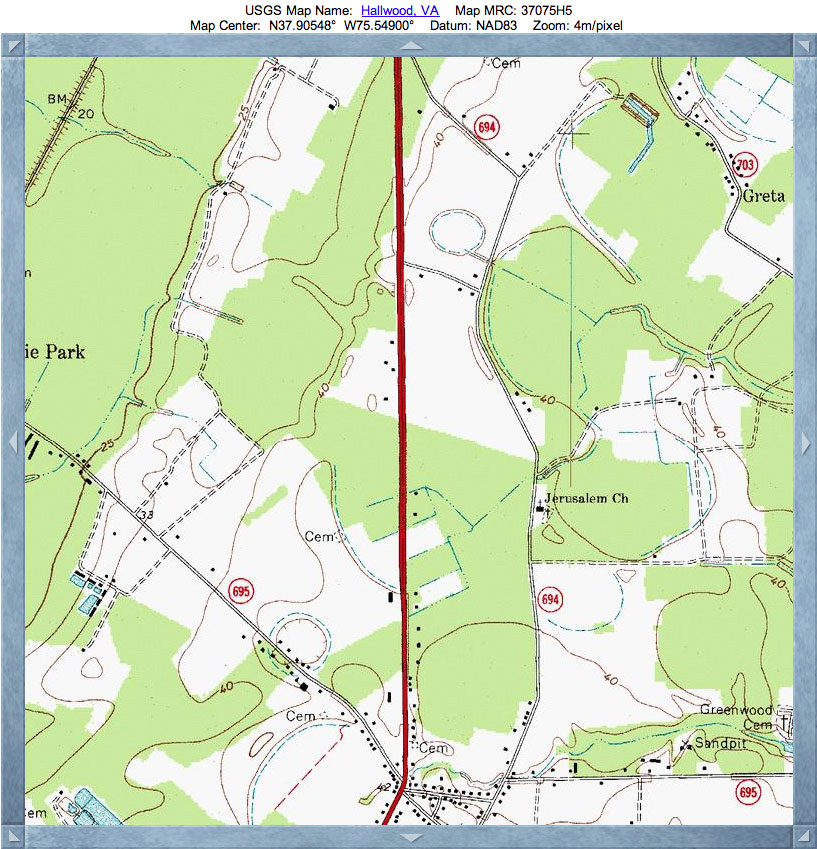
The bay's floor here looks quite dry, owing to a significant network of drainage channels which fork into the bay and drain eastward and across the rim at a low point. These can be seen in the USGS Topographic Map of the bay site, included in the album here. The shape measured is a fairly tight fit to the bayShore archetype seen across the Eastern Shore.
A very recent addition to the topography is a building construction site which runs from US 13 westward to the rim. The rim looks to be exposed, and might be a good site to take sand and OSL samples.
In honor of place as the head of the 2013 class of bay posts, and its serendipitous location skewered by US 13, I have named the bay Twenty-13. There are numerous other bays on the Eastern Shore which are crossed by US 13, so our apologies to those for being usurped by this one.
Shown in the attached album is a photo taken by me from within the bay on December 12, 2012. The location is noted on the KMZ file, taken from along the shoulder of US 13 looking west across the field towards the rim, which is just under 1/4 km distant. The photo is a panorama which has a vertical exaggeration of 2x applied to further highlight the "wave" front.
The bay's floor here looks quite dry, owing to a significant network of drainage channels which fork into the bay and drain eastward and across the rim at a low point. These can be seen in the USGS Topographic Map of the bay site, included in the album here. The shape measured is a fairly tight fit to the bayShore archetype seen across the Eastern Shore.
A very recent addition to the topography is a building construction site which runs from US 13 westward to the rim. The rim looks to be exposed, and might be a good site to take sand and OSL samples.
- Index #: 151302_6118
- Location: 37.90317948889971,-75.54736468949616
- Major: 0.86 km . . . Minor: 0.76 km
- Eccentricity: 0.478
- Area: 52.18 hectares
- Bearing: 124.13º
- Elevation: 12.16 m
- Planform: bayShore
- Effective Diameter: 815.092 m
Copyright 2018 by Michael Davias