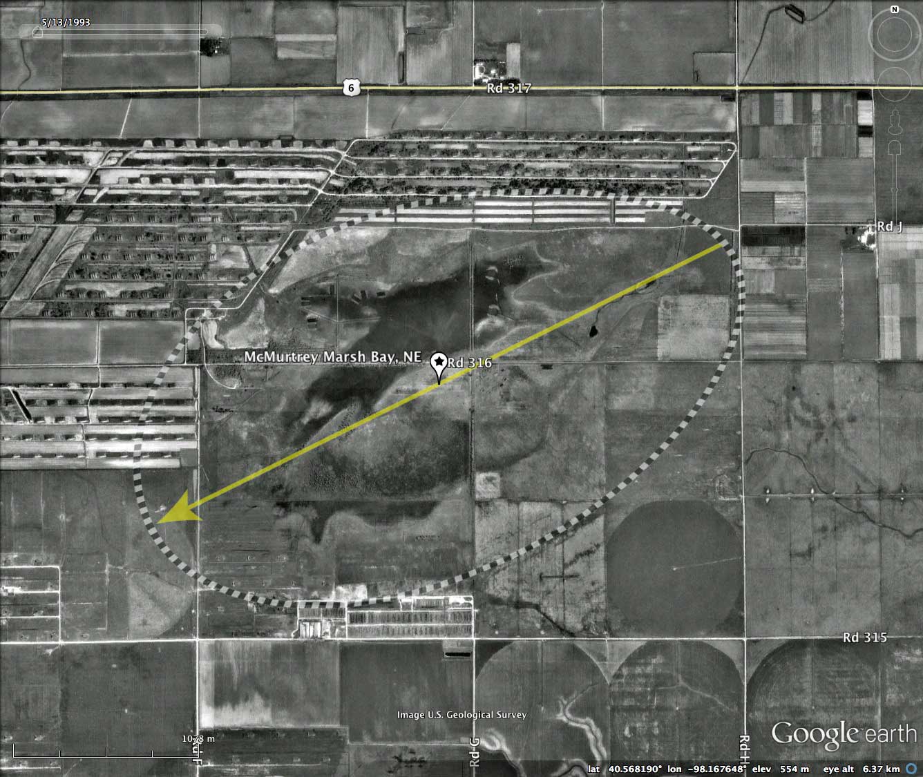
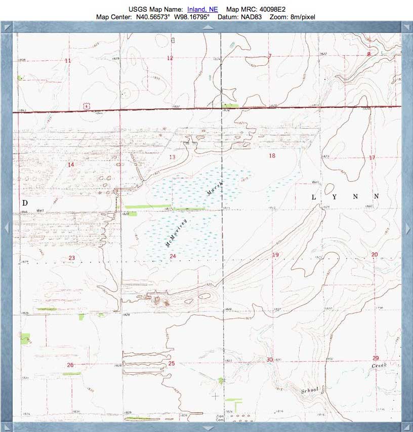
McMurtrey Marsh Bay, NE
McMurtrey Bay has been named by me based on the presence of the McMurtrey Wildlife Refuge located in its basin. The site is in Clay County, Nebraska, and includes 651 acres of wetlands and 401 acres of uplands. According to a web page on the refuge, there is no public access offered.
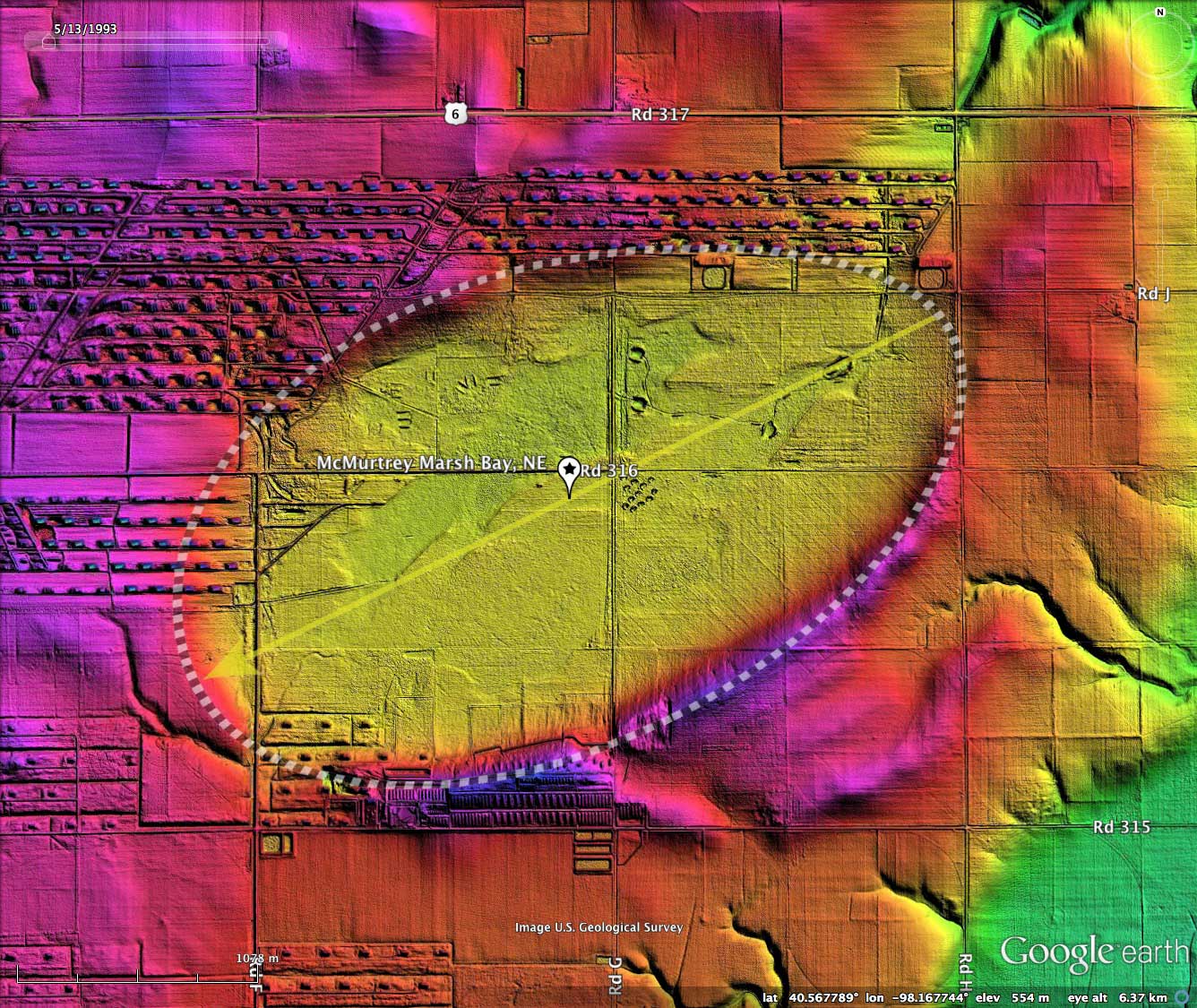
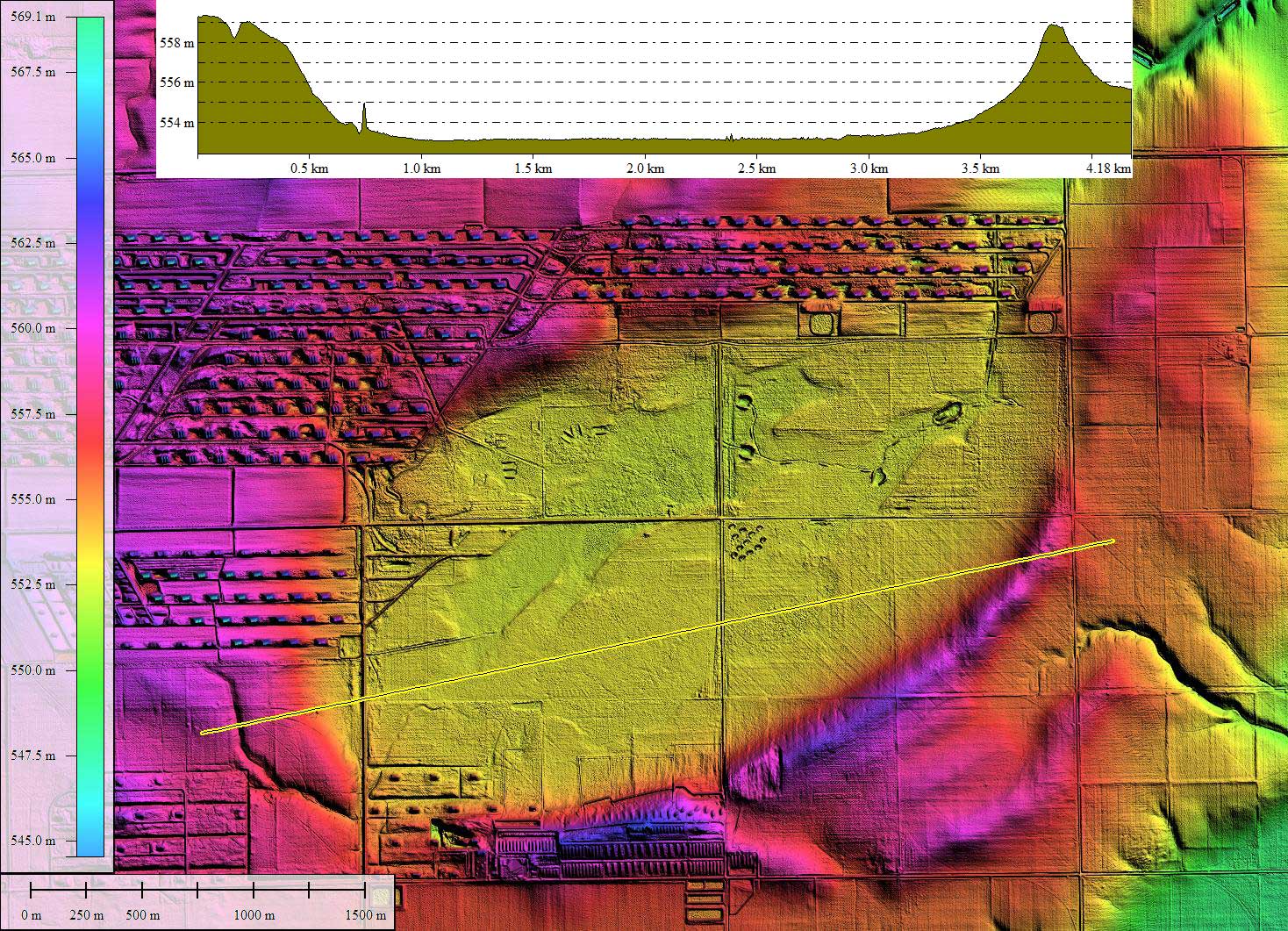
The basin conforms very well to the common bayWest archetype shape, and has an orientation similar to other bays in the area. This landform measures 3.8 kilometers on its long axis, which places it in the top 75 bays in the Carolina Bay Survey based on major axis length.
The landscape to the immediate north and west of the bay has been extensively modified by man, primarily to construct the expansive Hasting Naval Ammunition Depot (NAD), now largely abandoned. It was the largest of the Navy's WWII inland munitions plants, covering almost 49,000 acres of Adams and Clay County farmland. Ordnance was loaded, assembled and stored from groundbreaking in July 1942 to final closing in June 1966. 40% of all WWII Marine and Navy munitions were manufactured there. A uTube video discusses the history of the Hasting depot is available HERE , not that it has anything to do with the Carolina Bay Survey :)
Some of the property of the NAD has been converted to feed lots with open water. This has led to some recent controversy which involves McMurtrey Bay. Below is an excerpt from a report entitled Environmental Contaminants Associated With A Swine Concentrated Animal Feeding Operations And Implications For McMurtrey National Wildlife Refuge. [LINK]
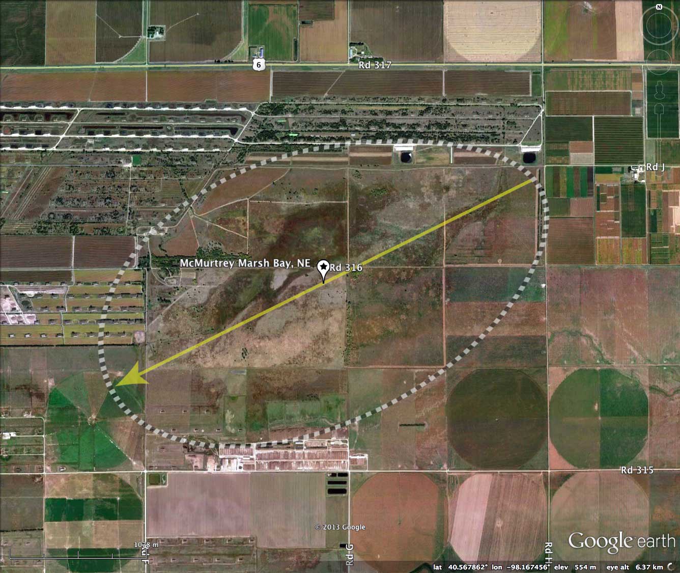
In 2000, the U.S. Fish and Wildlife Service began to characterize CAFO contaminants in lagoons, canals, and created wetlands operated by Hastings Pork, a large swine CAFO adjacent to McMurtrey National Wildlife Refuge (McMurtrey) in Clay County, Nebraska. The created wetlands were designed to attract waterfowl; therefore, the primary purpose of this research was to evaluate whether migratory waterfowl were likely exposed to CAFO contaminants. A secondary research objective was to determine if created wetland water was suitable as a supplementary water source for McMurtrey. Wetlands created from swine wastewater effluent had 5-50 fold greater concentrations of phosphorus, ammonia, and total nitrogen and 2-3 fold greater salinity compared to control sites.
About 260 bunkers that were formerly used by the Navy to store munitions are now used for swine production. These bunkers house approximately 64,000 swine and around 1.5 million liters of water per day is used to flush them out.
U.S. Fish And Wildlife Service Division of Environmental Quality Region 6, 2004
The Rainwater Basin Joint Venture has a web site that provides some background on the Rainwater Basins. LINK
The Carolina Bay Survey has identified and measured over 17 bays in Octant 162392. Their location and metrics can be referenced through a Fusion Table spatial visualization.
The Carolina Bay Survey has identified and measured over 17 bays in Octant 162392. Their location and metrics can be referenced through a Fusion Table spatial visualization.
- Index #: 162392_2667
- Location: 40.56707321000546,-98.1677729603123
- Major: 3.8 km . . . Minor: 2.2 km
- Eccentricity: 0.814
- Area: 658.88 hectares
- Bearing: 243.68º
- Elevation: 553.42 m
- Archetype: West_Prototype
- Effective Diameter: 2,896.394 m
Copyright 2018 by Michael Davias