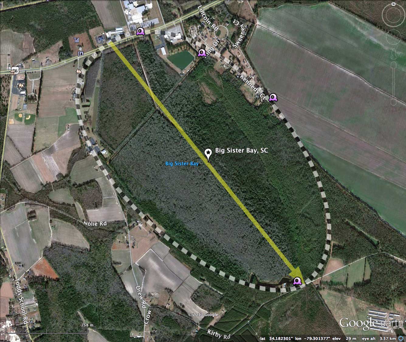
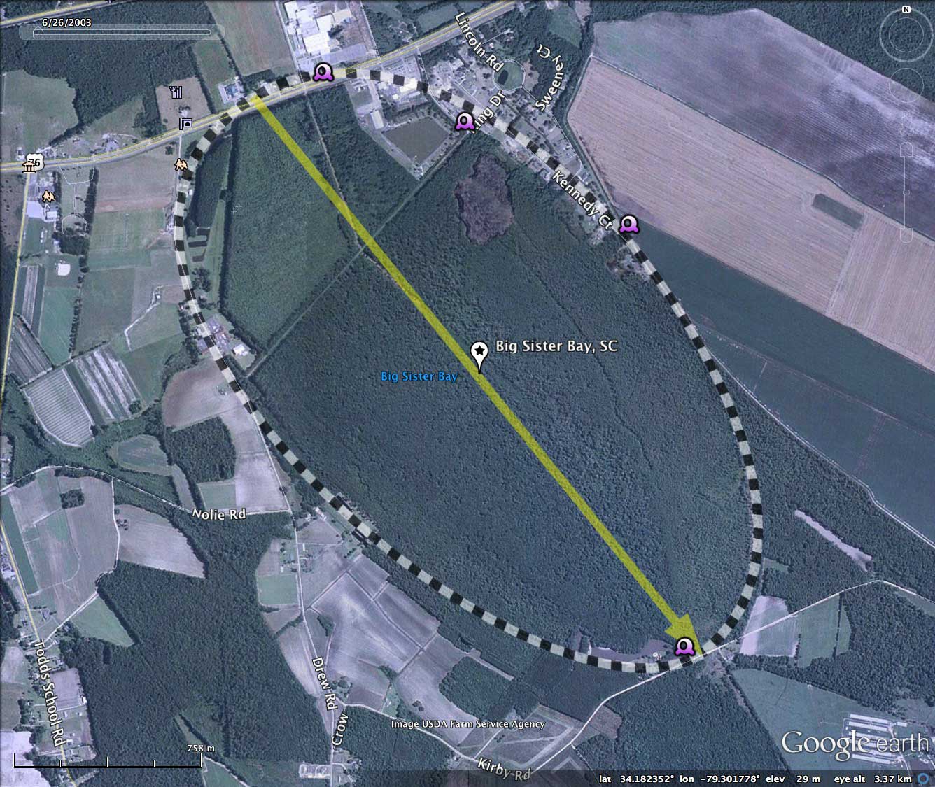
Big Sister Bay, SC
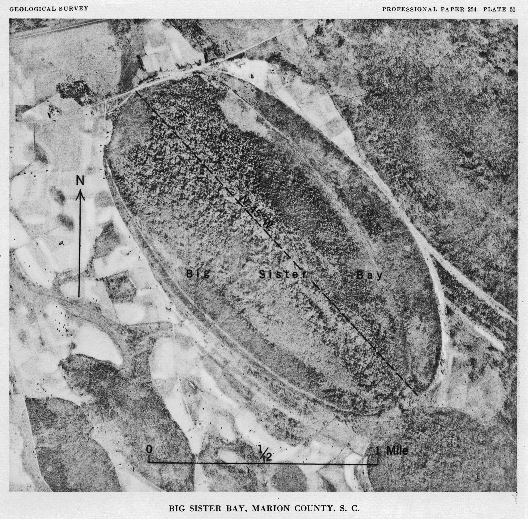
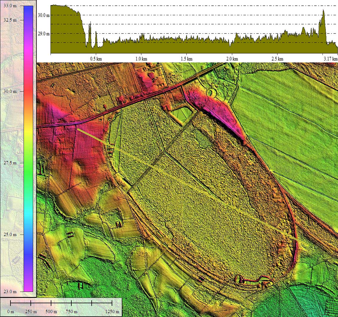
Big Sister Bay is in Marion County, NC. The bay is a bayCarolina archetype Carolina Bay, and a very large one at that. Indeed, the bay was included in C.Wythe Cooke's 1954 scientific report on Carolina Bay geomorphology, shown in a full-page plate (#51, see attached album)
US Route 76 crosses the northern tip of the bay, and although a large percentage of the bay remains in a native state, it has been channeled and bermed for drainage, and is slowing being assimilated. Such has been the fate of 95% of all Carolina bays - divide and conquer. Being realistic, given some areas of bays occupy such a high percentage of the landscape, it is unrealistic to consider preserving all of them!
Extensive coverage of Google Streetview imagery is available around the bay. Discussed here and included in the attached album are several individual images, each placemarked in the referenced KMZ file for direct review in Google Earth, and additionally linked below for viewing in your web browser using Google Streetview.
One Google Streetview image provided here is looking across the bay along the cross-bay drainage berm created by channel construction. A large surface catch basin can be seen on the right. Perhaps this was a borrow pit to provide fill for raising the elevation of the land for development within the bay rim perimeter. Browse interactively in Google maps using this LINK.
A second Streetview is from US 76, looking down into the bay, where the result of recent clearing operations are seen. The bay floor looks very organically rich, wet, and heavily forested. I would expect that the area between the already-filled bay floor to the east, and the drainage channel to the west will eventually be converted to dry land for development, but they will need a LOT of fill. Browse interactively in Google maps this LINK.
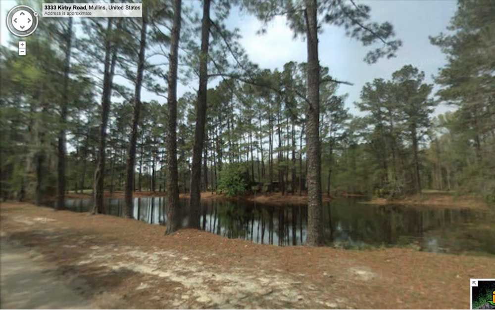
On the south end of the bay, a third Streetview image shows some open water collection ponds just inside the bay rim, which are likely man-made borrow pits for raising the elevation of the surrounding bay floor. Browse interactively in Google maps using this LINK.
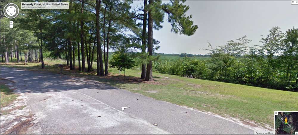
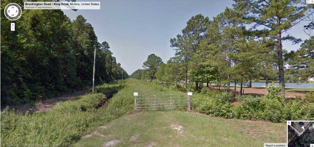
Google Streetview is available along Kennedy Court as it runs directly along the top of the narrow raised bay rim for about 1 kilometer. From this location near its southern terminus, the view is looking out of the bay, where the rim can be seen to drop down to the neighboring terrain, currently open cropland. Browse interactively in Google maps using this LINK.
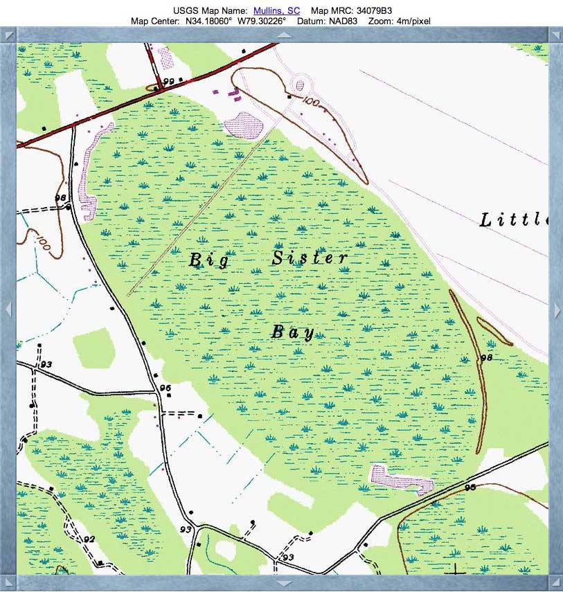
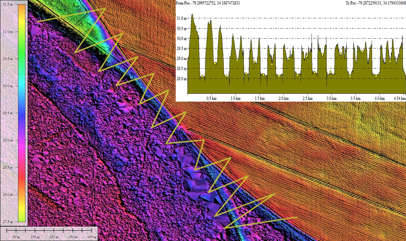
This narrow rim is shared with the adjoining bay, Little Sister, whose floor is nearly all cropland today. An elevation profile map of a transect stitching back and forth across this joint rim area is presented in the attached album. It demonstrates a ~1 meter elevation difference between the bay floors, a rim height of between 2 and 3 meters (seen from the lower Little Sister Bay floor, and a rim width of ~50 meters where the rims are conjoined.
The Carolina Bay Survey has identified and over 250 bays in Octant 136317. Their location and metrics can be referenced through a Fusion Table spatial visualization.
US Route 76 crosses the northern tip of the bay, and although a large percentage of the bay remains in a native state, it has been channeled and bermed for drainage, and is slowing being assimilated. Such has been the fate of 95% of all Carolina bays - divide and conquer. Being realistic, given some areas of bays occupy such a high percentage of the landscape, it is unrealistic to consider preserving all of them!
Extensive coverage of Google Streetview imagery is available around the bay. Discussed here and included in the attached album are several individual images, each placemarked in the referenced KMZ file for direct review in Google Earth, and additionally linked below for viewing in your web browser using Google Streetview.
One Google Streetview image provided here is looking across the bay along the cross-bay drainage berm created by channel construction. A large surface catch basin can be seen on the right. Perhaps this was a borrow pit to provide fill for raising the elevation of the land for development within the bay rim perimeter. Browse interactively in Google maps using this LINK.
A second Streetview is from US 76, looking down into the bay, where the result of recent clearing operations are seen. The bay floor looks very organically rich, wet, and heavily forested. I would expect that the area between the already-filled bay floor to the east, and the drainage channel to the west will eventually be converted to dry land for development, but they will need a LOT of fill. Browse interactively in Google maps this LINK.
On the south end of the bay, a third Streetview image shows some open water collection ponds just inside the bay rim, which are likely man-made borrow pits for raising the elevation of the surrounding bay floor. Browse interactively in Google maps using this LINK.
Google Streetview is available along Kennedy Court as it runs directly along the top of the narrow raised bay rim for about 1 kilometer. From this location near its southern terminus, the view is looking out of the bay, where the rim can be seen to drop down to the neighboring terrain, currently open cropland. Browse interactively in Google maps using this LINK.
This narrow rim is shared with the adjoining bay, Little Sister, whose floor is nearly all cropland today. An elevation profile map of a transect stitching back and forth across this joint rim area is presented in the attached album. It demonstrates a ~1 meter elevation difference between the bay floors, a rim height of between 2 and 3 meters (seen from the lower Little Sister Bay floor, and a rim width of ~50 meters where the rims are conjoined.
The Carolina Bay Survey has identified and over 250 bays in Octant 136317. Their location and metrics can be referenced through a Fusion Table spatial visualization.
- Index #: 136317_7220
- Location: 34.181568372008726,-79.30168241295178
- Major: 2.94 km . . . Minor: 1.65 km
- Eccentricity: 0.826
- Area: 382.99 hectares
- Bearing: 141.19º
- Elevation: 28.74 m
- Archetype: bay
- Effective Diameter: 2,208.25 m
Copyright 2018 by Michael Davias