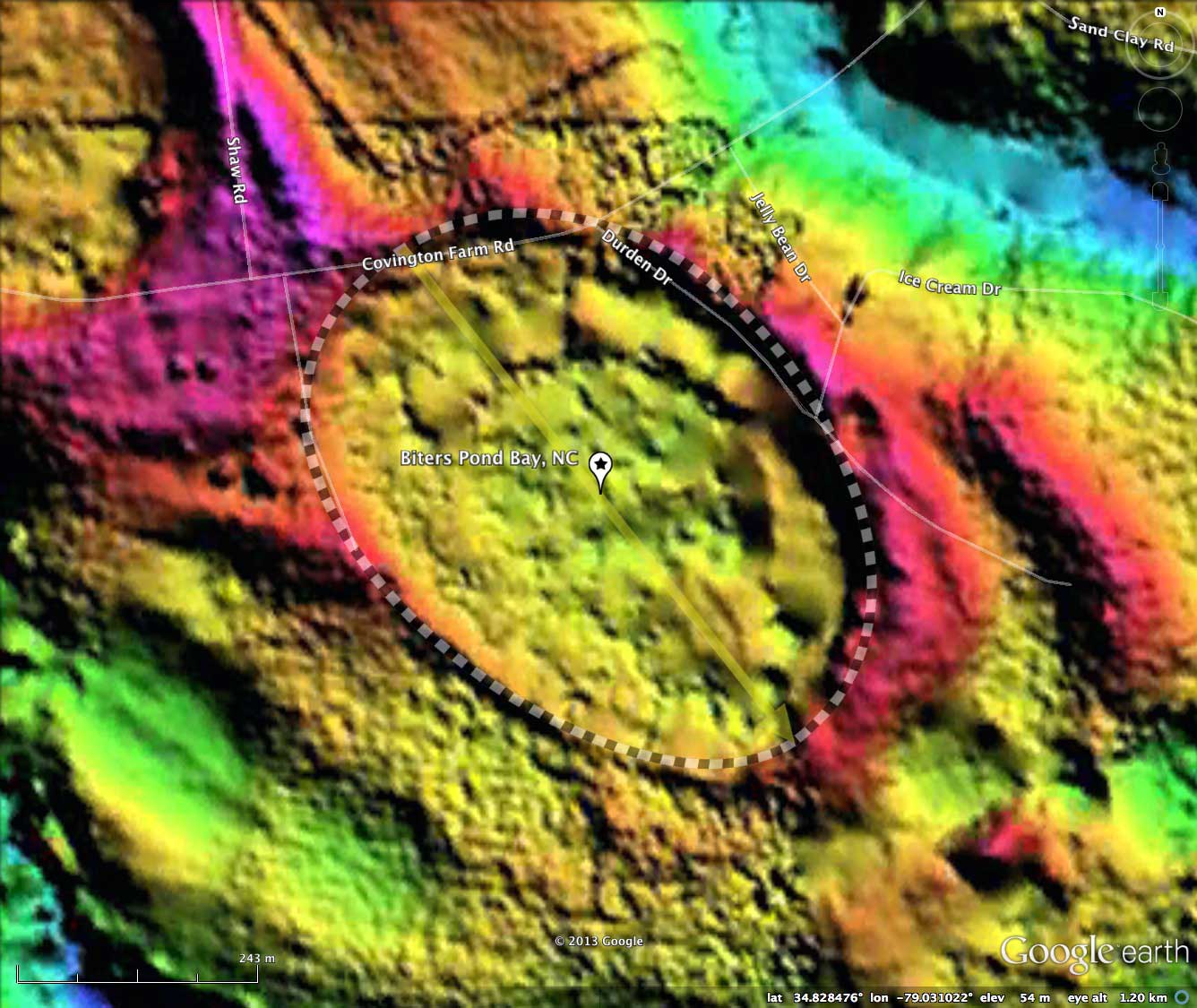
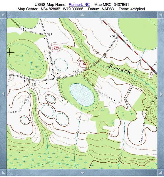
Biters Pond Bay, NC
Listed here as Bitters Pond Bay, this bay has also been referred to as Gallinule Bay. As can be seen in the satellite imagery, the bay has good water coverage at its center, and remains in a fairly original state. As such, it has been the focus of at least one attempt to document its exotic flora and fauna.
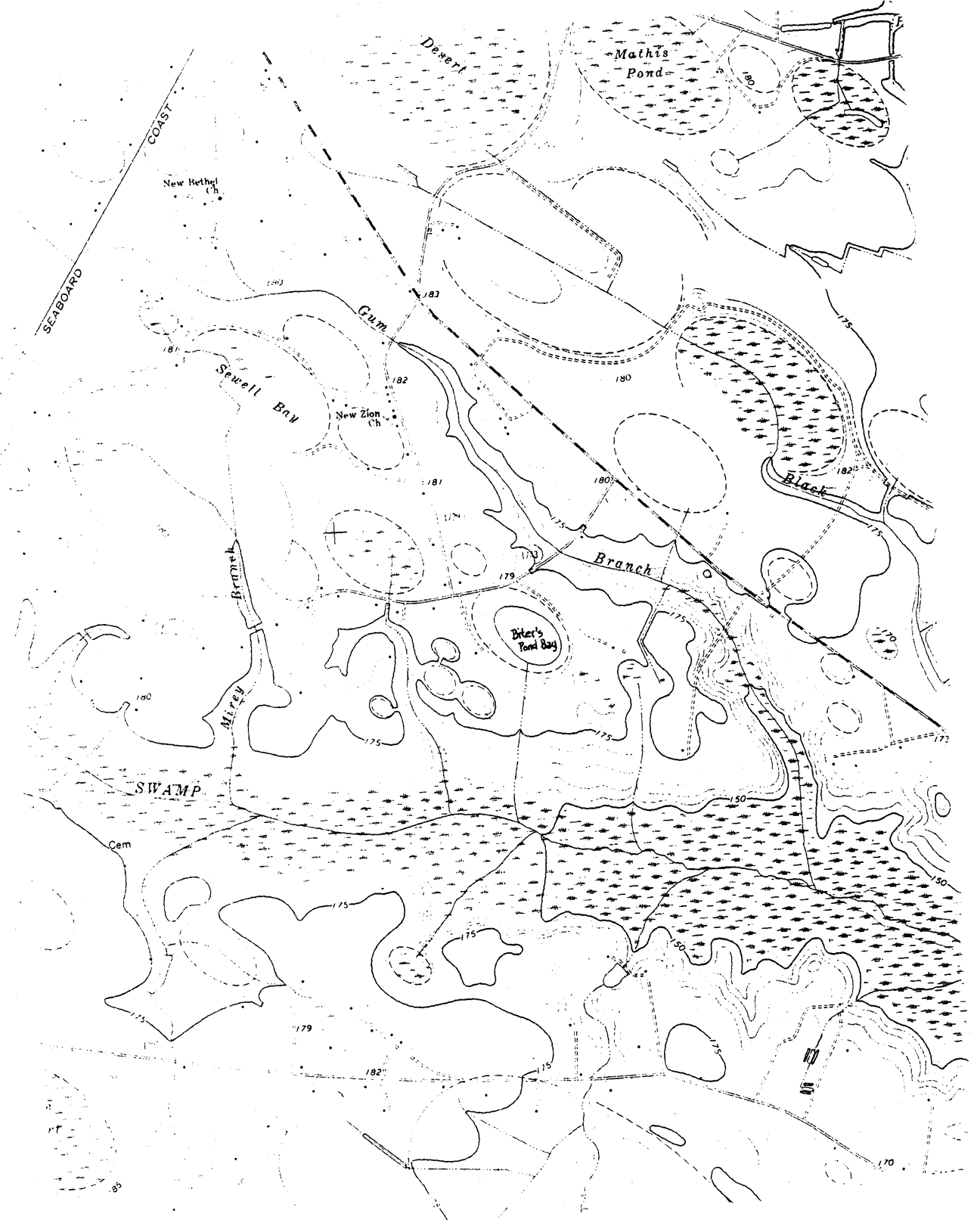
The report was generated by Timothy Nifong in his review of The "Clay Subsoil" Carolina Bays of North Carolina (1982). Nifong's map, annotated with applied bay names, is included in the album here. A PDF of his Biter Bay inventory can be retrieved from my site HERE. Here is his description of the bay:
"The forested portion of this bay (approximately 40%) was cut in 1979. However, the relative permanence of the high water table in the remainder of the bay, even during the severe drought conditions of 1980 - 1981, has rendered the water-filled portion of the bay a comparatively large measure of protection from disturbance."
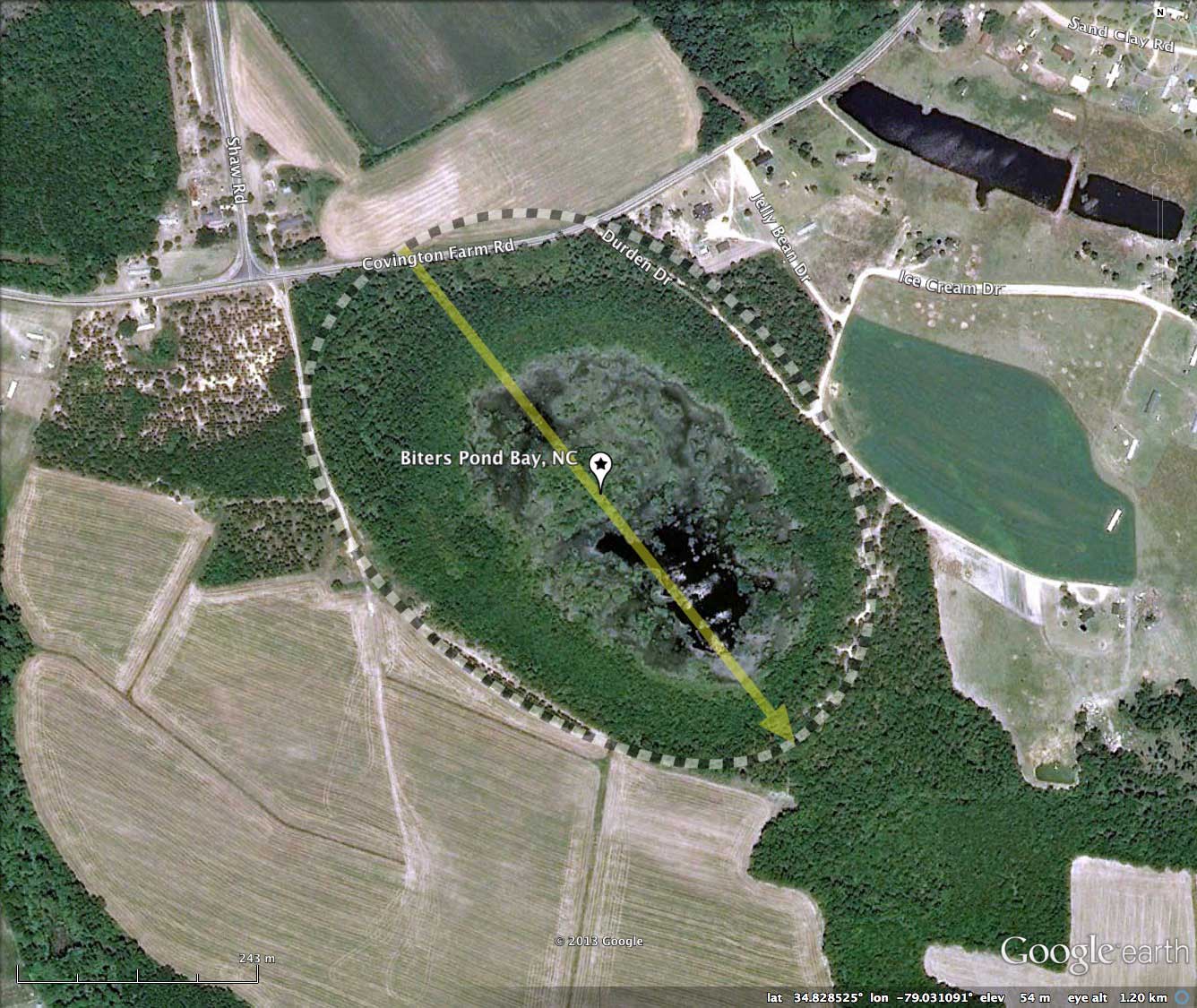
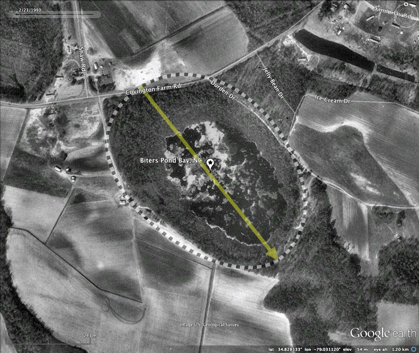
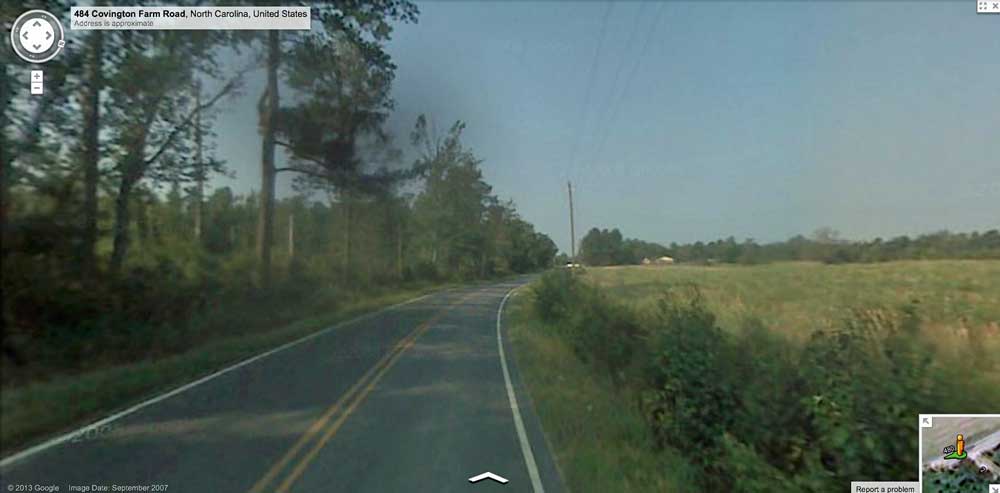
Google Streetview is available from Covington Farm Road, as it nips the northern end of the bay floor. The hints of the bay are subtle here, but the area to the left of the image in the album is the bay proper, heavily forested and resting slightly below the road's grade. On the right is the bay rim, slightly elevated from the road bed. Browse interactively in Google maps using this LINK.
The Carolina Bay Survey has identified and measured over 1600 bays in Octant 139316, making it one of the most saturated 1/4º x 1/4º grid elements in the Survey. Their location and metrics can be referenced through a Fusion Table spatial visualization.
The report was generated by Timothy Nifong in his review of The "Clay Subsoil" Carolina Bays of North Carolina (1982). Nifong's map, annotated with applied bay names, is included in the album here. A PDF of his Biter Bay inventory can be retrieved from my site HERE. Here is his description of the bay:
"The forested portion of this bay (approximately 40%) was cut in 1979. However, the relative permanence of the high water table in the remainder of the bay, even during the severe drought conditions of 1980 - 1981, has rendered the water-filled portion of the bay a comparatively large measure of protection from disturbance."
Google Streetview is available from Covington Farm Road, as it nips the northern end of the bay floor. The hints of the bay are subtle here, but the area to the left of the image in the album is the bay proper, heavily forested and resting slightly below the road's grade. On the right is the bay rim, slightly elevated from the road bed. Browse interactively in Google maps using this LINK.
The Carolina Bay Survey has identified and measured over 1600 bays in Octant 139316, making it one of the most saturated 1/4º x 1/4º grid elements in the Survey. Their location and metrics can be referenced through a Fusion Table spatial visualization.
- Index #: 139316_3112
- Location: 34.82829701443765,-79.03105889716548
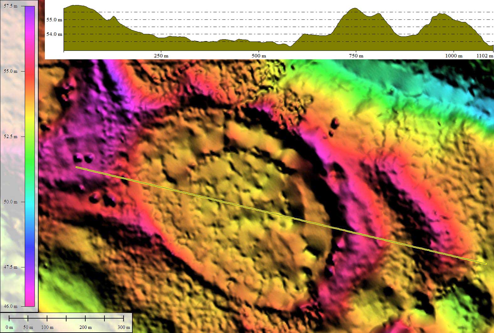
- Major: 0.63 km . . . Minor: 0.46 km
- Eccentricity: 0.684
- Area: 23.22 hectares
- Bearing: 141.61º
- Elevation: 53.51 m
- Archetype: bayCarolina
- Effective Diameter: 543.733 m
Copyright 2018 by Michael Davias