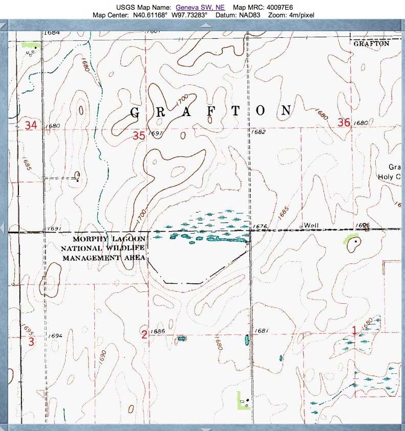
Morphy Lagoon, NE
This Rainwater Basin is home to the Morphy Lagoon National Wildlife Management Area. It is located in Fillmore County, 1 mile south and 1 mile west of Grafton. The habitat includes 80 wetland acres and 9 upland acres.
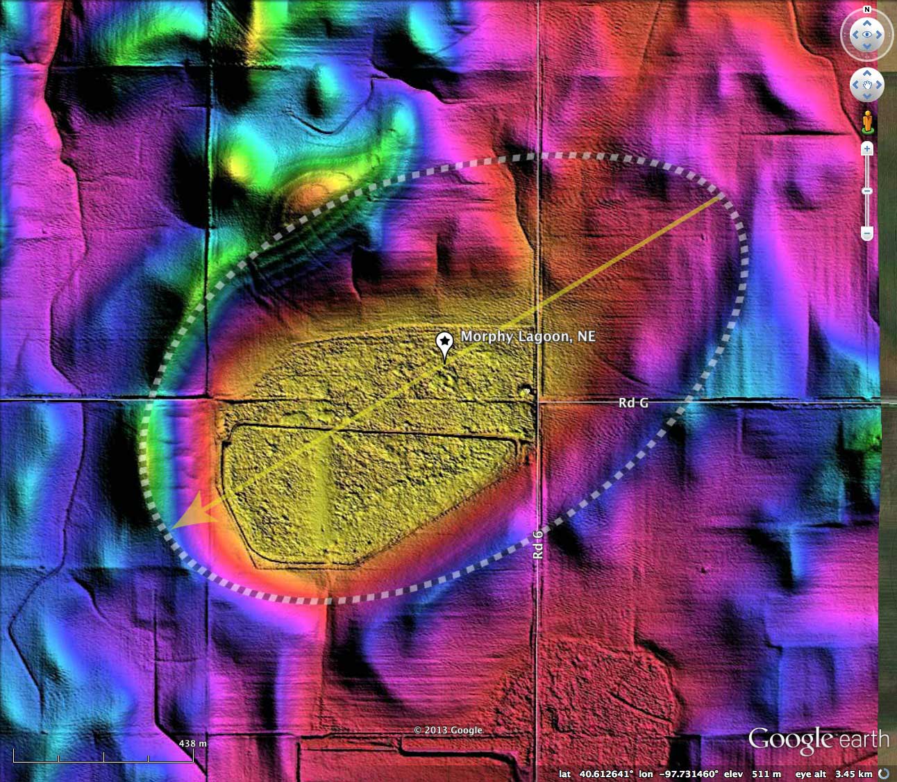
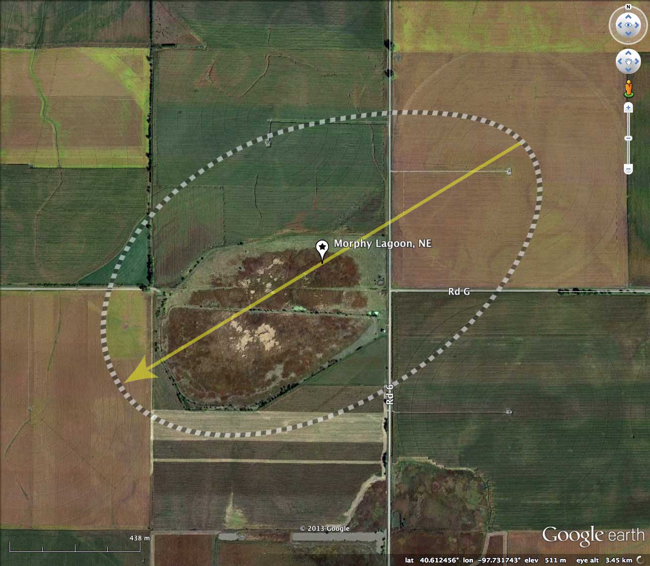
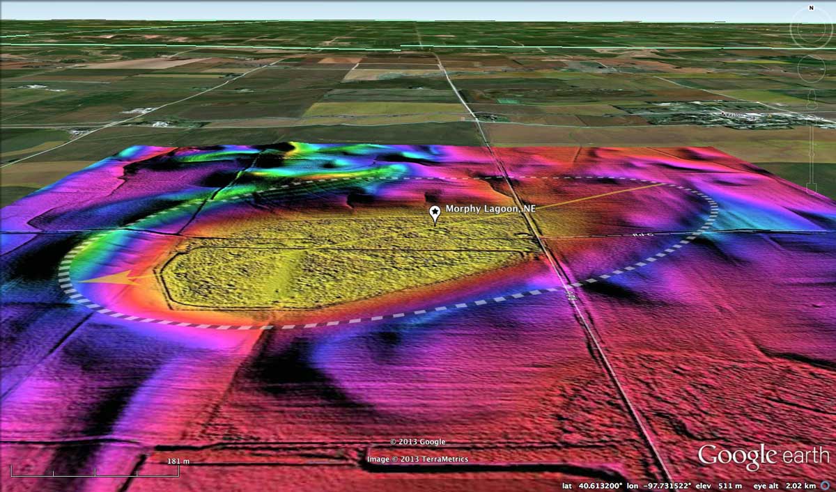
The basin is has a good fit into the bayWest archetype shape. Its alignment, at 238.78º, matches the predicted bearing.
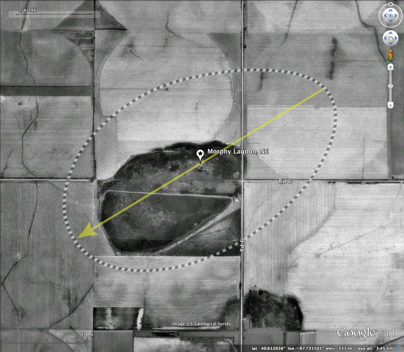
The lagoon has a natural break in the southwestern rim, but it is a few meters above the current basin floor, so it may not be providing much natural drainage at present. A narrow linear feature in the channel suggest it may have been trenched at some point. This would prevent the basin from "filling".
According to a 2006 survey conducted by Jeff Drahota, U.S. Fish and Wildlife Service, 77 of the 89 public acres in the Morphy WPA were wetlands, but only 1% was open water.
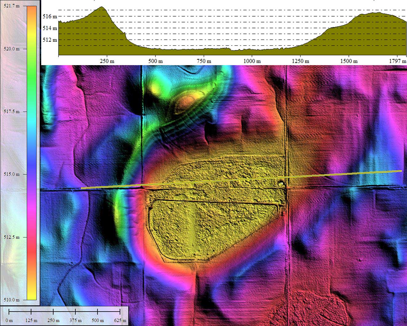
One feature of the Nebraska basins which differs from the Carolina Bays on the Atlantic coastal plain is the relative hight of the rims above the basin floors. The elevation profile map for Morphy Lagoon documents at least a 7 meter relief between floor and rim. For a 1.6 km basin, this is roughly twice what is seen out east, where a 3 meters relief is be more common.
Let me emphasize yet again that the "wet" area of a bay/basin does in no way represent the true shape or orientation of the actual sandy rim. Without the LiDAR DEM, the survey and the orientation triangulation would not yield a supportable correlated focus. This reality has led to misrepresentations as to the robustness of the shapes and the true nature of their orientation's systematic variation by position of the spherical globe.
The U.S. Fish and Wildlife Service offers a PDF (12MB, September 2011) discussing their comprehensive Land Protection Plan for the Rainwater Basin Wetland Management District. LINK . From the Introduction:
The basin is has a good fit into the bayWest archetype shape. Its alignment, at 238.78º, matches the predicted bearing.
The lagoon has a natural break in the southwestern rim, but it is a few meters above the current basin floor, so it may not be providing much natural drainage at present. A narrow linear feature in the channel suggest it may have been trenched at some point. This would prevent the basin from "filling".
According to a 2006 survey conducted by Jeff Drahota, U.S. Fish and Wildlife Service, 77 of the 89 public acres in the Morphy WPA were wetlands, but only 1% was open water.
One feature of the Nebraska basins which differs from the Carolina Bays on the Atlantic coastal plain is the relative hight of the rims above the basin floors. The elevation profile map for Morphy Lagoon documents at least a 7 meter relief between floor and rim. For a 1.6 km basin, this is roughly twice what is seen out east, where a 3 meters relief is be more common.
Let me emphasize yet again that the "wet" area of a bay/basin does in no way represent the true shape or orientation of the actual sandy rim. Without the LiDAR DEM, the survey and the orientation triangulation would not yield a supportable correlated focus. This reality has led to misrepresentations as to the robustness of the shapes and the true nature of their orientation's systematic variation by position of the spherical globe.
The U.S. Fish and Wildlife Service offers a PDF (12MB, September 2011) discussing their comprehensive Land Protection Plan for the Rainwater Basin Wetland Management District. LINK . From the Introduction:
The Rainwater Basin was once covered by native prairie and was largely isolated from streams and natural drainages. Heavy rains or snow melts would fill the numerous shallow depressions scattered throughout the region...
Today, the landscape is dramatically changed. The expansive grasslands and numerous wetlands have been replaced with fields of corn and soybeans. Roads traverse the landscape at 1-mile intervals, and small rural communities are scattered within a 10-mile radius of one another. Many of the wetlands have been filled or drained, reducing their numbers to only about 16 percent of their historical level.
US F&WS Rainwater Basin Wetland Management District
The Carolina Bay Survey has identified and measured 36 bays in Octant 162390. Their location and metrics can be referenced through a Fusion Table spatial visualization.
- Index #: 162390_4492
- Location: 40.612193839744414,-97.7316340569206
- Major: 1.6 km . . . Minor: 0.96 km
- Eccentricity: 0.8
- Area: 121.74 hectares
- Bearing: 238.78º
- Elevation: 510.47 m
- Archetype: bayWest
- Effective Diameter: 1,245.005 m
Copyright 2018 by Michael Davias