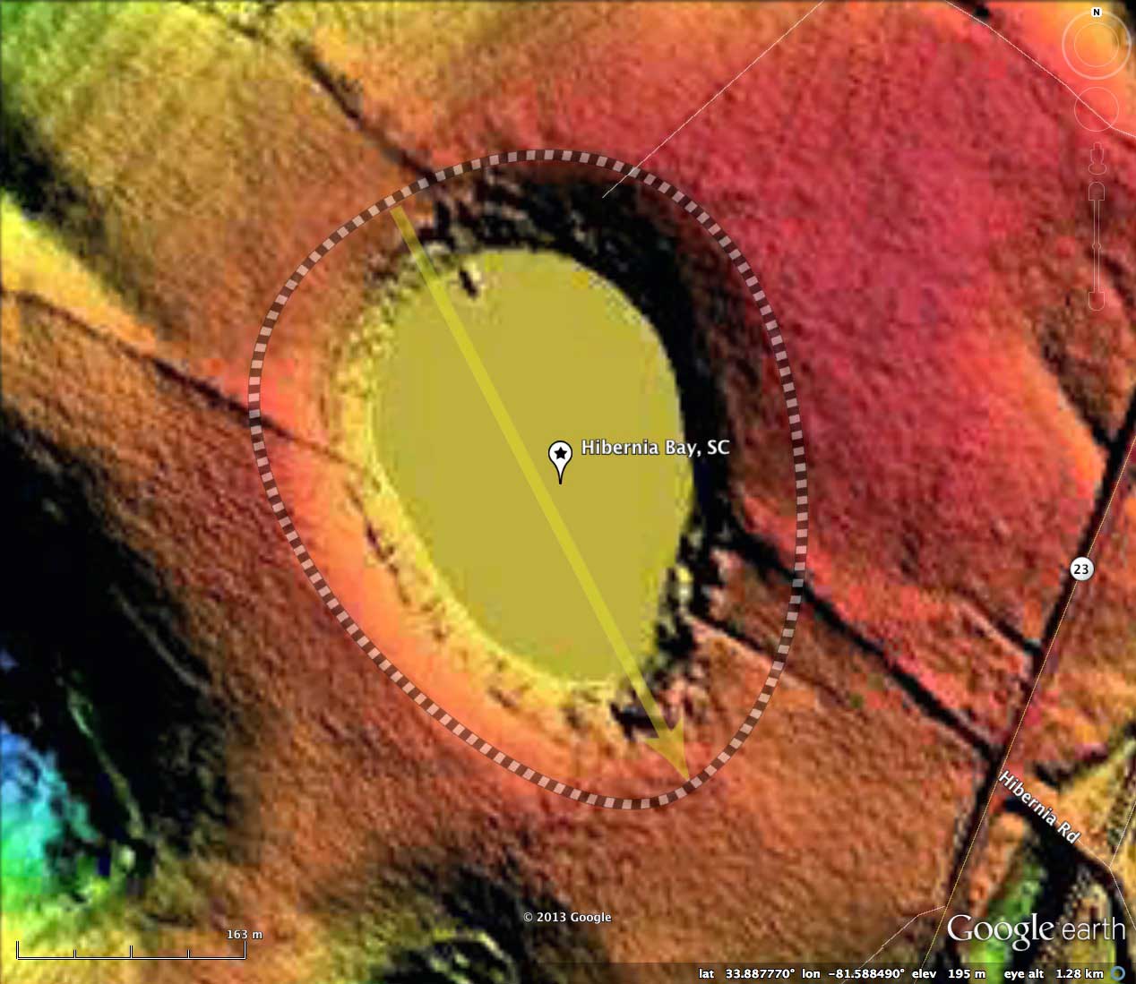
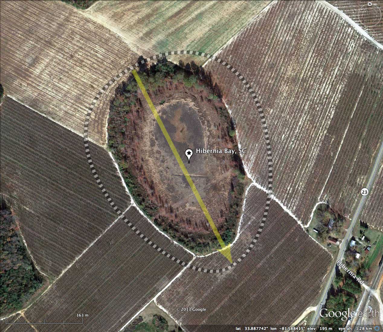
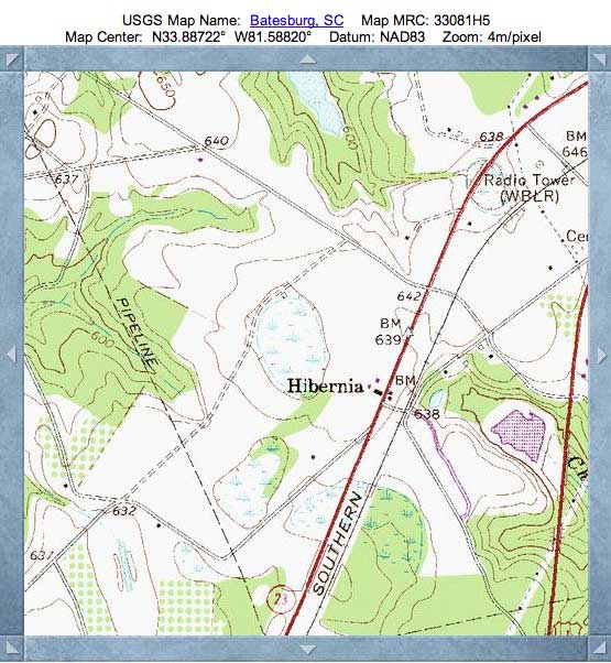
Hibernia Bay, SC
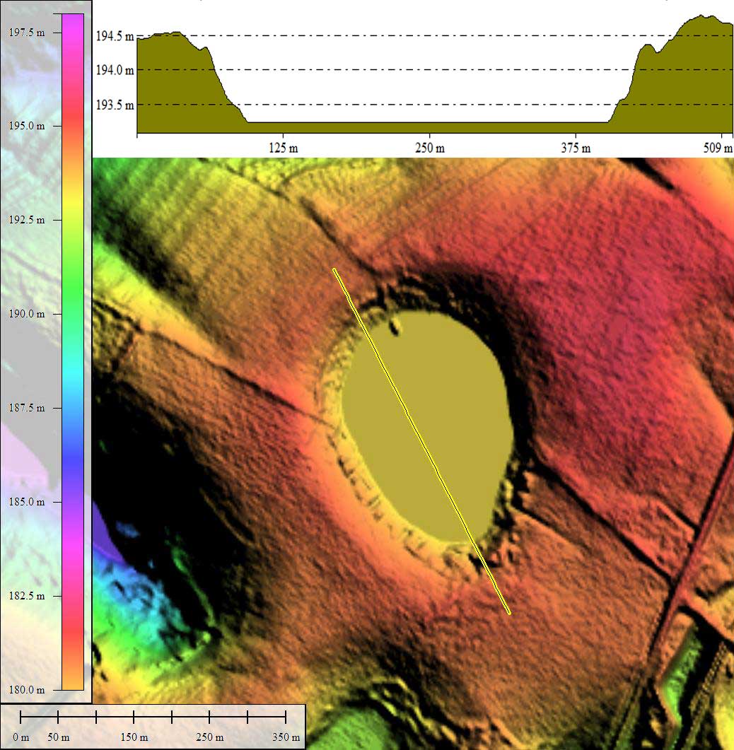
Today's bay is located 30 miles due west of Columbia, SC, and at a lofty elevation of 633 feet above sea level! And it is not alone, as the broad ridge it sets into extends for 20 miles and is peppered with well-formed baySouth archetype-shaped bays. Also notable is that this bay - and most of its neighbors - have no standing rim, but rather present themselves as basins set into the surrounding terrain. The existence of this assemblage of bays so high above (and 200 kilometers removed from) the Atlantic suggests that a marine shoreline mechanism for creation of the bays is not possible unless they are many millions of years old.
Hibernia Bay was among the bays considered as restoration candidates in a 1991 report by the South Carolina Wildlife and Marine Resources Department, entitled _Distribution And Status of Carolina Bays in South Carolina_; which can be retrieved using this LINK.
Here is a quote from the report, which was written by Stephen H. Bennett and John B. Nelson:
"We have concluded that there are far fewer bays in South Carolina than had been previously believed and that most of them have been significantly altered. Of the 219 relatively intact bays found during the study, only 36 have been identified as protection projects of the Heritage Trust Program."
In the report this bay was simply referred to as "BayID 1770243415", as indeed it has no given USGS geo-name. To give it one, I applied the name of the small populated place located immediately to the east.
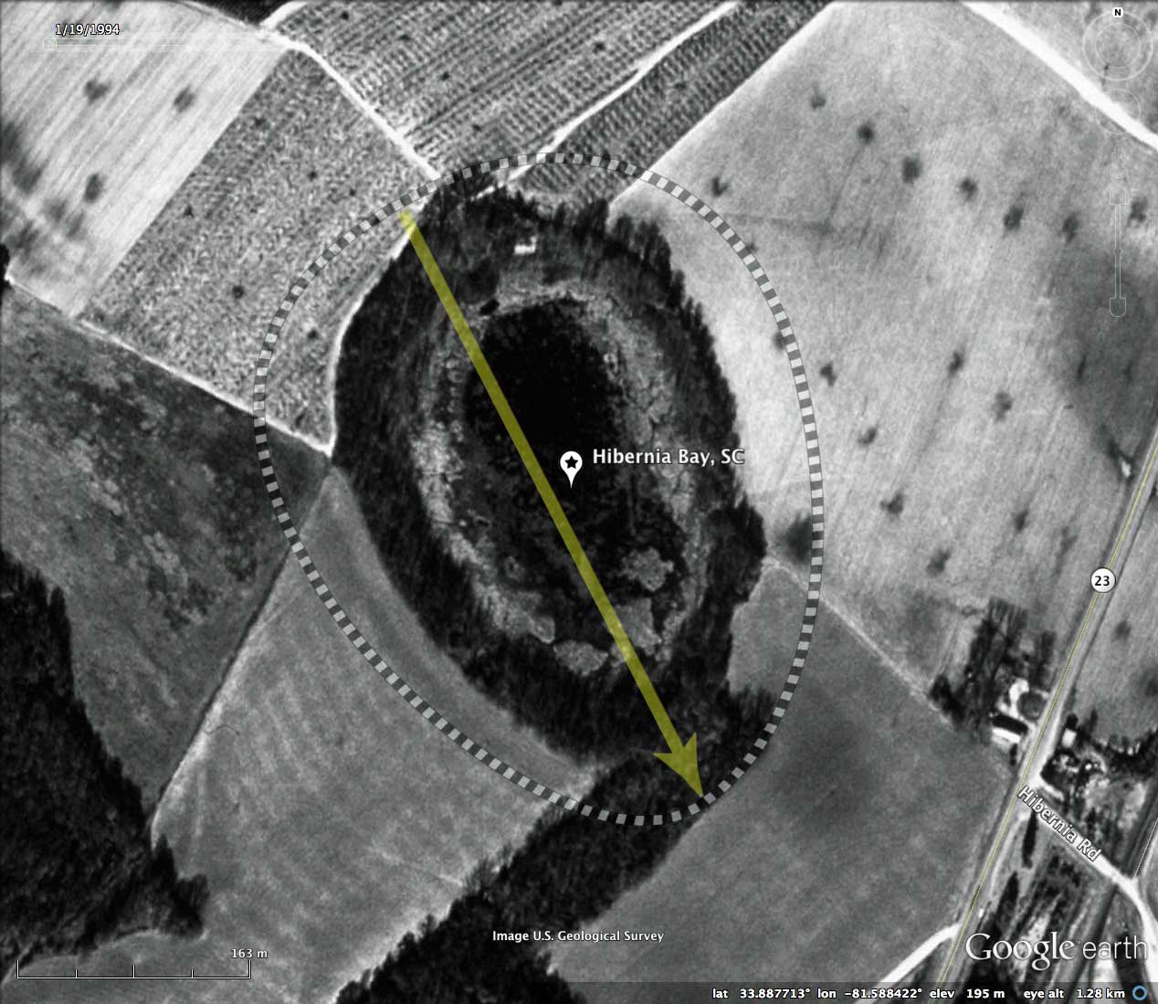
Historical aerial photography from 1941 compares favorably to Google Earth's 1994 imagery, and both do suggest that the bay is relatively undisturbed.
The Carolina Bay Survey has identified and measured ~90 bays in _Octant 135326_. Their location and metrics can be referenced through a Fusion Table spatial visualization.
Hibernia Bay was among the bays considered as restoration candidates in a 1991 report by the South Carolina Wildlife and Marine Resources Department, entitled _Distribution And Status of Carolina Bays in South Carolina_; which can be retrieved using this LINK.
Here is a quote from the report, which was written by Stephen H. Bennett and John B. Nelson:
"We have concluded that there are far fewer bays in South Carolina than had been previously believed and that most of them have been significantly altered. Of the 219 relatively intact bays found during the study, only 36 have been identified as protection projects of the Heritage Trust Program."
In the report this bay was simply referred to as "BayID 1770243415", as indeed it has no given USGS geo-name. To give it one, I applied the name of the small populated place located immediately to the east.
Historical aerial photography from 1941 compares favorably to Google Earth's 1994 imagery, and both do suggest that the bay is relatively undisturbed.
The Carolina Bay Survey has identified and measured ~90 bays in _Octant 135326_. Their location and metrics can be referenced through a Fusion Table spatial visualization.
- Index #: 135326_5535
- Location: 33.88754265646966,-81.58845976840524
- Major: 0.47 km . . . Minor: 0.37 km
- Eccentricity: 0.599
- Area: 14.03 hectares
- Bearing: 152.89º
- Elevation: 193.0 m
- Archetype: baySouth
- Effective Diameter: 422.652 m
Copyright 2018 by Michael Davias