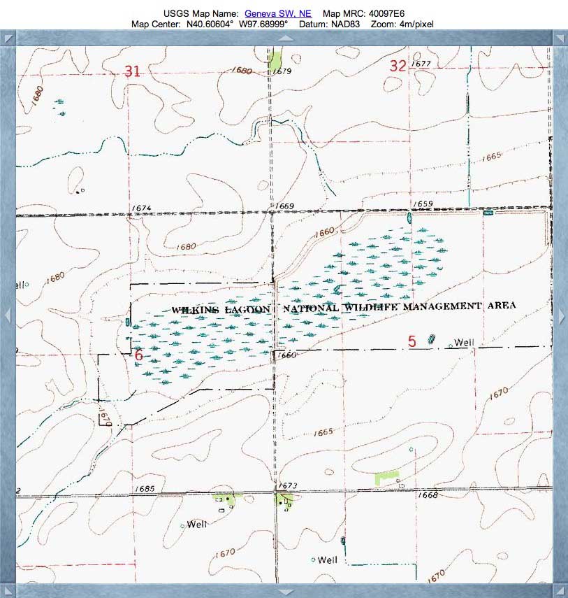
Wilkins Lagoon, NE
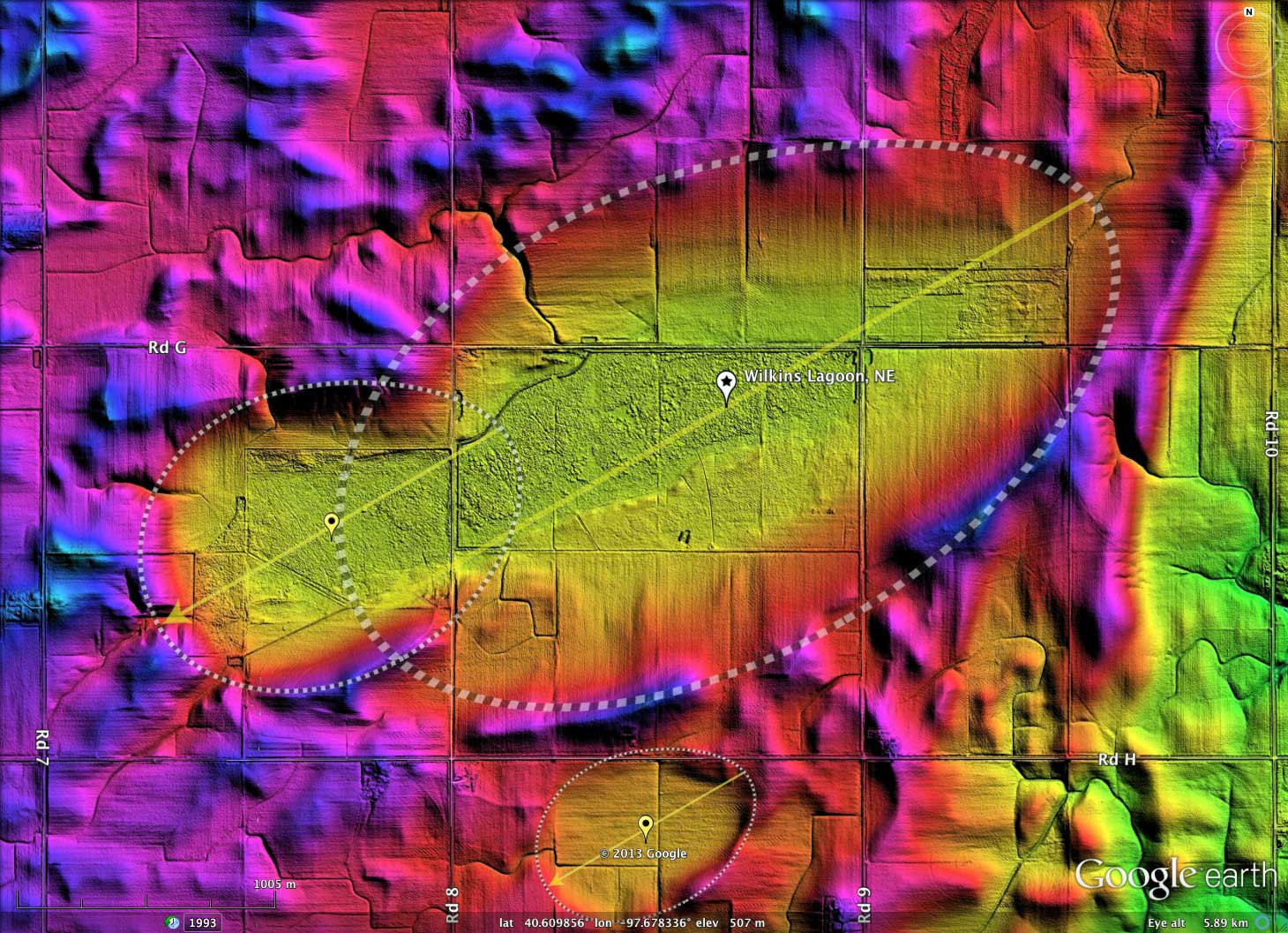
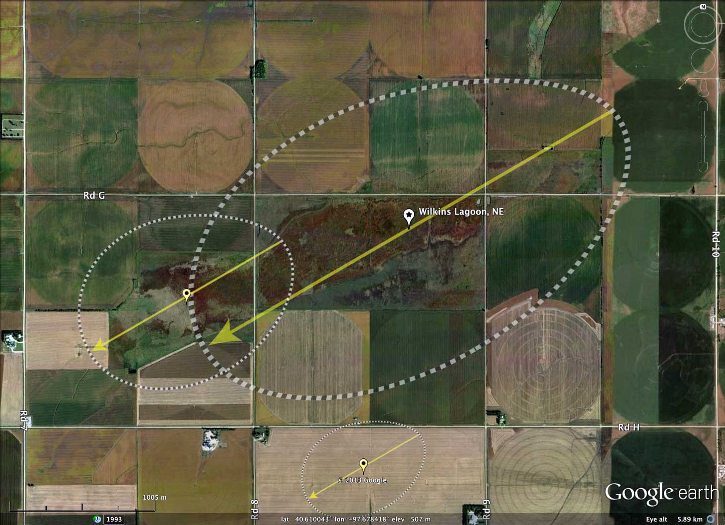
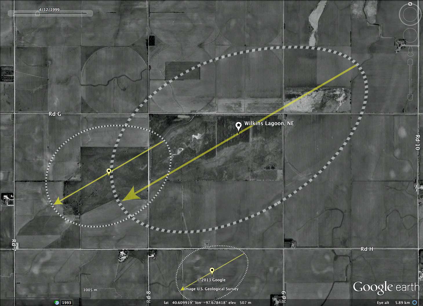
I interpret the shape of Wilkins Lagoon to be comprised of two bayWest shapes aligned nearly nose-to-tail. The imagery also includes a smaller bay immediately to the south. All three overlay templates are shown using the identical orientation of 239.87º. The imagery seems to suggest that numerous others basins with similar alignments may exist nearby. The repetition of the bayWest archetype shape across Nebraska is remarkable, and similar to the repetitiveness seen in the eastern Carolina Bays.
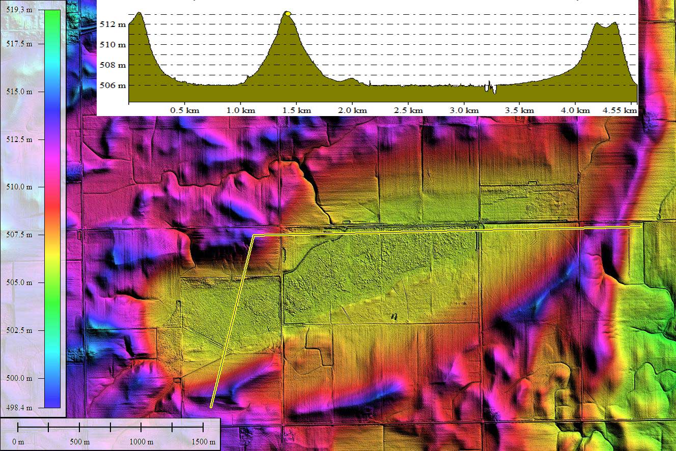
Together, the two basins form a depression 4 kilometers in length. Several small drainage networks flow into the basin, but there appears to be no natural or man-made drainage outlet.
LiDAR data for Nebraska has been provided by the Nebraska Department of Natural Resources' Spatial Data Bank. The 1-2 meter spatial resolution raw data was processed in Global Mapper to yield the Google Earth overlays used.
"The basin is the site of the Wilkins Lagoon National Wildlife Management Area: _Located in Fillmore County, 1 mile east and 2 miles south of Grafton. Habitat includes 321 acres of wetland and 208 acres of upland habitat. Another large "spring" basin that should be checked during that particular season. Dirt roads from every direction can make access impossible during wet spells." Source: Nebraska Birding Trails
The U.S. Fish & Wildlife Service's National Wildlife Refuge System offers a web section for the Rainwater Basin Wetland Management District, which manages 61 Waterfowl Production Areas comprised of over 24,000 wetland and upland acres across 13 Nebraska Counties. Web LINK
- Index #: 162390_4371
- Location: 40.60918571127279,-97.67836361660795
- Major: 3.32 km . . . Minor: 1.92 km
- Eccentricity: 0.814
- Area: 504.03 hectares
- Bearing: 239.87º
- Elevation: 505.98 m
- Archetype: bayWest
- Effective Diameter: 2,533.277 m
- http://www.fws.gov/refuge/rainwater_basin_wmd/
- Location: 40.60498157945146,-97.69667487957229
- Major: 1.56 km . . . Minor: 1.18 km
- Eccentricity: 0.65
- Area: 145.29 hectares
- Bearing: 239.87º
- Elevation: 506.01 m
- Archetype: bayWest
- Effective Diameter: 1,360.105 m
- Index #: 162390_3772
- Location: 40.59435438050769,-97.68210342807897
- Major: 0.9 km . . . Minor: 0.64 km
- Eccentricity: 0.7
- Area: 46.34 hectares
- Bearing: 239.87º
- Elevation: 507.14 m
- Archetype: bayWest
- Effective Diameter: 768.126 m
Copyright 2018 by Michael Davias