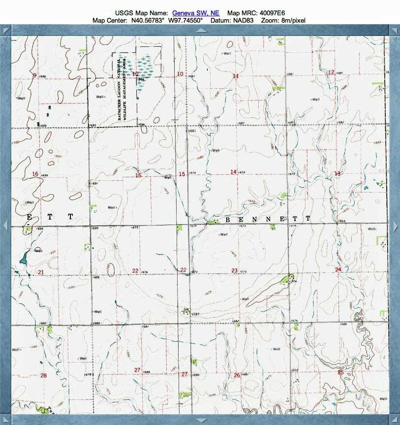
Griess Bay, NE
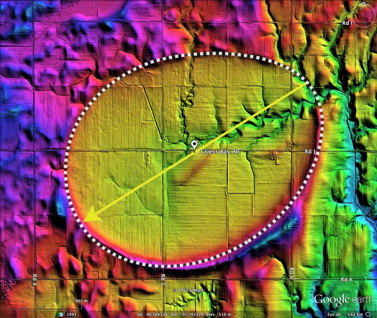
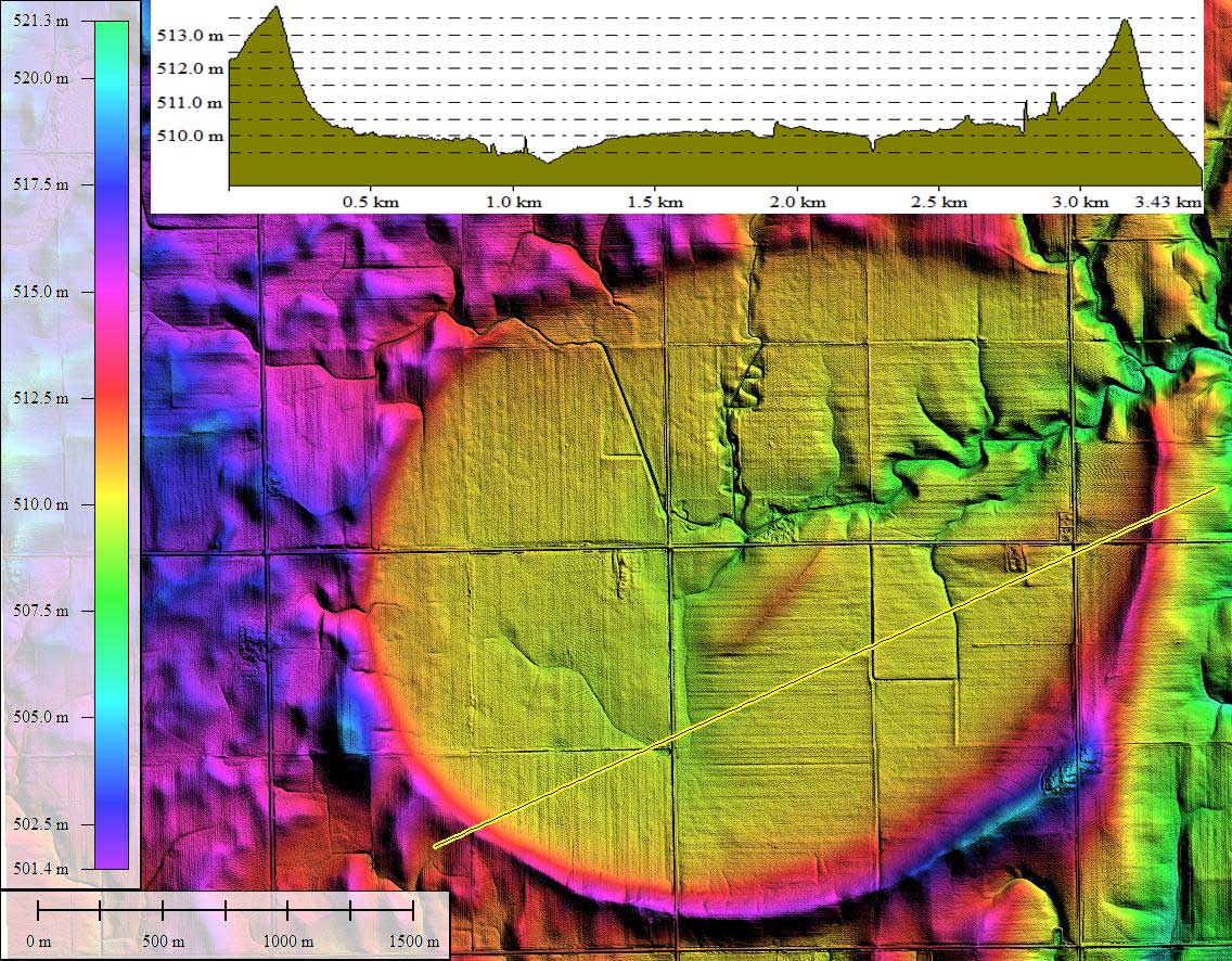
Griess Bay, is among the largest of the Carolina Bay landforms on the continent. It is over 3 kilometers across its major axis, and has a full 4+ meters of relief from the rim to the current basin floor.
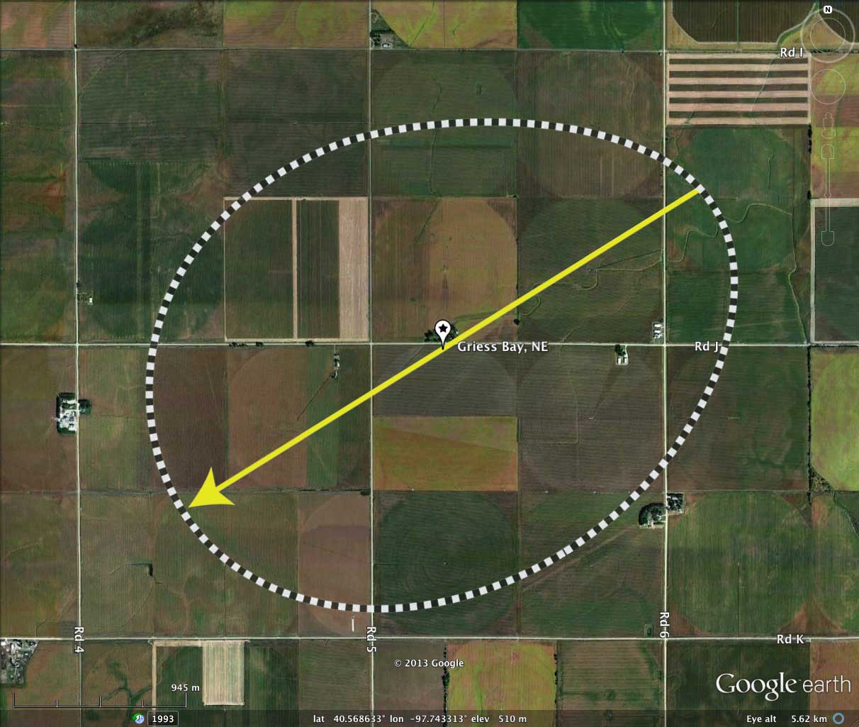
The existence of a well developed natural drainage network within the basin has allowed the floor to remain well drained, and that is likely why it has not been identified as a "Rainwater Basin". Having no designated topographic name, I have named this Carolina Bay after a major landholder.
The shape of this bay is well described by the common bayWest archetype. The orientation is consistent with other nearby bays, and agrees with the Bearing Calculator's predictions for a bay at this location.
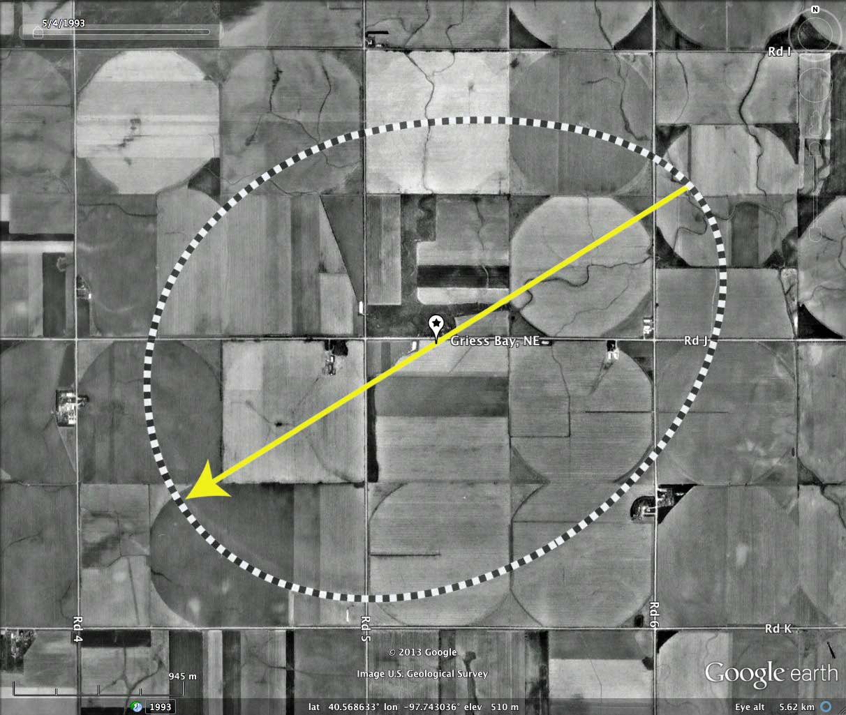
The floor of the bay is under active agricultural uses, and has only a handful of buildings present. With no standing water, waterfowl are not attracted to the bay.
The existence of a well developed natural drainage network within the basin has allowed the floor to remain well drained, and that is likely why it has not been identified as a "Rainwater Basin". Having no designated topographic name, I have named this Carolina Bay after a major landholder.
The shape of this bay is well described by the common bayWest archetype. The orientation is consistent with other nearby bays, and agrees with the Bearing Calculator's predictions for a bay at this location.
The floor of the bay is under active agricultural uses, and has only a handful of buildings present. With no standing water, waterfowl are not attracted to the bay.
- Index #: 162390_2797
- Location: 40.56762900571524,-97.74331835133316
- Major: 3.39 km . . . Minor: 2.62 km
- Eccentricity: 0.633
- Area: 699.32 hectares
- Bearing: 238.12º
- Elevation: 509.5 m
- Archetype: bayWest
- Effective Diameter: 2,983.957 m
Copyright 2018 by Michael Davias