Elder Bay, SC
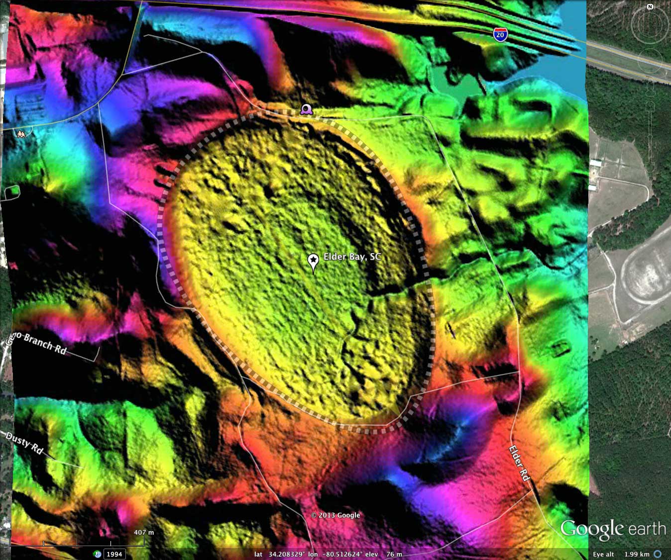
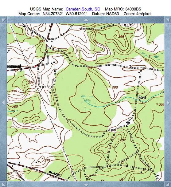
Here is a very well expressed bay in the shape of the common baySouth archetype. It has an orientation which is similar to nearby bays. I have named the bay after a road which passes just to the north.
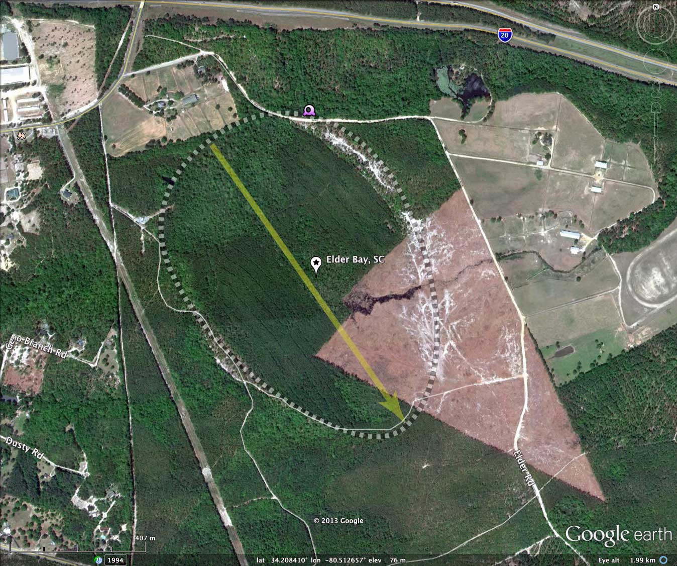
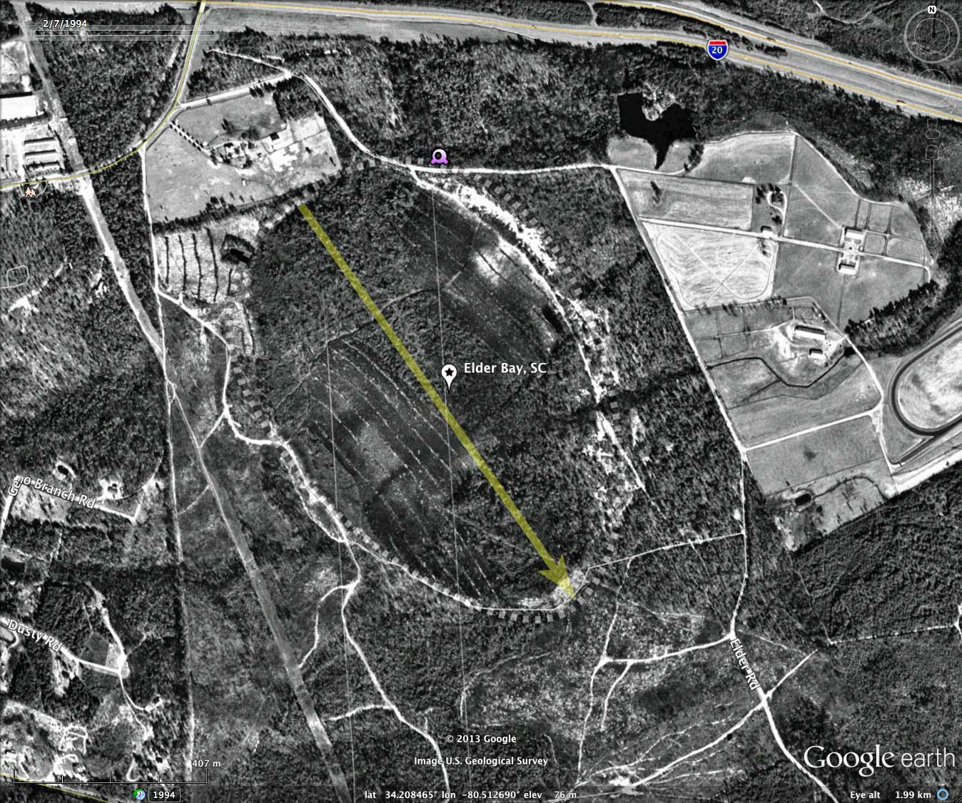
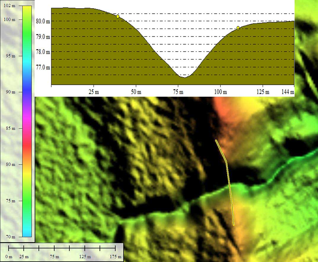
It is not clear to me if the drainage from the bay, seen in the LiDAR on the south eastern side, is natural or man-made. The bay floor looks to have been previously put into pine lumber farming, but is currently mostly wooded. The 2011 satellite imagery suggests that clear-cut timber harvesting is proceeding again east to west across the bay floor.
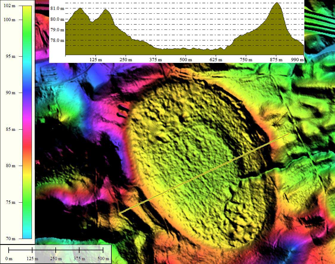
The double walled rim on the southwestern side of this bay might indicate the presence of a borrow pit. If so, there may be deep-rim exposures for OSL dating samples. Exposures along the drainage exit on the southeastern side might also offer some sampling opportunities.
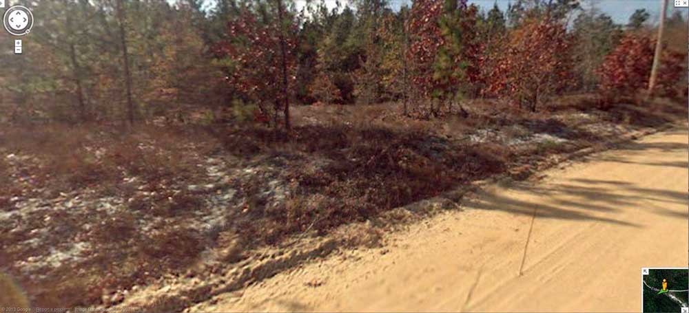
Google Streetview imagery is available from Elder Road, as it grazes outside of the northeastern rim, which is seen rising up on the left. Note white rim sand. Open in your web browser using this LINK.
It is not clear to me if the drainage from the bay, seen in the LiDAR on the south eastern side, is natural or man-made. The bay floor looks to have been previously put into pine lumber farming, but is currently mostly wooded. The 2011 satellite imagery suggests that clear-cut timber harvesting is proceeding again east to west across the bay floor.
The double walled rim on the southwestern side of this bay might indicate the presence of a borrow pit. If so, there may be deep-rim exposures for OSL dating samples. Exposures along the drainage exit on the southeastern side might also offer some sampling opportunities.
Google Streetview imagery is available from Elder Road, as it grazes outside of the northeastern rim, which is seen rising up on the left. Note white rim sand. Open in your web browser using this LINK.
- Index #: 136322_8305
- Location: 34.20810225477977,-80.51268530374796
- Major: 1.04 km . . . Minor: 0.72 km
- Eccentricity: 0.72
- Area: 59.98 hectares
- Bearing: 145.13º
- Elevation: 75.25 m
- Archetype: baySouth
- Effective Diameter: 873.892 m
Copyright 2018 by Michael Davias