Kissinger Basin, NE
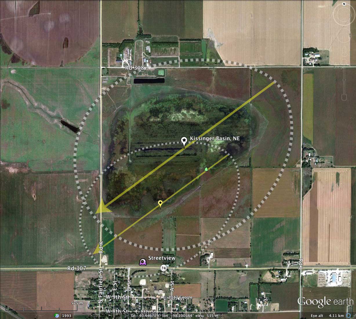
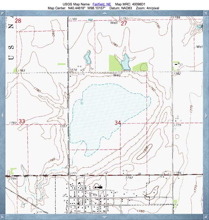
Kissinger Basin in Clay County, Nebraska, is located immediately north of Fairfield. It is home to the Kissinger Basin State Wildlife Management Area.
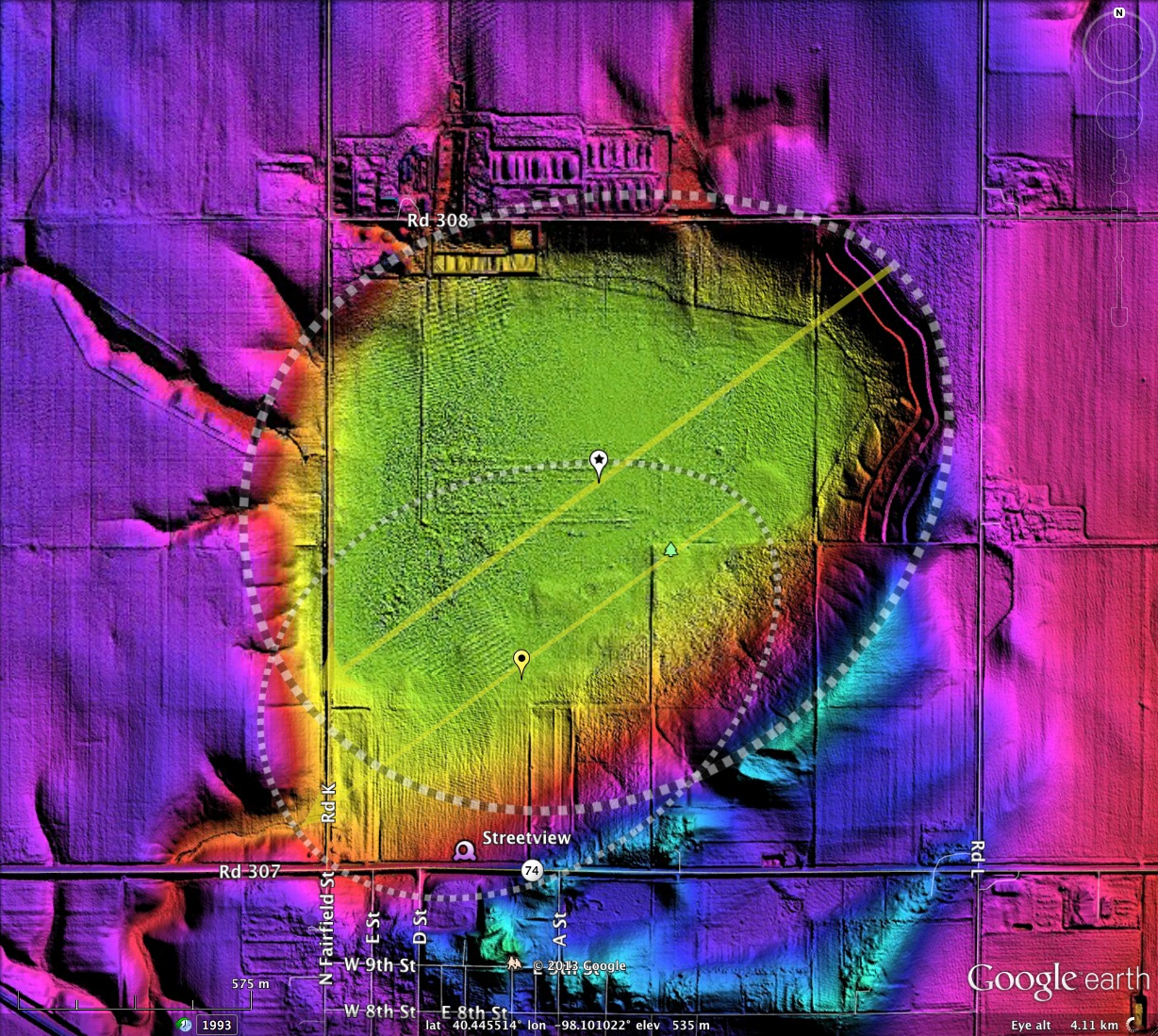
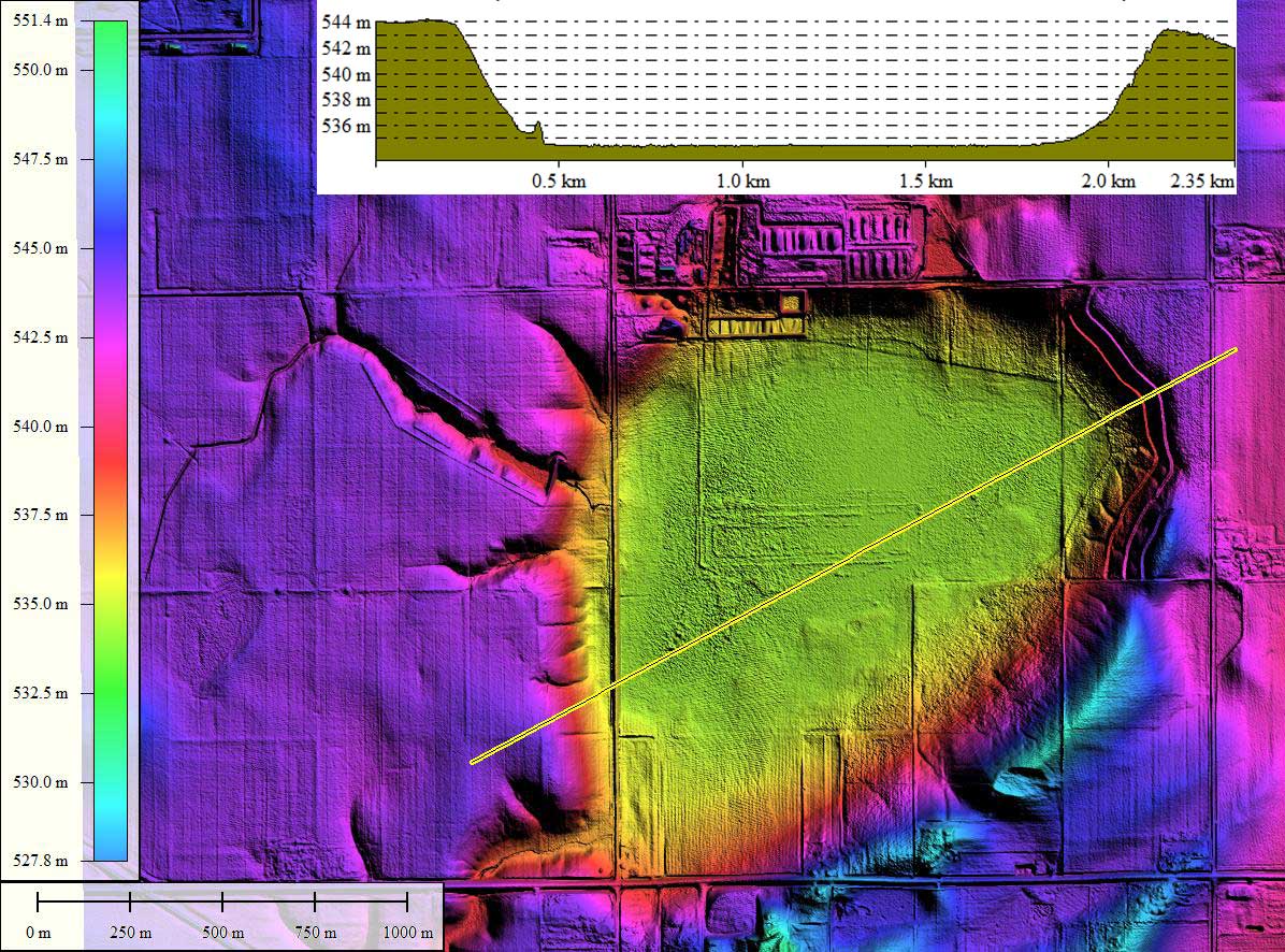
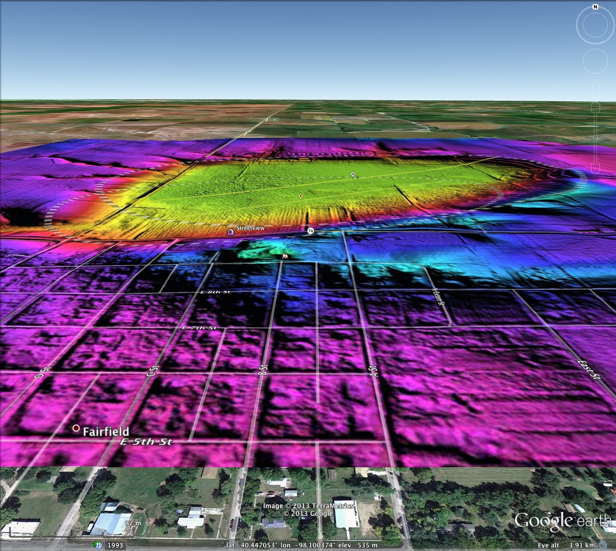
The shape of Kissinger Basin in Clay County, Nebraska is interpreted by me as being the mashup of two bay landforms. Both measurement overlays applied have a bearing of 233.74º, with the smaller body being offset slightly to the southwest from the main body. Wave-like landforms are seen to the south and east of the primary rim.
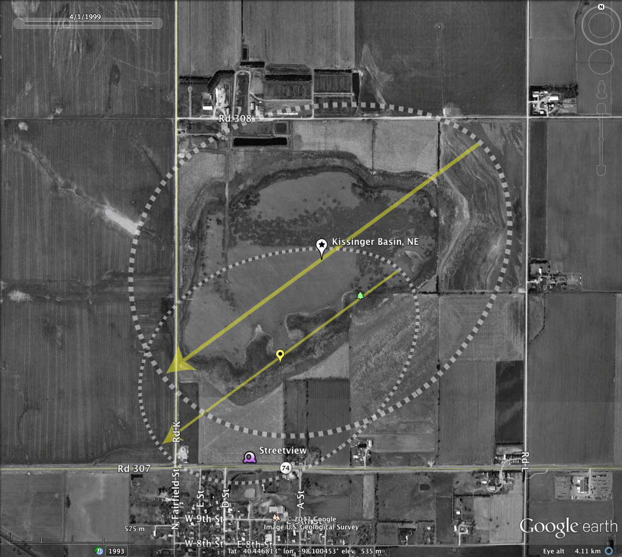
As is the case with most bays, the shape of the enclosed wetland/lake does not accurately describe the depression's shape as seen in the LiDAR.
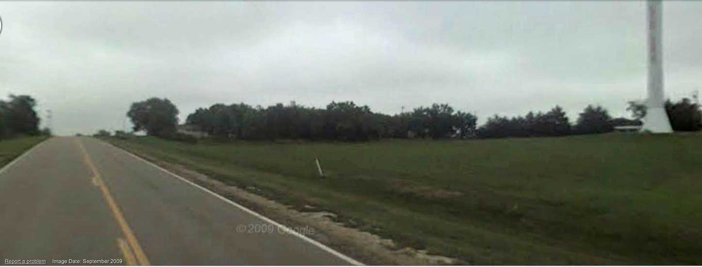
Streetview photo looking east along Rd 307. Shows water tower on rim, and road passing over rim in distance. The view is from where Road 307 dips slightly into the bay, on the village of Fairfield's northern edge. Streetview LINK.
For further information on the Rainwater Basins, see: *Guide to Nebraska's Wetlands*
The guide is a full-color 59-page special publication by the Nebraska Game and Parks Commission. It defines and describes Nebraska wetlands and discusses wetland functions, dynamics, classification, inventory and conservation efforts. Fourteen wetland complexes are covered in depth. A listing of wetland plants and animals is provided as well as literature references. LINK:
The shape of Kissinger Basin in Clay County, Nebraska is interpreted by me as being the mashup of two bay landforms. Both measurement overlays applied have a bearing of 233.74º, with the smaller body being offset slightly to the southwest from the main body. Wave-like landforms are seen to the south and east of the primary rim.
As is the case with most bays, the shape of the enclosed wetland/lake does not accurately describe the depression's shape as seen in the LiDAR.
Streetview photo looking east along Rd 307. Shows water tower on rim, and road passing over rim in distance. The view is from where Road 307 dips slightly into the bay, on the village of Fairfield's northern edge. Streetview LINK.
For further information on the Rainwater Basins, see: *Guide to Nebraska's Wetlands*
The guide is a full-color 59-page special publication by the Nebraska Game and Parks Commission. It defines and describes Nebraska wetlands and discusses wetland functions, dynamics, classification, inventory and conservation efforts. Fourteen wetland complexes are covered in depth. A listing of wetland plants and animals is provided as well as literature references. LINK:
- Index #: 161392_7840
- Location: 40.44630340146681,-98.10048007166685
- Major: 1.83 km . . . Minor: 1.52 km
- Eccentricity: 0.561
- Area: 219.69 hectares
- Bearing: 233.74º
- Elevation: 534.42 m
- Archetype: bayWest
- Effective Diameter: 1,672.475 m
- Index #: 161392_7641
- Location: 40.44223068758386,-98.10275396875498
- Major: 1.39 km . . . Minor: 1.0 km
- Eccentricity: 0.697
- Area: 109.83 hectares
- Bearing: 233.74º
- Elevation: 534.61 m
- Archetype: bayWest
- Effective Diameter: 1,182.538 m
Copyright 2018 by Michael Davias