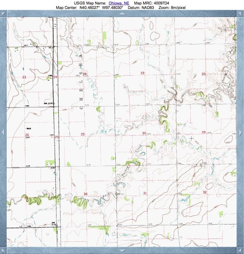
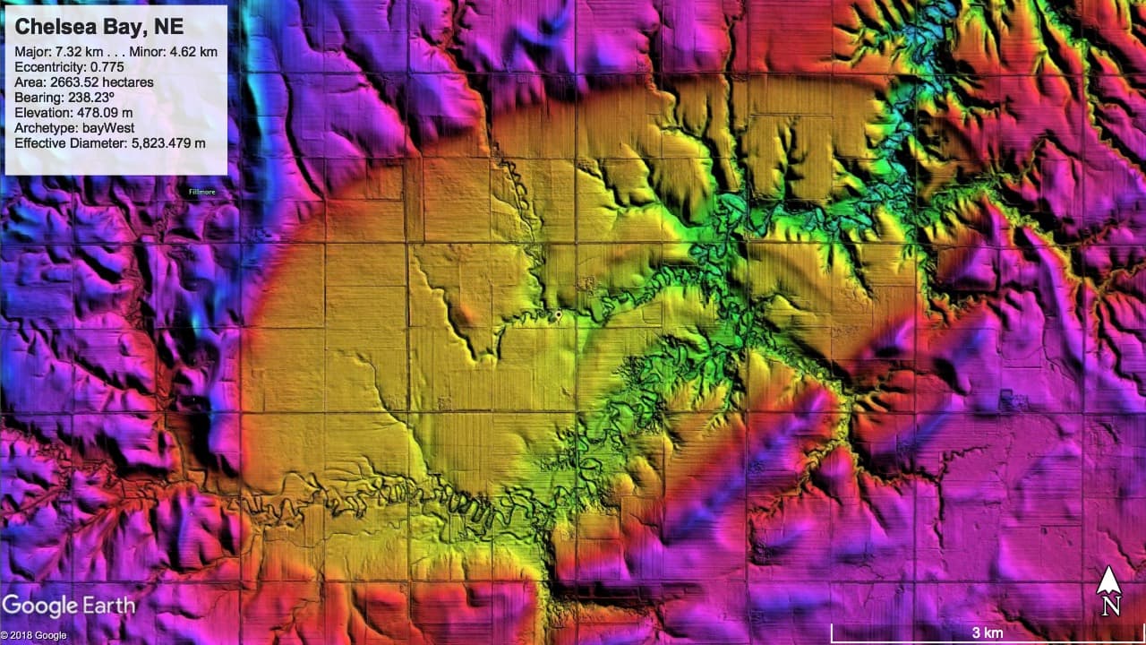
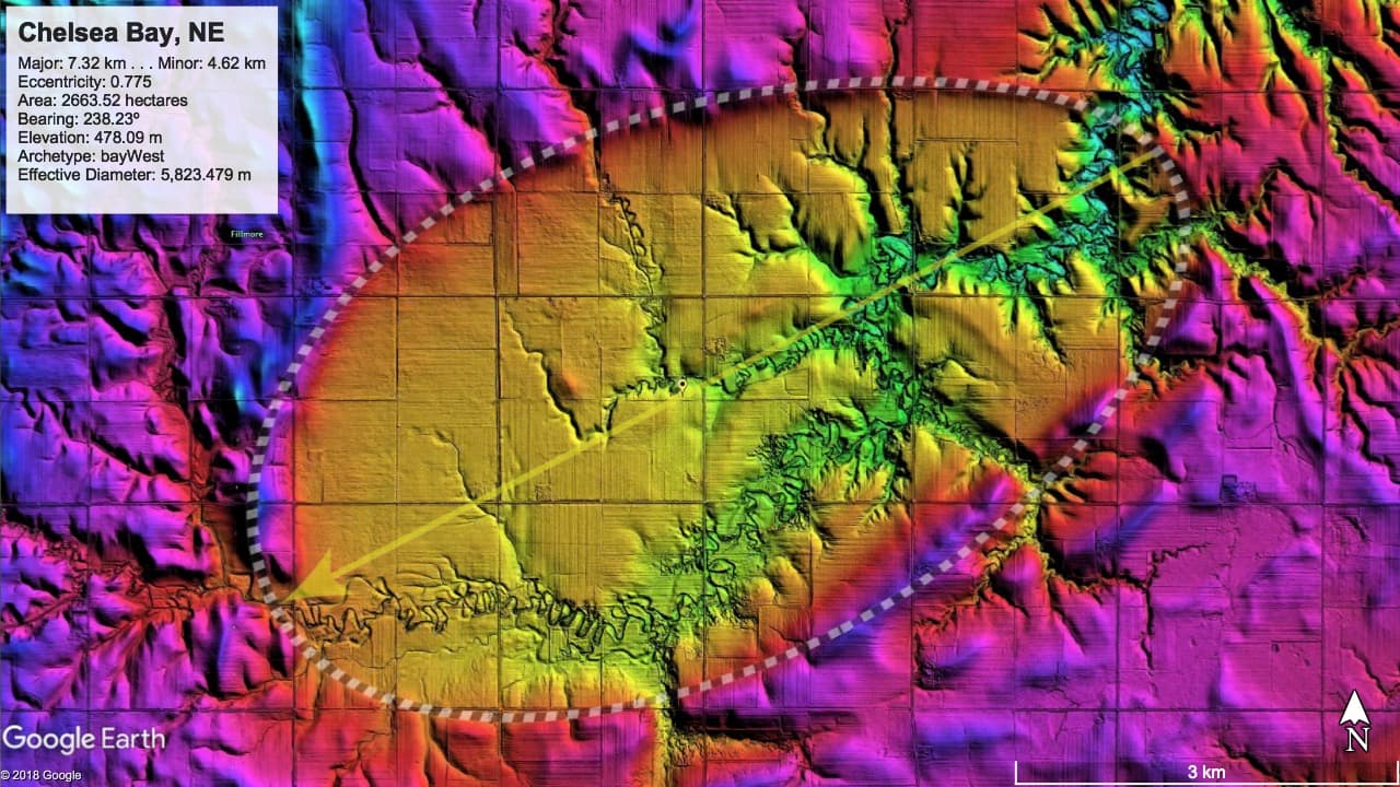
Chelsea Bay, NE
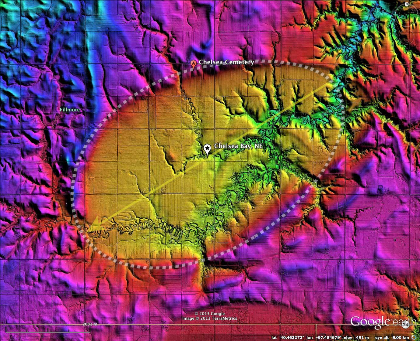
Chelsea Bay is a massive landform, extending over 7 kilometers in length and almost 5 kilometers at its widest. The basin, located in Fillmore County, Nebraska, conforms tightly to the common bayWest archetype shape, and has an orientation similar to others southeastern Nebraska.
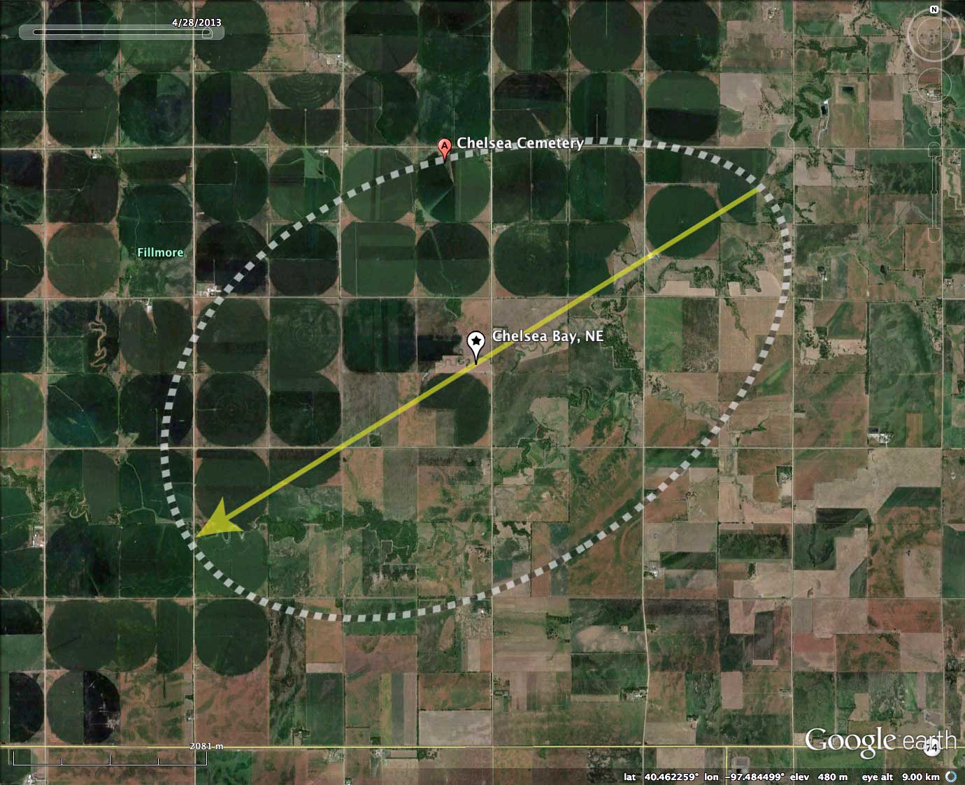
I named the landform after a cemetery located on northern rim, which services a populated place just to the west. The sandy, well-drained character of Carolina Bay rims are commonly utilized as cemetery sites.
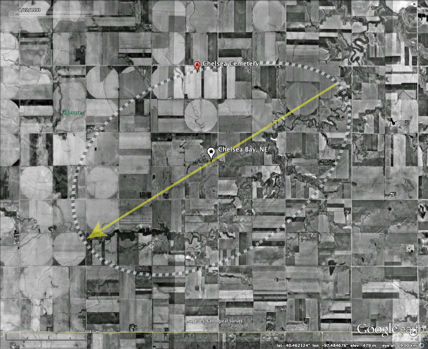
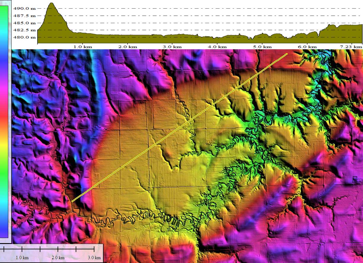
The northern half of the bay is farmed, and the grid of pivot irrigation plots is continuous across the rims, suggesting they do not present an impediment to the farming activity. IT must be remembered that our LiDAR is created with a 20x elevation exaggeration, so the sharply - defined rims presented here remain a challenge to visualize from the ground with the human eye. Areas of the rim have, impressively, as much as 10 meters in relief down to the bay floor from the surrounding landscape - see the elevation profile map included in the attached Photo Album.
The basin has not been identified as a Rainwater Basin, likely due to the extensive natural drainage across the landform. The floor of the basin is heavily dissected by South Fork Turkey Creek. An important question regarding the drainage is whether the South Fork of Turkey Creek advanced into and through the basin as a result of headward migration, or was it in existence prior to the creation of the basin?
The Carolina Bay Survey has identified and measured 17 bays in Octant 160298.
I named the landform after a cemetery located on northern rim, which services a populated place just to the west. The sandy, well-drained character of Carolina Bay rims are commonly utilized as cemetery sites.
The northern half of the bay is farmed, and the grid of pivot irrigation plots is continuous across the rims, suggesting they do not present an impediment to the farming activity. IT must be remembered that our LiDAR is created with a 20x elevation exaggeration, so the sharply - defined rims presented here remain a challenge to visualize from the ground with the human eye. Areas of the rim have, impressively, as much as 10 meters in relief down to the bay floor from the surrounding landscape - see the elevation profile map included in the attached Photo Album.
The basin has not been identified as a Rainwater Basin, likely due to the extensive natural drainage across the landform. The floor of the basin is heavily dissected by South Fork Turkey Creek. An important question regarding the drainage is whether the South Fork of Turkey Creek advanced into and through the basin as a result of headward migration, or was it in existence prior to the creation of the basin?
The Carolina Bay Survey has identified and measured 17 bays in Octant 160298.
- Index #: 161389_8492
- Location: 40.46017046773948,-97.48469584986833
- Major: 7.32 km . . . Minor: 4.62 km
- Eccentricity: 0.775
- Area: 2663.52 hectares
- Bearing: 238.23º
- Elevation: 478.09 m
- Archetype: bayWest
- Effective Diameter: 5,823.479 m
Compare LiDAR with the fitted overlays for this scene using the slider interface below
LiDAR
Planform
Copyright 2018 by Michael Davias