Sandhill Bay, SC
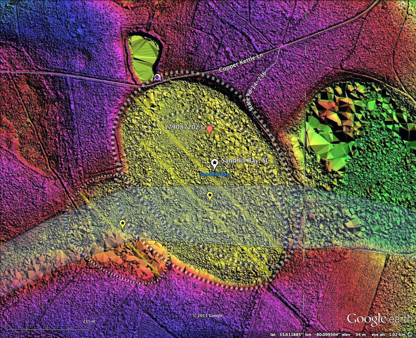
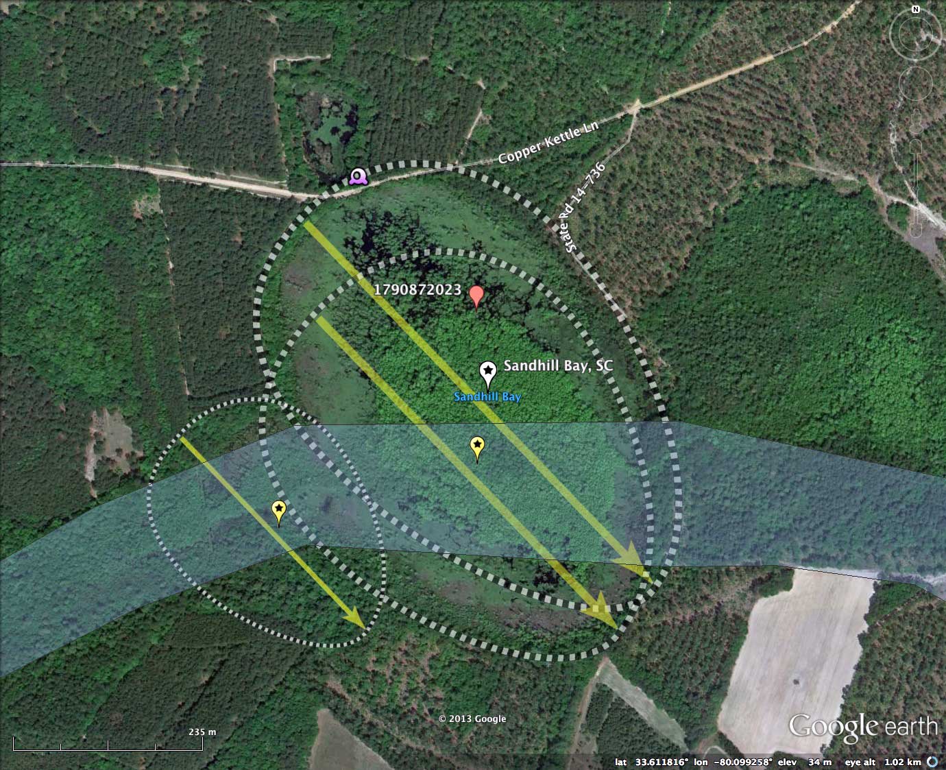
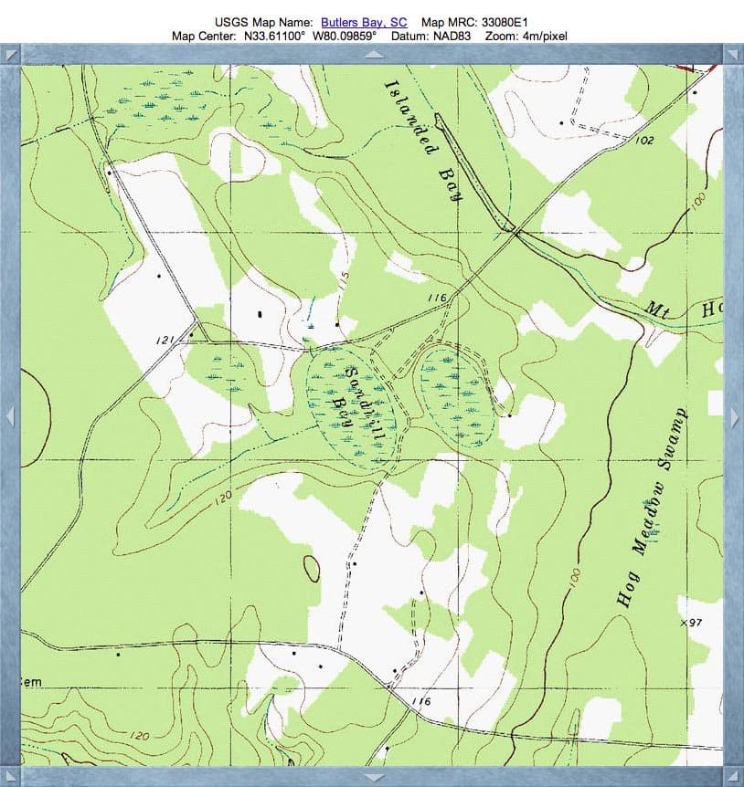
I interpret the shape of Sandhill Bay, SC, to be composed of three baySouth archetype shaped overlays. Two comprise the main body, while a smaller third generates the bulge to the southwest In addition, an antecedent drainage channel may exist, cutting across the southern section of the bay.
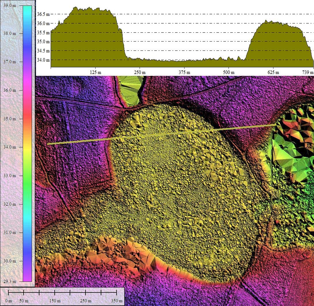
The KMZ file referenced here will present the measurement overlays on the Google Earth virtual globe, as well as display my hsv-shaded LiDAR elevation map of the site. The proposed antecedent channel is highlighted where it crosses the bay complex. The USGS topographic map also makes a strong case for the existence of a drainage system passing west to east under the bay complex.
Sandhill Bay has been identified as Carolina Bay of interest #1790872023 in an U.S. Environmental Protection Agency study entitled Advance Identification Of Carolina Bays For South Carolina Wetlands Protection , and a PDF of the document is available HERE.
http://www.dnr.sc.gov/wildlife/docs/CarolinaBays.pdf
Here is an extract from the bay's citation:
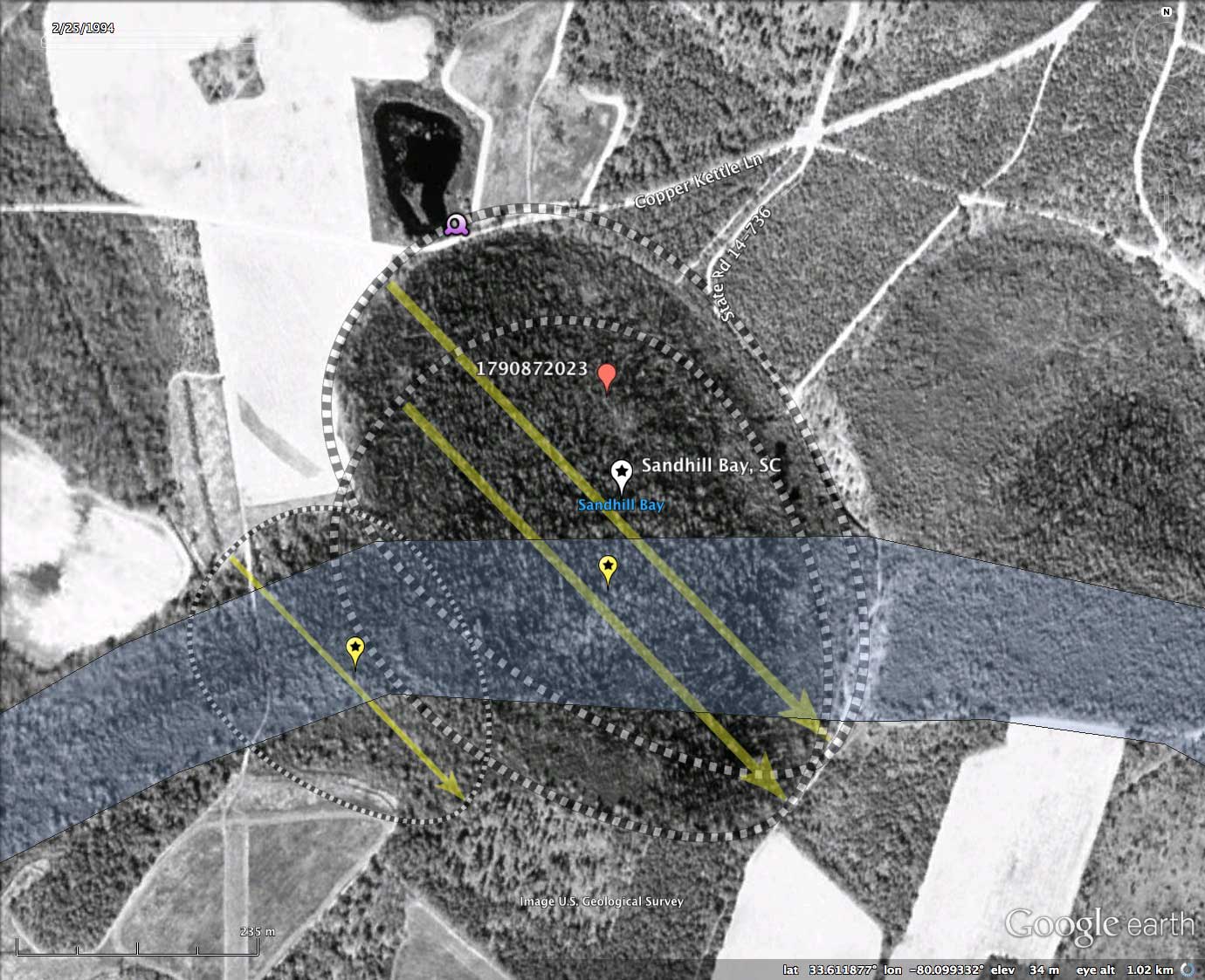
Included in the album is a 1948 historical aerial photo, sourced from the SC University Libraries Digital Collection. It supports a finding that the bay remains in a natural state.
An interesting aspect of the LiDAR is that it clearly shows the smaller "bay" immediately across Copper Kettle Lane is actually a borrow pit. Based on the 1948 historical historical imagery, it was mined prior to 1948 and not worked since,
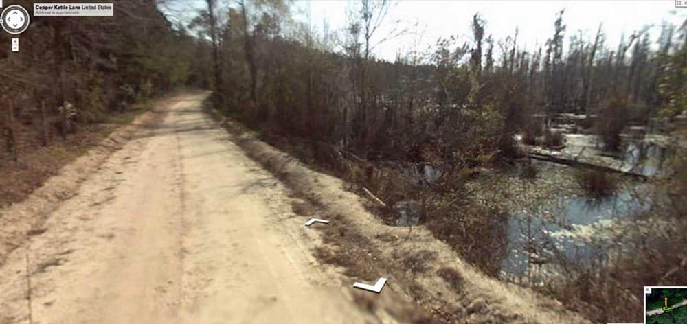
A very unique sequence of Google Streetview imagery is available from Copper Kettle Lane, where it dips briefly close to the bay floor at the northern end of the bay. In an image included in the attached Photo Album (and placemarked in the KMZ file), the rim is shown rising on the left, and open water across the bay floor is seen on right. Among all the bays I have featured in the blog, this is the first one I have identified that Google Streetview provides such an expansive look into a bay with standing water under an open canopy. You can browse this stretch of Copper Kettle Lane interactively in Google maps using this LINK.
The KMZ file referenced here will present the measurement overlays on the Google Earth virtual globe, as well as display my hsv-shaded LiDAR elevation map of the site. The proposed antecedent channel is highlighted where it crosses the bay complex. The USGS topographic map also makes a strong case for the existence of a drainage system passing west to east under the bay complex.
Sandhill Bay has been identified as Carolina Bay of interest #1790872023 in an U.S. Environmental Protection Agency study entitled Advance Identification Of Carolina Bays For South Carolina Wetlands Protection , and a PDF of the document is available HERE.
http://www.dnr.sc.gov/wildlife/docs/CarolinaBays.pdf
Here is an extract from the bay's citation:
- CANOPY: Acer spp., Nyssa biffora, Pinus taeda, Magnolia virginia SHRUB: Clethra alnifofia, Persea borbonia, Myrica cerifera, Lyonia Iucida, ltea virginica, Vaccinium spp., Cephafanthus occidentalis, flex myrtifofia
- GROUNDCOVER: Rhus vernix, Woodwardia spp., Sphagnum. spp., Peltandra spp., Saururus spp., Osmunda cinnamomea, Osmunda regalis
Included in the album is a 1948 historical aerial photo, sourced from the SC University Libraries Digital Collection. It supports a finding that the bay remains in a natural state.
An interesting aspect of the LiDAR is that it clearly shows the smaller "bay" immediately across Copper Kettle Lane is actually a borrow pit. Based on the 1948 historical historical imagery, it was mined prior to 1948 and not worked since,
A very unique sequence of Google Streetview imagery is available from Copper Kettle Lane, where it dips briefly close to the bay floor at the northern end of the bay. In an image included in the attached Photo Album (and placemarked in the KMZ file), the rim is shown rising on the left, and open water across the bay floor is seen on right. Among all the bays I have featured in the blog, this is the first one I have identified that Google Streetview provides such an expansive look into a bay with standing water under an open canopy. You can browse this stretch of Copper Kettle Lane interactively in Google maps using this LINK.
- Index #: 134320_4439
- Location: 33.61087563319212,-80.09948541087326
- Major: 0.55 km . . . Minor: 0.43 km
- Eccentricity: 0.634
- Area: 18.78 hectares
- Bearing: 136.07º
- Elevation: 34.0 m
- Archetype: baySouth
- Effective Diameter: 488.993 m
- Index #: 134320_4439
- Location: 33.611660480225055,-80.09934205358702
- Major: 0.64 km . . . Minor: 0.41 km
- Eccentricity: 0.768
- Area: 20.92 hectares
- Bearing: 136.07º
- Elevation: 34.01 m
- Archetype: baySouth
- Effective Diameter: 516.102 m
- Index #: 134320_4440
- Location: 33.610162231389104,-80.10214385793248
- Major: 0.34 km . . . Minor: 0.25 km
- Eccentricity: 0.671
- Area: 6.81 hectares
- Bearing: 136.07º
- Elevation: 34.15 m
- Archetype: baySouth
- Effective Diameter: 294.461 m
Copyright 2018 by Michael Davias