Dismal Bay, Sampson, NC
There are numerous Dismal Bays noted in the USGS geoNames database, so I have added the county name to the name string. An earlier post covered a Dismal Bay in Bladen County, NC. While we have come to view the Carolina Bays as wondrously alien landscapes hosting exotic habitats, early settlers likely simply viewed them as Dismal.
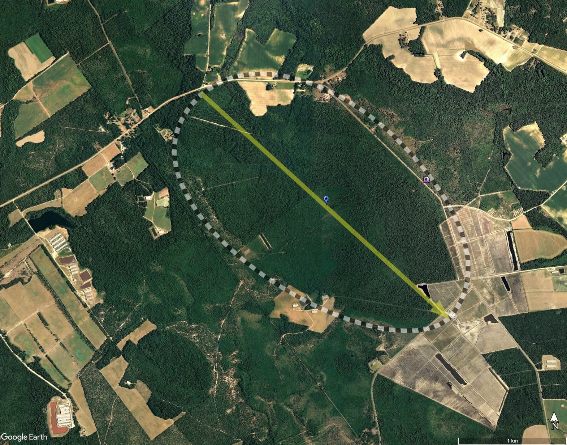
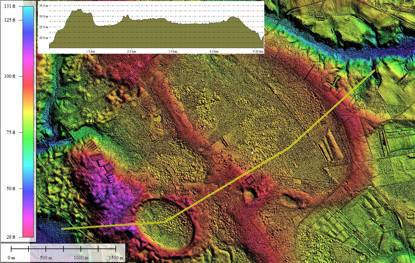
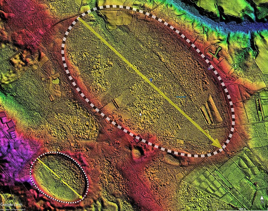
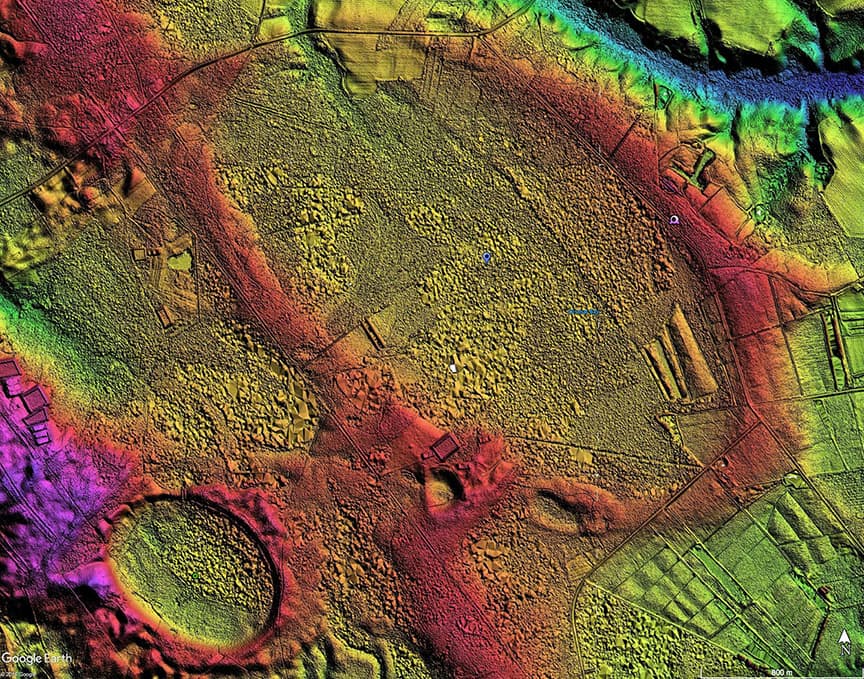
The bay presents a robust correlation to the bayArchetype archetype shape, and the measured orientation is similar to the other local bays. As an update to the original post, I have re-generated the LiDAR imagery using the newer sub-meter data. The earlier version's imagery was created with the early technology used by the North Carolina Floodplain project, and there, Dismal Bay looked a bit compromised, likely due to the extensive areas of deep forest canopy, through which the early LiDAR technology could not penetrate.
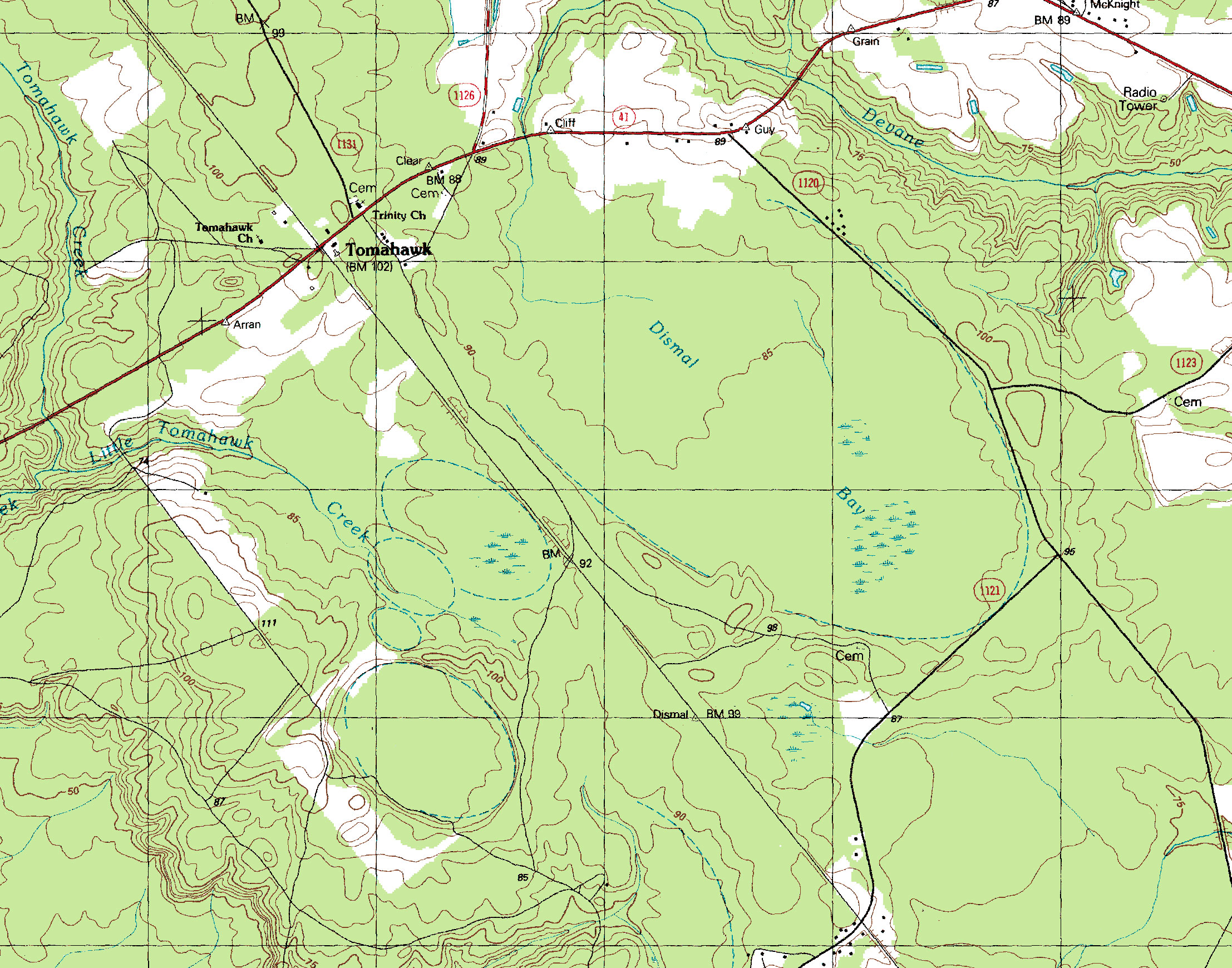
The North Carolina Natural Heritage Program's Natural Area Inventory of the county does not mention this bay. Perhaps the long-ongoing logging activities and private ownership have diminished its value as a Carolina Bay habitat. The presence of a natural drainage channel out of the bay on the northern end would have also allowed the bay to avoid deep inundation in periods of wet weather, and diminishing the establishment of an extensive wetlands habitat.
Google historical satellite imagery over the past 20 years show continuous timber operations across various segments of the bay.
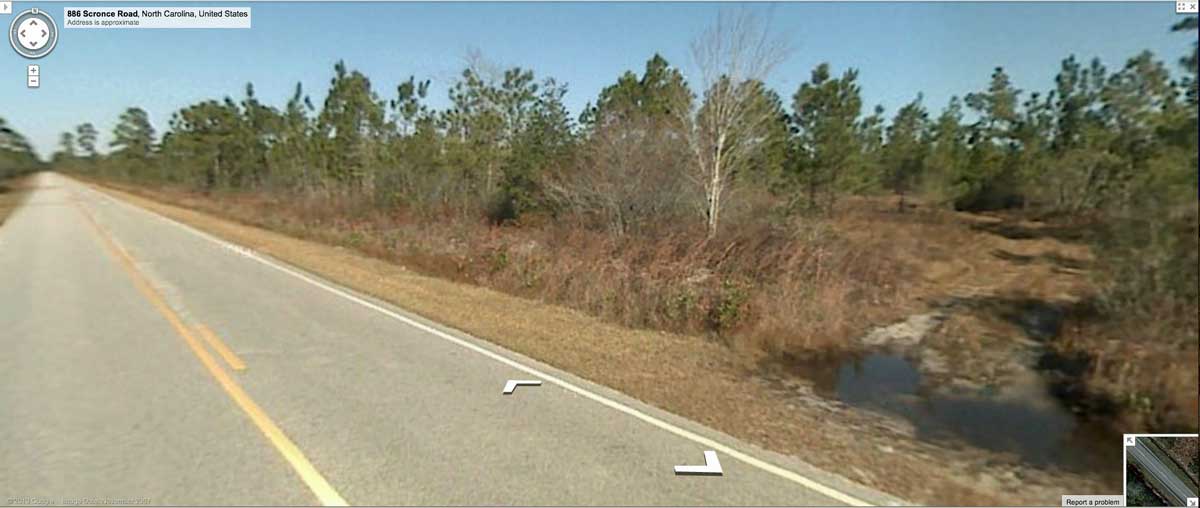
Extensive Google Streetview imagery is available along the northern, eastern, and souther extents of the bay's rim. For much of its traverse through the bay, Scronce Road runs just inside the rim. You can inspect this area in your web browser using this LINK. The location is marked with an annotated placemark in the linked KMZ file, and the view from that location is available as a static image in the attached Photo Album.
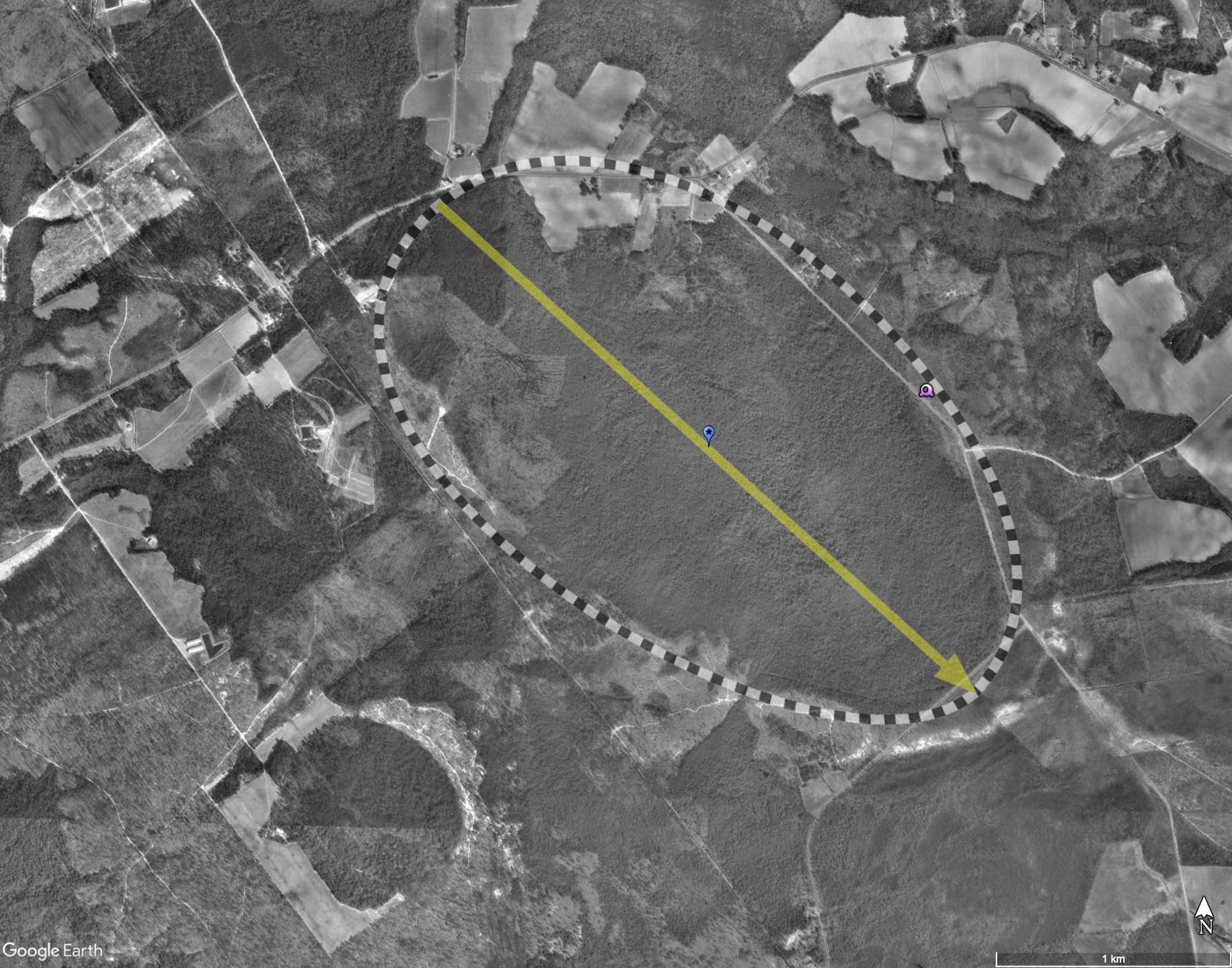
We add the metrics for the smaller ( but still a full kilometer across!) bay to the southwest. There is no name provided, so we apply the indexed name 138313_7629. An interesting comparison is between their Eccentricity, 0.812 vs 0.661. We commonly see larger bays holding larger eccentricities than the smaller ones in any given area. Why?
The Carolina Bay Survey had initially identified and measured ~250 bays in Octant 138313. The location and metrics of bays that have been resolved and measured can be referenced through a Fusion Table spatial visualization.
Dismal Bay
The bay presents a robust correlation to the bayArchetype archetype shape, and the measured orientation is similar to the other local bays. As an update to the original post, I have re-generated the LiDAR imagery using the newer sub-meter data. The earlier version's imagery was created with the early technology used by the North Carolina Floodplain project, and there, Dismal Bay looked a bit compromised, likely due to the extensive areas of deep forest canopy, through which the early LiDAR technology could not penetrate.
The North Carolina Natural Heritage Program's Natural Area Inventory of the county does not mention this bay. Perhaps the long-ongoing logging activities and private ownership have diminished its value as a Carolina Bay habitat. The presence of a natural drainage channel out of the bay on the northern end would have also allowed the bay to avoid deep inundation in periods of wet weather, and diminishing the establishment of an extensive wetlands habitat.
Google historical satellite imagery over the past 20 years show continuous timber operations across various segments of the bay.
Extensive Google Streetview imagery is available along the northern, eastern, and souther extents of the bay's rim. For much of its traverse through the bay, Scronce Road runs just inside the rim. You can inspect this area in your web browser using this LINK. The location is marked with an annotated placemark in the linked KMZ file, and the view from that location is available as a static image in the attached Photo Album.
We add the metrics for the smaller ( but still a full kilometer across!) bay to the southwest. There is no name provided, so we apply the indexed name 138313_7629. An interesting comparison is between their Eccentricity, 0.812 vs 0.661. We commonly see larger bays holding larger eccentricities than the smaller ones in any given area. Why?
The Carolina Bay Survey had initially identified and measured ~250 bays in Octant 138313. The location and metrics of bays that have been resolved and measured can be referenced through a Fusion Table spatial visualization.
Dismal Bay
- Index #: 138313_8222
- Location: 34.705137619564326,-78.30731285250214
- Major: 3.12 km . . . Minor: 1.82 km
- Eccentricity: 0.812
- Area: 448.46 hectares
- Bearing: 132.34º
- Elevation: 26.13 m
- Archetype: bay
- Effective Diameter: 2,389.552 m
- Index #: 138313_7629
- Location: 34.69154325042579,-78.3230454965418
- Major: 0.98 km . . . Minor: 0.73 km
- Eccentricity: 0.661
- Area: 56.67 hectares
- Bearing: 131.74º
- Elevation: 26.83 m
- Archetype: bayCarolina
Compare LiDAR with the fitted overlays for this scene using the slider interface below
LiDAR
Planform
Copyright 2018 by Michael Davias