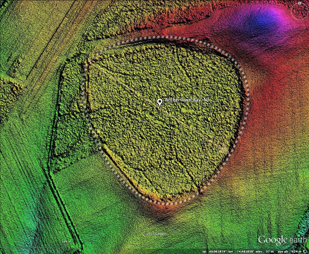
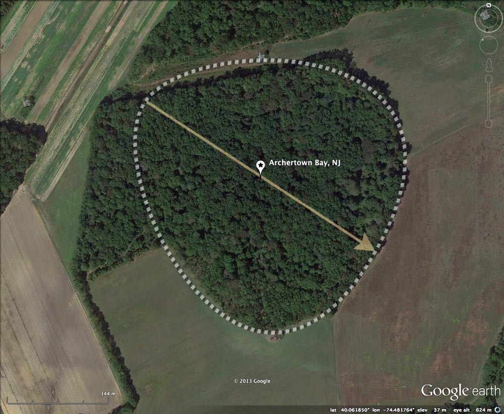
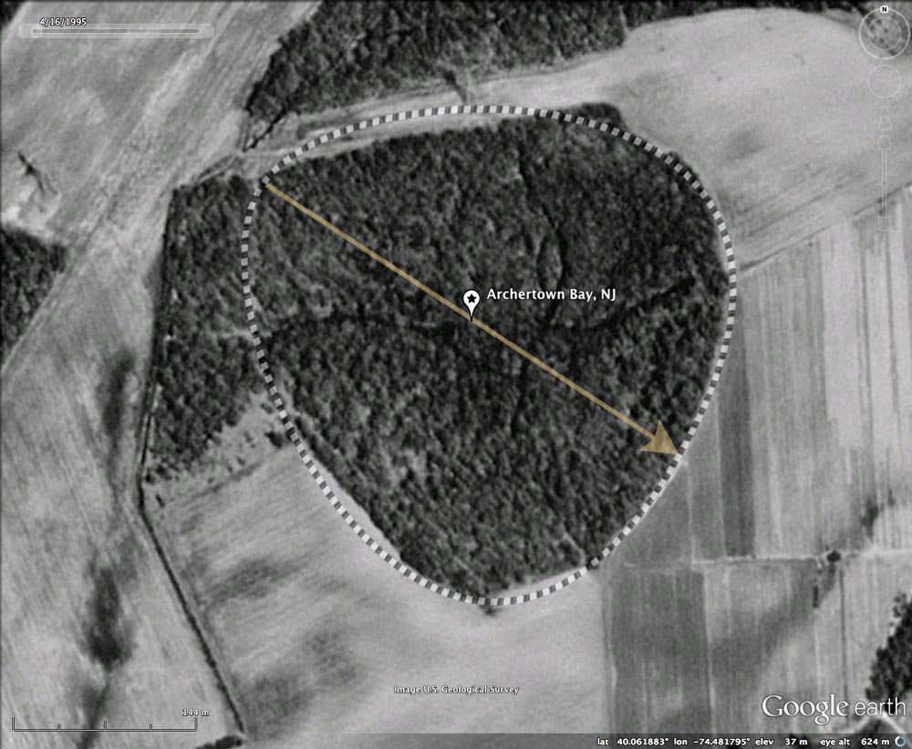
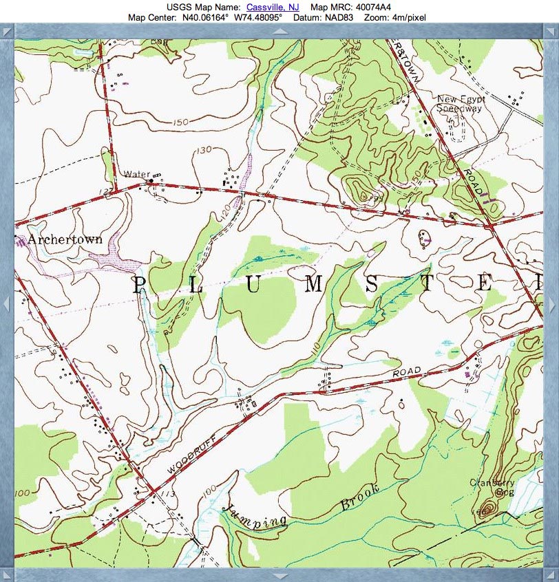
Archertown Bay, NJ
This crisply-defined bayBell archetype Carolina Bay has been named by me after the small USGS named populated place to the west. The bay adheres so well to the common bayBell archetype that it could have been the type locale - but it wasn't. The orientation of Archertown Bay is similar to that of other bays in the area.
On a humorous, but coincidental note, the term "Archer" might be appropriate looking at this bay, where the elevated southeastern half of the rim could be viewed as a bow, the remainder of the thin rim seen as a bow-string pulled back to the northeast, while the yellow orientation arrow could stand in for a projectile about to be launched to the southeast.
In 1953 The Journal of Geology ( Vol. 61, No. 5 ) published a paper The Periglacial Frost-Thaw Basins in New Jersey: A Discussion, by William C. Rasmussen. Among his observations were:
- Their very randomness of grouping and scatter demands an explanation. As a statistical phenomenon, they deserve to be studied statistically.
- … flying for 4 hours … in the vicinity of Wilmington, Delaware. In general, these "basins" had a long axis in the north-westerly direction, similar to the classic "bays," and were in other respects comparable to the "bays" or "basins" of Delaware and Maryland's eastern shore.
- …any comprehensive theory of the formation of these "bays" or "basins" must either account for their wide geographic distribution on the Atlantic Coastal Plain or show that somewhere along their spread the basins change in character or in origin.
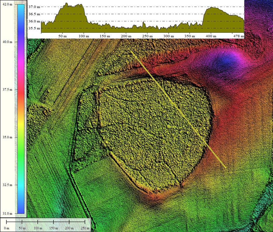
- Index #: 160297_2492
- Location: 40.06172338472405,-74.48182072695154
- Major: 0.39 km . . . Minor: 0.39 km
- Eccentricity: 0.193
- Area: 12.25 hectares
- Bearing: 124.32º
- Elevation: 35.66 m
- Archetype: bayBell
- Effective Diameter: 394.932 m
Copyright 2018 by Michael Davias