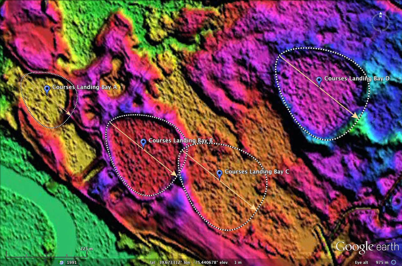
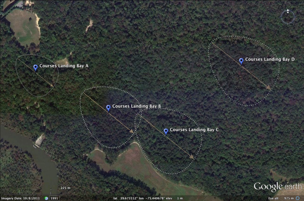
Courses Landing Bays, NJ
Located near sea level in southern New Jersey, within eyeshot of the Deleware Memorial Bridges, and 1 kilometer due south of the New Jersey Turnpike barrier toll, these four bays are crisp renditions of the bayBell Archetype. Their sizes differ slightly, around 1/4 kilometer on the major axis, but they all share the same bearing: 129.81º.
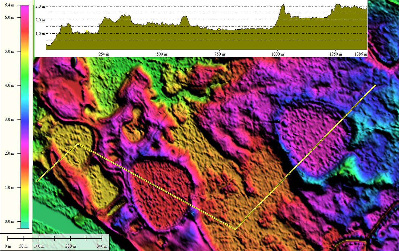
The elevation profile map traces across all four bays, and demonstrates that the bay floor and rim elevations are all different. Whatever mechanism was at work here, it was not controlled by elevation above sea level.
The commonly-accepted geomorphology for the "Deleware Basins" or "NJ Spungs" is Thermokarst-Lake-Basin. Here are two quotes taken from discussions by others:
USGS, Wayne L. Newell, 2005 @ LINK:
- Excavations through surficial deposits across the New Jersey Coastal Plain commonly reveal homogenized surficial sediments, deformed sedimentary structures, chaotically rearranged bed-forms, and wedge-shaped cracks filled with sand from the top-most layers of extant soil profiles. As a whole, these abundant, broadly distributed phenomena are best explained as artifacts of an era of frozen ground during the last Pleistocene glacial maximum. Vigorous freeze-thaw processes and abundant seasonal rainfall created a landscape of low relief covered by highly mobile surficial deposits. The surficial deposits are at grade into broad, flat bottomed valleys now drained by small, tightly meandering, under-fit streams. Modern fluvial, aeolian, and slope processes are ineffectual in either creating or modifying these landscapes.
- The ‘frost-thaw’ or thermokarst-lake-basin hypothesis, first invoked by P. E. Wolfe in 1953 to explain the enclosed depressions and shallow basins (‘spungs’) of southern New Jersey, is re-examined. The most probable explanation is that they formed in late Wisconsinan times as deflation hollows, or ‘blowouts’, when strong katabatic winds flowed southwards from the continental ice margin across the sparsely vegetated, tundra terrain of the Pine Barrens.
Courses Landing Bay A
- Index #: 158301_6978
- Location: 39.67423347478416,-75.44569682448486
- Major: 0.17 km . . . Minor: 0.14 km
- Eccentricity: 0.546
- Area: 1.96 hectares
- Bearing: 129.81º
- Elevation: 1.01 m
- Planform: bayBell
- Effective Diameter: 157.973 m
- Index #: 158301_6977
- Location: 39.67289816251112,-75.44256438387632
- Major: 0.24 km . . . Minor: 0.21 km
- Eccentricity: 0.48
- Area: 4.12 hectares
- Bearing: 129.81º
- Elevation: 1.61 m
- Planform: bayBell
- Effective Diameter: 229.036 m
- Index #: 158301_6876
- Location: 39.67211972646085,-75.44009014644999
- Major: 0.27 km . . . Minor: 0.22 km
- Eccentricity: 0.57
- Area: 4.77 hectares
- Bearing: 129.81º
- Elevation: 1.34 m
- Planform: bayBell
- Effective Diameter: 246.441 m
- Index #: 158301_6974
- Location: 39.674444808352916,-75.43686475940817
- Major: 0.28 km . . . Minor: 0.23 km
- Eccentricity: 0.558
- Area: 5.31 hectares
- Bearing: 129.81º
- Elevation: 2.19 m
- Planform: bayBell
- Effective Diameter: 260.017 m
Copyright 2018 by Michael Davias