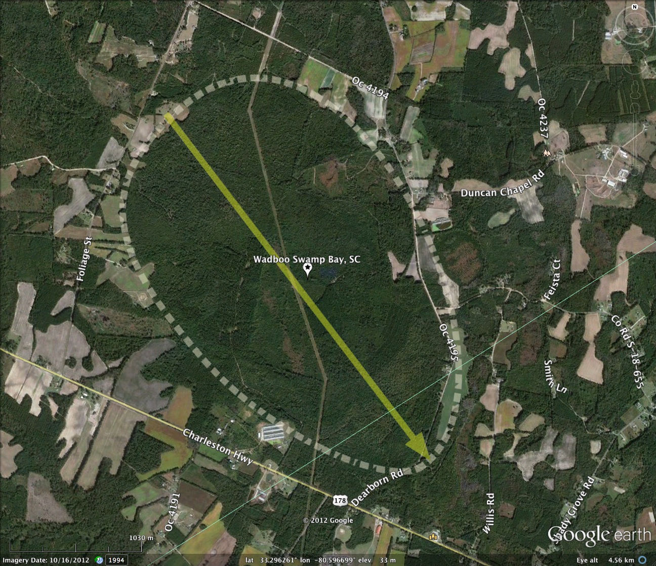
Wadboo Swamp, SC
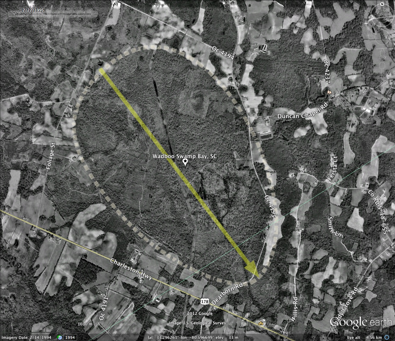
Presented here is an interesting rendition of the "Carolina Bay" landform. Conforming well to the baySouth archetype, the general appearance is one of deterioration. Much of the rim is only perceivable as a run of discontinuous segments, although the northwestern quadrant is fully carved into the uplands in that area. In the LiDAR, the match to the archetype shape can be seen as robust. Indeed, given that the swamp is virtually all natural swamplands, the shape is also apparent in the satellite imagery, differentiated from the surrounding areas by the dense vegetation. Numerous smaller bays lie in the surrounding area, each presenting similar shape and alignment.
Wadboo Swamp is located primarily in Orangeburg County, 30 km SE of Orangeburg, but the southern tip lies in Dorchester.
The Wadboo swamp was frequented by the American Civil War hero know as the "Swamp Fox", because of his us of swamps such as the Wadboo to evade capture. The Wadboo Swamp bay is about 3 1/2 kilometers long, providing significant cover.
From SCIWAY, South Carolina's Information HighWAY: LINK
From Swamp Fox National Recreational Trail, South Carolina, LINK.
Wadboo Swamp is located primarily in Orangeburg County, 30 km SE of Orangeburg, but the southern tip lies in Dorchester.
The Wadboo swamp was frequented by the American Civil War hero know as the "Swamp Fox", because of his us of swamps such as the Wadboo to evade capture. The Wadboo Swamp bay is about 3 1/2 kilometers long, providing significant cover.
From SCIWAY, South Carolina's Information HighWAY: LINK
- General Brigadier Francis Marion, known as the "Swamp Fox," was one of the fathers of modern guerrilla warfare. The Mel Gibson film, The Patriot, was influenced by Marion's military exploits. Some Brits still feel pangs of resentment from Marion's guerrilla styling. British author Neil Norman, writing in The Evening Standard, called Marion "a thoroughly unpleasant dude who was, basically, a terrorist."
- A Georgetown native, Marion was famous for his uncanny ability to elude and outsmart British forces. He typically led groups of irregular troops who were troops who fought without pay, supplied their own arms and horses, and in many cases, even their own food. Many of their supplies were captured from British or Loyalist armies.
From Swamp Fox National Recreational Trail, South Carolina, LINK.
- The Swamp Fox Trail is one of South Carolina Lowcountry's oldest trails and offers a long, flat, one-way journey through the swampy wetlands and coastal pine forests of Francis Marion National Forest. The total length of the trail is 42 miles, but only the eastern 27 miles are designated as a National Recreation Trail.
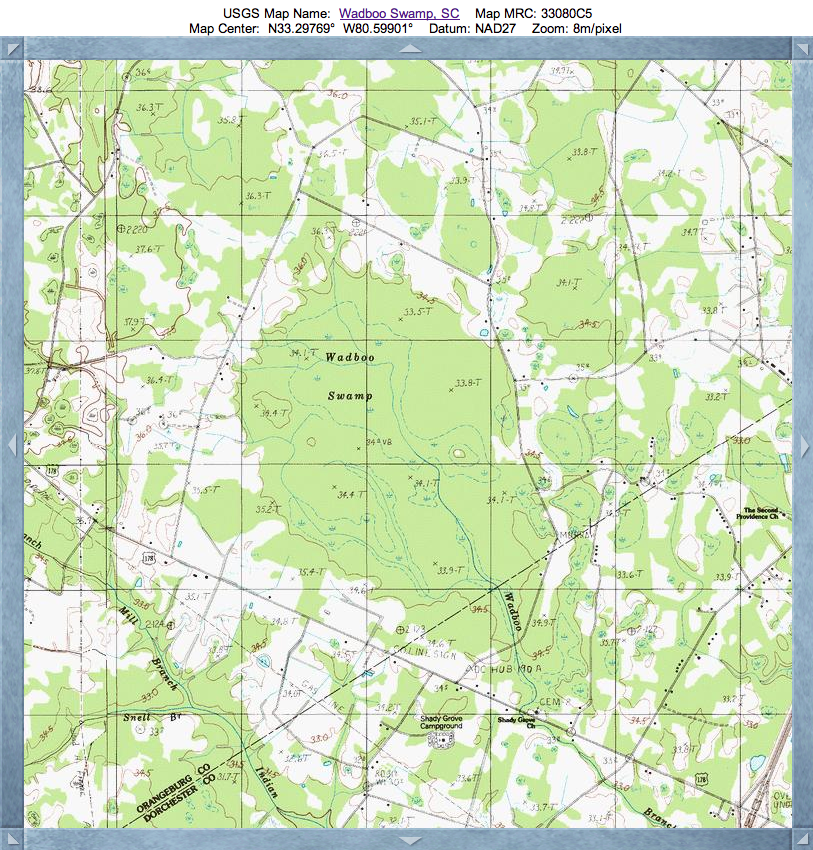
- Index #: 133322_1839
- Location: 33.29648247027193,-80.5984629358449
- Major: 3.45 km . . . Minor: 2.12 km
- Eccentricity: 0.788
- Area: 578.78 hectares
- Bearing: 142.67º
- Elevation: 33.24 m
- Planform: bay_south_prototype
- Effective Diameter: 2,714.634 m


Copyright 2018 by Michael Davias