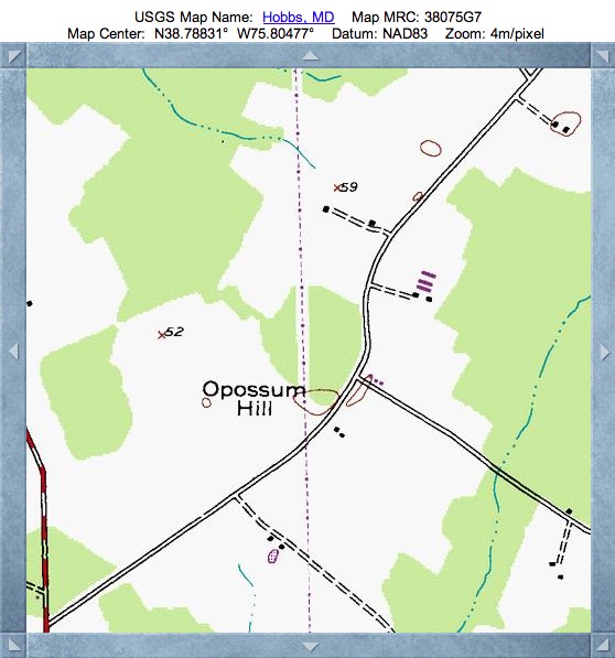
Opossum Hill Bay, MD
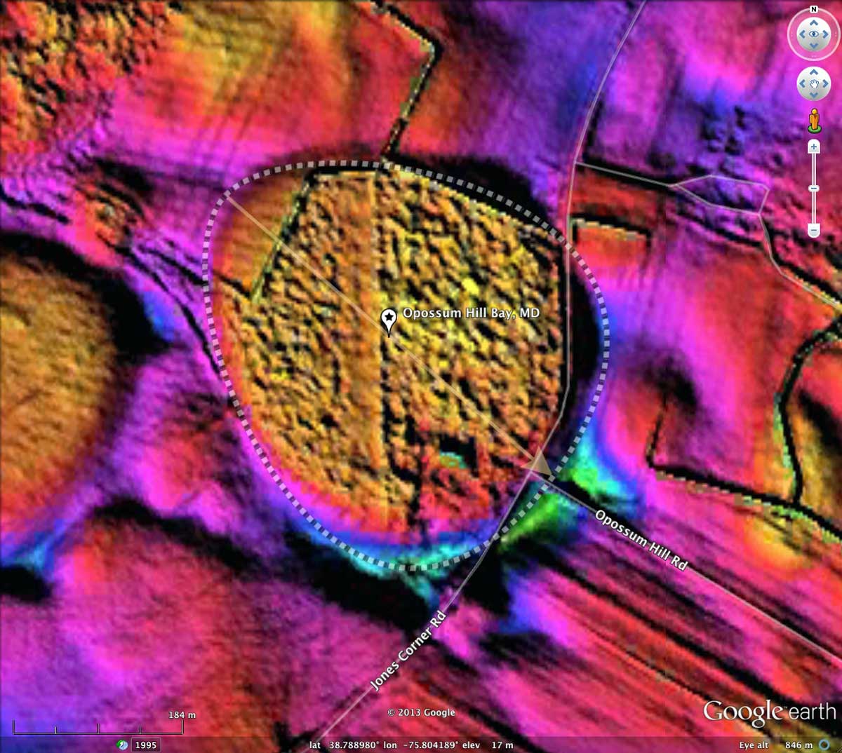
While the name Opossum might be a natural fit for a Carolina Bay in its own right, I gave that name to this unassuming bay based on a USGS locality name at its southeastern end, and the road which leads away from the bay at that point. The USGS Topographic map does identify the rim surround the bay, but the LiDAR makes it a dead ringer for a perfect bayBell archetype shape, common across New Jersey and the DelMarVa Peninsula.
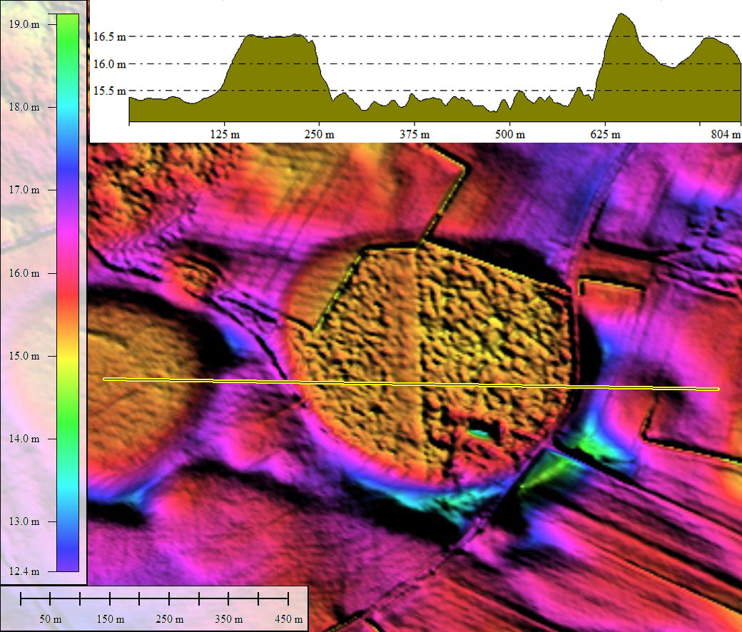
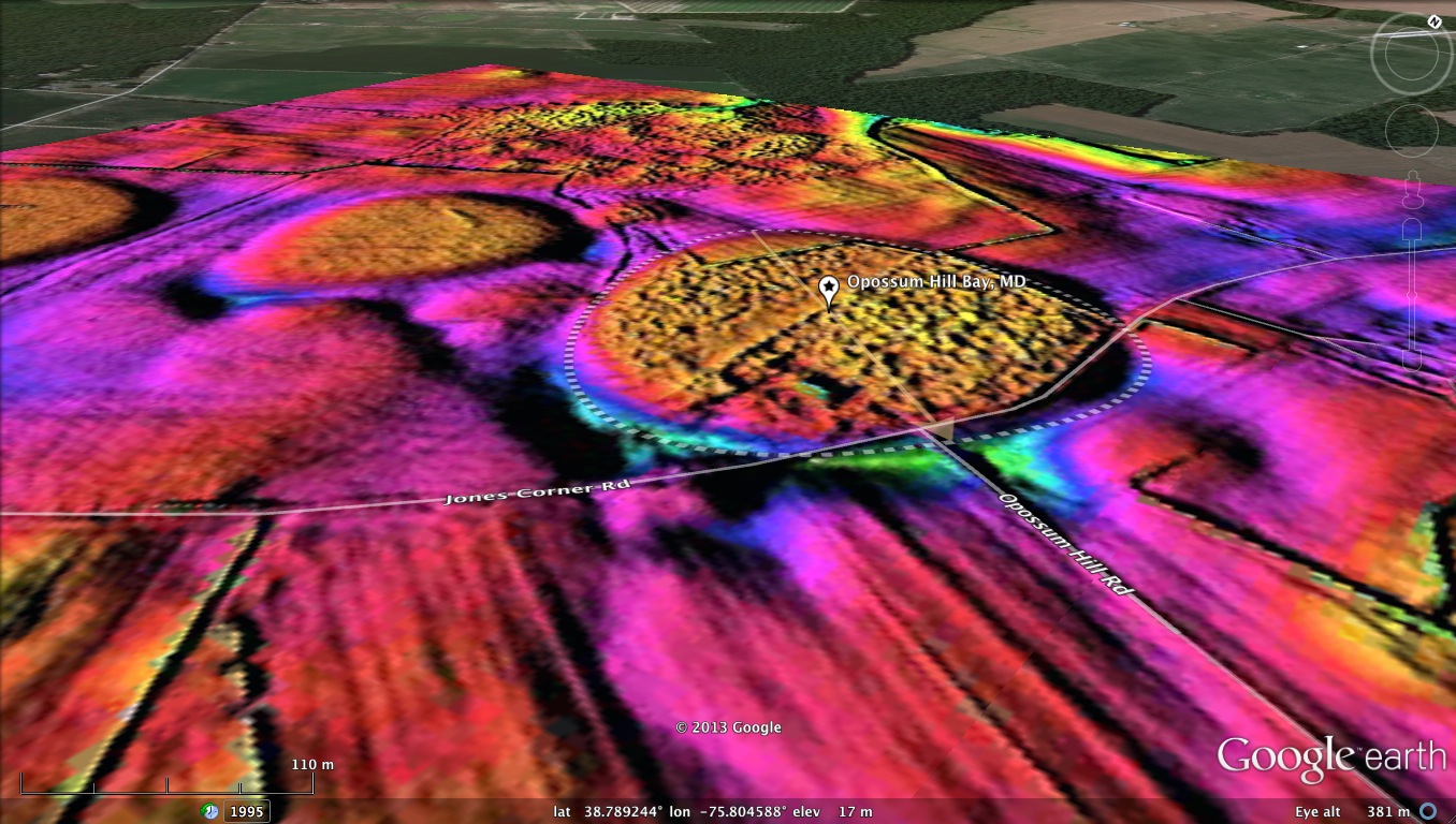
I have added a new category of imagery in the attached album: Google Earth LiDAR Oblique. With the smaller bays - here just under 1/2 kilometer - a Google Earth 3x elevation exaggeration, when combined with the LiDAR, presents a "3D" effect for the bay, its rim, and the surrounding countryside. Its all an illusion, of course, since to the naked eye, this area is flat as a pool table.
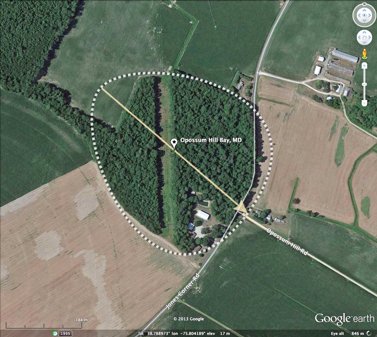
Opossum Hill Bay is located in the heart of the DElMarva Peninsula, and 65 miles due east of Washington, DC.
The most accepted current speculation regarding the "bayBell" depressions across this region is that they were formed by periglacial processes during the periods of permafrost resulting from glacial maximums, when continental ice sheets extended into central New Jersey. If one was to accept that hypothesis, they could not support their being classified as true Carolina Bays. Hence, the term "Maryland Basins" is often applied.
I have added a new category of imagery in the attached album: Google Earth LiDAR Oblique. With the smaller bays - here just under 1/2 kilometer - a Google Earth 3x elevation exaggeration, when combined with the LiDAR, presents a "3D" effect for the bay, its rim, and the surrounding countryside. Its all an illusion, of course, since to the naked eye, this area is flat as a pool table.
Opossum Hill Bay is located in the heart of the DElMarva Peninsula, and 65 miles due east of Washington, DC.
The most accepted current speculation regarding the "bayBell" depressions across this region is that they were formed by periglacial processes during the periods of permafrost resulting from glacial maximums, when continental ice sheets extended into central New Jersey. If one was to accept that hypothesis, they could not support their being classified as true Carolina Bays. Hence, the term "Maryland Basins" is often applied.
- Index #: 155303_1521
- Location: 38.78880296316497,-75.80419683776114
- Major: 0.47 km . . . Minor: 0.41 km
- Eccentricity: 0.493
- Area: 15.57 hectares
- Bearing: 131.66º
- Elevation: 15.16 m
- Archetype: bayBell
- Effective Diameter: 445.245 m
Copyright 2018 by Michael Davias