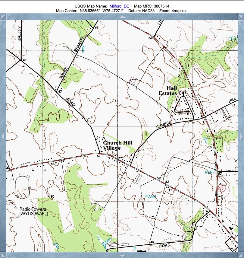
Church Hill Bay, DE
Here is our first post of a "bay" in the State of Deleware. The name was taken by me after the unincorporated Village of Church Hill which appears on the USGS topographic maps (see album). In many cases, the broad sandy ridge surrounding the bays has been used as sites for churches and graveyards. Charmingly, this name is very appropriate for this particular bay. I have found no indication that the bay landform had been noted previously by the inhabitants.
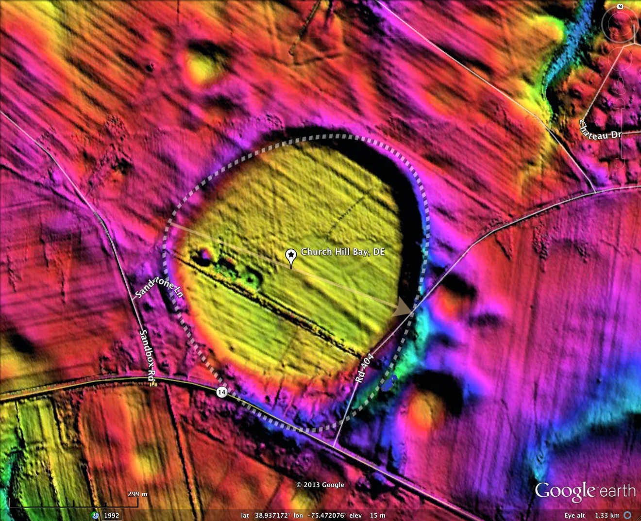
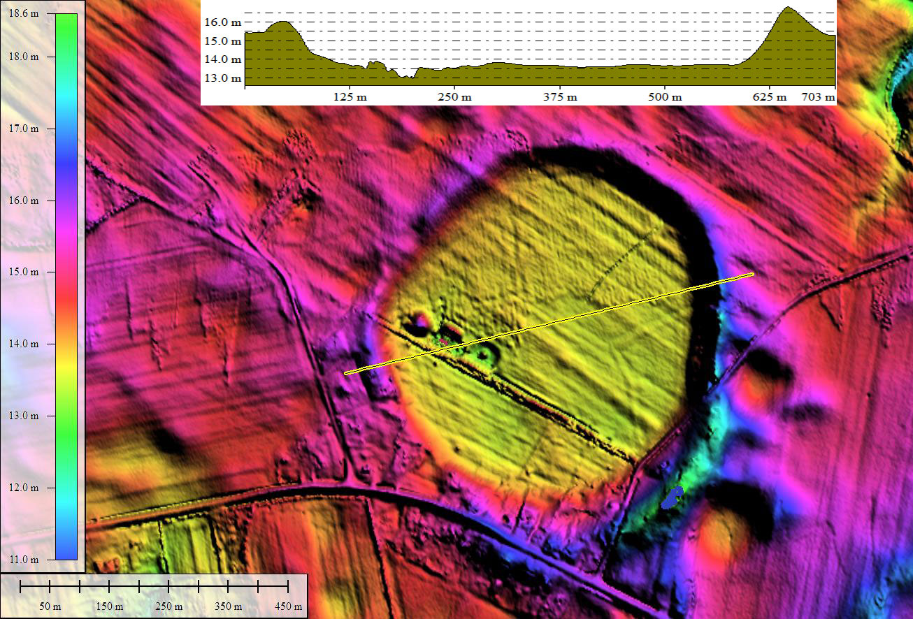
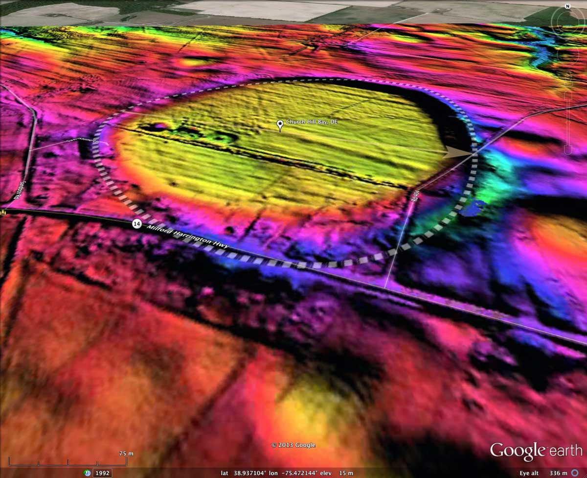
The shape matches the bayBell archetype well, and has an orientation similar to others on the DelMarVa Peninsula. The elevation profile map documents that the bay's floor is a good 2 to 3 meters below the circumpherial rim.
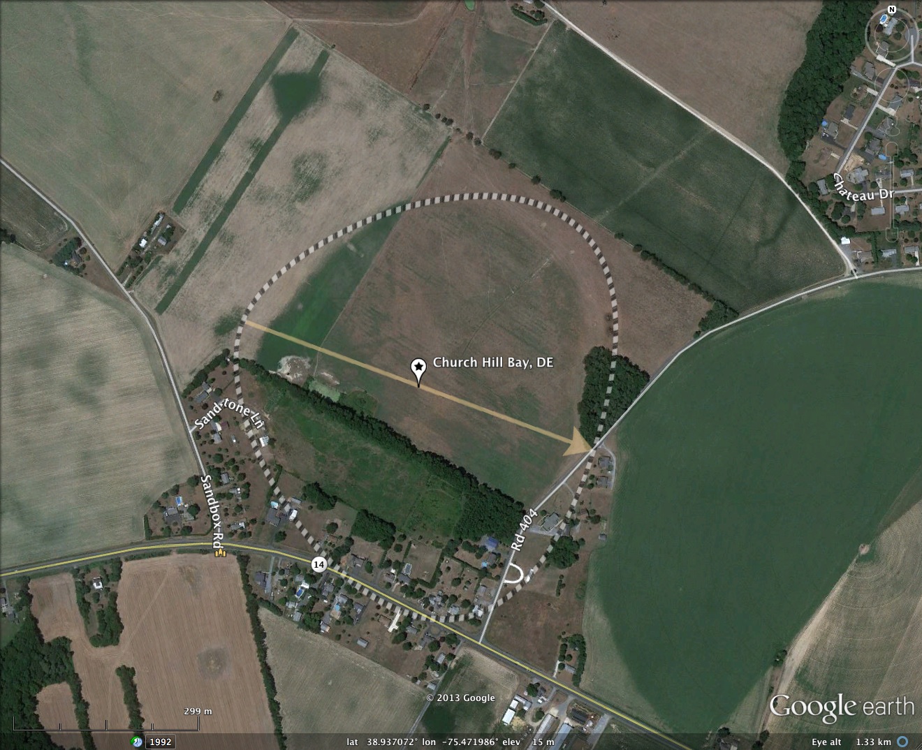
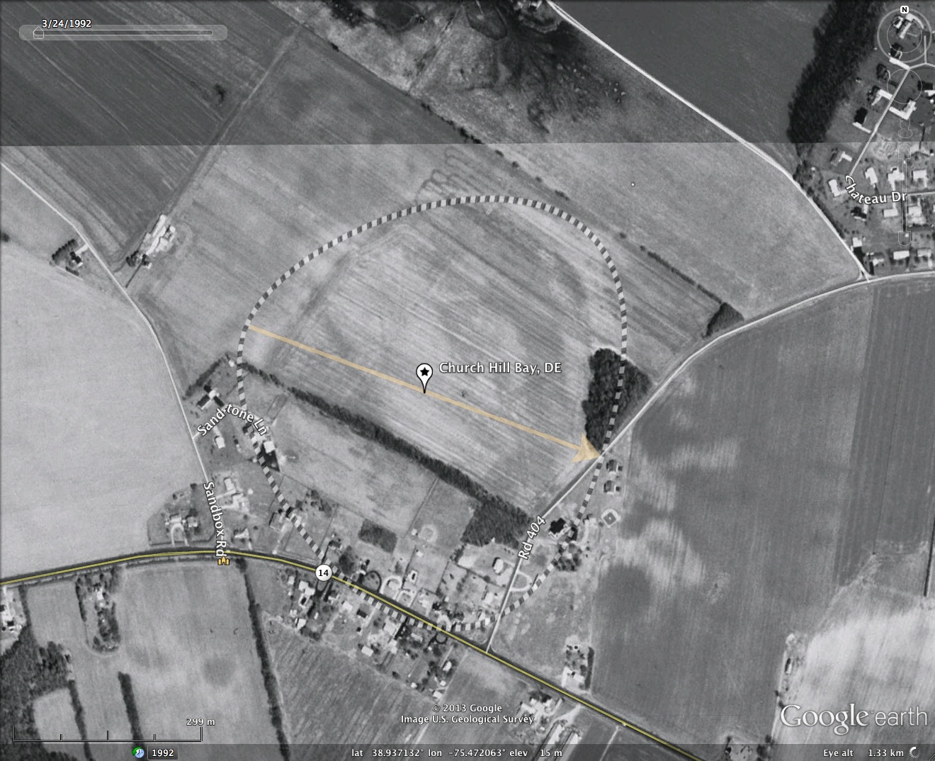
A cross-bay drainage channel is apparent in the imagery, and the satellite images suggest the ground is damper (darker) than the surrounding landscape. Numerous village homes exist along the southern rim, but the vast majority of the landform is in use as open farmland. The album includes an oblique view using Google Earth and the LiDAR elevation data.
Google Streetview imagery is available along Church Hill Road, which dips gently across the southeastern end of the bay. A view to the south as the road enters the bay provides a view as the rim rises from the bay floor on the right, up to the houses on the left - which are on the top of the rim. You can browse the area yourself with this LINK.
The shape matches the bayBell archetype well, and has an orientation similar to others on the DelMarVa Peninsula. The elevation profile map documents that the bay's floor is a good 2 to 3 meters below the circumpherial rim.
A cross-bay drainage channel is apparent in the imagery, and the satellite images suggest the ground is damper (darker) than the surrounding landscape. Numerous village homes exist along the southern rim, but the vast majority of the landform is in use as open farmland. The album includes an oblique view using Google Earth and the LiDAR elevation data.
Google Streetview imagery is available along Church Hill Road, which dips gently across the southeastern end of the bay. A view to the south as the road enters the bay provides a view as the rim rises from the bay floor on the right, up to the houses on the left - which are on the top of the rim. You can browse the area yourself with this LINK.
- Index #: 155301_7488
- Location: 38.93690430702344,-75.47209853589851
- Major: 0.6 km . . . Minor: 0.69 km
- Eccentricity: 0.0
- Area: 33.36 hectares
- Bearing: 111.66º
- Elevation: 14.82 m
- Archetype: bayBell
- Effective Diameter: 651.73 m
Copyright 2018 by Michael Davias