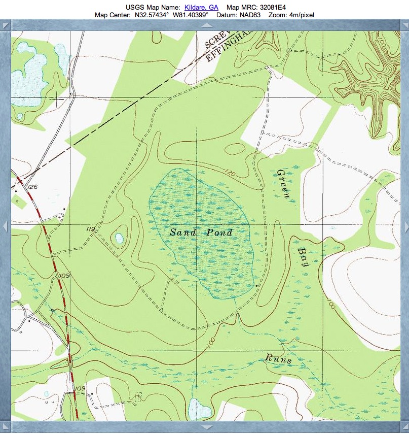
Sand Pond Bay. GA
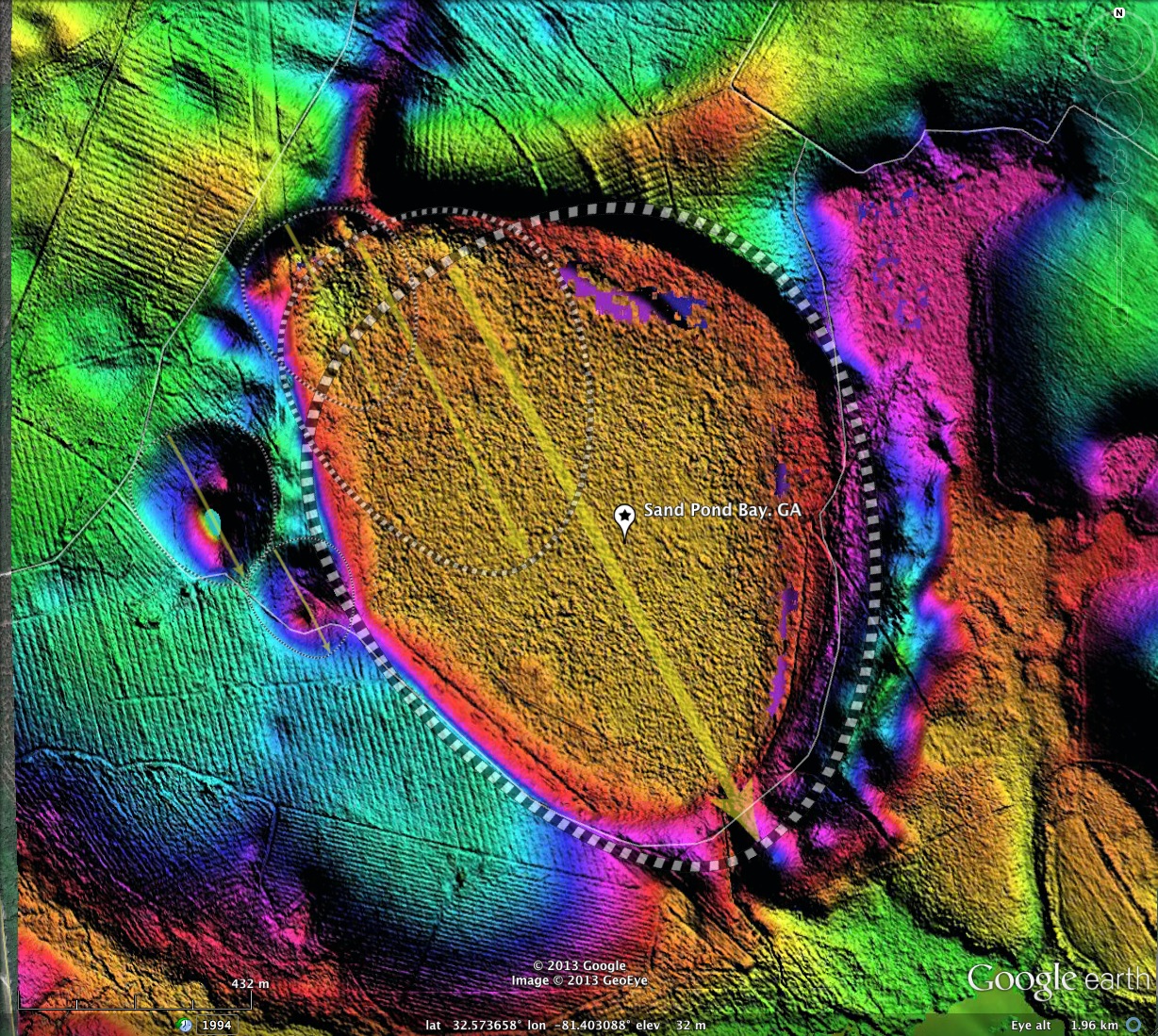
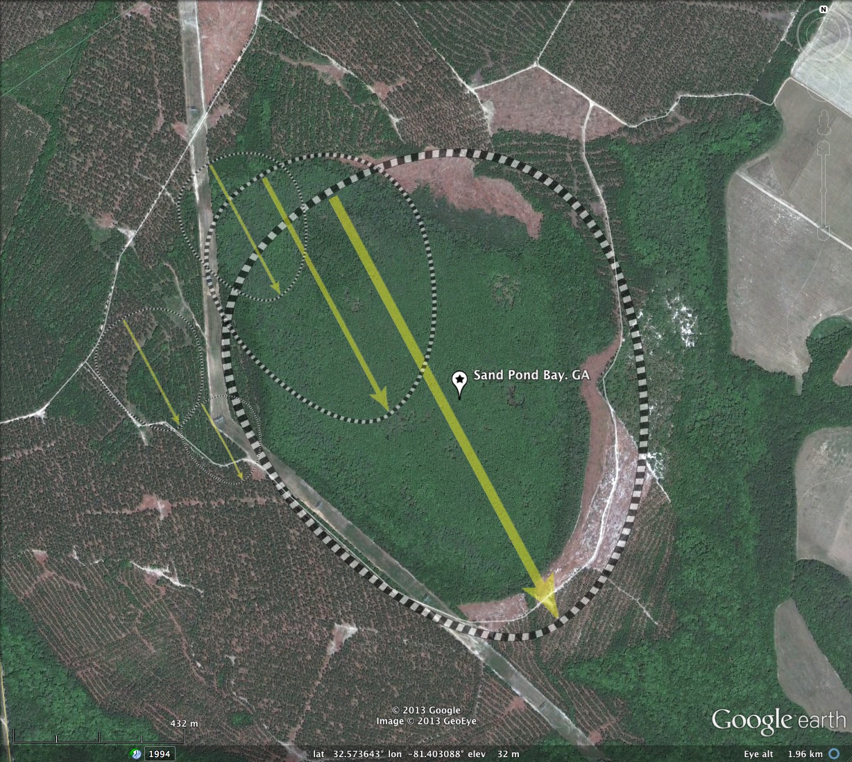
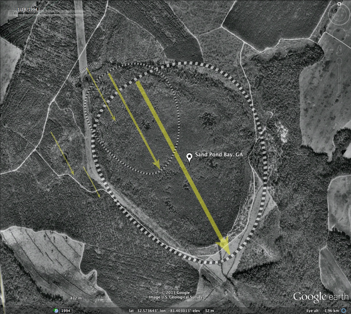
Sand Pond Bay, in northeastern Georgia along the South Carolina border, is one of the most pristine bays I have documented in the blog to date. The shape is interpreted by me as being a mash-up of four to five bay shapes, all with the same orientation and having the same archetype: baySouth.
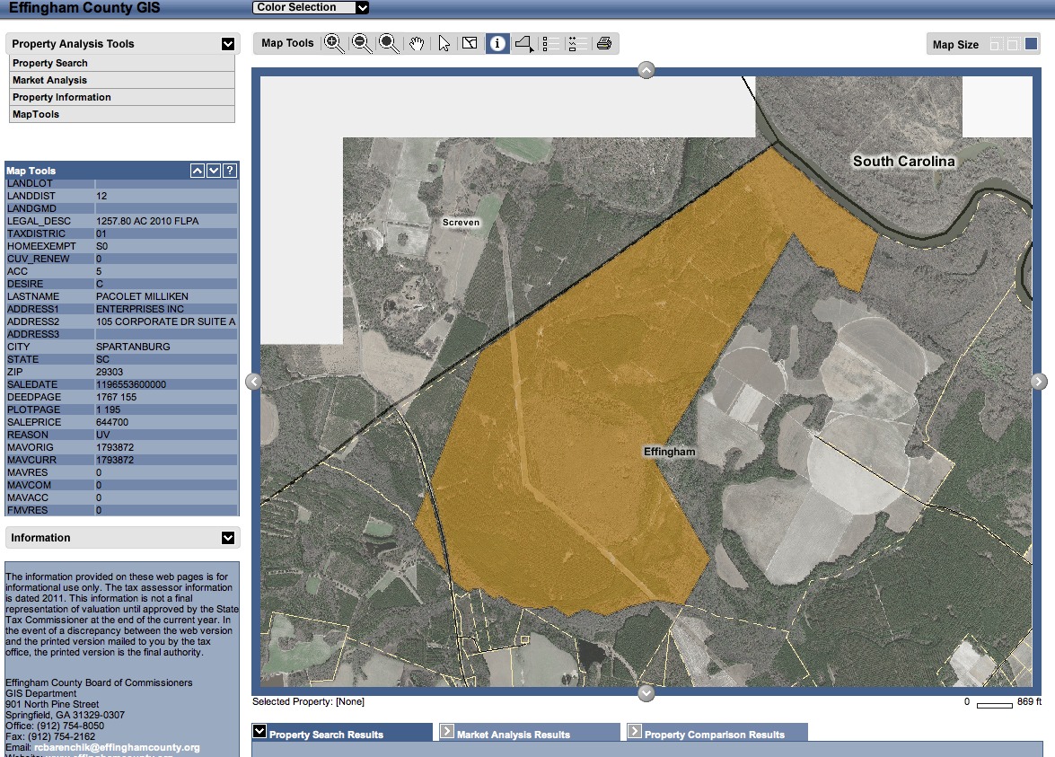
A transmission line right of way skirts the bay along the rim on the western flank, but otherwise the bay seems to be untouched by the human hand. This might be a good preservation candidate. At present, Effingham County reports that the entire area around and including the bay (~1,250 acres) is in the hands of a single corporate owner.
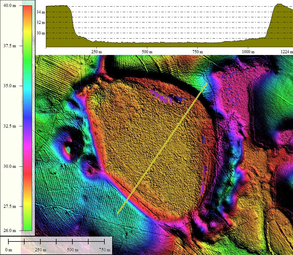
I have listed all the bay metrics below, although it should be noted that the primary element, with a major axis of 1.25 kilometers, does a good job of describing the bay all by itself.
A transmission line right of way skirts the bay along the rim on the western flank, but otherwise the bay seems to be untouched by the human hand. This might be a good preservation candidate. At present, Effingham County reports that the entire area around and including the bay (~1,250 acres) is in the hands of a single corporate owner.
I have listed all the bay metrics below, although it should be noted that the primary element, with a major axis of 1.25 kilometers, does a good job of describing the bay all by itself.
- Index #: 130325_2961
- Location: 32.57322582994973,-81.40308041372515
- Major: 1.25 km . . . Minor: 1.03 km
- Eccentricity: 0.567
- Area: 101.81 hectares
- Bearing: 151.86º
- Elevation: 28.16 m
- Archetype: baySouth
- Effective Diameter: 1,138.544 m
- Index #: 130325_3062
- Location: 32.57570784161488,-81.40645834600835
- Major: 0.69 km . . . Minor: 0.56 km
- Eccentricity: 0.589
- Area: 30.55 hectares
- Bearing: 151.86º
- Elevation: 28.56 m
- Archetype: baySouth
- Effective Diameter: 623.678 m
- Index #: 130325_3063
- Location: 32.57712232933895,-81.40871056220732
- Major: 0.38 km . . . Minor: 0.31 km
- Eccentricity: 0.568
- Area: 9.37 hectares
- Bearing: 151.86º
- Elevation: 27.49 m
- Archetype: baySouth
- Effective Diameter: 345.402 m
- Index #: 130325_2863
- Location: 32.5723072840334,-81.40935083547353
- Major: 0.22 km . . . Minor: 0.19 km
- Eccentricity: 0.516
- Area: 3.4 hectares
- Bearing: 151.86º
- Elevation: 30.99 m
- Archetype: baySouth
- Effective Diameter: 208.063 m
- Index #: 130325_2964
- Location: 32.573886698767815,-81.41121512307647
- Major: 0.31 km . . . Minor: 0.26 km
- Eccentricity: 0.516
- Area: 6.51 hectares
- Bearing: 151.86º
- Elevation: 28.54 m
- Archetype: baySouth
- Effective Diameter: 287.902 m
Copyright 2018 by Michael Davias