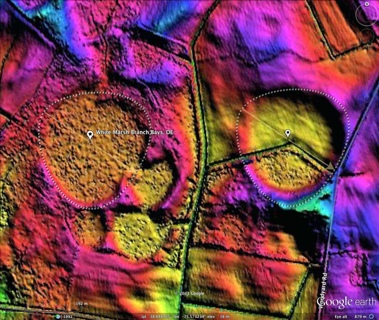
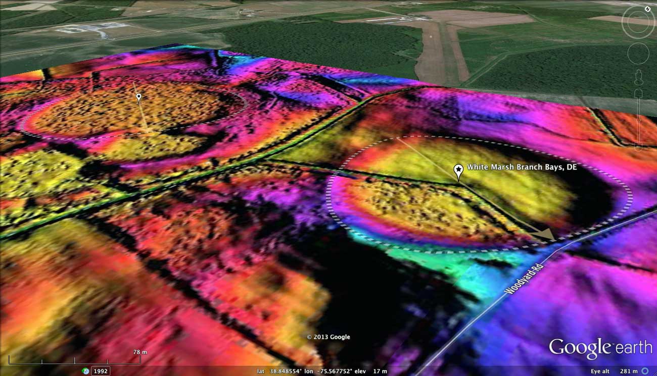
White Marsh Branch Bays, DE
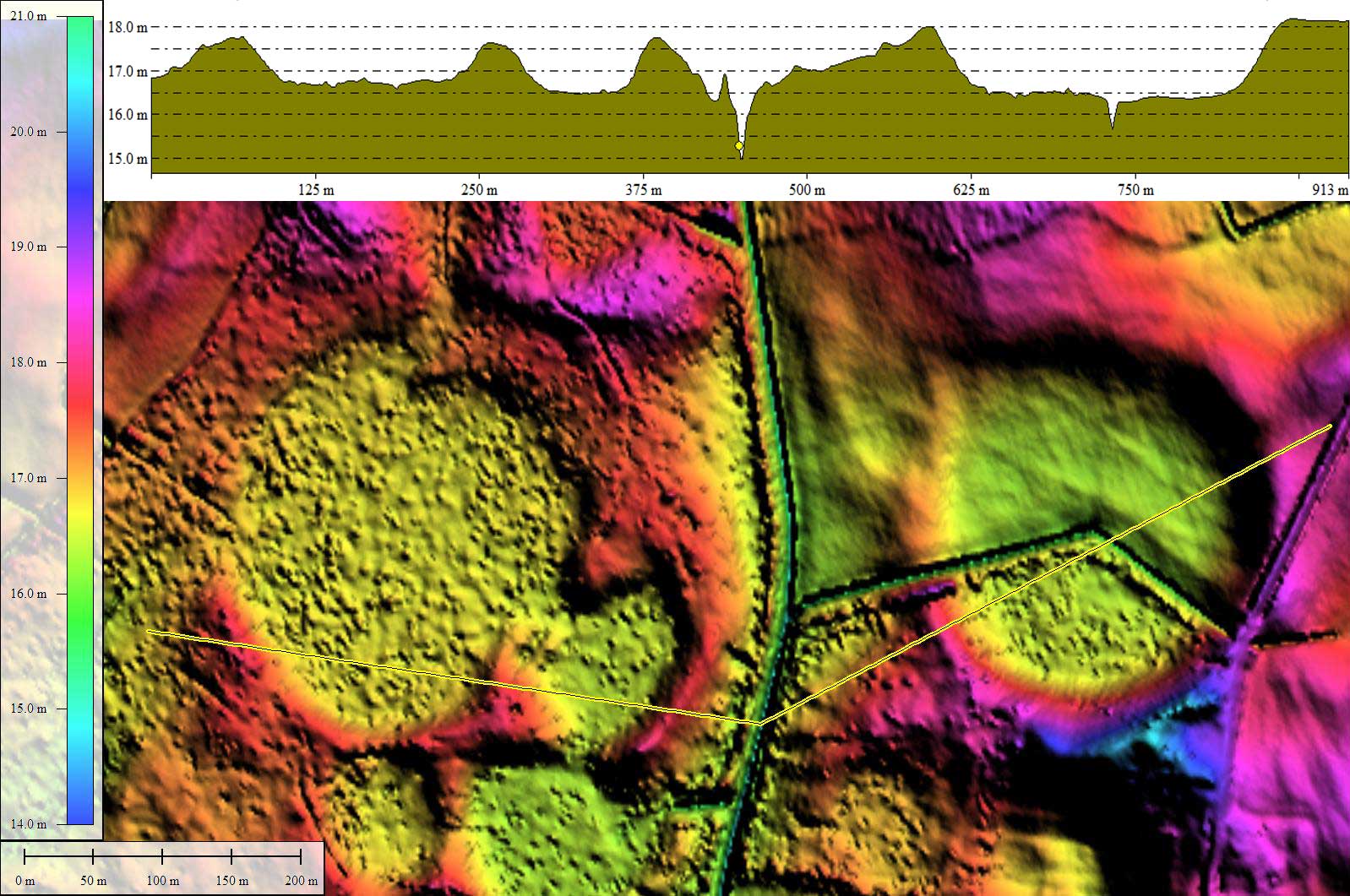
Presented today are two small neighboring bays in Maryland which have identical planforms - effectively "twins". When viewing in LiDAR or the photographic imagery, they appear different in subtle aspects of rim and basin texture, but the identical bayBell archetype overlay was used to measure them. I encourage the reader to open the referenced KMZ file in Google Earth, select one of the overlays, select edit/properties, and move it around. You should find that you can adjust the length and width of the overlay and have it also match several other smaller bays in the LiDAR imagery.
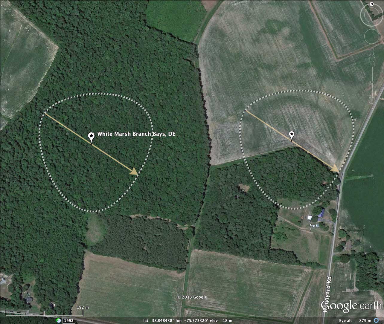
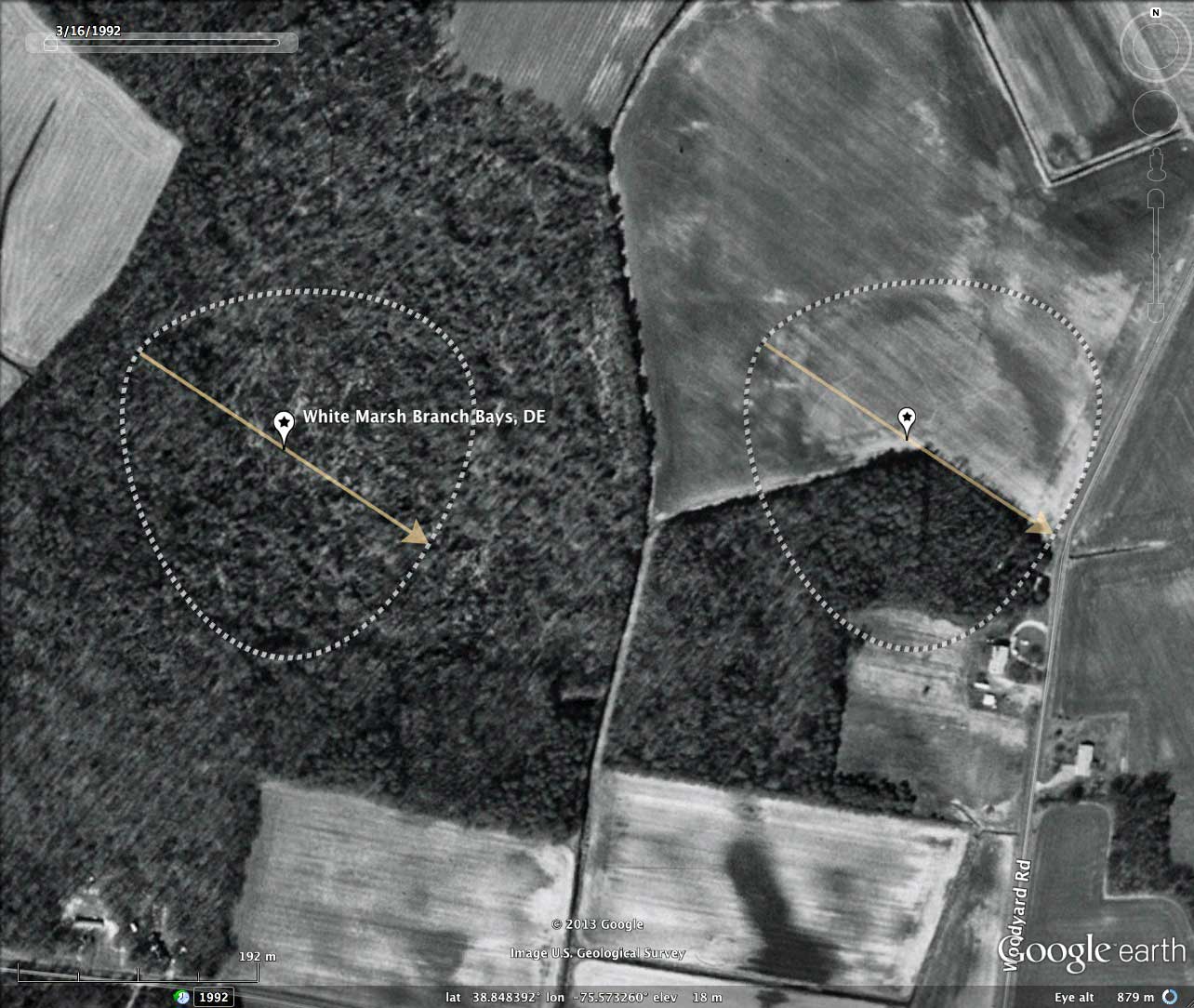
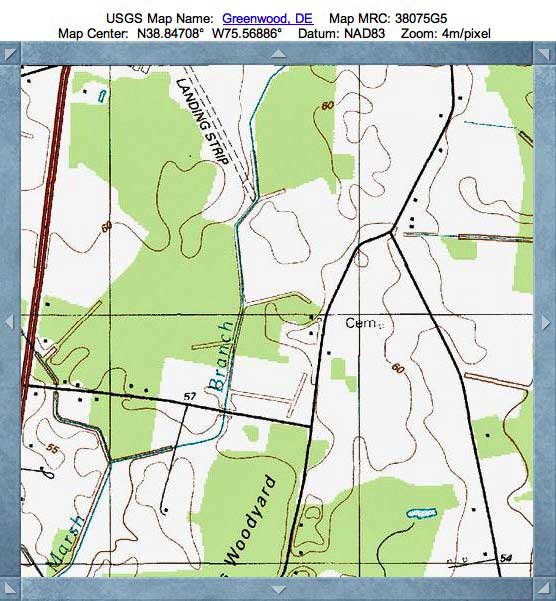
Deleware offers historical aerial orthophotography across the state. I have included imagery from 1954 in the album and as an alternate (vs LiDAR) imagery selection in the referenced KMZ file. The 1954 imagery suggest not much has changed in the landscape over the past 60 years. A bit more farmland has been recovered from the forested area of the eastern bay, but the western bay and the small bay to the south of Marsh Branch Road remain in the same forested state.
There is no direct Google Streetview imagery available for the twins, but I have included a view of the small, nearly round, bay immediately to their south across March Branch Road (index #). That bay is fully forested, and with its subtle elevated surrounding rim visible, looks like an "island" of trees in a farm field. If one did not have the LiDAR, it certainly would not be recognized as a Carolina bay! See it in your browser with the is Streetview LINK.
The Carolina Bay Survey has identified and measured over 600 bays in _Octant 155302_. Their location and metrics can be referenced through a Fusion Table spatial visualization.
- Index #: 155302_3927
- Location: 38.84829828783883,-75.56759972171227
- Major: 0.28 km . . . Minor: 0.3 km
- Eccentricity: 0.0
- Area: 6.7 hectares
- Bearing: 124.81º
- Elevation: 16.56 m
- Archetype: bayBell
- Effective Diameter: 292.073 m
- Index #: 155302_3929
- Location: 38.84822831801954,-75.5733351642551
- Major: 0.28 km . . . Minor: 0.3 km
- Eccentricity: 0.0
- Area: 6.7 hectares
- Bearing: 124.81º
- Elevation: 17.47 m
- Archetype: bayBell
- Effective Diameter: 292.073 m
Copyright 2018 by Michael Davias