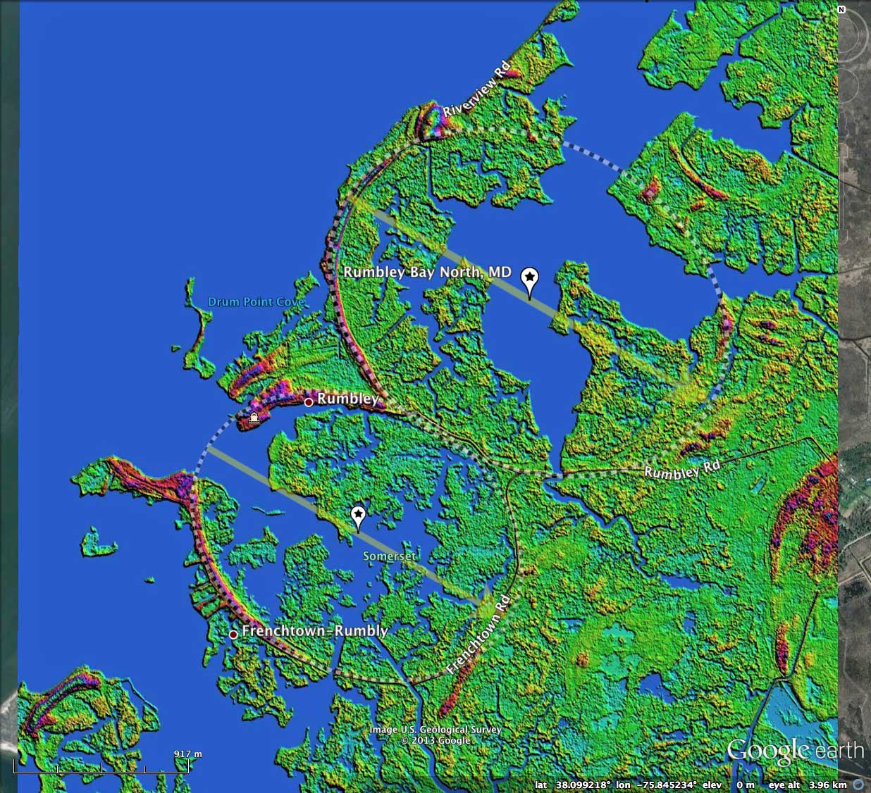
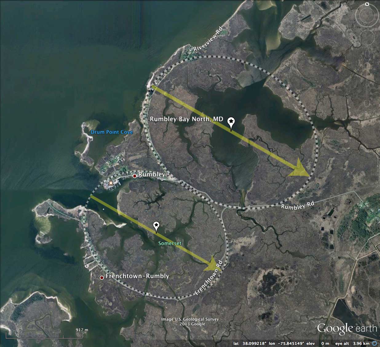
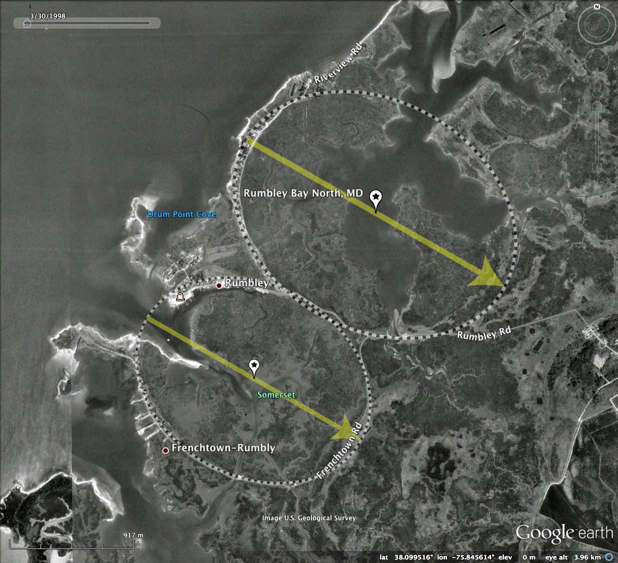
Rumbley Bays, MD
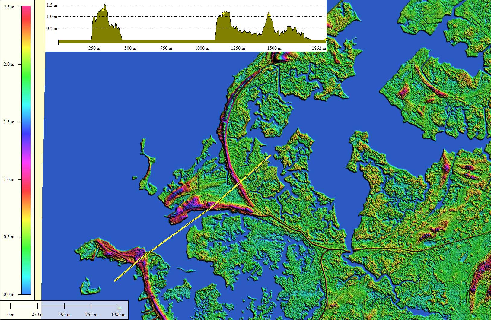
Presented here are two individual bay landforms which have been associated under the name "Rumbley Bays". The largest, with a major axis of 2.34 kilometers, is our survey index # 152303_3938. The other is our index # 152303_3442, with a major axis of 1.94 kilometers. These two bays have the same orientation of 140.69, and are robustly represented by the bayOval archetype shape. The bay "floors" are today at sea level, and the rims stand less than 1.5 meters above sea level.
One way that Carolina Bays can be visualized is simply by looking at how man-made roadways commonly trace the rim of a bay (to stay on high ground) or veer away form them to avoid the wetlands contained within. The Rumbly Bays certainly have their share of this feature attribute!
The KMZ file linked above contains an imagery section where the user can view the usual LiDAR hsv-shaded elevation map, or alternatively, the 1943 USGS Topographic map.
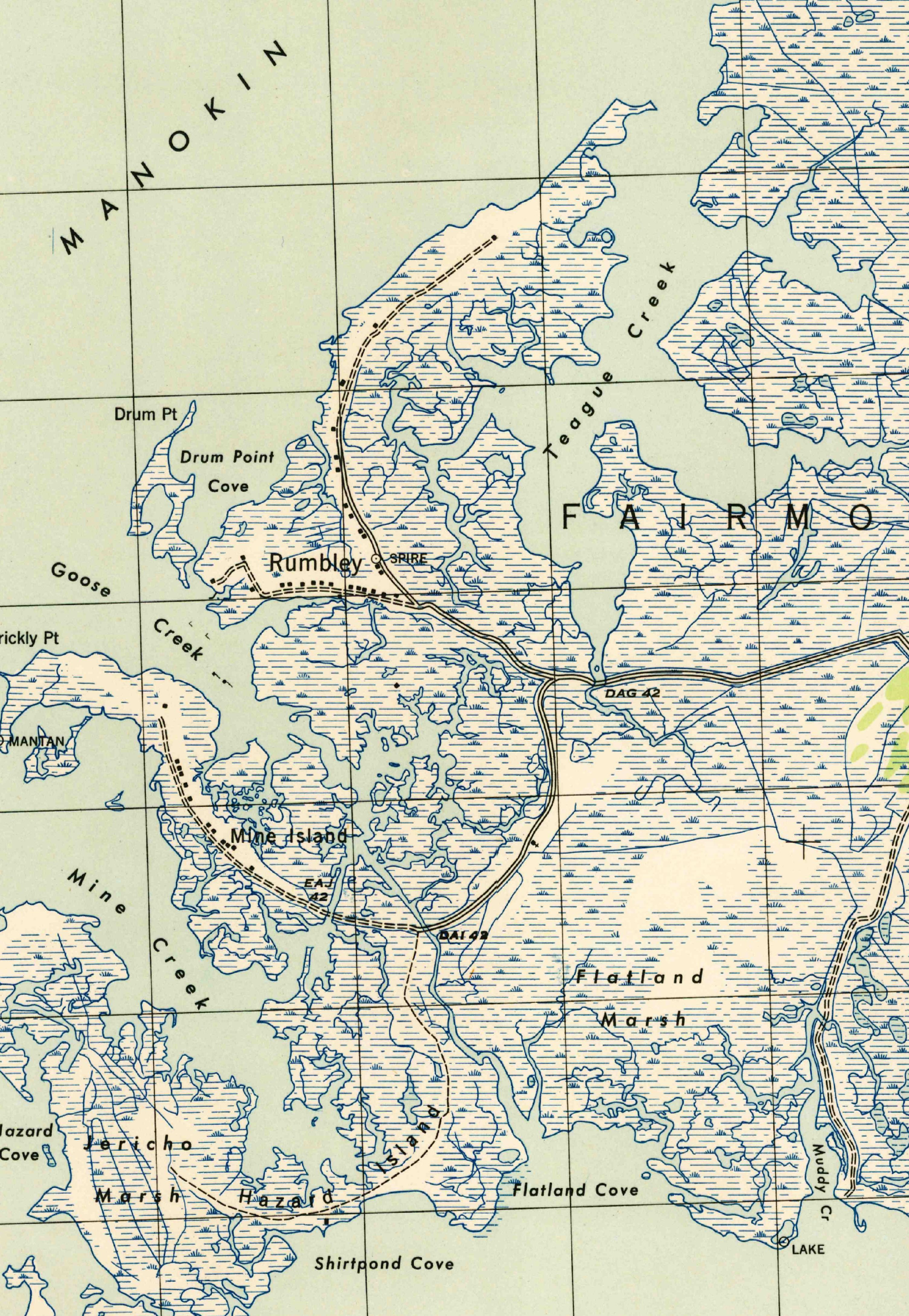
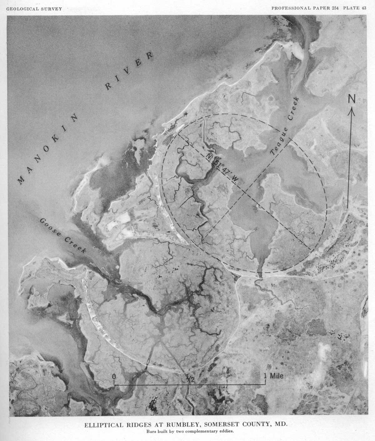
In a scientific report by C. Wythe Cooke (1954), these shapes were judge to have been formed by eddies in the Chesapeake Bay estuary. A case was made for precessing eddies caused by the rotation of the Earth. He included a b/w full-page graphic of the Rumbly Bays area as Plate # 43, and a copy of that is included in the attached album. Here is an excerpt from Cooke's paper, ref:[LINK]
…houses are strung out in single file along a V-shaped ridge averaging 100 feet or less in width and rising generally less than 5 feet above sea level. This V-shaped ridge appears to include adjacent segments of bars built by two tangent elliptical eddies, the northeasterly one flowing clockwise and the other counterclockwise. The soil consists of rather coarse, well-rounded sand grains mixed with much finer silt. Salt marshes occupy much of the area within the ellipses, except the drowned channels of Goose Creek and Teague Creek; and there are irregular areas of salt marsh outside the ellipses fronting Manokin River, an arm of Tangier Sound.
see also the CBoD post about the Pee Dee Islands, which contains additional excerpts from Cooke's paper: [LINK]
I interpret the bays as having been created when sea level was lower than today, and at present they are slowly being indented by the Chesapeake Bay waters as they rise. The general consensus is that relative sea level in this area is rising due to global sea level rise and augmented by regional ground subsidence due to collapse of the glacial-isostatic forebulge from the last glacial maximum.
The Carolina Bay Survey has identified and measured 75 bays in _Octant 152303_. Their location and metrics can be referenced through a Fusion Table spatial visualization.
- Index #: 152303_3442
- Location: 38.08726568625333,-75.85530741784267
- Major: 1.94 km . . . Minor: 1.54 km
- Eccentricity: 0.604
- Area: 235.87 hectares
- Bearing: 119.7º
- Elevation: 0.0 m
- Archetype: bayOval
- Effective Diameter: 1,732.969 m
- Index #: 152303_3938
- Location: 38.09827557566197,-75.84504055368242
- Major: 2.34 km . . . Minor: 1.85 km
- Eccentricity: 0.61
- Area: 340.55 hectares
- Bearing: 119.7º
- Elevation: 0.0 m
- Archetype: bayOval
- Effective Diameter: 2,082.308 m
Copyright 2018 by Michael Davias