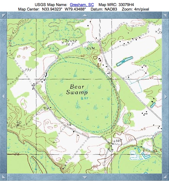
Bear Swamp Bay, Marion, SC
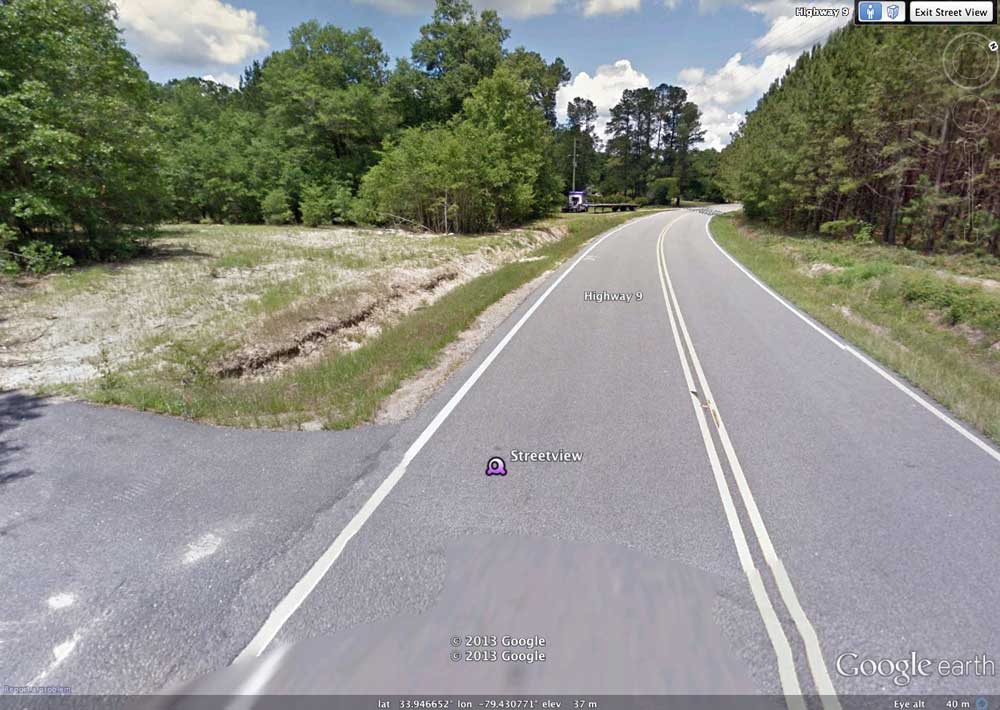
Bear Swamp Bay is located 2.5 kilometers northwest of Gresham, SC, along Route 9. A Streetview photo of the outside of the northeastern rim of the bay is shown in the attached album, and can be browsed using this LINK.
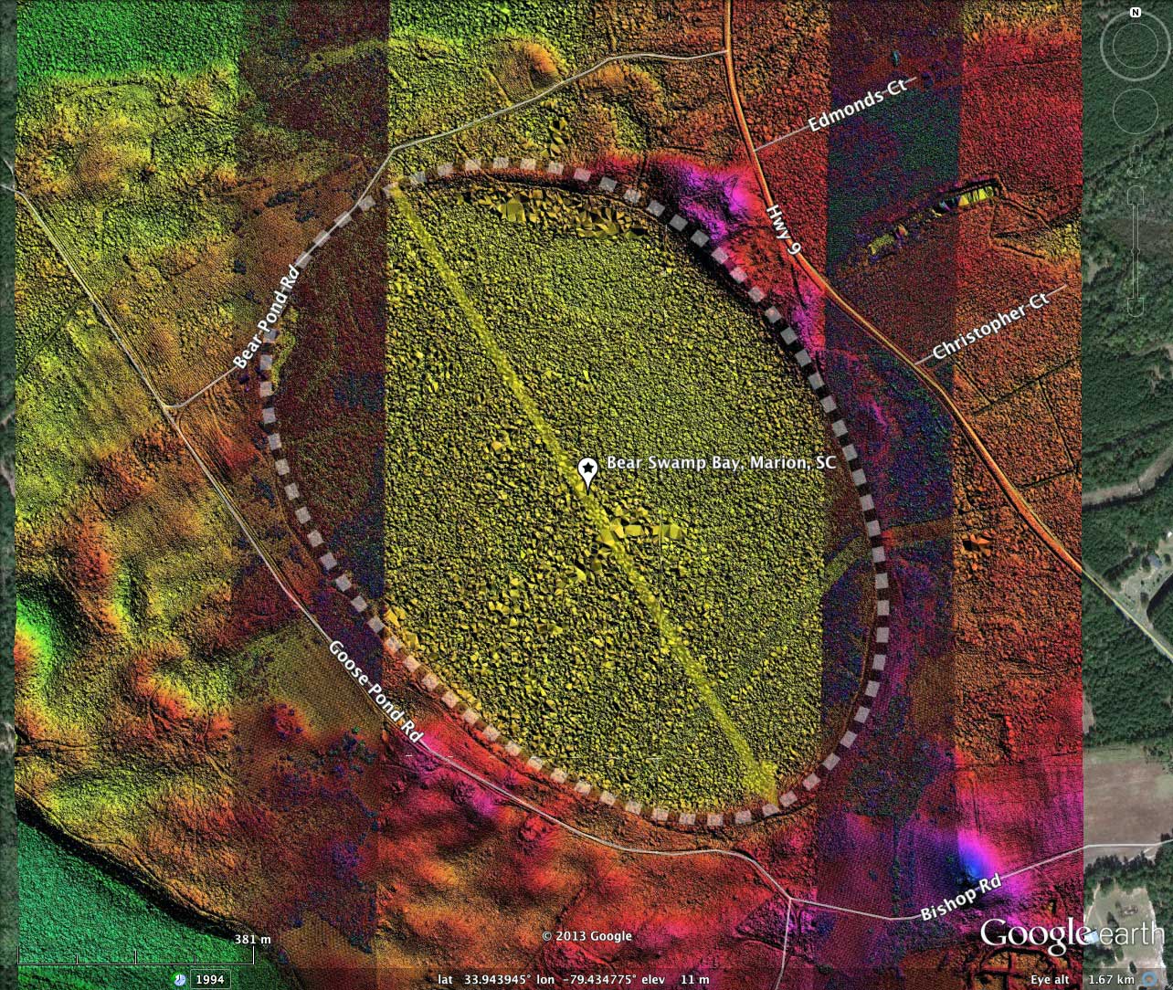
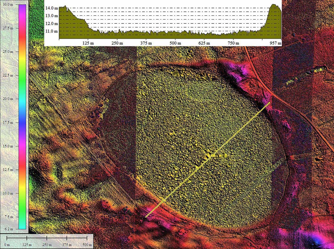
The bay conforms well to the bayCarolina archetype shape, and has an orientation similar to other bays in the immediate area. The location is immediately east of the Great Pee Dee River basin, and sets among an extensive dune field which appears to been driven eastward from the river basin.
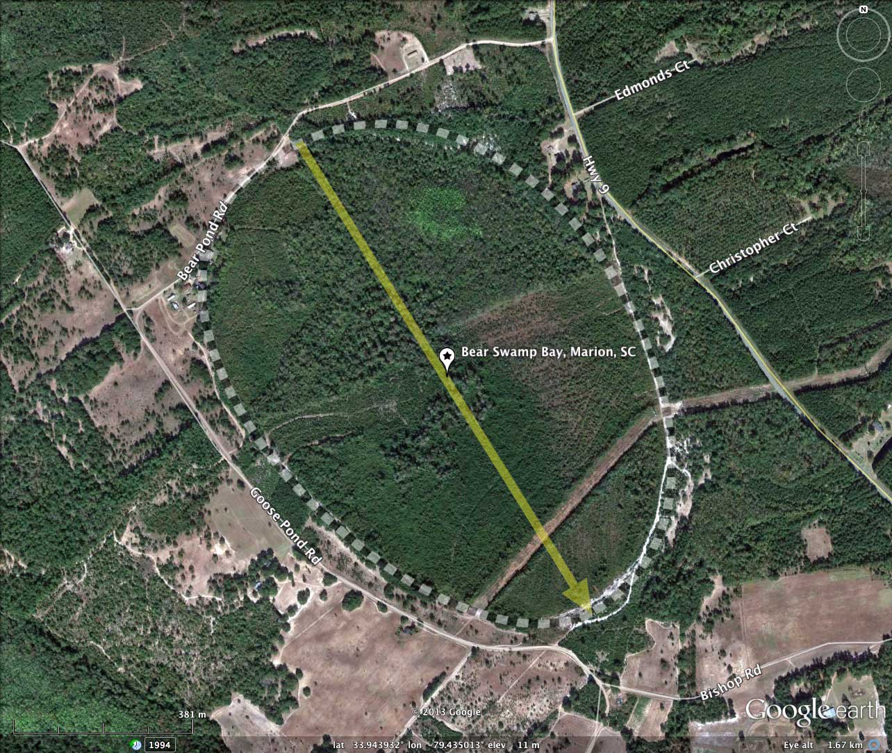
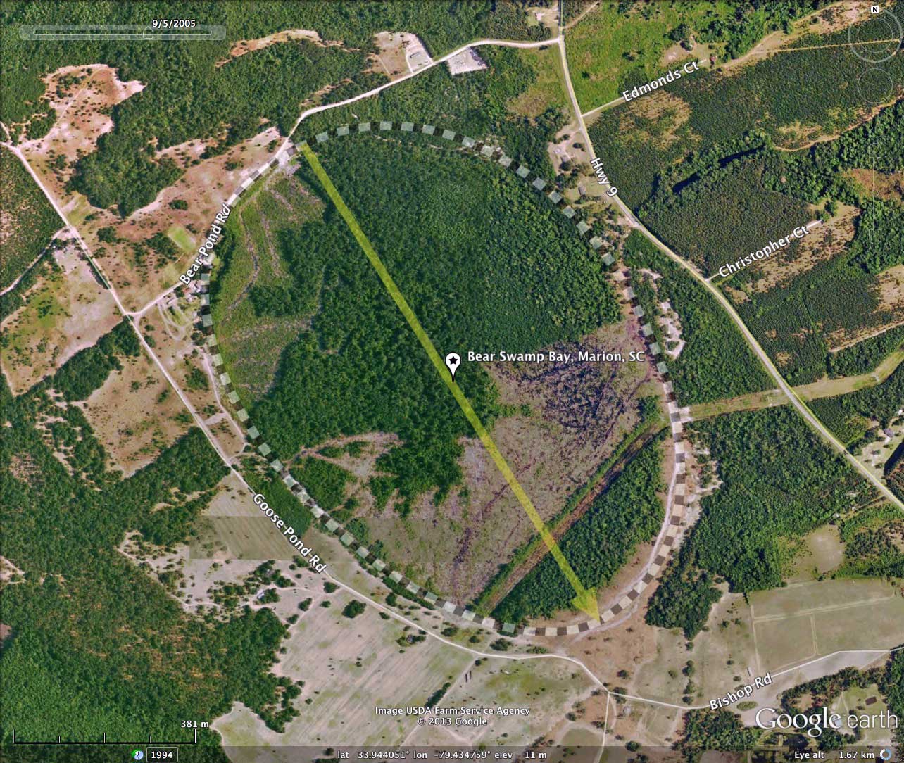
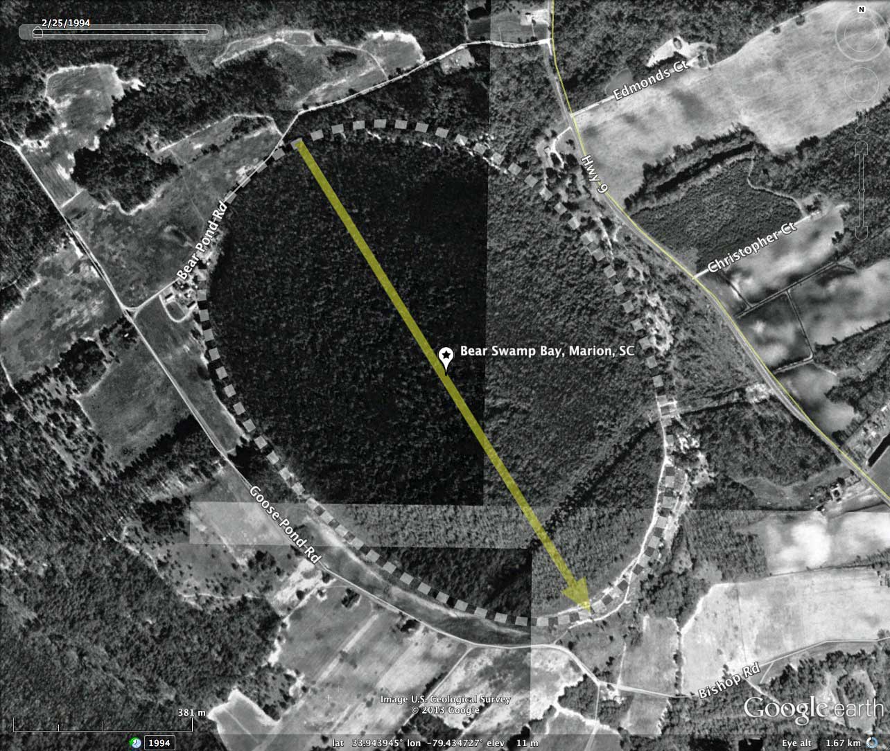
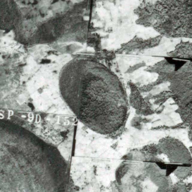
The bay does not appear to have been ditched and drained, and is in use as a tree plantation. Clear-cutting activities in the southern half of the bay are evident in the Google Earth historical imagery from 2005. The Marion County historical aerial imagery from 1950 (see album) suggest the bay had more tree-cover, but there may have been some clearing in the western areas of the basin.
The hsv-shaded elevation imagery used in today's post was generated from the source LiDAR point cloud, gridded at 1 meter, and has more detail than the USGS's 3-meter DEM data. There are some flight direction artifacts evident in stripes which have less of the vegetation removed.
The Carolina Bay Survey has identified and measured ~71 bays in _Octant 135317_. Their location and metrics can be referenced through a Fusion Table spatial visualization.
The bay conforms well to the bayCarolina archetype shape, and has an orientation similar to other bays in the immediate area. The location is immediately east of the Great Pee Dee River basin, and sets among an extensive dune field which appears to been driven eastward from the river basin.
The bay does not appear to have been ditched and drained, and is in use as a tree plantation. Clear-cutting activities in the southern half of the bay are evident in the Google Earth historical imagery from 2005. The Marion County historical aerial imagery from 1950 (see album) suggest the bay had more tree-cover, but there may have been some clearing in the western areas of the basin.
The hsv-shaded elevation imagery used in today's post was generated from the source LiDAR point cloud, gridded at 1 meter, and has more detail than the USGS's 3-meter DEM data. There are some flight direction artifacts evident in stripes which have less of the vegetation removed.
The Carolina Bay Survey has identified and measured ~71 bays in _Octant 135317_. Their location and metrics can be referenced through a Fusion Table spatial visualization.
- Index #: 135317_7773
- Location: 33.94360279504623,-79.43481464021954
- Major: 1.18 km . . . Minor: 0.83 km
- Eccentricity: 0.709
- Area: 77.74 hectares
- Bearing: 148.18º
- Elevation: 10.92 m
- Archetype: bayCarolina
- Effective Diameter: 994.894 m
Copyright 2018 by Michael Davias