University Bay, Sussex, DE
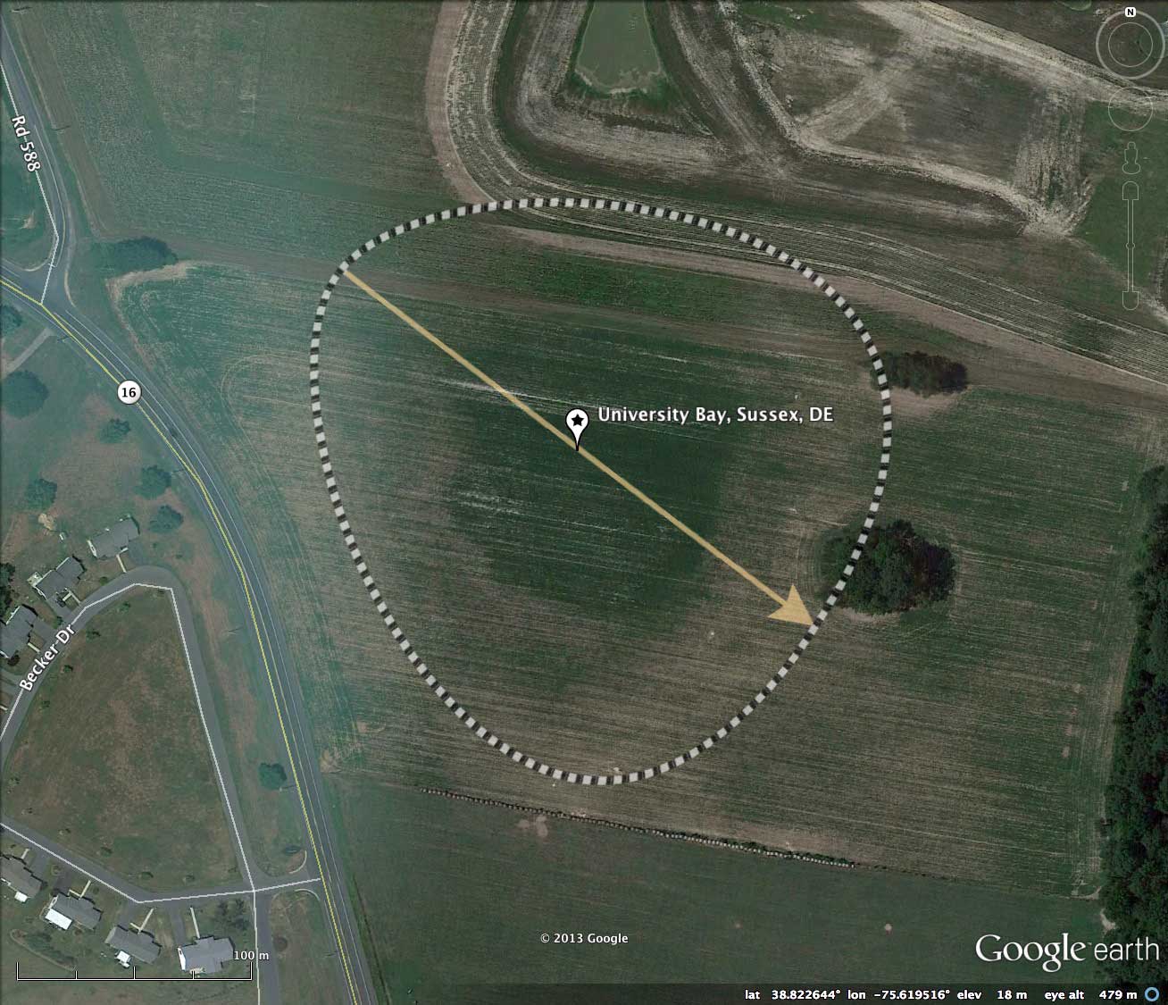
This bay is located at the intersection of Hickman Road and Rd 588, ~3 kilometers northwest of Greenwood. It sets in an open field which has clearly been cleared and farmed, although there are no indications it has been artificially ditched. I provided the name for this bay based on the former ownership of the property by the University of Deleware.
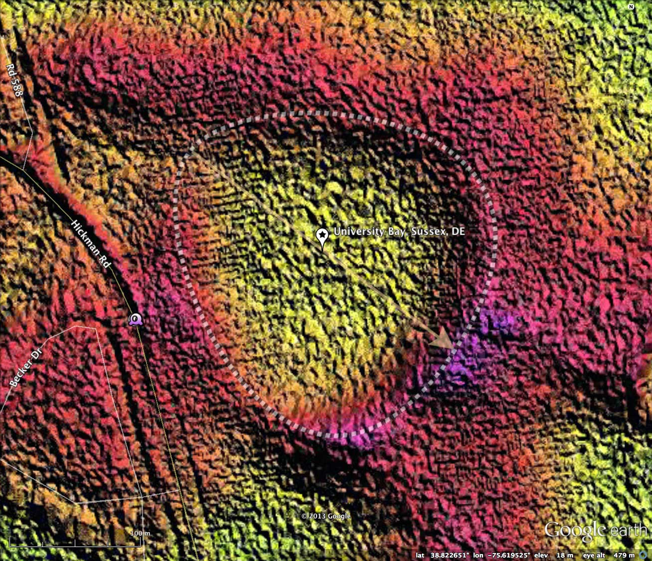
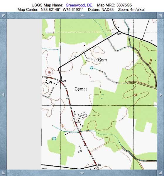
The older USGS Topographic map fails to properly call out the bay, but there is a crisp topo line describing the northwestern rim point, a common aspect of the bayBell archetype.
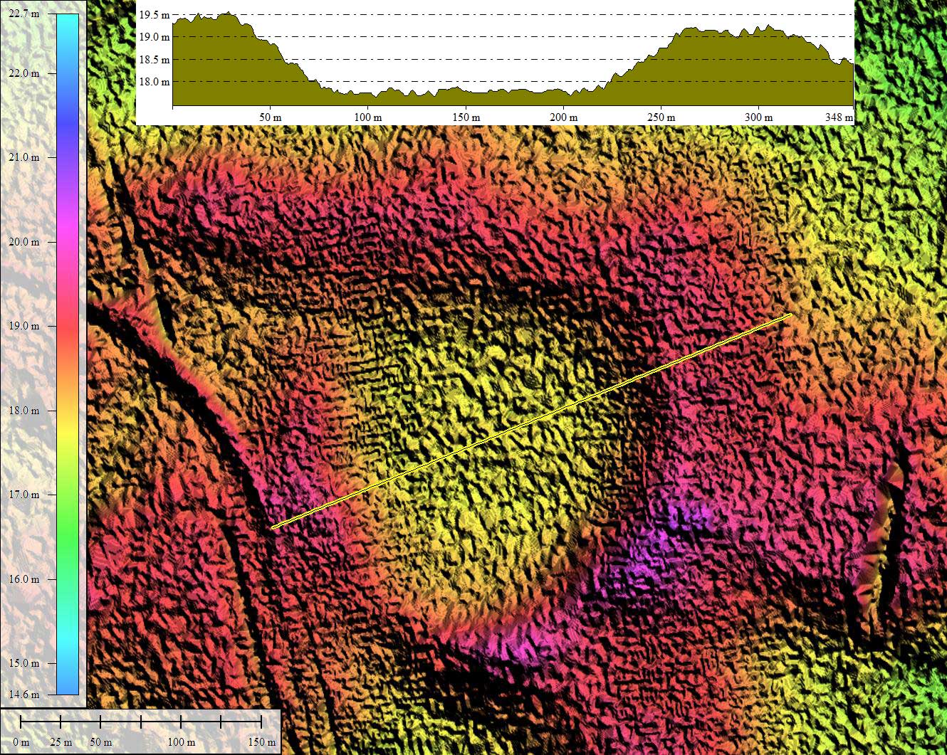
While the bay is relatively small at 1/4 kilometer in diameter, it has a vertical relief of 2 meters from the bay floor to the rim.
The tiled network-loaded LiDAR imagery presented here was re-gridded to 1 meter from NOAA-supplied (DE 2006) sub-meter grid data, to reduce the size. The bay is visualized as a common *bayBell* archetype, with an orientation which is similar to other nearby bayBell-shaped landforms.
There are indications in the LiDAR of another bay immediately to the southeast, but it presents unequivocally only 1/2 of the expected rim. The Survey indexes that structure as # 155302_2846 , and it has been included in the survey results. Far less than 1% of the 40,000 landforms in the survey fail to present a 360º circumpherial rim, but are usually well fit by the the same archetype overlay and orientation of its nearby neighbors. In this case, the best fit is for a bay about 10% larger (0.28 vs 0.25 km)than University bay, at the identical 128.16 orientation.
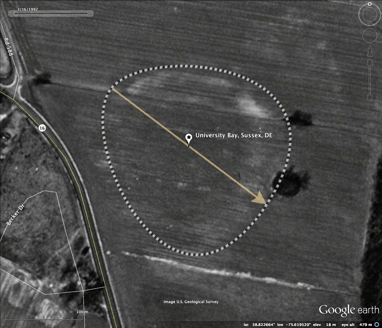
The latest satellite imagery shows a significant amount new work on the former University of Deleware property to the northeast (sold in 2000). If I was not so "bay" happy, I'd say they were trying to create an artificial bay, where none previously existed. Or was there a bay there? Have a look yourself at the 7/4/2010 Google Earth imagery view, included in the attached album. Motivated by that landscape exercise, I added a bay to the survey (# 155302_2946) which conforms to the other two bays' shape and orientation, but sets into the existing partial rim and overlays the newly constructed body of water.
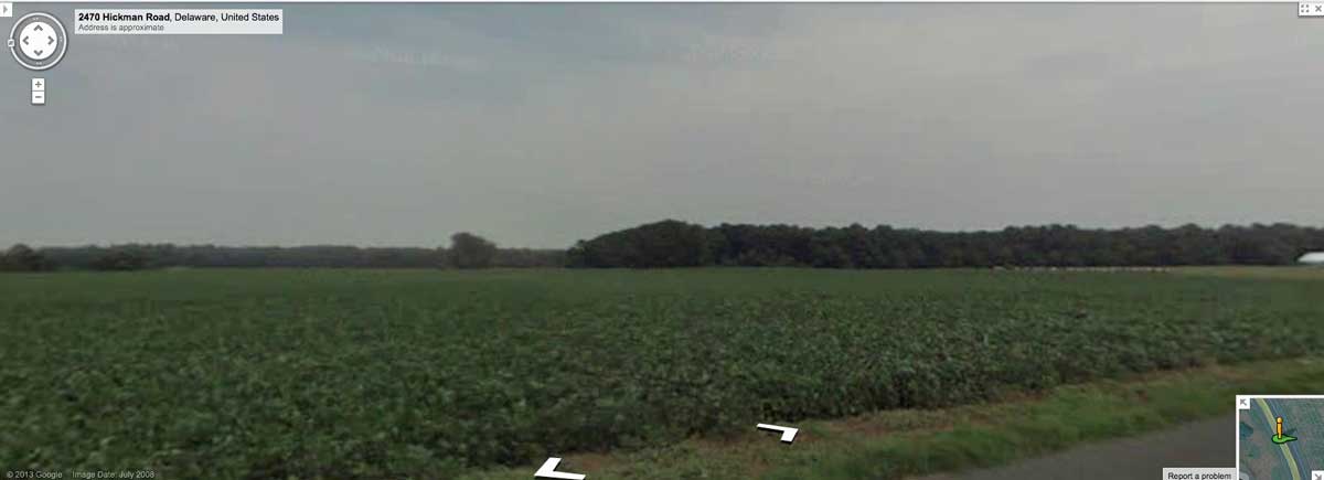
Google Streetview is available along the adjacent roads, but not much indication of the bays existence appears to the uninitiated eye. The image in the attached album hints at the bay resting down into the field as the viewer looks east towards the rim on the far side. Explore the Streetview interactively in your browser HERE.
The Carolina Bay Survey has identified and measured over 650 bays in Octant 155302. Their location and metrics can be referenced through a Fusion Table spatial visualization.
The older USGS Topographic map fails to properly call out the bay, but there is a crisp topo line describing the northwestern rim point, a common aspect of the bayBell archetype.
While the bay is relatively small at 1/4 kilometer in diameter, it has a vertical relief of 2 meters from the bay floor to the rim.
The tiled network-loaded LiDAR imagery presented here was re-gridded to 1 meter from NOAA-supplied (DE 2006) sub-meter grid data, to reduce the size. The bay is visualized as a common *bayBell* archetype, with an orientation which is similar to other nearby bayBell-shaped landforms.
There are indications in the LiDAR of another bay immediately to the southeast, but it presents unequivocally only 1/2 of the expected rim. The Survey indexes that structure as # 155302_2846 , and it has been included in the survey results. Far less than 1% of the 40,000 landforms in the survey fail to present a 360º circumpherial rim, but are usually well fit by the the same archetype overlay and orientation of its nearby neighbors. In this case, the best fit is for a bay about 10% larger (0.28 vs 0.25 km)than University bay, at the identical 128.16 orientation.
The latest satellite imagery shows a significant amount new work on the former University of Deleware property to the northeast (sold in 2000). If I was not so "bay" happy, I'd say they were trying to create an artificial bay, where none previously existed. Or was there a bay there? Have a look yourself at the 7/4/2010 Google Earth imagery view, included in the attached album. Motivated by that landscape exercise, I added a bay to the survey (# 155302_2946) which conforms to the other two bays' shape and orientation, but sets into the existing partial rim and overlays the newly constructed body of water.
Google Streetview is available along the adjacent roads, but not much indication of the bays existence appears to the uninitiated eye. The image in the attached album hints at the bay resting down into the field as the viewer looks east towards the rim on the far side. Explore the Streetview interactively in your browser HERE.
The Carolina Bay Survey has identified and measured over 650 bays in Octant 155302. Their location and metrics can be referenced through a Fusion Table spatial visualization.
- Index #: 155302_2947
- Location: 38.8225600246129,-75.61951857734881
- Major: 0.25 km . . . Minor: 0.23 km
- Eccentricity: 0.317
- Area: 4.71 hectares
- Bearing: 128.16º
- Elevation: 17.79 m
- Archetype: bayBell
- Effective Diameter: 244.887 m
- Index #: 155302_2846
- Location: 38.820570818430554,-75.61616937460346
- Major: 0.28 km . . . Minor: 0.25 km
- Eccentricity: 0.474
- Area: 5.8 hectares
- Bearing: 128.16º
- Elevation: 17.06 m
- Archetype: bayBell
- Effective Diameter: 271.749 m
Copyright 2018 by Michael Davias