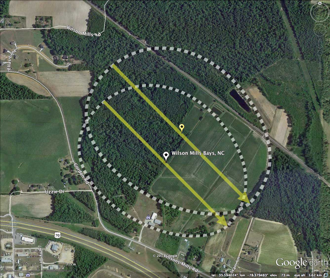
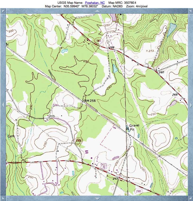
Wilson's Bay, NC
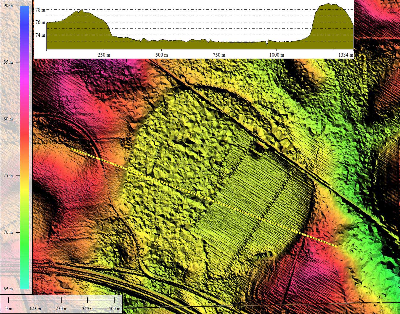
The third overly describes a separate bay, with a centers spacing of ~ 1 kilometer NNW of Wilson's Bay. That bay (# 142313_4153) appears to have a natural drainage channel out the south east tip, perhaps keeping it relatively dry and not normally identified as a Carolina Bay. I have included it here in the post to show that its shape and orientation correlates well with Wilson's Bay's metrics. It's floor does rest at an elevation 3 meters above Wilson's Bay's, but we have come to expect that closely-set bays usually have have elevation differences. Douglas Johnson, among others, have noted this and felt it falsified a common marine shoreline genesis, where common elevations would be expected.
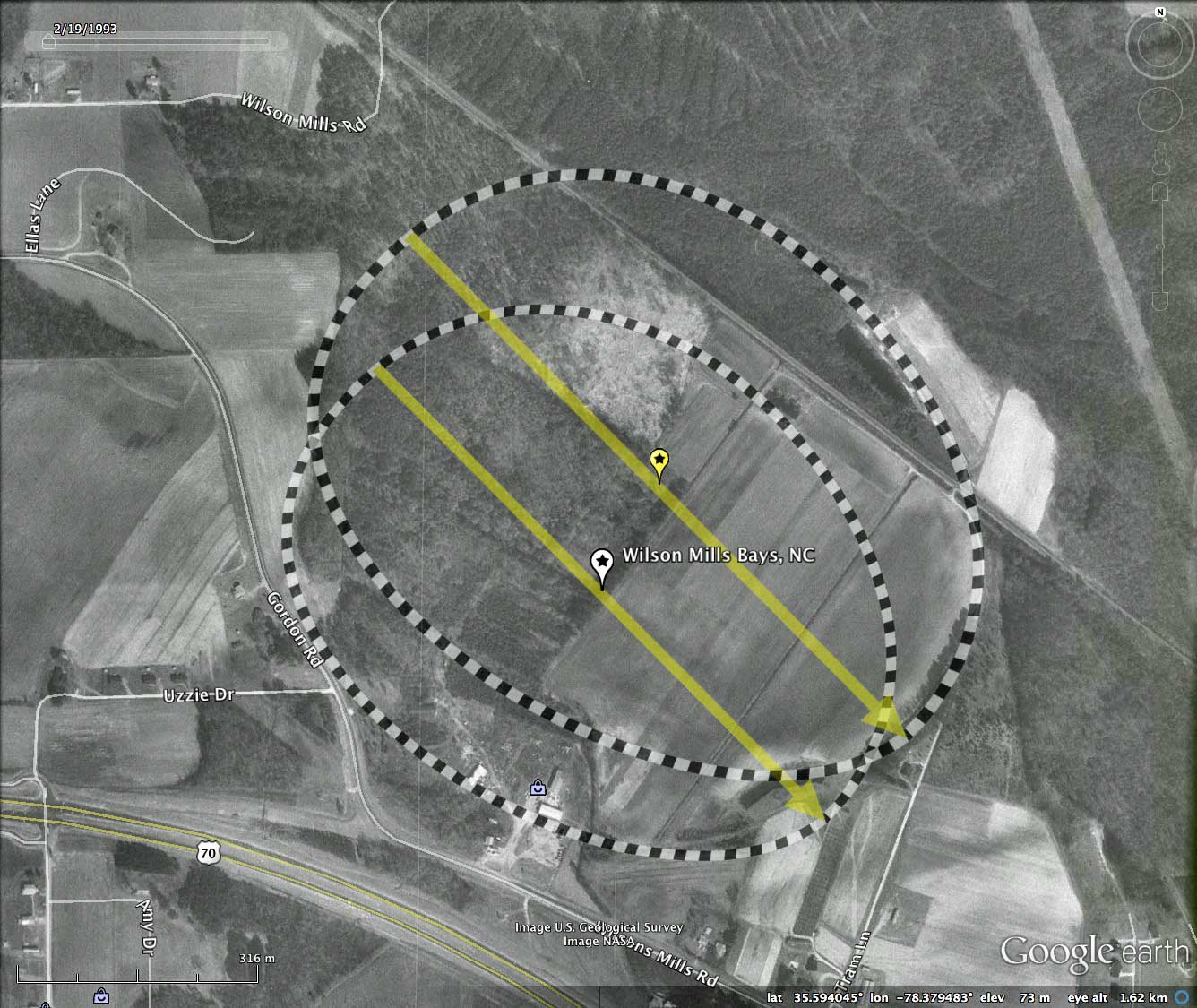
The exceptionally high quality 1-meter gridded LiDAR DEM data available in this area from NOAA exceeds the common NC State LiDAR from 2001/2002. The graphics really sparkle!
Bliley and Burney researched this bay in 1988, and reported on their findings in Southeastern Geology. Here is the abstract:
The onset of the bay's open-water phase (Radiocarbon data to a minimum of 22,000 yr B.P.) was accompanied by a shift to colder and possibly wetter climatic conditions. The gravelly rim sediment units are similar to ice-push deposits that have been described along the shores of modern lakes in the northern U.S. and southern Canada. Further evidence of ice-push activity comes from the sorted nature of the deposits, the apparent formation of the deposits concurrent with a shift to colder climate, the relationship of the deposits to an adjacent saprolite surface which has been depleted of coarse fragments, and the large size of some of the transported stones.
The distinct sandy rim unit is believed to be partly eolian in origin, deposited by strong southwesterly winds. The distribution of the basal sands in the fine-textured surficial deposit reflects the influence of the SW wind on shoreline erosion, sediment transport, and the orientation of the bay. Initial bay expansion, however, did not correlated with the SW wind component.
The Carolina Bay Survey has identified and measured ~70 bays in Octant 142313. Their location and metrics can be referenced through a Fusion Table spatial visualization.
- Index #: 142313_3751
- Location: 35.59371734174725,-78.37954856974355
- Major: 0.86 km . . . Minor: 0.67 km
- Eccentricity: 0.615
- Area: 46.03 hectares
- Bearing: 135.29º
- Elevation: 73.04 m
- Archetype: bay
- Effective Diameter: 765.553 m
- Index #: 142313_3851
- Location: 35.59500599820919,-78.37870028481925
- Major: 0.95 km . . . Minor: 0.73 km
- Eccentricity: 0.637
- Area: 55.36 hectares
- Bearing: 135.29º
- Elevation: 73.28 m
- Archetype: bay
- Effective Diameter: 839.562 m
- Index #: 142313_4153
- Location: 35.60499186855238,-78.38302433037197
- Major: 0.99 km . . . Minor: 0.77 km
- Eccentricity: 0.627
- Area: 60.73 hectares
- Bearing: 135.29º
- Elevation: 76.39 m
- Archetype: bay
- Effective Diameter: 879.339 m