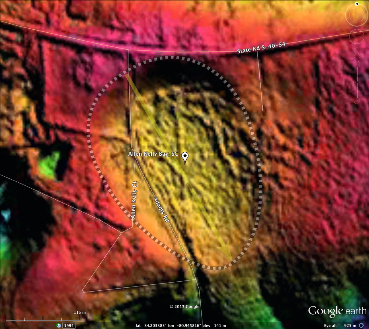
Allen Kelly Bay, SC
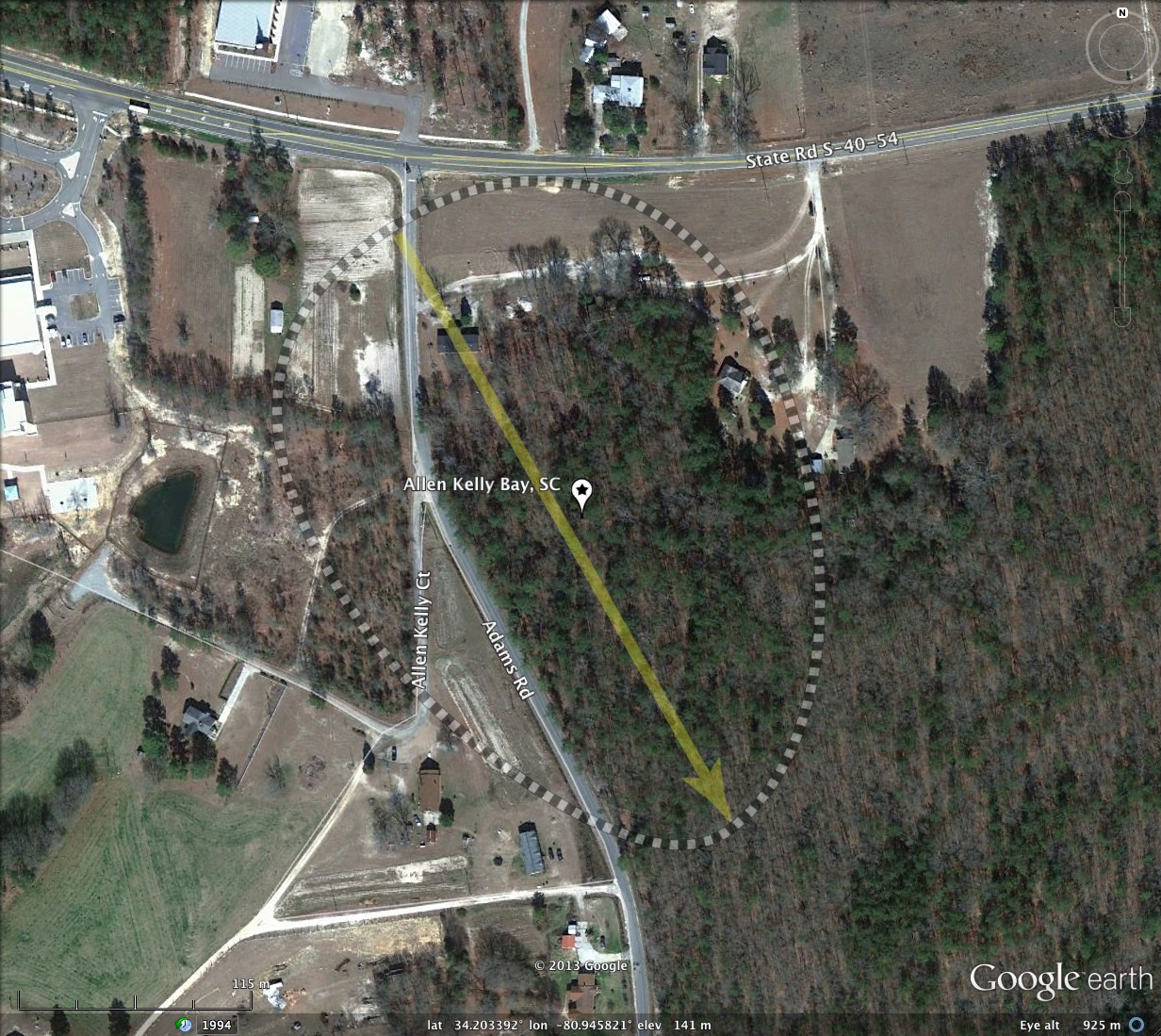
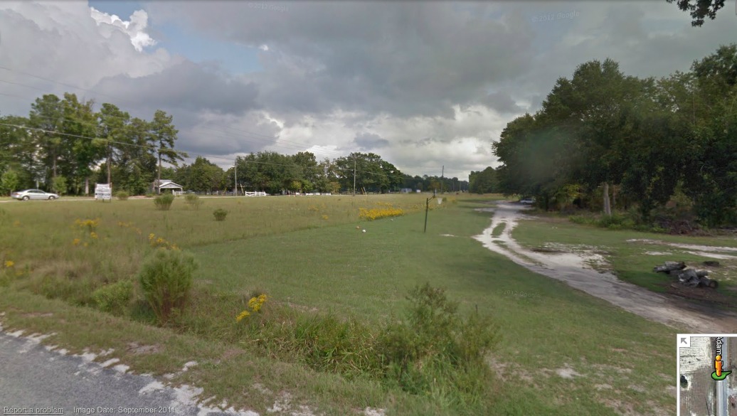
Follow Langford Road 1 1/2 miles east out of Blythewood, SC, and you will find Allen Kelly Bay just past the intersection with Adams Road, which takes you immediately down into the bay on your right. Looking east from Adams Road, the bay rim can be seen rising from your right, which is on the bay floor, to the left, where Langford Road continues east across the northern rim. A Streetview image of the scene is included in the attached album. You can browse the area using this LINK.
I named the bay after Allen Kelly Court, which runs from Adams Road on the bay floor, then up and over the rim 100 yards out.
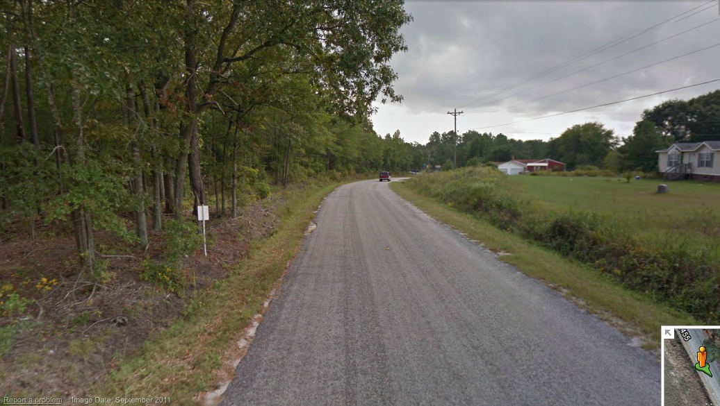
The bay drains south through ditches along Adams Road as it passes through the southern rim. This can be seen in the second Streetview image in the album, or viewed in Streetview using this LINK.
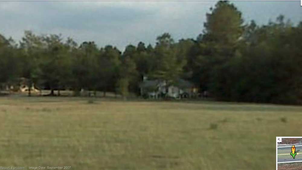
A third Streetview photo from the rim along Langford Road shows a house in the distance which is on the northeastern floor of the bay, and the rim is shown to the left of it at a higher elevation. The scene can be seen interactively with this LINK.
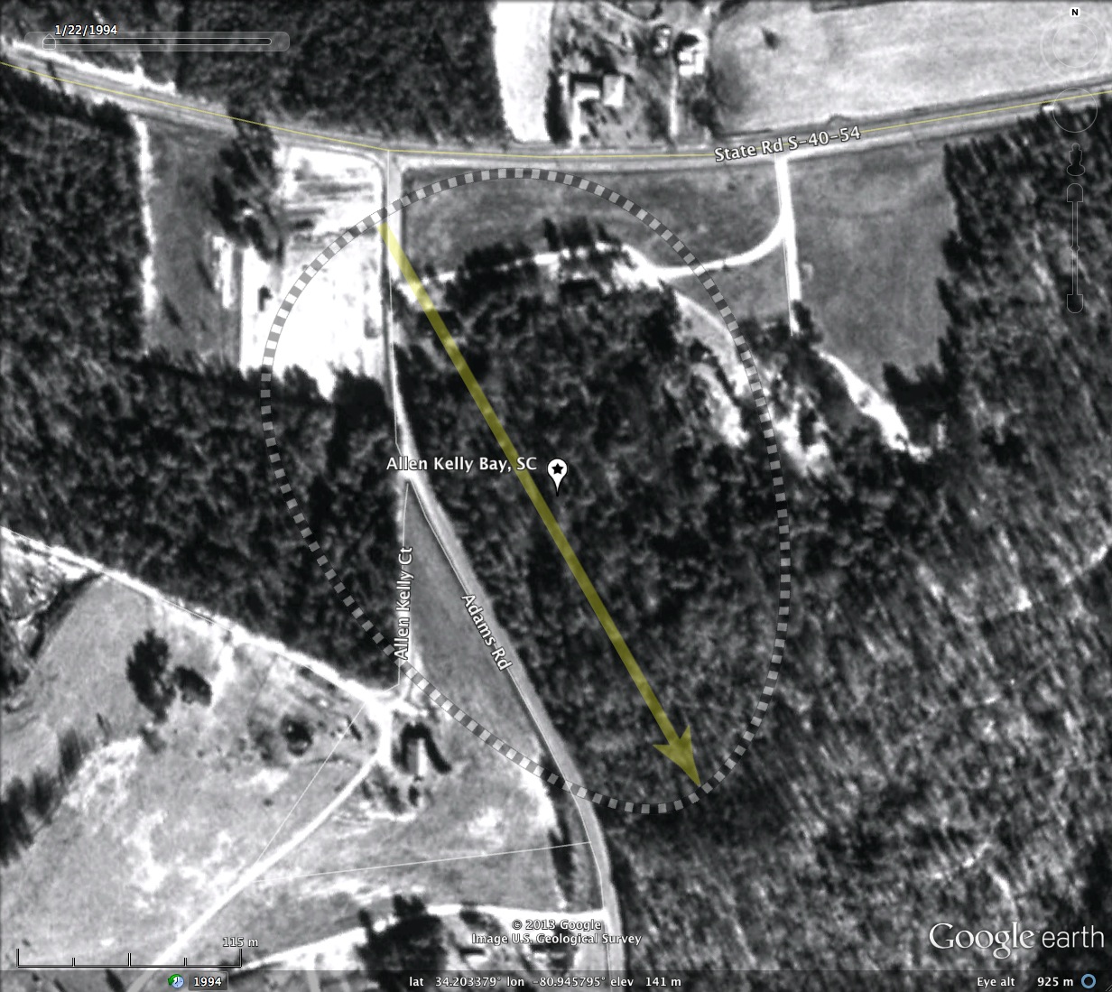
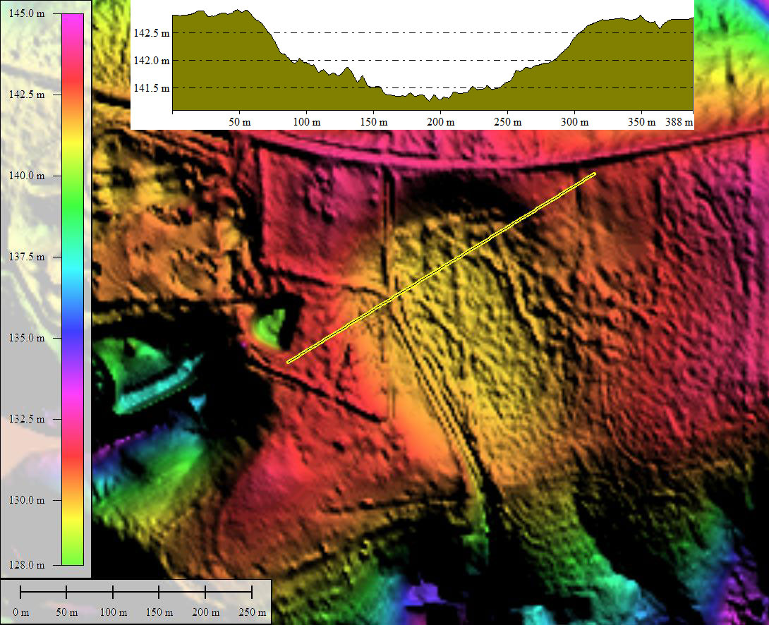
Although there is drainage, a good part of the bay is forested and looks to be in a natural state. Historical imagery from 1994 shows little change in the bay's character over the past 20 years. Allen Kelly Bay's shape adheres to baySouth archetype, and has an orientation which conforms to our orientation calculator.
Both streetview image locations are identified and reproduced in the attached KMZ file. As usual, visualizing the gentle rims takes a sharp eye and a bit of imagination...
I named the bay after Allen Kelly Court, which runs from Adams Road on the bay floor, then up and over the rim 100 yards out.
The bay drains south through ditches along Adams Road as it passes through the southern rim. This can be seen in the second Streetview image in the album, or viewed in Streetview using this LINK.
A third Streetview photo from the rim along Langford Road shows a house in the distance which is on the northeastern floor of the bay, and the rim is shown to the left of it at a higher elevation. The scene can be seen interactively with this LINK.
Although there is drainage, a good part of the bay is forested and looks to be in a natural state. Historical imagery from 1994 shows little change in the bay's character over the past 20 years. Allen Kelly Bay's shape adheres to baySouth archetype, and has an orientation which conforms to our orientation calculator.
Both streetview image locations are identified and reproduced in the attached KMZ file. As usual, visualizing the gentle rims takes a sharp eye and a bit of imagination...
- Index #: 136323_8178
- Location: 34.20327990371735,-80.94581305544791
- Major: 0.34 km . . . Minor: 0.24 km
- Eccentricity: 0.698
- Area: 6.85 hectares
- Bearing: 150.45º
- Elevation: 140.55 m
- Archetype: baySouth
- Effective Diameter: 295.325 m
Copyright 2018 by Michael Davias