Drexell Landing Bay, MD
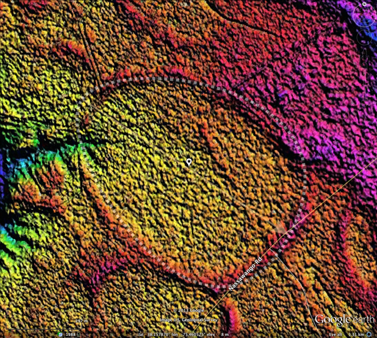
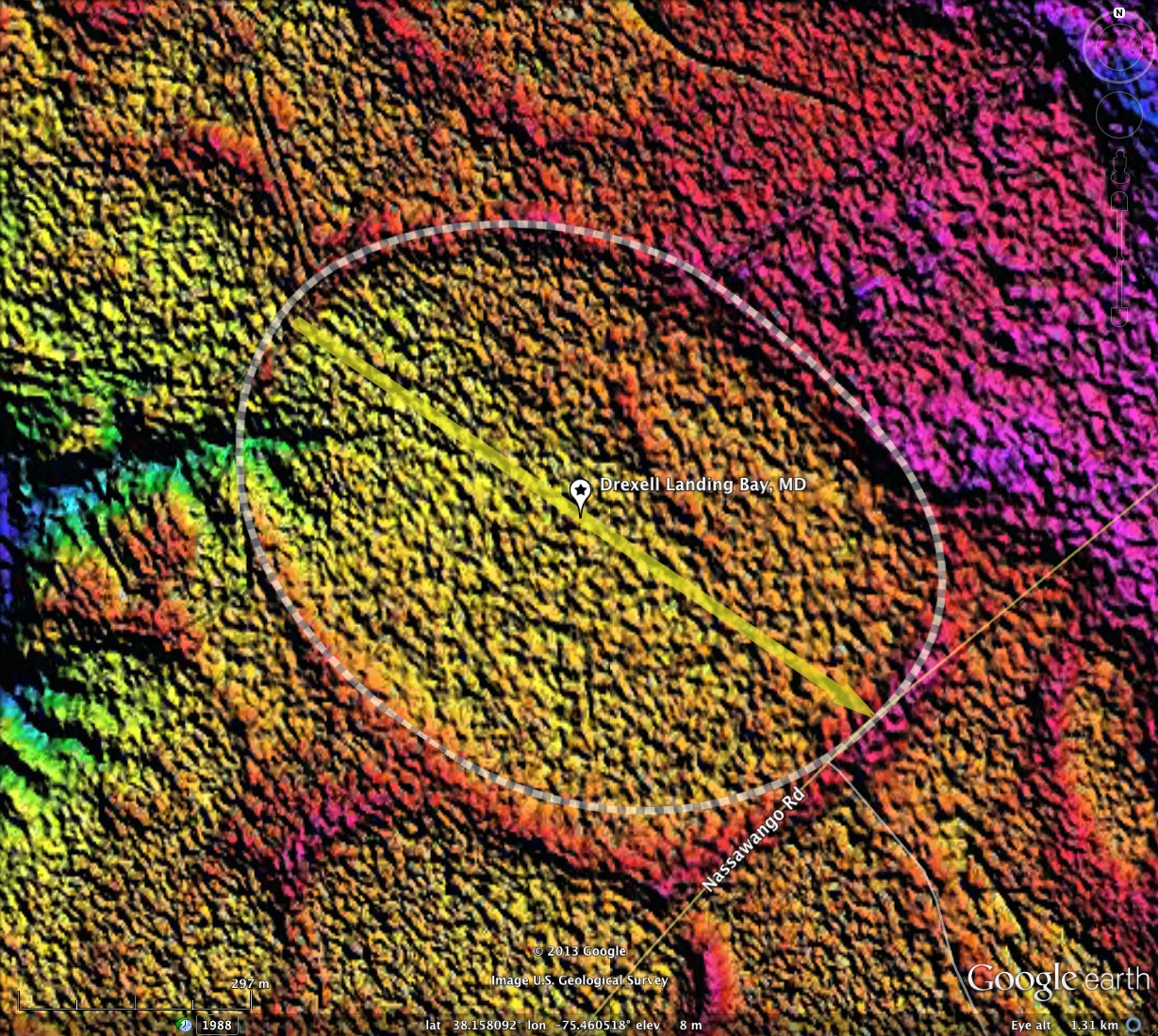
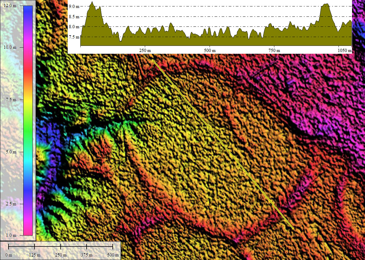
Bay archetype shapes are seen to change gradually as the coastal plain is traversed from North to South. Each oval shape is similar, but there are nuances which are apparent. As should be expected, there are areas where two shapes compete for fit, and here we present one such bay. To the North, the bayBell archetype is prevalent, and to the South the bayShore archetype is a fit. Drexell Landing Bay has characteristics of both: the smoother Northwestern rim of the bayShore, vs the pointed shape of the bayBell; the flatter Southeastern "bottom" of the bayBell, vs the smoother curve of the bayShore archetype.
Bays fitting either type are seen across the area, but this is one which fits neither perfectly, and begs to use both. The attached album shows imagery of the bay in LiDAR using each of the archetypes separately - which would you pick? My choice would be the bayBell.
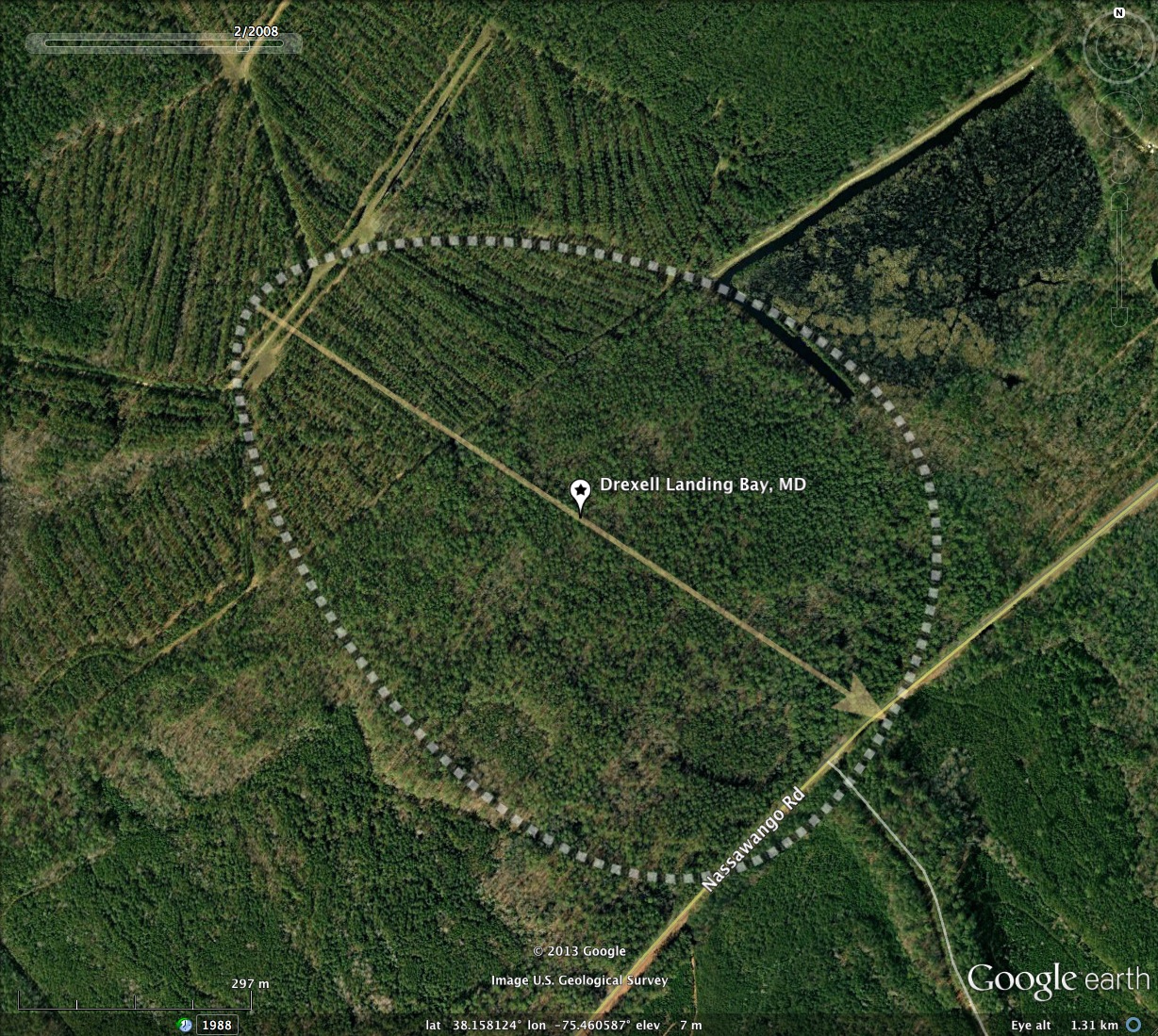
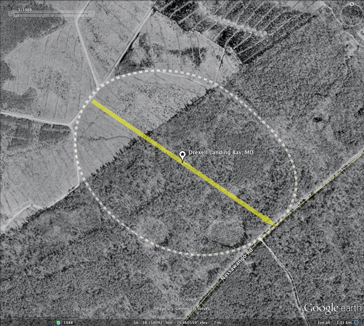
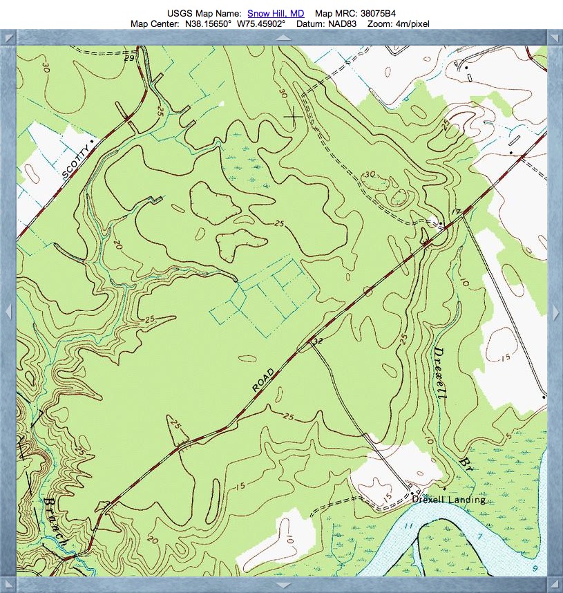
I named Drexell Landing Bay after a USGS nameplace nearby, and for Drexell Brook, which flows nearby. Both are shown on the USGS Topographic map, as is the extensive boxy network of drainage channels which have been cut inside to bay. Drainage is eventually carried across the rim at the western-most extent, in what seems to be a natural channel.
Bays fitting either type are seen across the area, but this is one which fits neither perfectly, and begs to use both. The attached album shows imagery of the bay in LiDAR using each of the archetypes separately - which would you pick? My choice would be the bayBell.
I named Drexell Landing Bay after a USGS nameplace nearby, and for Drexell Brook, which flows nearby. Both are shown on the USGS Topographic map, as is the extensive boxy network of drainage channels which have been cut inside to bay. Drainage is eventually carried across the rim at the western-most extent, in what seems to be a natural channel.
- bayShore Archetype Version
- Index #: 152301_6384
- Location: 38.15786982203767,-75.46052509853854
- Major: 0.93 km . . . Minor: 0.69 km
- Eccentricity: 0.673
- Area: 50.7 hectares
- Bearing: 124.3º
- Elevation: 7.92 m
- Archetype: bayShore
- Effective Diameter: 803.449 m
- bayBell Archetype Version
- Location: 38.157911764283114,-75.46067215072085
- Major: 0.98 km . . . Minor: 0.73 km
- Eccentricity: 0.669
- Area: 56.86 hectares
- Bearing: 124.14º
- Elevation: 7.62 m
- Archetype: bayBell
- Effective Diameter: 850.86 m
Copyright 2018 by Michael Davias