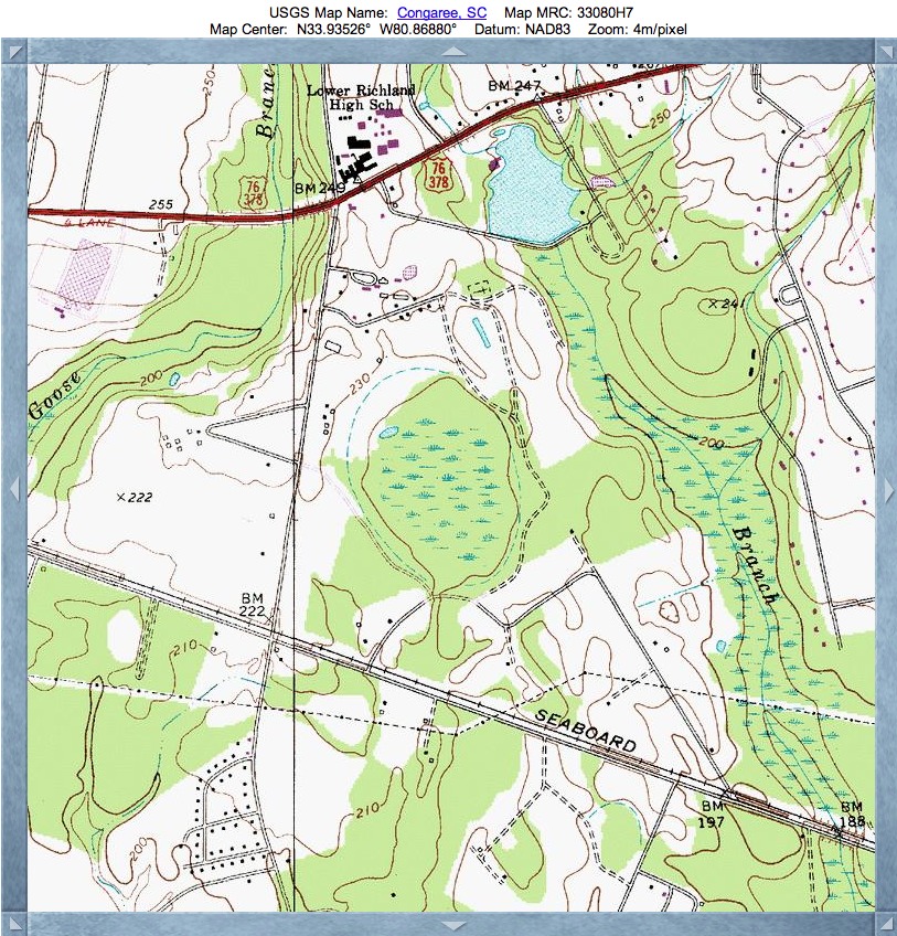
Hopkins Bay, SC
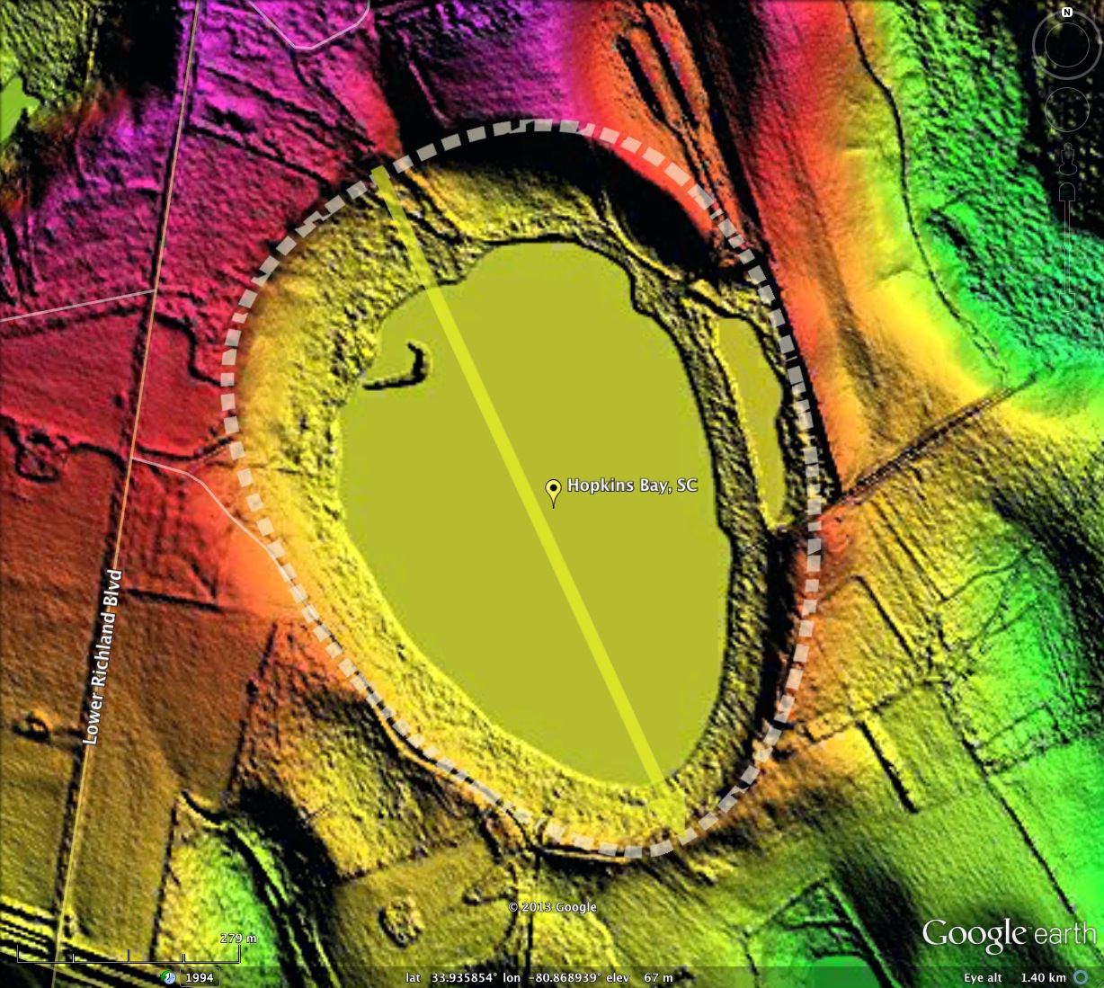
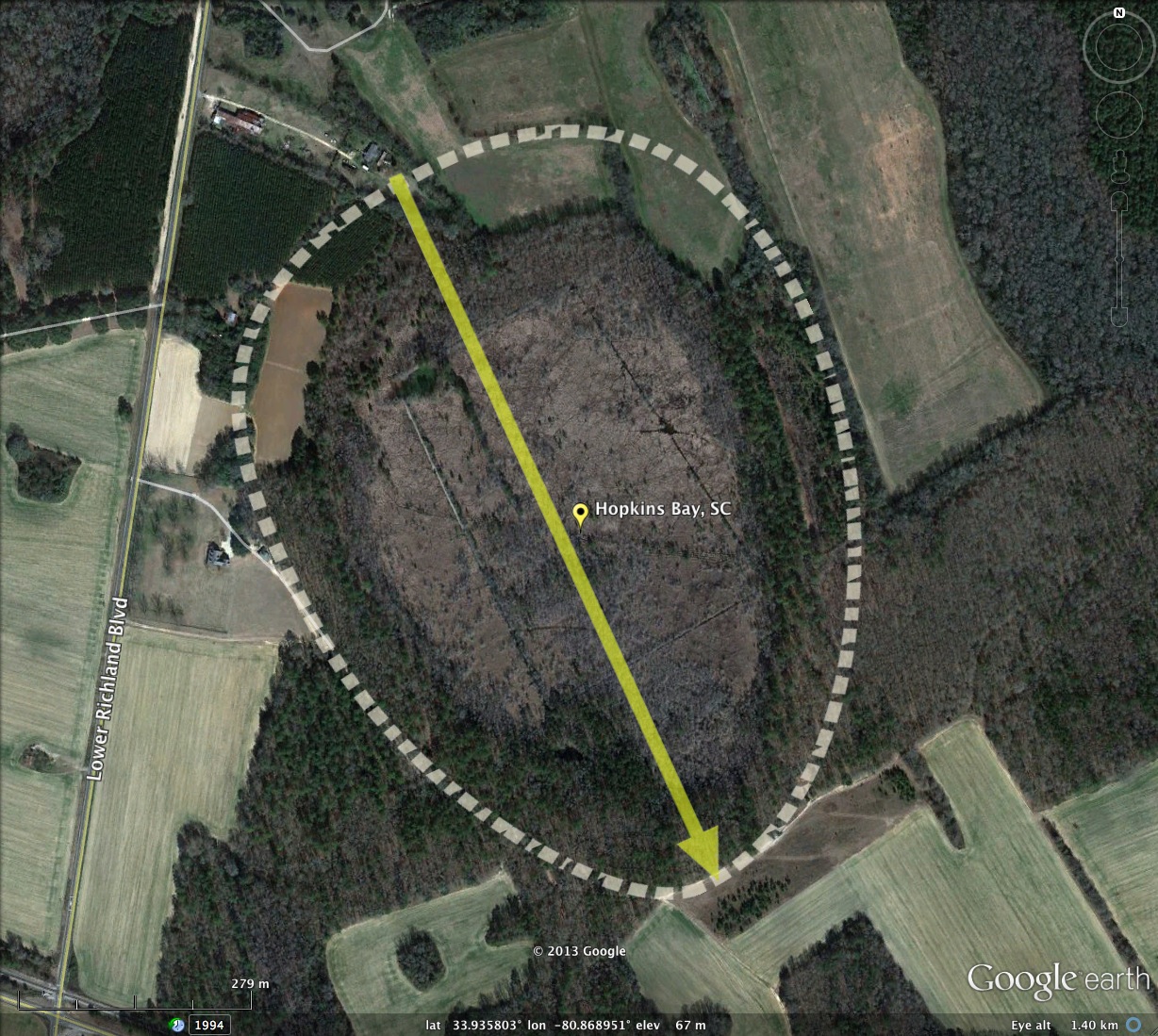
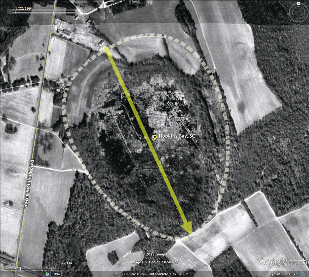
Hopkins Bay was named by me after the historical property owners, and the nearby hamlet of Hopkins. The bay adheres perfectly with the baySouth archetype shape, and presents an orientation similar to numerous other local bays.
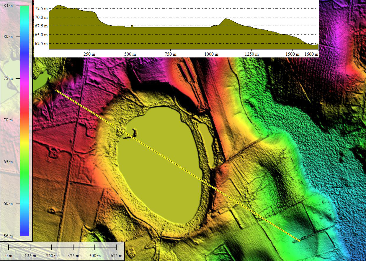
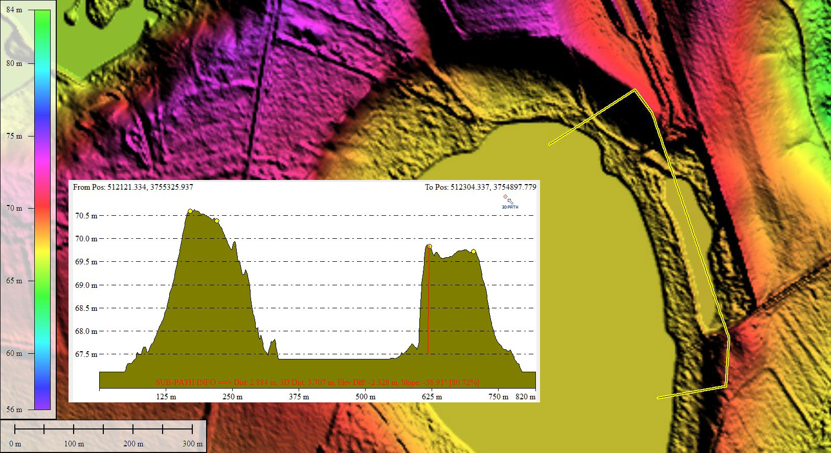
Here is a bay just waiting to be preserved. From the Google Visuals, to the LiDAR, the bay seems largely undisturbed. Sure, the eastern rim has been mined for sand - but the excavation looks to be a precision extraction of a rectangular 100-meter wide by 300 meter section of rim. As such it might just be an invitation to sample the rim structure at each end of the pit, with 2+ meters of vertical exposure available.
There are man-made drainage channels apparent across sections of the bay floor, but the system does not extend across and out of the rim at elevations adequate to drain the bay, so the bay remains a closed system hydrologically.
The bay is identified as a wetland on the USGS Topographic map, and the LiDAR suggests a significant amount of the bay floor surface area is covered with water when the imagery was acquired.
- Index #: 135323_7447
- Location: 33.93583845268049,-80.86894471682822
- Major: 0.93 km . . . Minor: 0.7 km
- Eccentricity: 0.658
- Area: 51.69 hectares
- Bearing: 155.41º
- Elevation: 66.55 m
- Archetype: baySouth
- Effective Diameter: 811.256 m
Copyright 2018 by Michael Davias