Kings Lynn Bay, VA
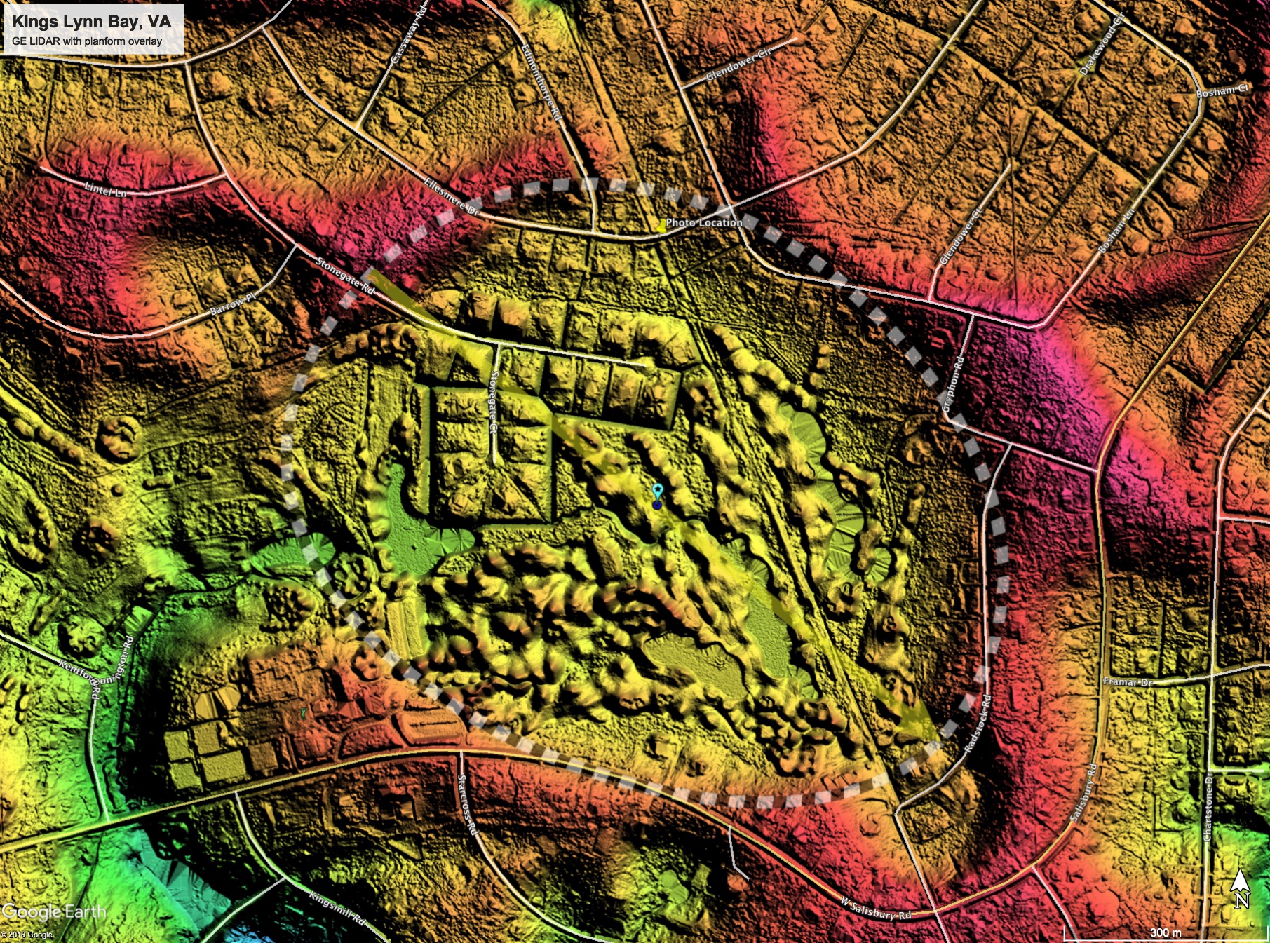
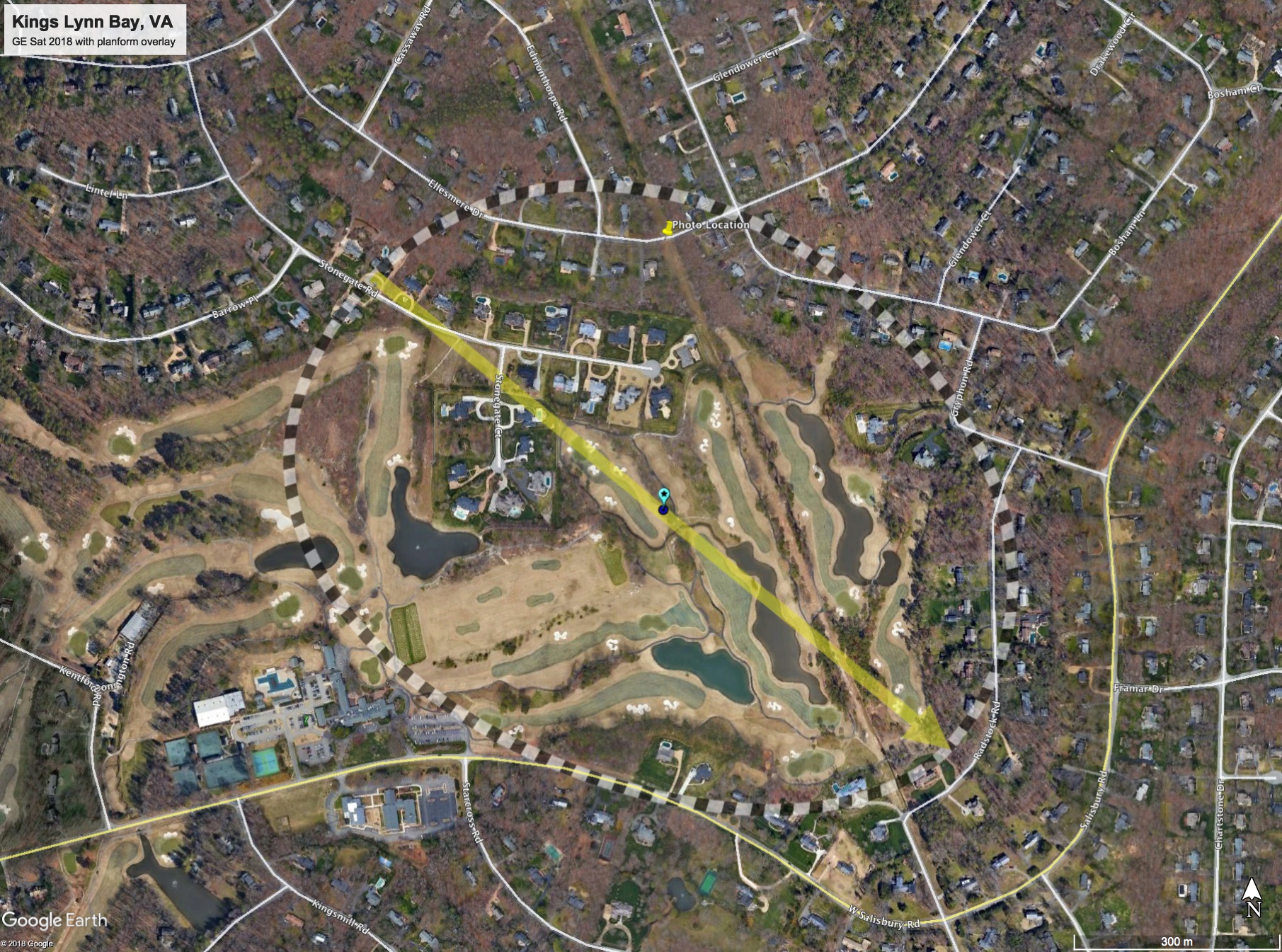
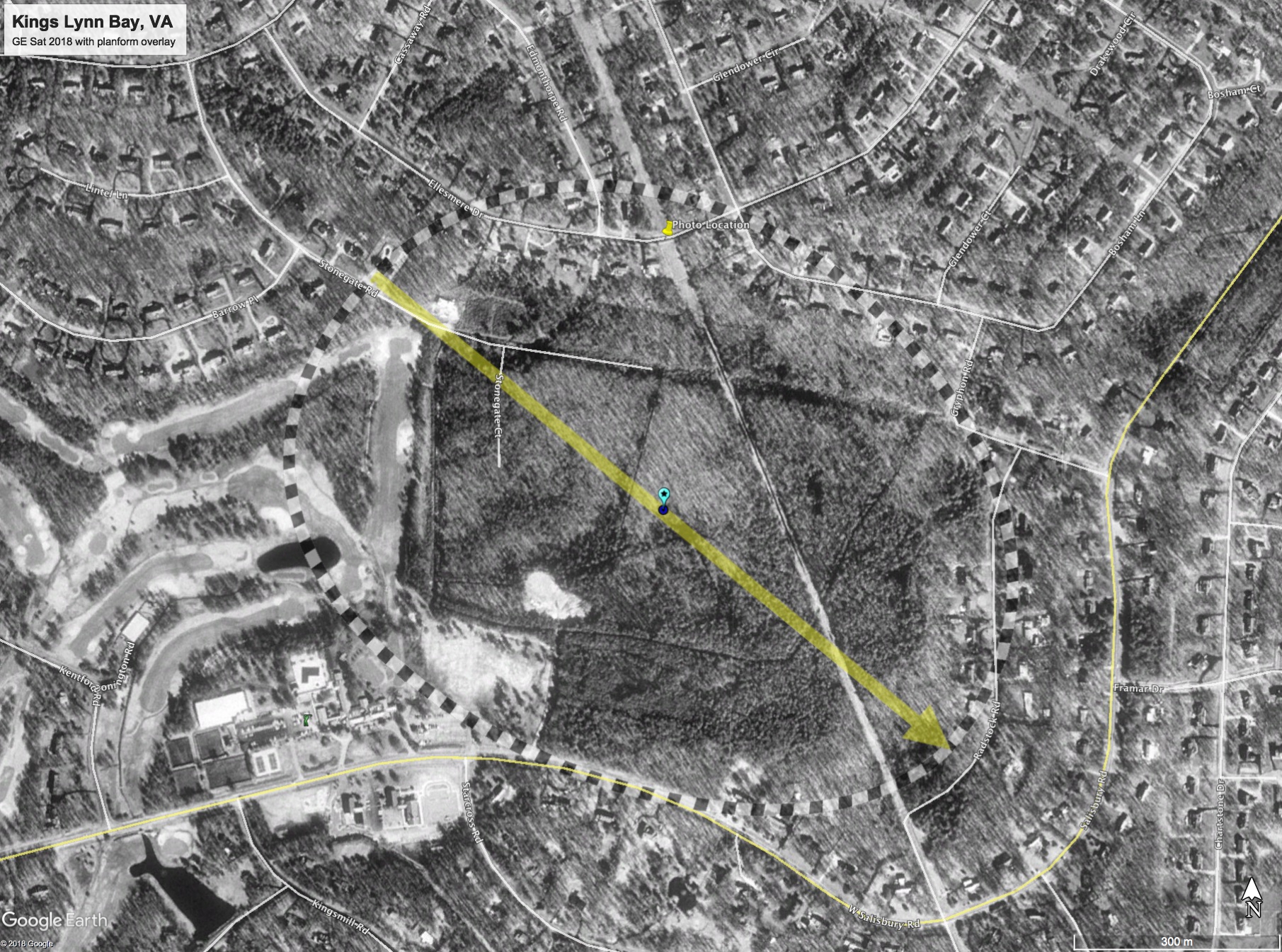
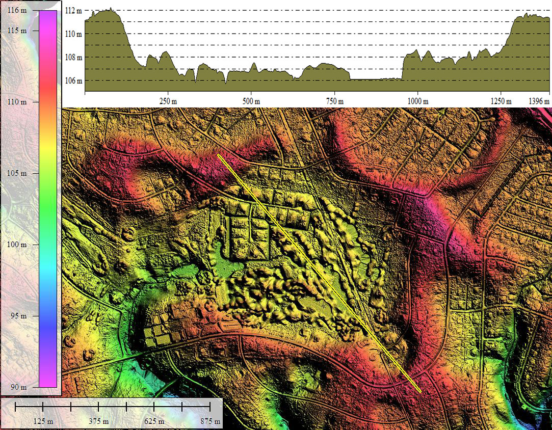
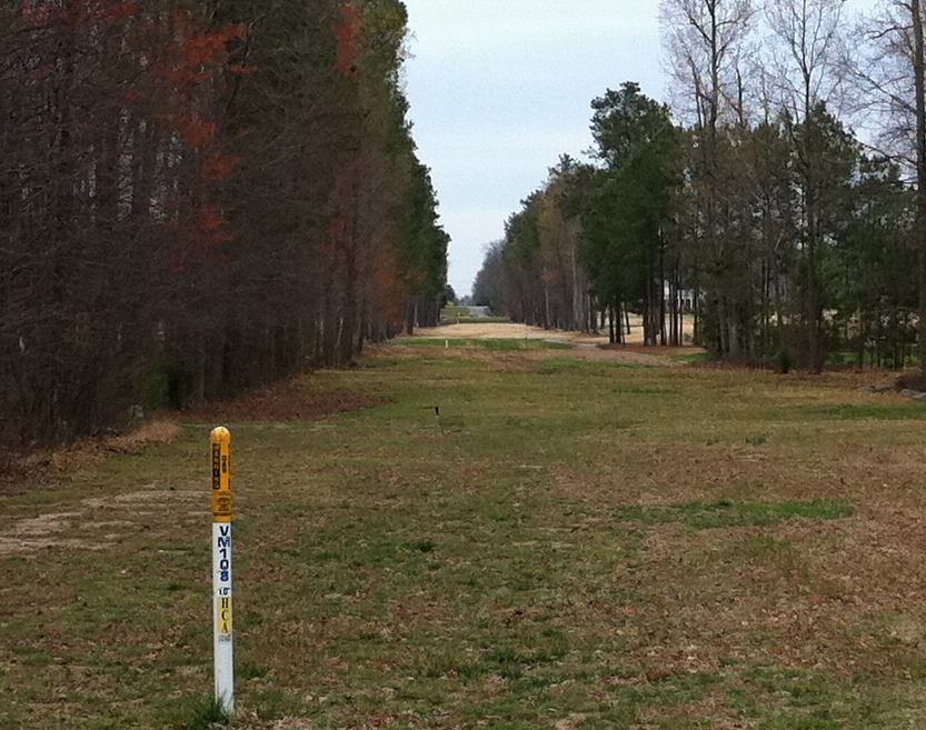
The bays in this area have been referred to be in the "Midlothian Gravels". A visit to these bays on 26 March, 2011 confirmed that the rims of these bays are pure sand. While these landforms may well REST upon the gravels, these structures are analogous to the Carolina bays in their rim composition. One photo in the attached album shows a view from this bay's floor, looking out along a pipeline right-of-way to the rim on the far side. The route is paved at that point, and its dip down into the bay is quite apparent in the image. The streets around the bay are available in Google Streetview imagery, although (as usual), the rim relief is hard to perceive.
The bay is currently well-drained by a natural channel to the west, and now contains many homes and a golf course. I have measured the bay with the Bay Archetype overlay, and it fits well here and over the nearby bays.
The Midlothian platform was discussed in my presentation at the 2015 GSA meeting in Baltimore, MD. A copy of the poster is available from the GSA on their abstract web page HERE.
The Carolina Bays in this area were covered in a field guid book - the only one I have found to exist on the subject of bays in general. I have included below some excerpts:
Geology Of The Upland Gravels Near Midlothian, Virginia, By Bruce K. Goodwin - LINK
The flat, undissected upland surface of the Midlothian gravels is marked by numerous elliptical to subcircular depressions or basins. These basins were first reported bait Johnson and Goodwin (1967). Over twenty such basins have been recognized in this area and nineteen are shown on Figures 2 and A. The basins have formed on the Midlothian gravels and the basin sediments are immediately underlain by course gravels. The elevation of the basin floors is between 345 to 360 feet above sea level and a low ridge or rim surrounds the basins (Fig. 4). This rim from five to 15 feet high, is most commonly best developed on the south and east sides of the basins. The basins range in size frown a few hundred feet to more than three quarters of a mile and where elliptical, their major axis trends from N 60° W to 80° W. The undrained basins contain organic-rich, fine-grained sediments and support a hygrophilous flora. A few of the basins have been breached by streams and are being drained. Because of the similarities between these depressions and the well-studied elliptical depressions known as Carolina Bays on the central and southern Atlantic Coastal Plain of North America, the authors have adopted the same name for the shallow basins on the Midlothian gravels.
B. Goodwin
A section from the interior through the rim of one of the Carolina bays in this area is described in Stop No. 7 of the road log of this guidebook end only an outline is presented here. In general the section shows that the rim is underlain dominantly by sand containing some pebbles but only very minor amounts of clay. Rarely cobbles or pebbles occur within the sand. A pronounced decrease in sand occurs from the rim toward the bay's interior and massive, brownish-gray, silty clay with a few scattered quartz pebbles becomes the dominant sediment. This clay is in direct contact with the underlying gravels. The lateral transition from sand to clay is gradational but occurs within a distance of less than 200 feet from the rim.
B. Goodwin
- Index #: 150310_1259
- Location: 37.53050973163869,-77.64853792403471
- Major: 1.08 km . . . Minor: 0.85 km
- Eccentricity: 0.582
- Area: 72.93 hectares
- Bearing: 129.73º
- Elevation: 104.64 m
- Planform: bayCarolina
- Effective Diameter: 937.233 m
Copyright 2018 by Michael Davias