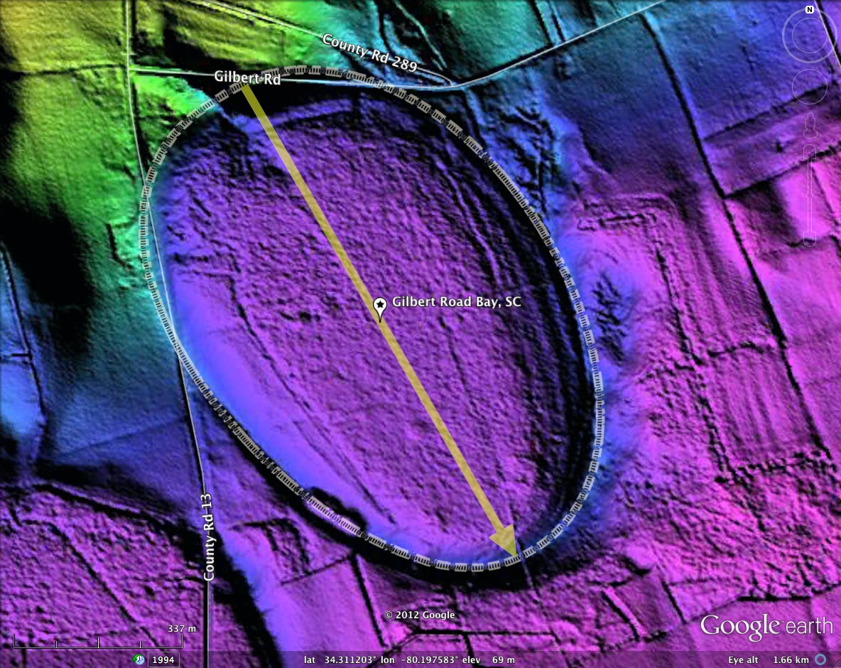
Gilbert Road Bay, SC
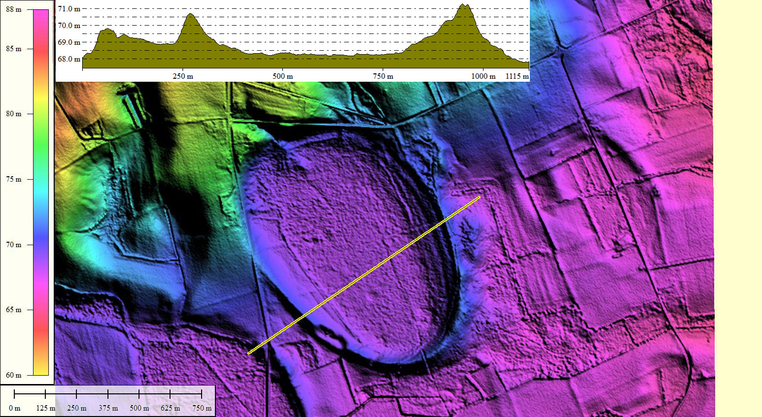
Gilbert Road Bay was named by me after the road which nicks its northern rim. The bay shape is classic Bay-Archetype. The northern half of the circumferential rim is level with the surrounding landscape, while the southern sections are elevated above it, as the landscape there is at a lower elevation. Effectively, the bay was formed into, or with, the scarp. This juxtaposition is often seen, and may be a clue to their genesis.
With the exception of a narrow trench cut through the southern apex, Gilbert Road Bay looks to possess a robust rim, and as such might represent a good candidate for restoration as an exotic Carolina Bay wetland.
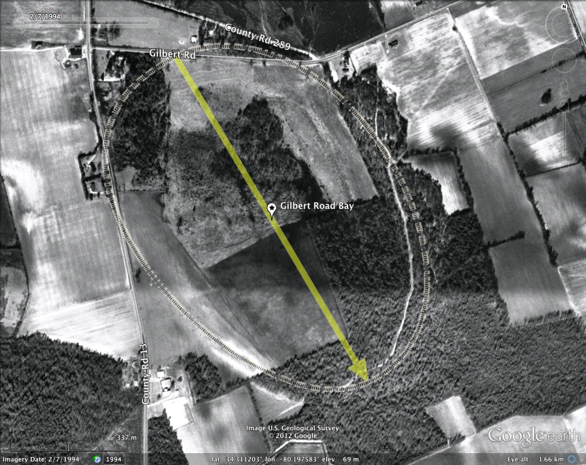
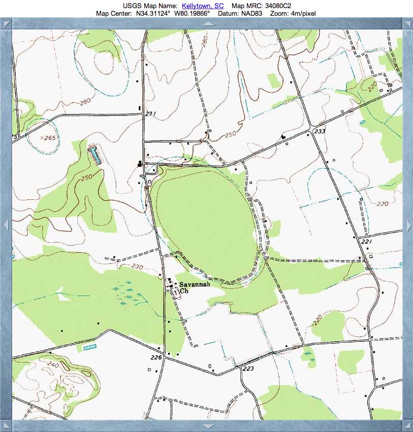
It is located 3 kilometers due south of Ashland, SC. The bay's shape and orientation matches those in the immediate area in Camden County. USGS Topographic map, included in the album here, shows the rim to be a crisp oval correlating to the LiDAR-visualized rim.
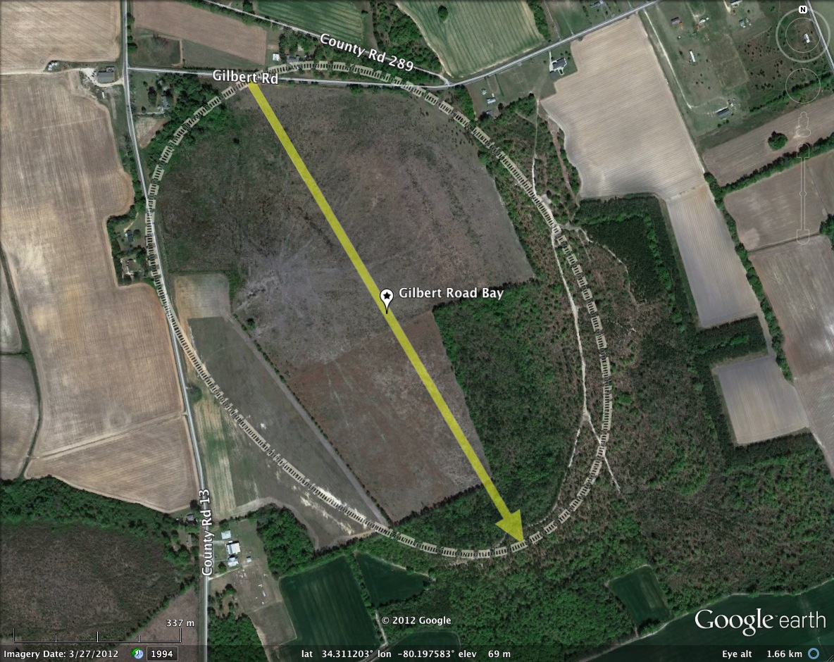
As usual, the heavily vegetated bay bottom's shape does not follow the rim. As such, a remote sensing survey based only on visual imagery may not have identified the proper size, shape or orientation.
With the exception of a narrow trench cut through the southern apex, Gilbert Road Bay looks to possess a robust rim, and as such might represent a good candidate for restoration as an exotic Carolina Bay wetland.
It is located 3 kilometers due south of Ashland, SC. The bay's shape and orientation matches those in the immediate area in Camden County. USGS Topographic map, included in the album here, shows the rim to be a crisp oval correlating to the LiDAR-visualized rim.
As usual, the heavily vegetated bay bottom's shape does not follow the rim. As such, a remote sensing survey based only on visual imagery may not have identified the proper size, shape or orientation.
- Index #: 137320_2479
- Location: 34.31141223791783,-80.1984621843356
- Major: 1.1 km . . . Minor: 0.76 km
- Eccentricity: 0.726
- Area: 66.08 hectares
- Bearing: 150.06º
- Elevation: 68.26 m
- Planform: bayCarolina
- Effective Diameter: 917.254 m
Copyright 2018 by Michael Davias