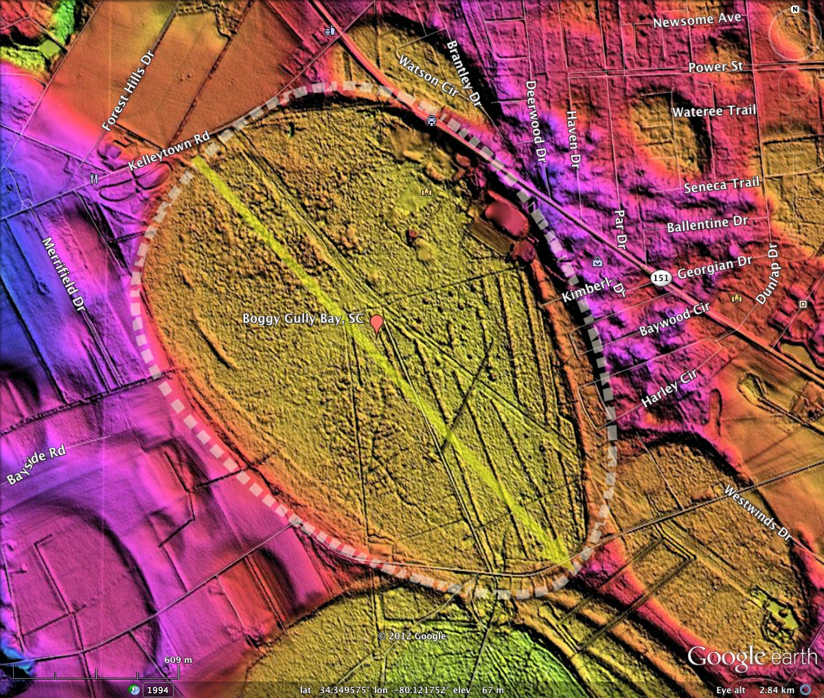
Boggy Gully Bay, SC
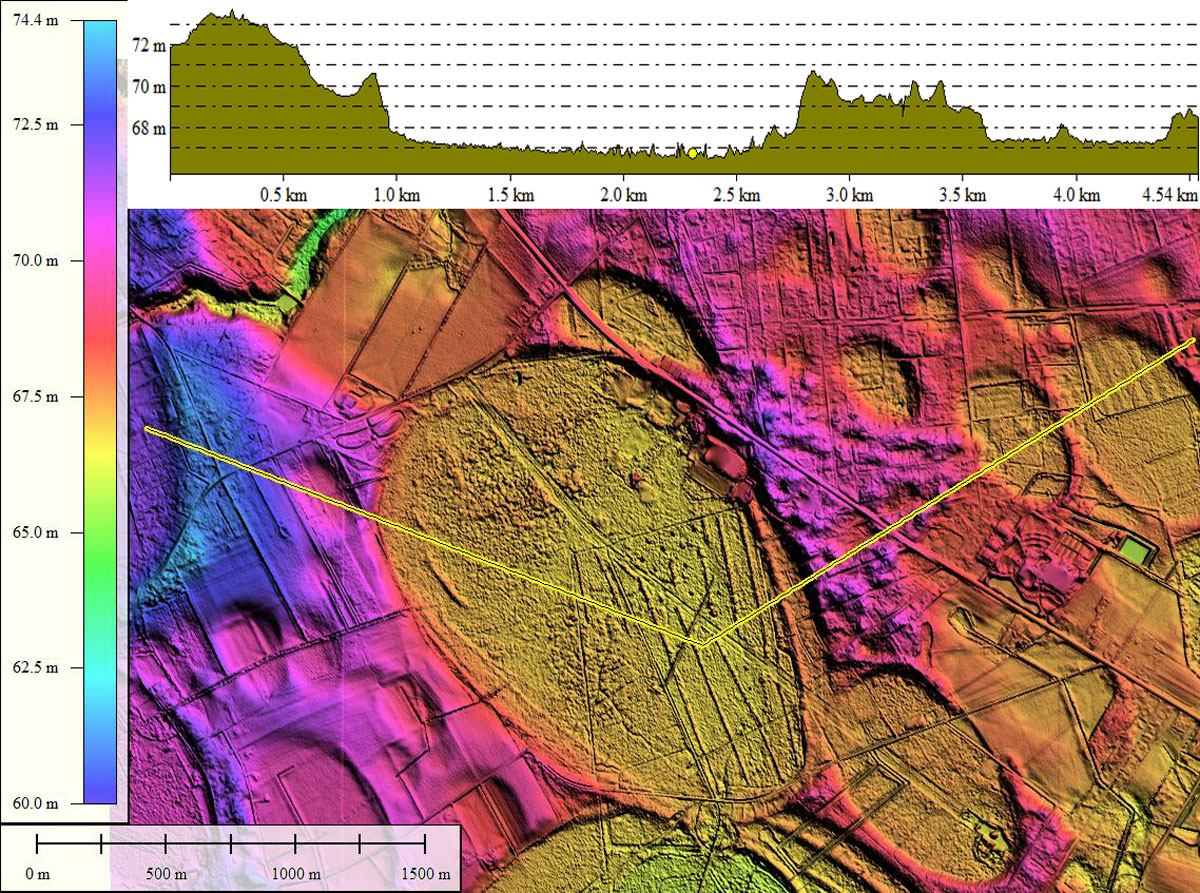
Well, this bay's given name is interesting, to say the least. It has the baySouth archetype shape, along with a double southeastern rim segment. This is one of the many bays in the region which share characteristics of both the baySouth and the standard bayCarolina Archetype shape. I see this as a transitionary phase between the two regional shapes types, which is noted in the larger bays first as the transition progresses across the landscape. Note that the smaller surrounding bays do not have the more pointed southeast rim, but rather conform to the bayCarolina Archetype shape.
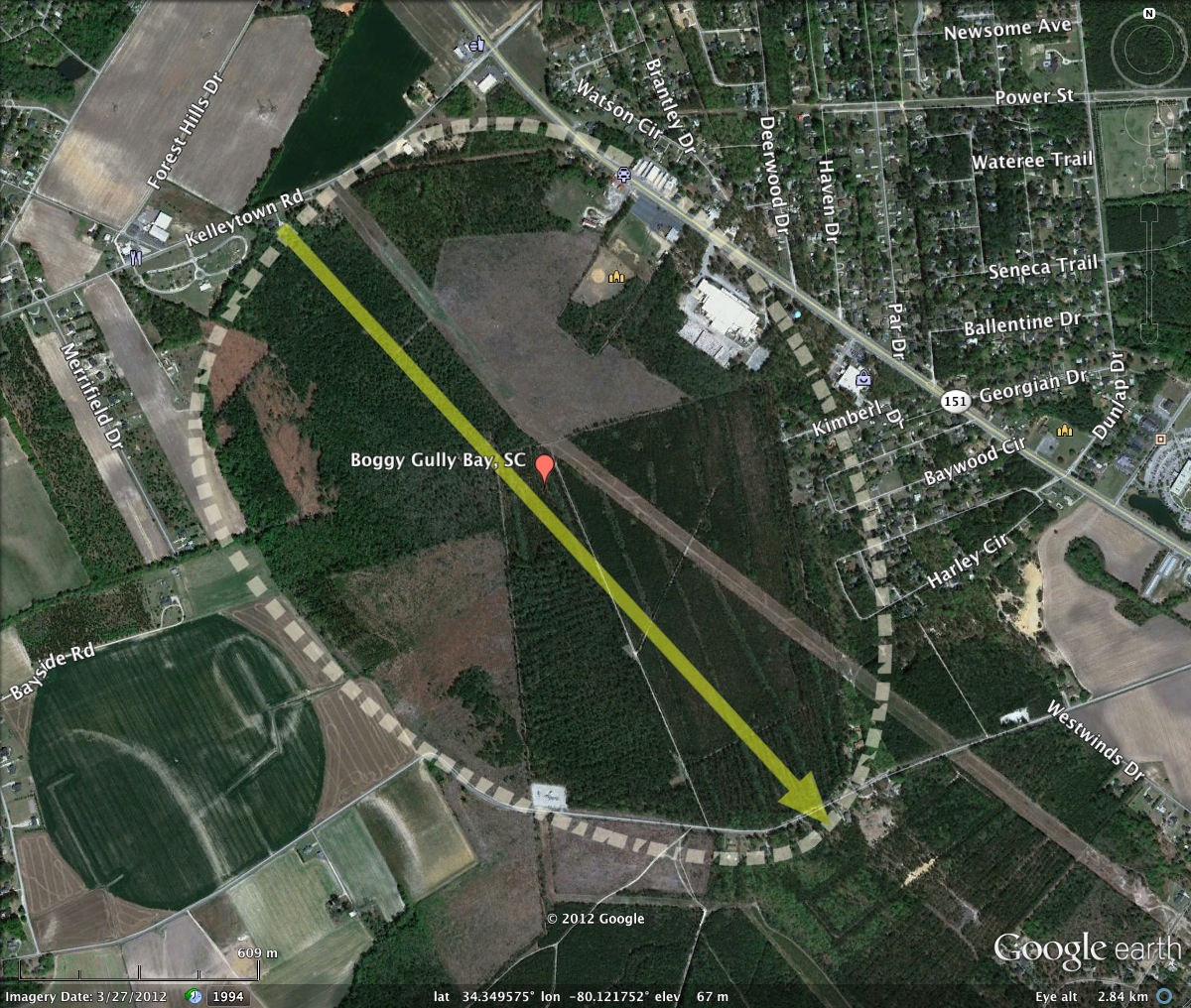
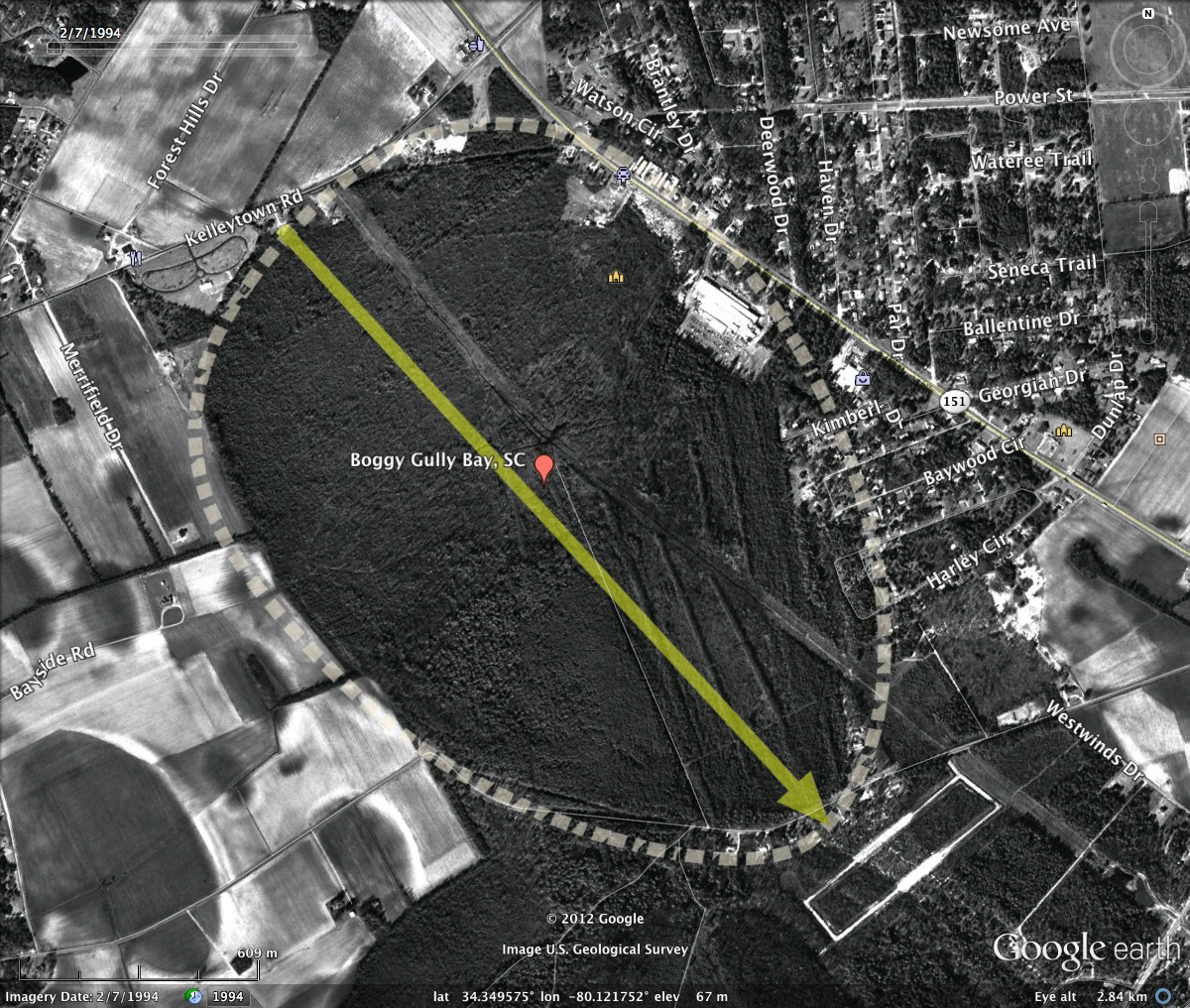
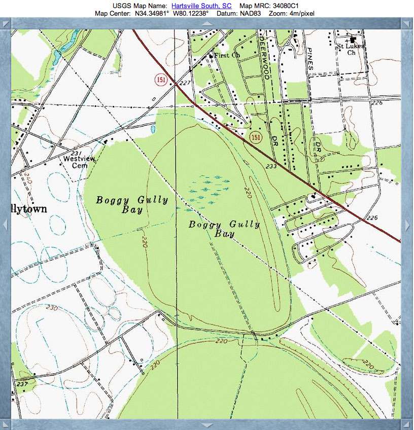
Also of interest is its presence - all 2km long of it - right on the outskirts of Hartsville, SC. A transmission line right of way passes across the length of the bay, and several large buildings lie within the bay rim on the northeast side, along with several small streets with houses. The remainder looks to be open farmland.
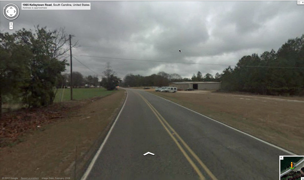
Since this bay lies within a major city, the good folks at Google have Streetview imagery to explore. Bay rims are almost imperceptible to the camera's eye, yet the Kellytown Road Streetview image shows how the bay rim rises up to the level of the roadbed on the left, and extends across on the right side, as the road runs along the rim of the bay in that area. The location is on the northwestern tip of the bay.
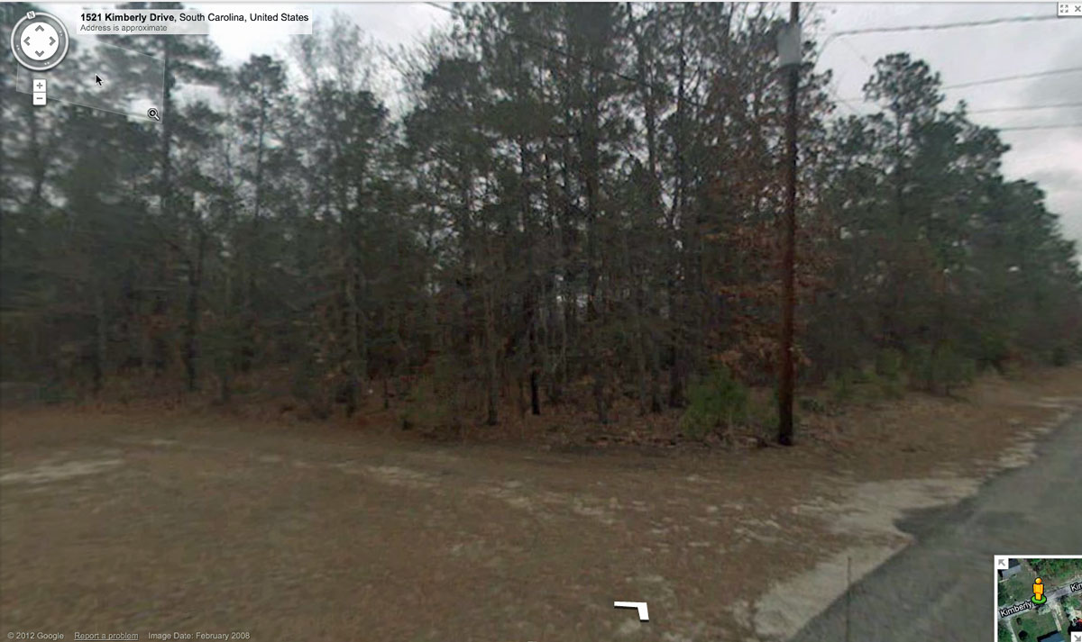
The Kimberly Drive Streetview shows the eastern rim looking from inside the bay. The forested area is at a slightly higher elevation than the yard in the foreground.
You can "drive around" most of the bay's rim using the Streetview roads around (and in) the bay using this LINK to start.
Also of interest is its presence - all 2km long of it - right on the outskirts of Hartsville, SC. A transmission line right of way passes across the length of the bay, and several large buildings lie within the bay rim on the northeast side, along with several small streets with houses. The remainder looks to be open farmland.
Since this bay lies within a major city, the good folks at Google have Streetview imagery to explore. Bay rims are almost imperceptible to the camera's eye, yet the Kellytown Road Streetview image shows how the bay rim rises up to the level of the roadbed on the left, and extends across on the right side, as the road runs along the rim of the bay in that area. The location is on the northwestern tip of the bay.
The Kimberly Drive Streetview shows the eastern rim looking from inside the bay. The forested area is at a slightly higher elevation than the yard in the foreground.
You can "drive around" most of the bay's rim using the Streetview roads around (and in) the bay using this LINK to start.
- Index #: 137320_3949
- Location: 34.349912806392396,-80.12318558025811
- Major: 2.03 km . . . Minor: 1.45 km
- Eccentricity: 0.698
- Area: 231.55 hectares
- Bearing: 148.01º
- Elevation: 66.75 m
- Planform: bayCarolina
- Effective Diameter: 1,717.026 m
Copyright 2018 by Michael Davias