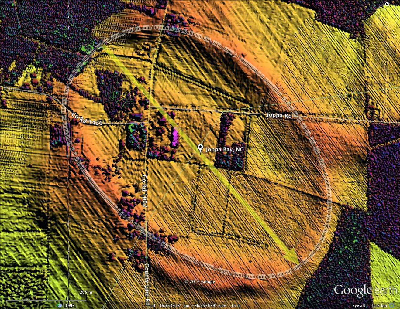
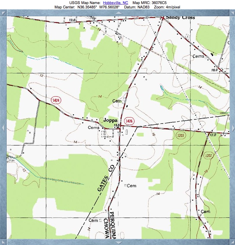
Joppa Bay, NC
Presented here is a 1-kilometer bay which has extents in three different North Carolina counties: Gates, Perquimans and Chowan (just a nip in the rim). The name I chose is taken from the historic placename of an intersection within the bay floor (ref the topographic map).
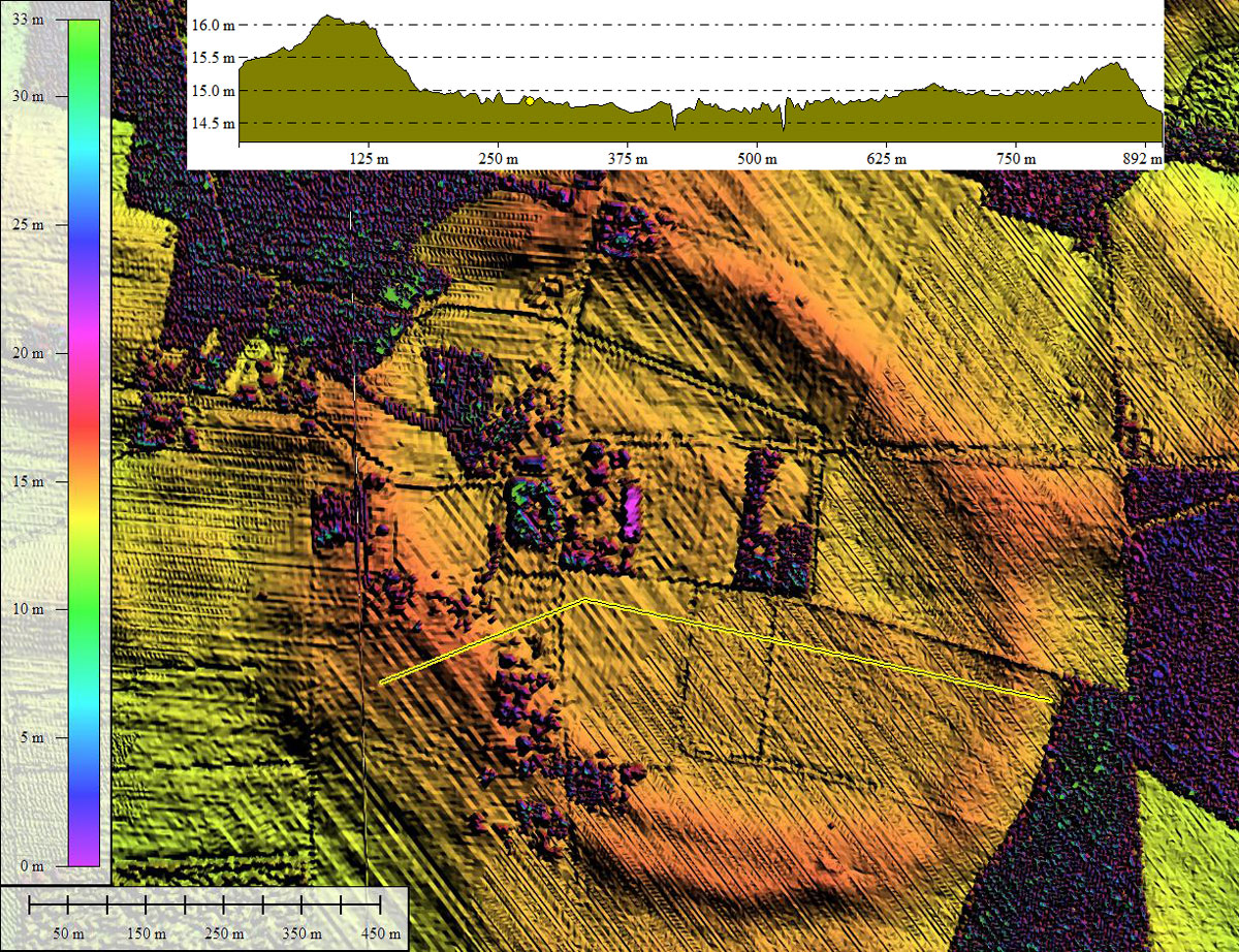
Joppa Bay is one of several scattered along an north-south trending escarpment known as the Suffolk Scarp, which is the remnant of an old line of beach dunes left when the ocean was last at this elevation, over 300,000 years ago. The scarp currently sits about 25 feet above sea level, and in some places is more than 75 miles from the current location of the Atlantic Ocean. Such dating allows setting a mid-Pleistocene age for Carolina bay formation.
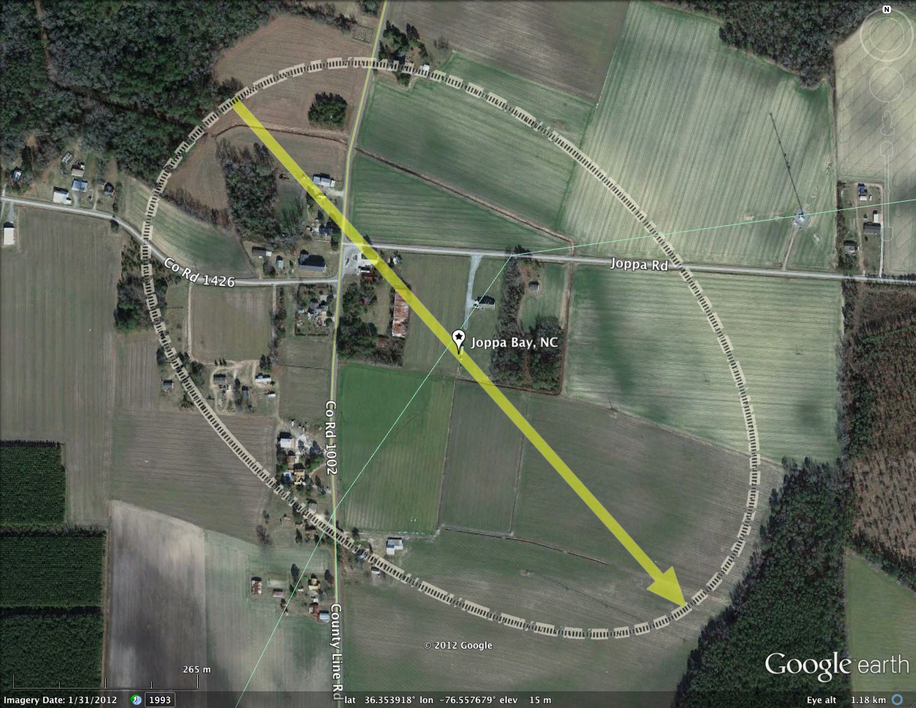
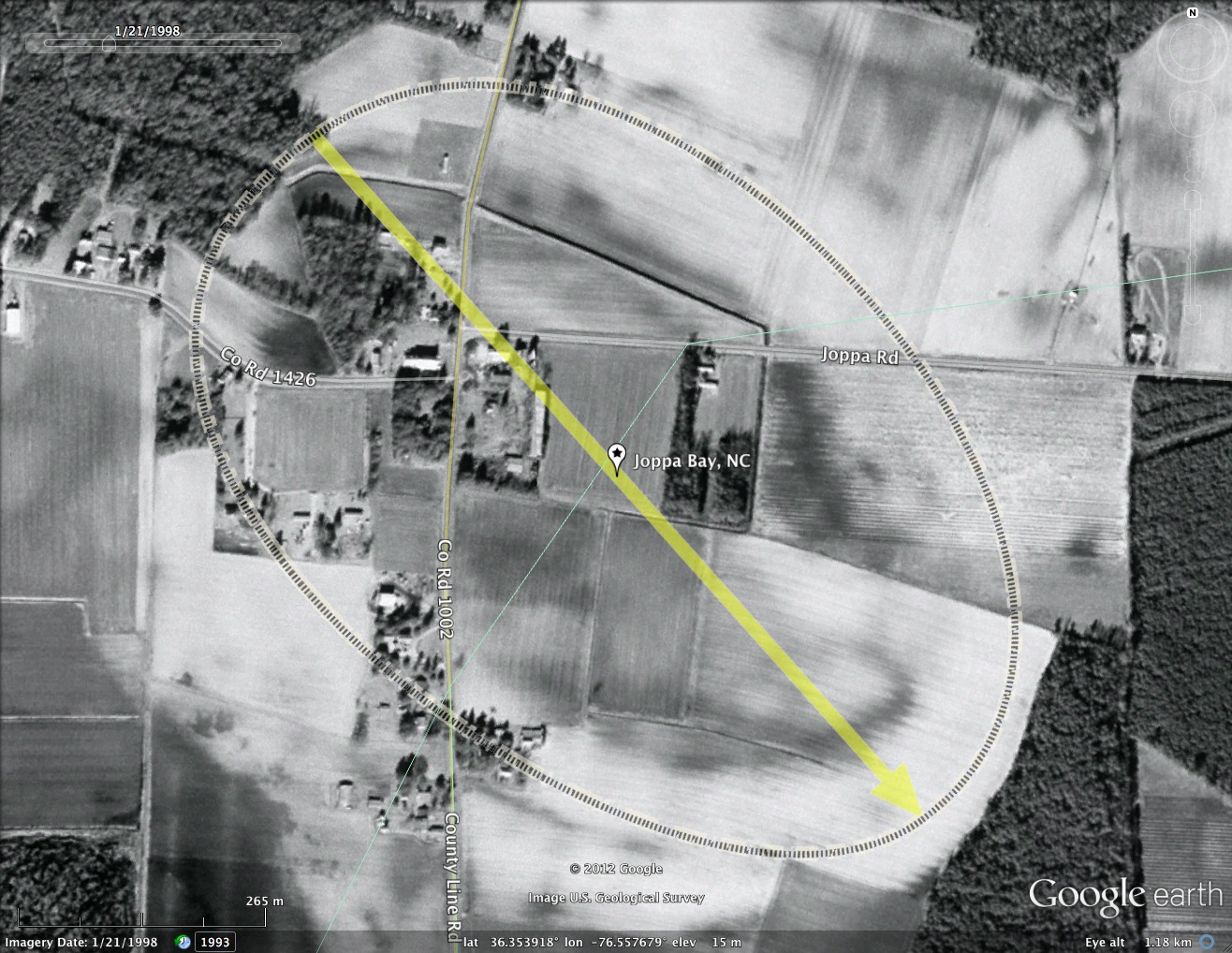
The LiDAR imagery used here is from a NOAA sub-meter set flown in 2008. The bare-earth points are not selectable from the cloud data, but most of this bay has no heavy vegetation, so the rim still stands out well.
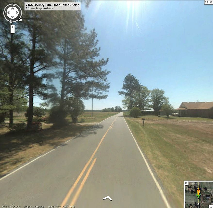
Google Streetview imagery is available across the bay along County Line Road. An image in the album here is taken looking south from on the broad southern rim, and shows the gradual drop-off to the surrounding terrain. You can browse the area in Streetview using this LINK.
Joppa Bay is one of several scattered along an north-south trending escarpment known as the Suffolk Scarp, which is the remnant of an old line of beach dunes left when the ocean was last at this elevation, over 300,000 years ago. The scarp currently sits about 25 feet above sea level, and in some places is more than 75 miles from the current location of the Atlantic Ocean. Such dating allows setting a mid-Pleistocene age for Carolina bay formation.
The LiDAR imagery used here is from a NOAA sub-meter set flown in 2008. The bare-earth points are not selectable from the cloud data, but most of this bay has no heavy vegetation, so the rim still stands out well.
Google Streetview imagery is available across the bay along County Line Road. An image in the album here is taken looking south from on the broad southern rim, and shows the gradual drop-off to the surrounding terrain. You can browse the area in Streetview using this LINK.
- Index #: 145306_4123
- Location: 36.35391831538386,-76.55767874077733
- Major: 0.98 km . . . Minor: 0.66 km
- Eccentricity: 0.741
- Area: 51.58 hectares
- Bearing: 138.26º
- Elevation: 14.88 m
- Archetype: bayCarolina
- Effective Diameter: 810.392 m
Copyright 2018 by Michael Davias