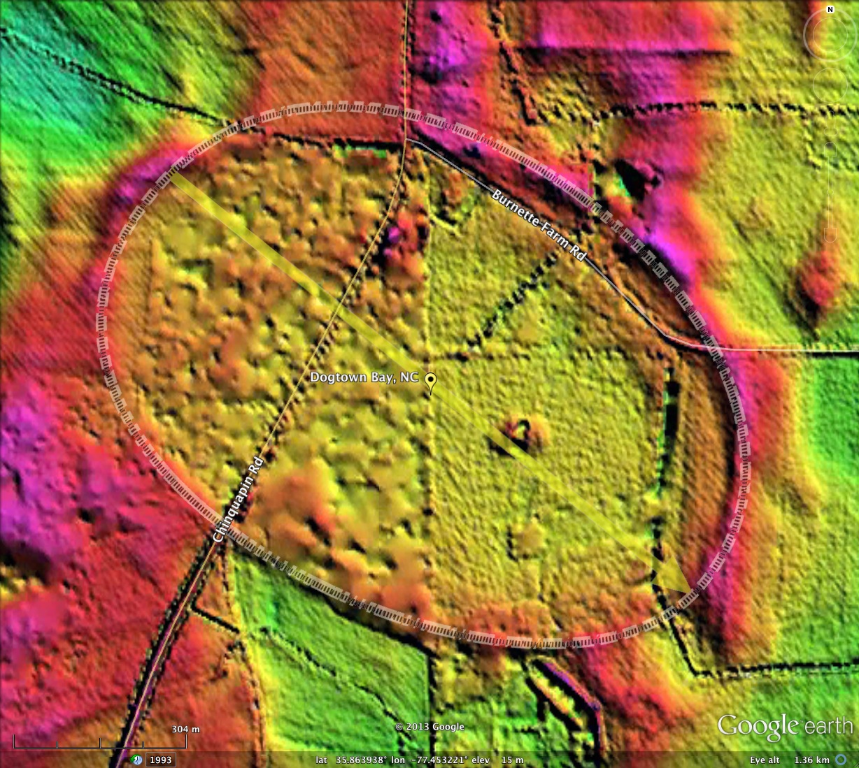
Dogtown Bay, NC
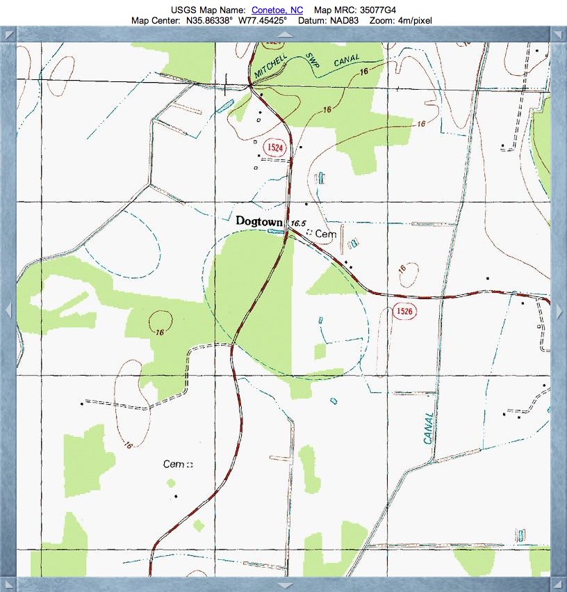
Dogtown bay was named by me after the historical location of Dogtown, located on the northern rim of the bay at the intersection of Chinquapin Road and Burnette Farm Road (See Topographic map in attached album).
This bay joins two previous CBoD bays (Contoe Bay and Chinquapin Road Bay) to the immediate south, to make a triple play of the common Bay Archetype seen along Chinquapin Road. They are all nearly identical in size, shape and orientation.
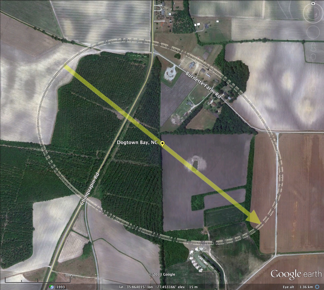
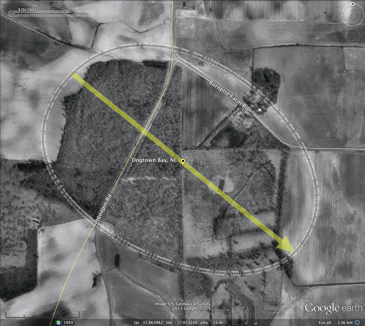
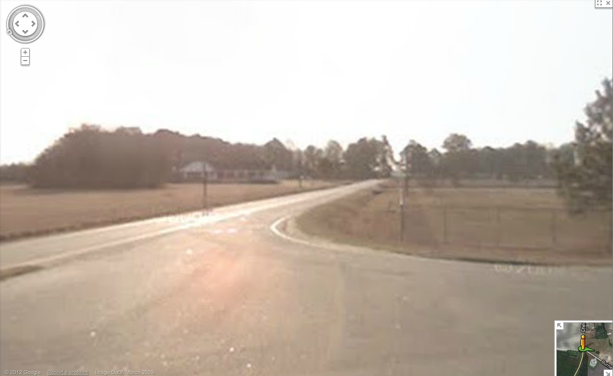
Google Streetview imagery is available across the bay. I have included one static view from Chinquapin Road east along Burnette Farm Road. The bay is on the right and Burnette Farm Road runs along the rim on the left. The elevation change is evident. Browse the Streetview imagery near Dogtown Bay: http://goo.gl/maps/tZ3O4
This bay joins two previous CBoD bays (Contoe Bay and Chinquapin Road Bay) to the immediate south, to make a triple play of the common Bay Archetype seen along Chinquapin Road. They are all nearly identical in size, shape and orientation.
Google Streetview imagery is available across the bay. I have included one static view from Chinquapin Road east along Burnette Farm Road. The bay is on the right and Burnette Farm Road runs along the rim on the left. The elevation change is evident. Browse the Streetview imagery near Dogtown Bay: http://goo.gl/maps/tZ3O4
- Index #: 143309_4581
- Location: 35.863965587663216,-77.45322767404701
- Major: 1.2 km . . . Minor: 0.86 km
- Eccentricity: 0.694
- Area: 82.04 hectares
- Bearing: 128.91º
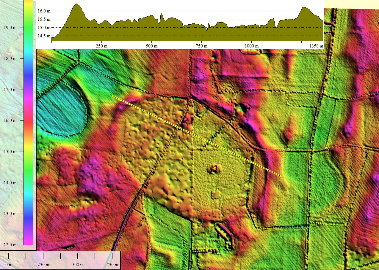
- Elevation: 15.2 m
- Archetype: bayCarolina
- Effective Diameter: 1,022.039 m
Copyright 2018 by Michael Davias