Lester Lane Bay, NC
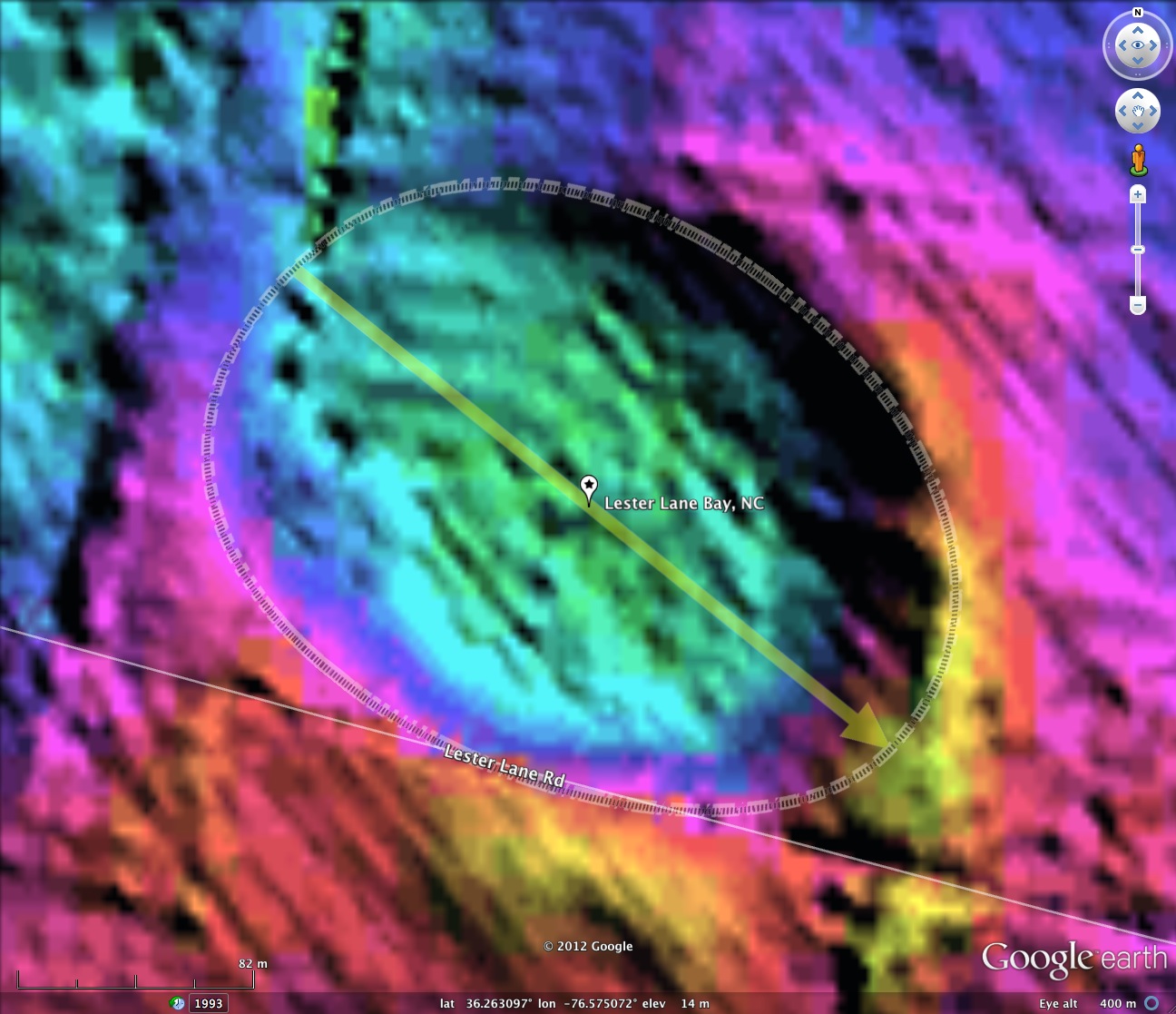
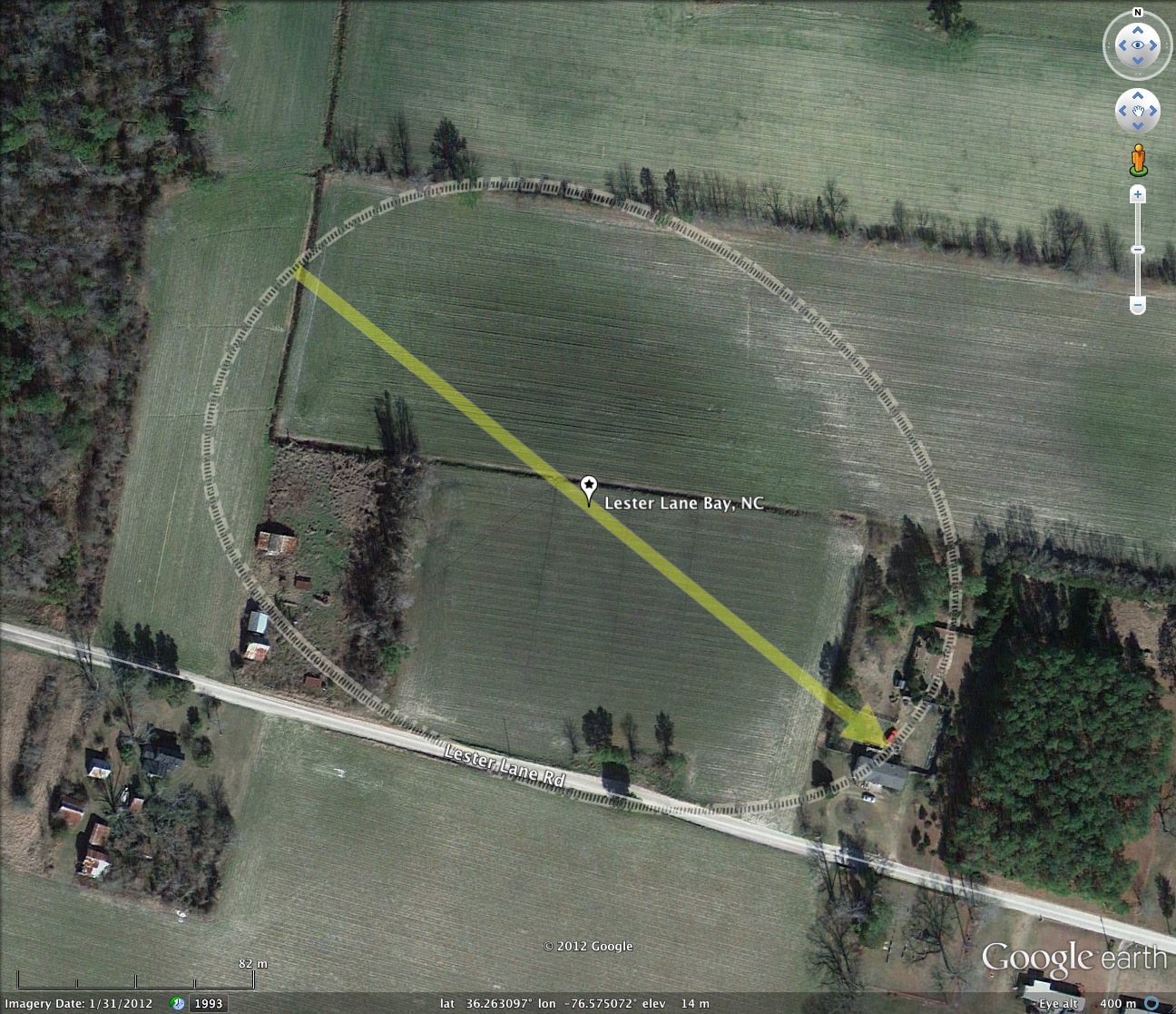
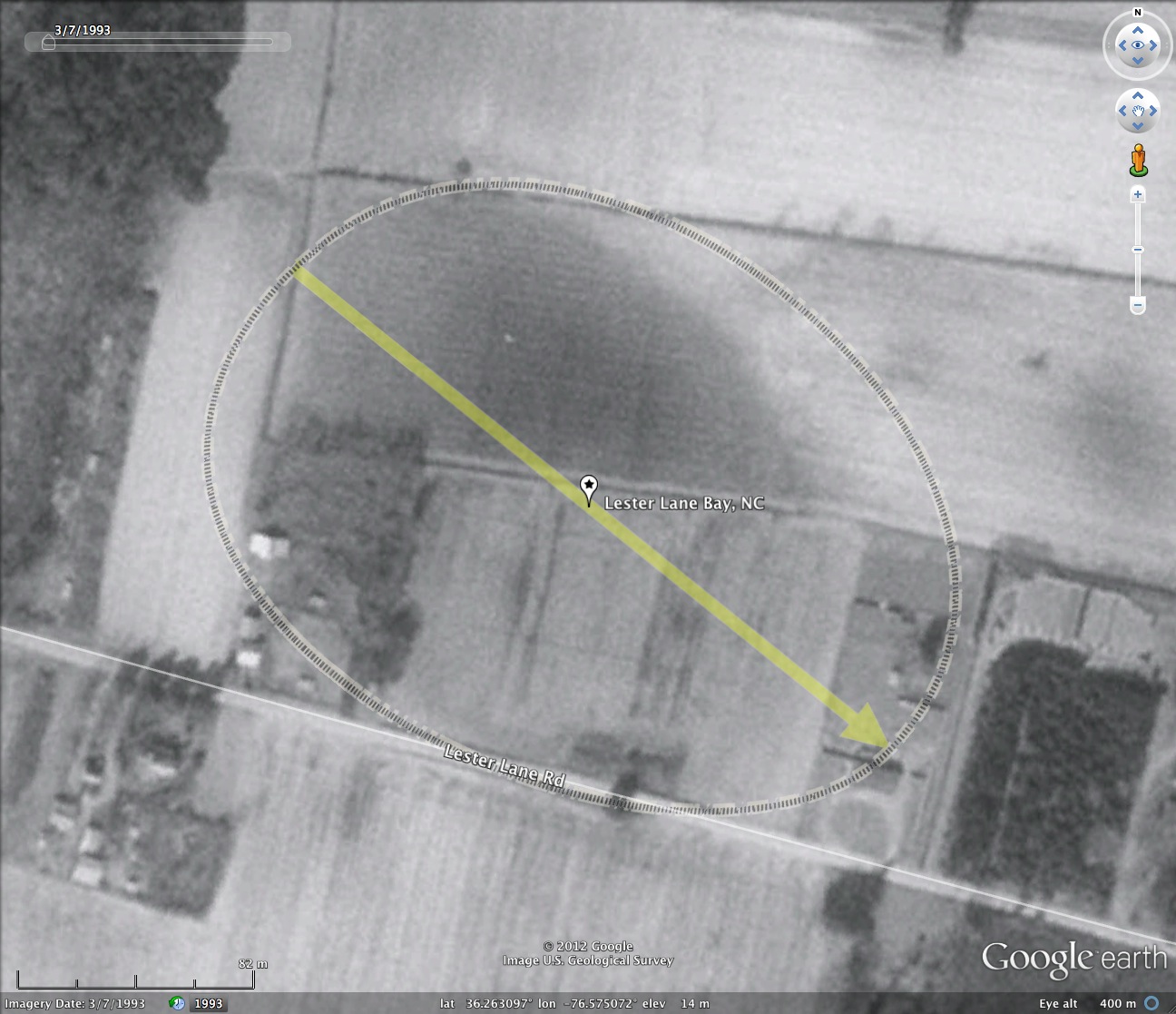
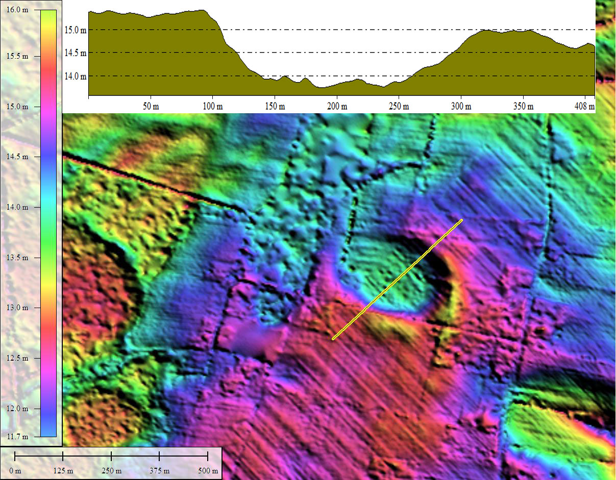
Lester Lane Bay is a rather small, pedestrian bay located 28 kilometers west of Elizabeth City in northeastern North Carolina. At 270 meters, it is not much bigger than a back yard. The bay does have a drainage channel to keep it dry enough to farm, a necessity given that its floor lies a full 2 meters below the surround terrain. The survey has identified literally thousands of small bays such as this, each demonstrating a gentle closed rim depression, which in this case matches the bayCarolina Archetype shape.
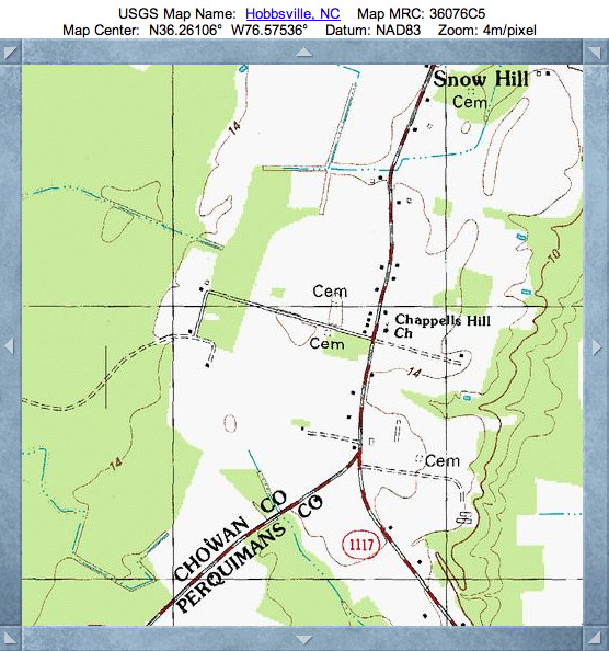
The USGS topographic map has no indication of they bays' presence, but does identify the slight hill on the south side of Lester lane. Also identified is the small cemetery on the raised rim segment on the southeast end, which can be seen in the satellite imagery.
The name was identified in a paper entitled The Carolina Bays: An Investigation of North America’s Post Last- Glacial Maximum Environment, by a group from Elizabeth City State University. See the paper using this LINK, from which the italicized text below was quoted:
Carolina Bays are shallow ponds and wetlands that dot the Coastal Plain from Delaware to Florida. Numbering in thousands, these elliptical, shallow depressions are most numerous in the Carolinas and occur individually and in groups with some bays appearing to have encroached upon neighbors. There are two pending theories about the formation of the bays.
(1) The Carolina Bay depressions were formed due to a fragmented asteroid or comet impact precipitating the Younger Dryas climate change. This caused a mass extinction of many species on the planet; species that include mammoths, saber toothed cats, and the earliest known human civilization, the Clovis people. In addition to causing a massive extinction, the YD is also believed to be the event that caused of the formation of many of the Carolina Bays.
D. Branch, et al
(2) On the contrary, other scientists credit the formation of the bays to natural events that happened after the Last Glacial Maximum (LGM) about 20,000 years ago. Due to the massive coverage of ice during the LGM, the land free of ice in continental North America would have become “cold deserts” because of the lack of moisture, resulting from the massive ice sheets containing all the water in a frozen state. Consequently, scientists believe that it was hurricane-force winds that created the bays. Katabatic winds would have resulted in the wind blowing and traveling down the edge of the glacier, which would be miles tall, reaching hurricane speeds. The strong winds would have blown the lighter material on top of the hard dry surface because of the lack of vegetation from the lack of moisture in the land and create the depressions leading to dunes that would look very similar to what are known as Carolina Bays.
D. Branch, et al
I find neither one these solutions to be satisfactory. The YDB and the LGM were too recent to be implicated in bay's which have deposits dating over 100,000 years. And, while hurricane force winds from the ice sheets is a tantalizing concept, the most widely accepted "wind & wave" formation model mandates wind directions alternating 50%-50% from opposite directions, something which is unlikely. I think the sand's provenance needs more investigation.
- Index #: 145306_0530
- Location: 36.26309664574113,-76.57507195366955
- Major: 0.27 km . . . Minor: 0.2 km
- Eccentricity: 0.652
- Area: 4.39 hectares
- Bearing: 128.87º
- Elevation: 13.86 m
- Planform: bayCarolina
- Effective Diameter: 236.421 m
Copyright 2018 by Michael Davias