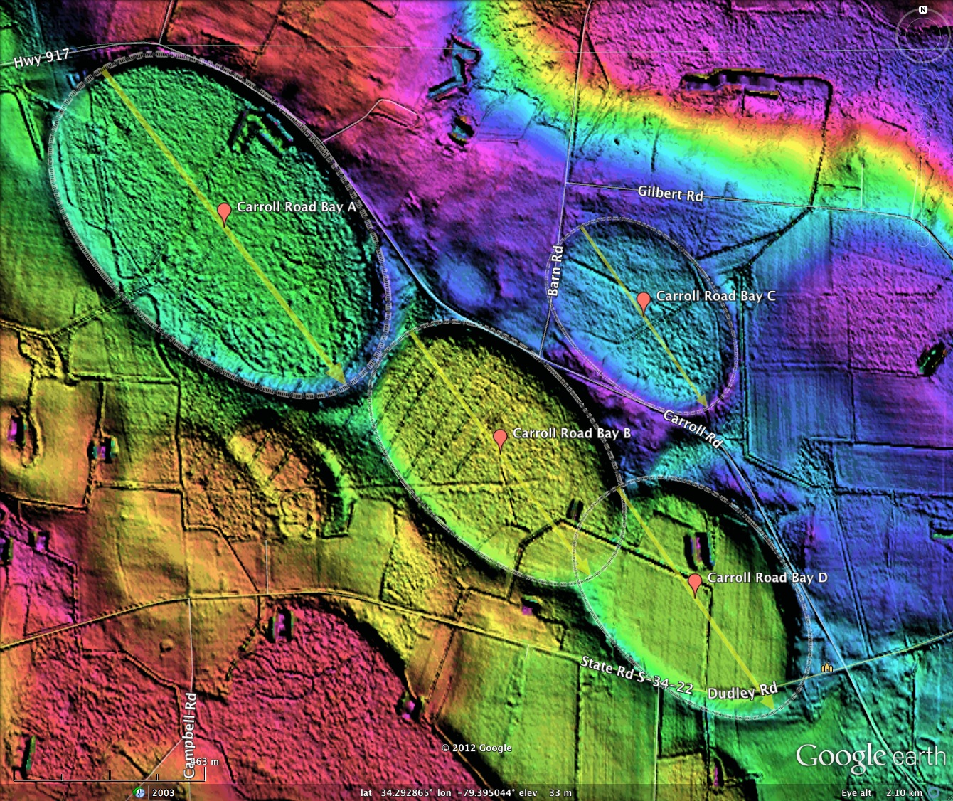
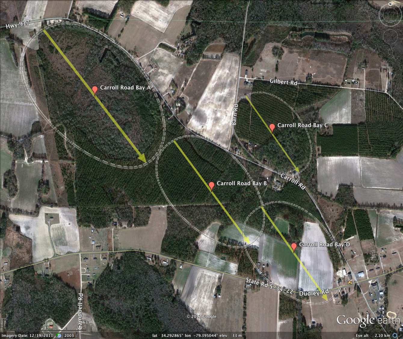
Carroll Road Bays, SC
My Holiday blog offering consists of four bays strung like ornaments along Carroll Road, south of Dillon, SC.
Bright in LiDAR hsv colors, they each rest at a different elevation upon the same ridge line. The orientations are within 1% of each other, similar to many other local bays. Planform is bayCarolina.
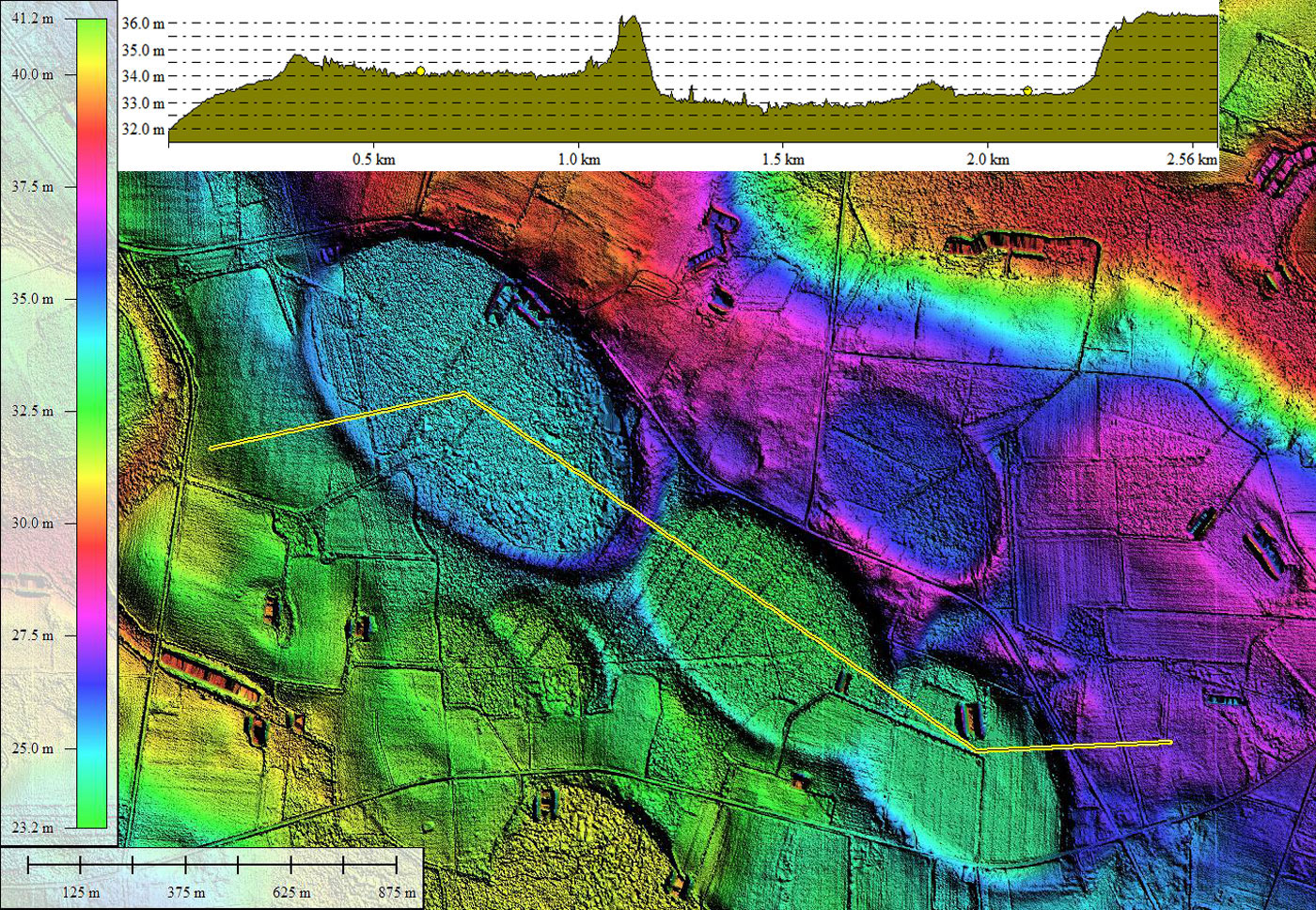
The southern rim of three of the bays seem to defy gravity and normal erosional activity, standing high and proud, while the opposite side of those bays are snuggled into higher elevations of the ridge. The fourth bay is sunk into the ridge.
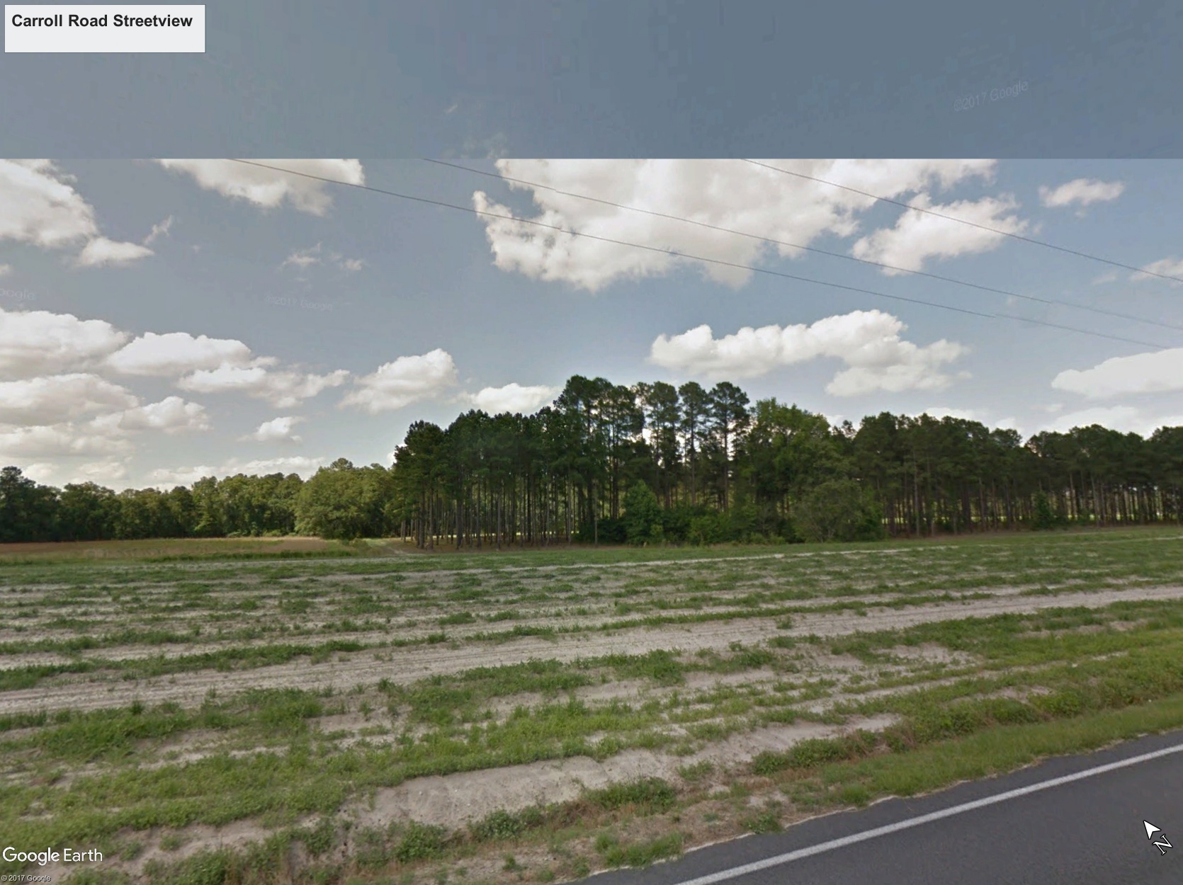
The southwestern raised of Bay B is visible looking North from Dudley Road using Google Streetview, using this LINK.
These bays will be entangled in the construction of I73 in the future. Efforts by local interests have managed to re-route so it only compromises Bay B instead of A, B and C.
As a special treat, a 8x10, 300 DPI image (24MB) of the four bays, created in Global Mapper with 1/4-meter grid data, is available at this LINK. Should the viewer wish to receive a 18”x24” printed poster of this image, please email me at michael@cintos.org.
Carroll Road Bay A
Bright in LiDAR hsv colors, they each rest at a different elevation upon the same ridge line. The orientations are within 1% of each other, similar to many other local bays. Planform is bayCarolina.
The southern rim of three of the bays seem to defy gravity and normal erosional activity, standing high and proud, while the opposite side of those bays are snuggled into higher elevations of the ridge. The fourth bay is sunk into the ridge.
The southwestern raised of Bay B is visible looking North from Dudley Road using Google Streetview, using this LINK.
These bays will be entangled in the construction of I73 in the future. Efforts by local interests have managed to re-route so it only compromises Bay B instead of A, B and C.
As a special treat, a 8x10, 300 DPI image (24MB) of the four bays, created in Global Mapper with 1/4-meter grid data, is available at this LINK. Should the viewer wish to receive a 18”x24” printed poster of this image, please email me at michael@cintos.org.
Carroll Road Bay A
- Index #: 137317_1860
- Location: 34.296608348383884,-79.40168166858244
- Major: 0.98 km . . . Minor: 0.61 km
- Eccentricity: 0.778
- Area: 47.51 hectares
- Bearing: 142.37º
- Elevation: 33.91 m
- Planform: bayCarolina
- Effective Diameter: 777.763 m
- Index #: 137317_1657
- Location: 34.291693814674346,-79.39442642432914
- Major: 0.75 km . . . Minor: 0.46 km
- Eccentricity: 0.783
- Area: 27.52 hectares
- Bearing: 143.64º
- Elevation: 32.81 m
- Planform: bayCarolina
- Effective Diameter: 591.941 m
- Index #: 137317_1756
- Location: 34.294670037981646,-79.39067096892396
- Major: 0.54 km . . . Minor: 0.36 km
- Eccentricity: 0.742
- Area: 15.55 hectares
- Bearing: 145.06º
- Elevation: 35.48 m
- Planform: bayCarolina
- Effective Diameter: 444.959 m
- Index #: 137317_1555
- Location: 34.288556248471735,-79.38930549617498
- Major: 0.67 km . . . Minor: 0.45 km
- Eccentricity: 0.732
- Area: 24.23 hectares
- Bearing: 144.8º
- Elevation: 33.24 m
- Planform: bayCarolina
- Effective Diameter: 555.432 m
Copyright 2018 by Michael Davias