Bittner Bay, NC
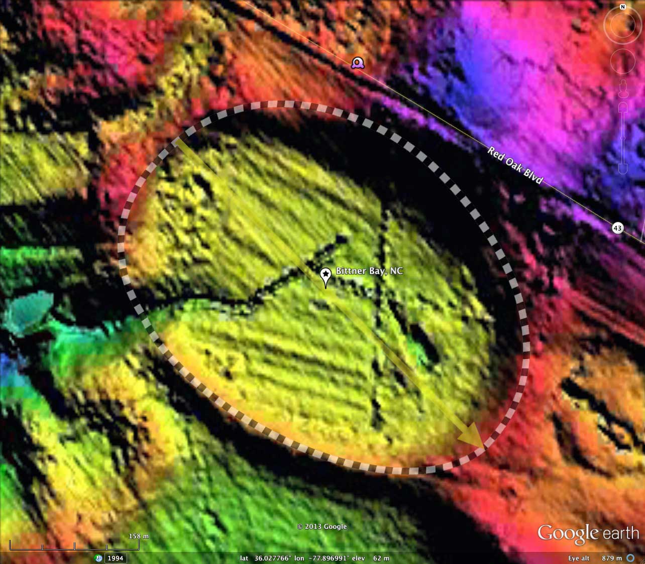
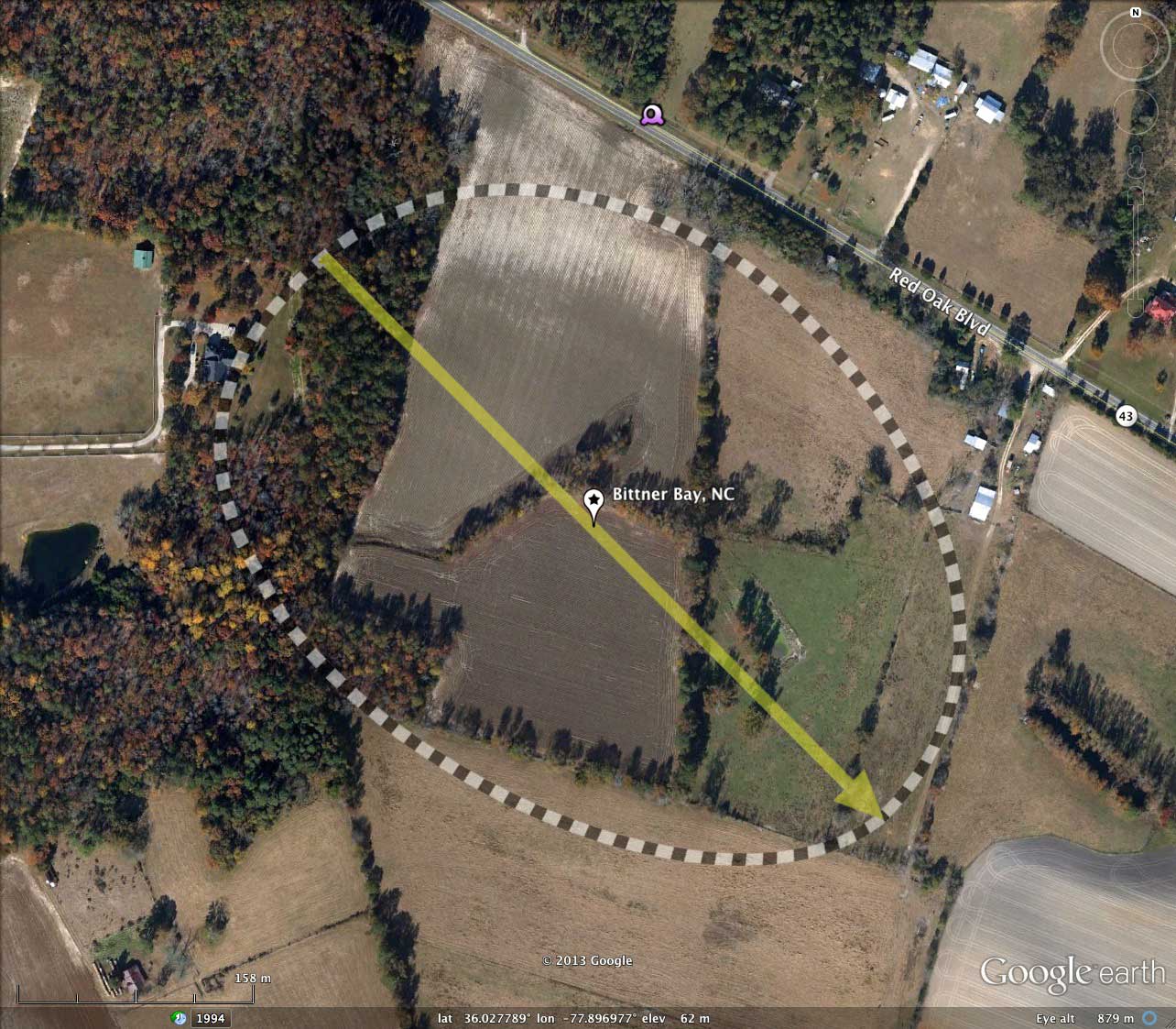
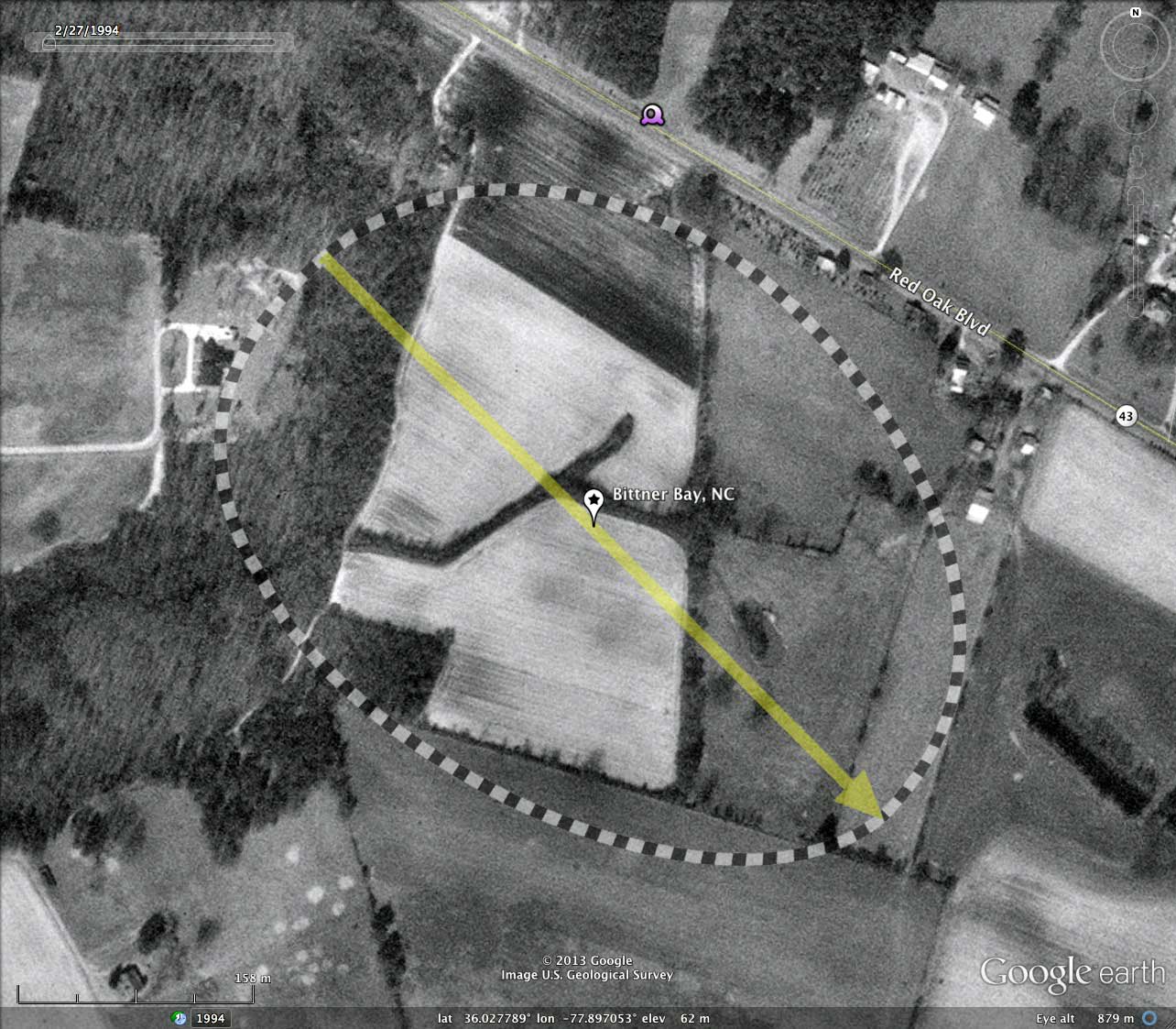
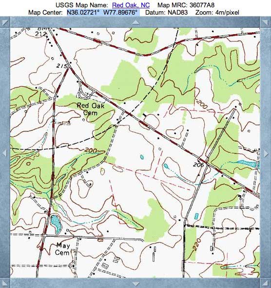
Bittner Bay was named by me after landowner of record. It is located 14 kilometers north west of Rocky Mount, NC, along Red Oak Blvd. The bay's shape is a good match to the common bayCarolina archetype shape, and presents an orientation similar to other bays in the immediate area.
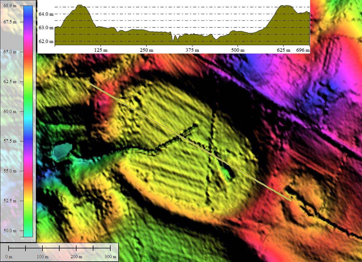
The bay is mostly open farmland, although it shows "wet" in the Google Earth Satellite imagery. A drainage network was constructed across the bay, and it drains out a natural break in the rim on the western end of the bay. This rim opening is 80 meters wide, and is located at the head of a natural drainage channel which measures over 200 meters wide where it is partially truncated by the bay rim, suggesting the channel may be antecedent to bay creation.
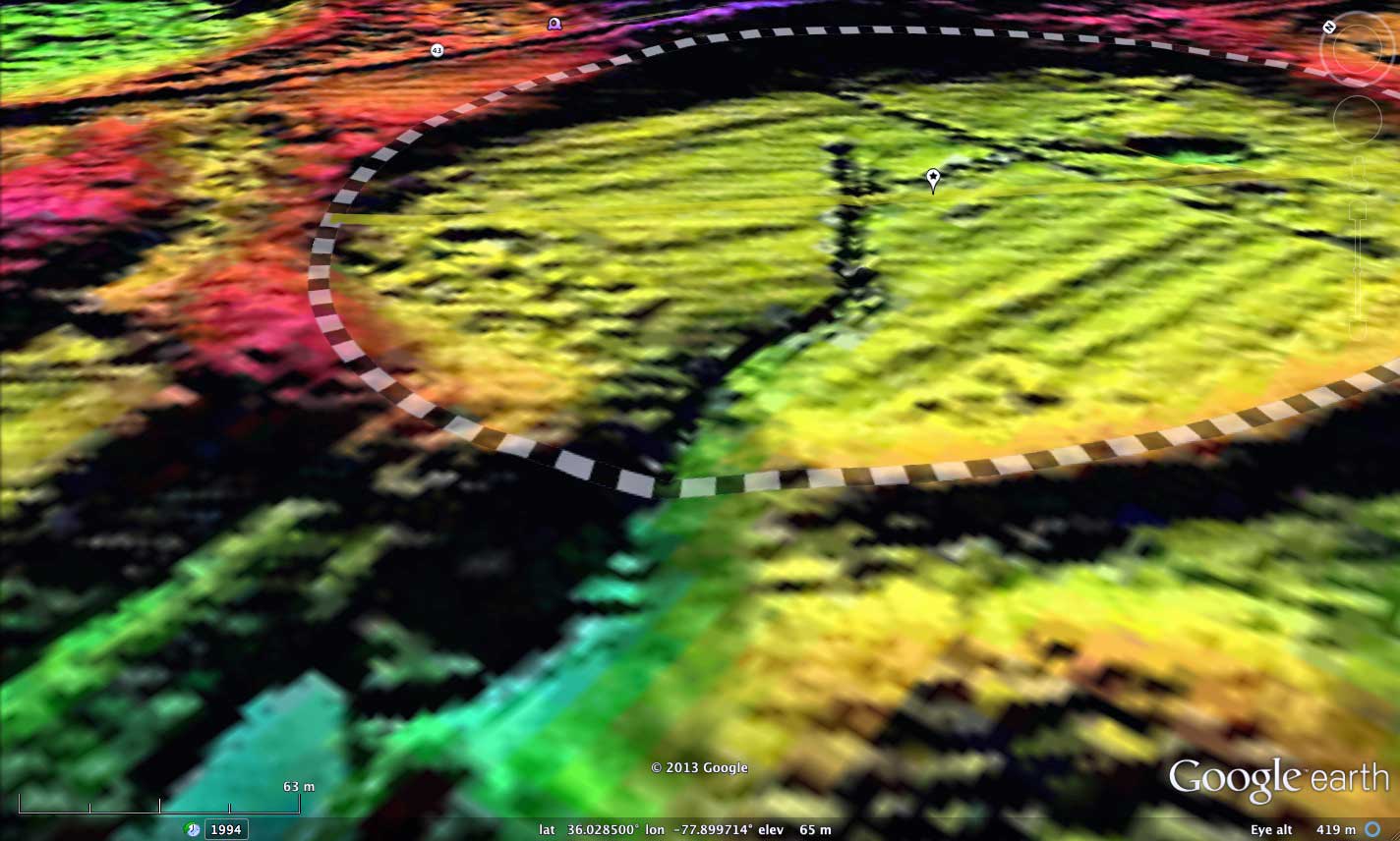
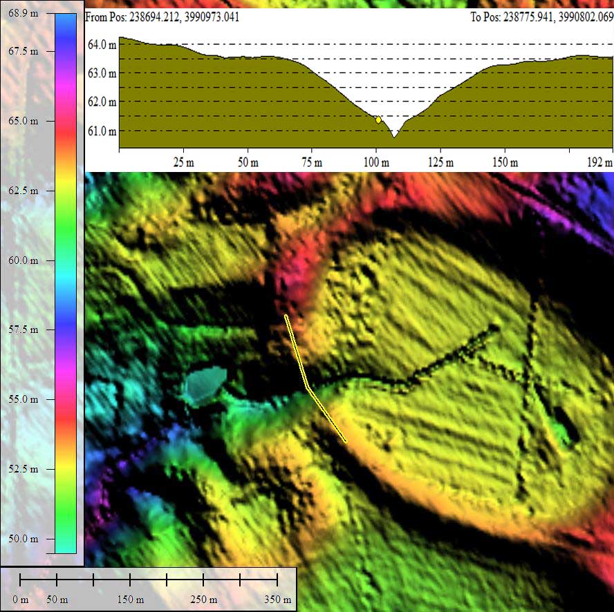
The attached album includes an elevation profile across the bay rim opening. The exposures seen here may offer a good view into the structure of the rim, and allow for deep-rim OSL dating. Included in the attached album is an oblique view into this cross-rim exposure, using Google Earth and the LiDAR hsv-hinted DEM.
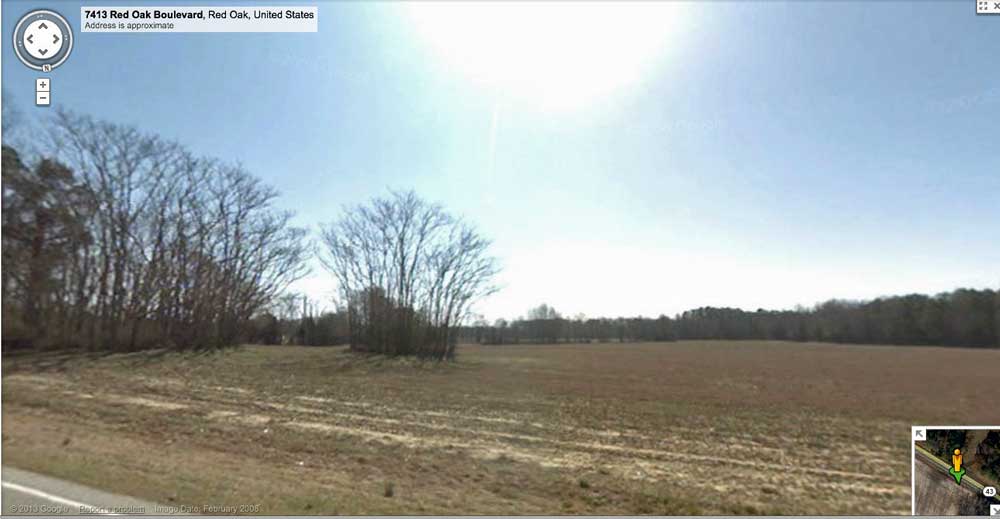
Google Streetview imagery is available along Red Oak Blvd, which traverses the pediment immediately to the east of the bay, and can be accessed in your browser using this LINK. The view from that location shows the rim rising up slightly in the distance, with the bay's floor falling away beyond that point. A placemark is included in the referenced KMZ file for access to Streetview Imagery within Google Earth.
The bay is mostly open farmland, although it shows "wet" in the Google Earth Satellite imagery. A drainage network was constructed across the bay, and it drains out a natural break in the rim on the western end of the bay. This rim opening is 80 meters wide, and is located at the head of a natural drainage channel which measures over 200 meters wide where it is partially truncated by the bay rim, suggesting the channel may be antecedent to bay creation.
The attached album includes an elevation profile across the bay rim opening. The exposures seen here may offer a good view into the structure of the rim, and allow for deep-rim OSL dating. Included in the attached album is an oblique view into this cross-rim exposure, using Google Earth and the LiDAR hsv-hinted DEM.
Google Streetview imagery is available along Red Oak Blvd, which traverses the pediment immediately to the east of the bay, and can be accessed in your browser using this LINK. The view from that location shows the rim rising up slightly in the distance, with the bay's floor falling away beyond that point. A placemark is included in the referenced KMZ file for access to Streetview Imagery within Google Earth.
- Index #: 144311_1158
- Location: 36.02762764298981,-77.89701618251394
- Major: 0.52 km . . . Minor: 0.36 km
- Eccentricity: 0.714
- Area: 15.1 hectares
- Bearing: 135.15º
- Elevation: 62.51 m
- Archetype: bay
- Effective Diameter: 438.473 m
Copyright 2018 by Michael Davias