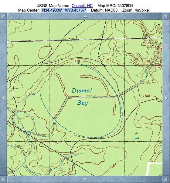
Dismal Bay, Bladen Co, NC
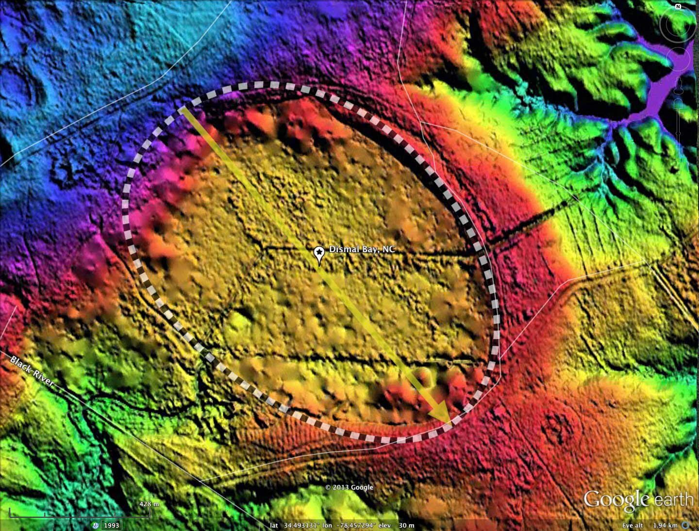
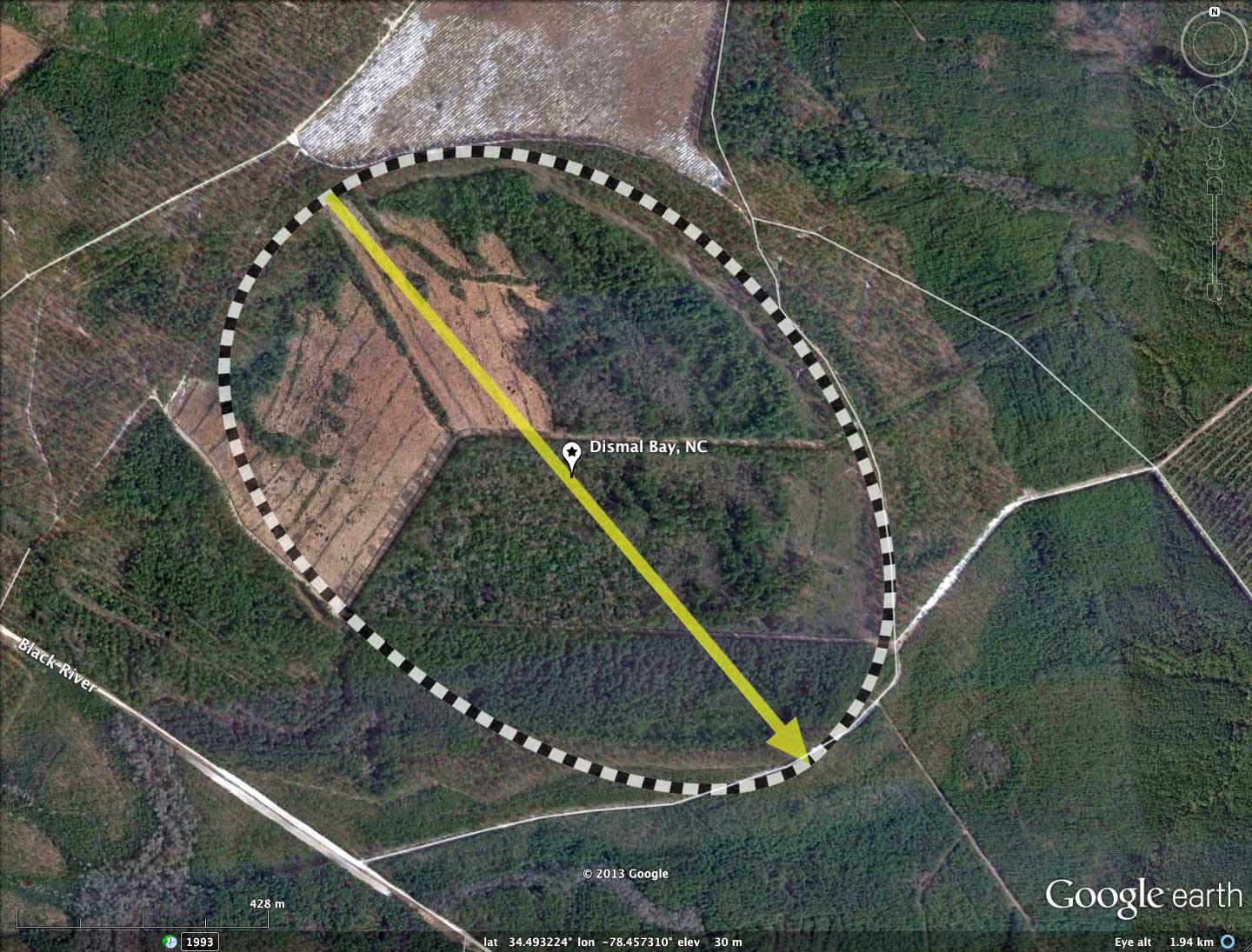
Not to be confused with the Great Dismal Swamp, our Bay of the Day from Bladen County, NC, is one of several USGS-recognized landforms with this name in North Carolina. It possess a perfect bayCarolina archetype shape, and is oriented similar to other bays in the immediate area.
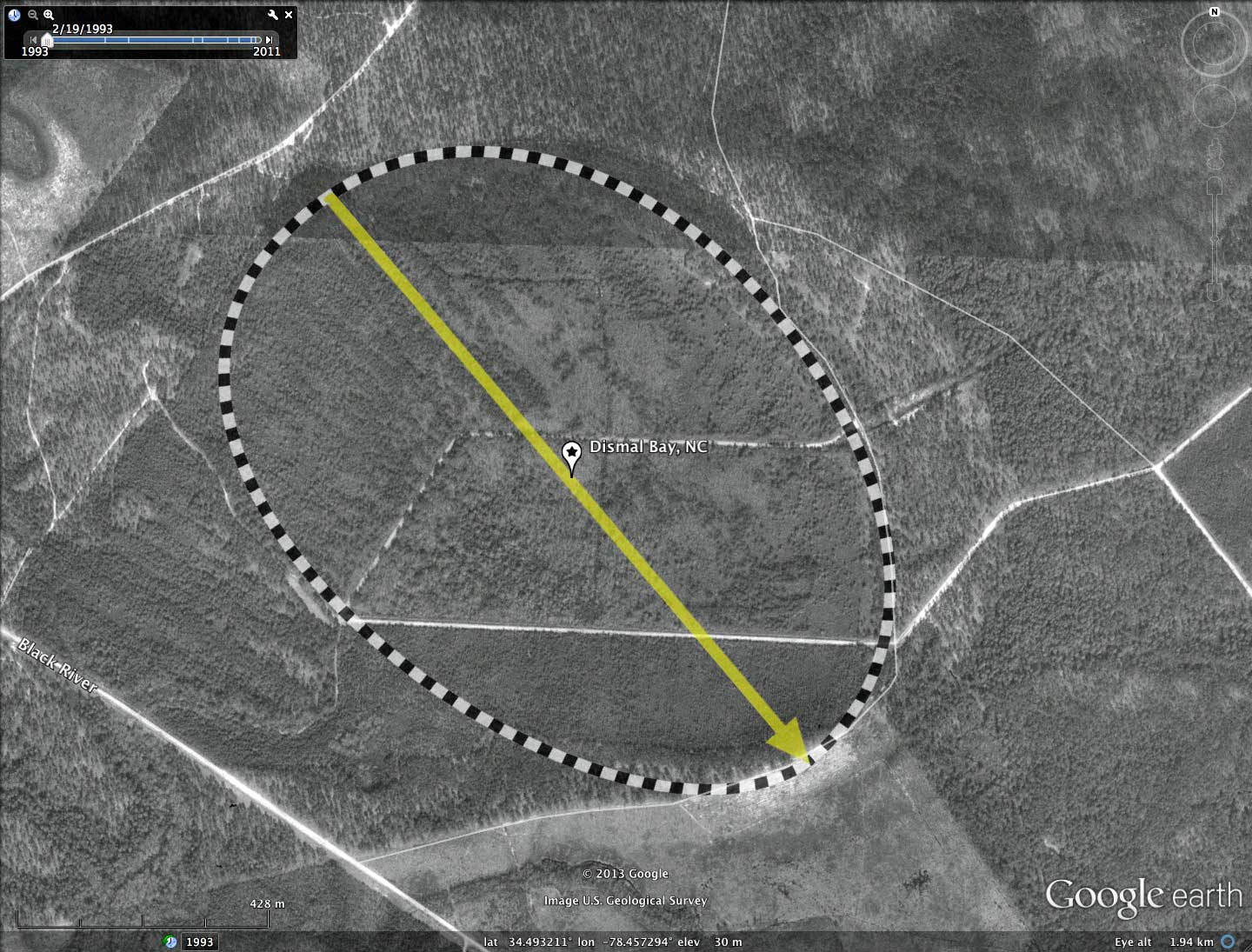
The bay floor has been logged and cleared in the past, and has been hosting tree plantain crops over the past 20 years. The bay has been extensively ditched for drainage. The western rim has a natural drainage outlet, and it is through this area that the man-made drainage has been directed. The lack of a prominent rim on this 500 meter portion of the bay's circumference suggest to me that the bay is either very old has never held standing water. This situation effectively makes any remediation attempts difficult to attempt.
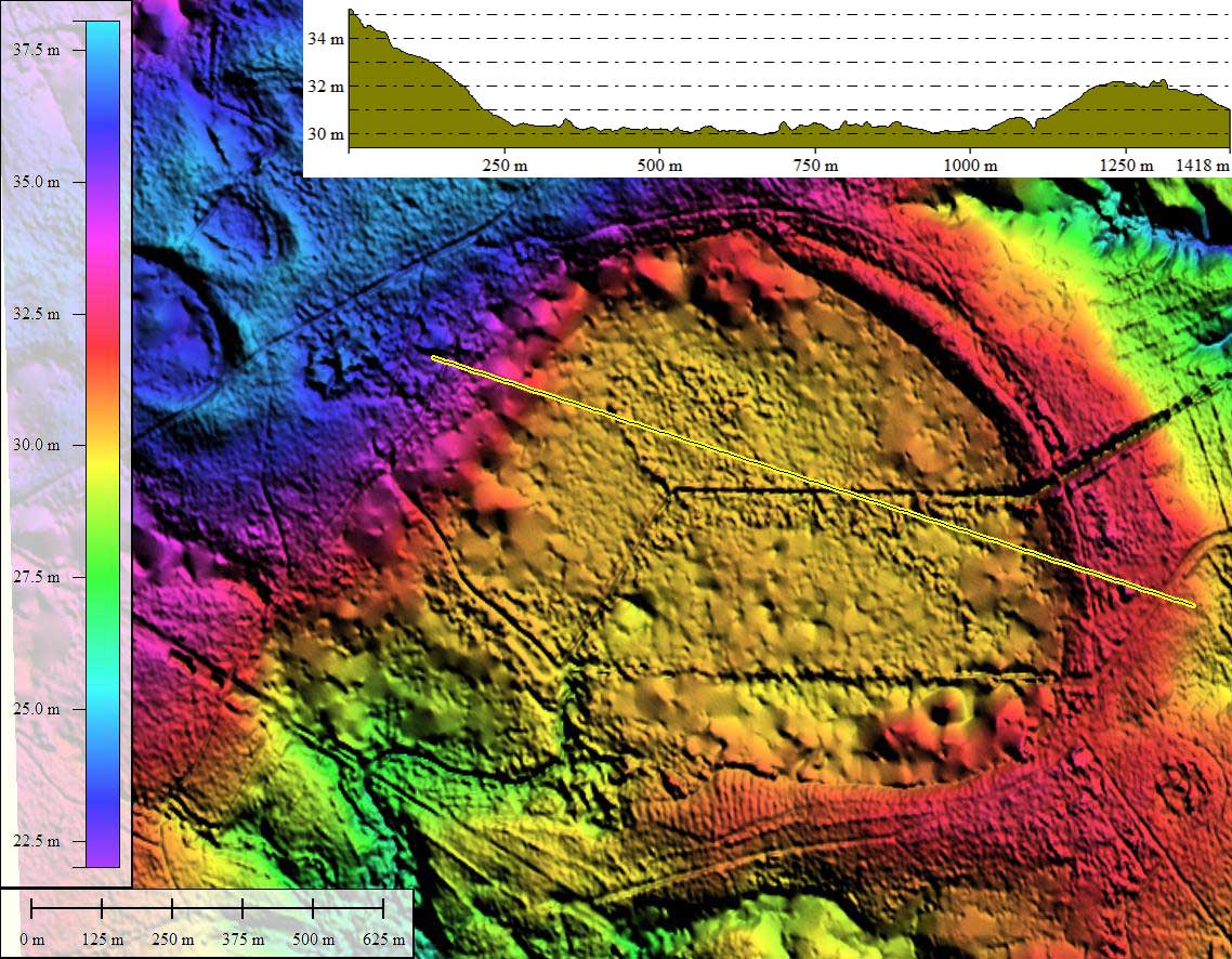
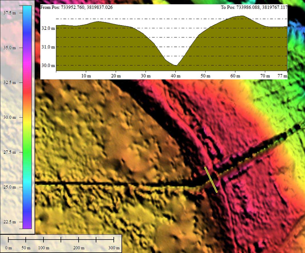
In addition, a man-made cross-rim drainage channel has been cut through the eastern rim. An elevation profile map of that cut is provided in the attached album. This provides a 2-meter vertical rim exposure for possible OSL deep-rim dating.
The bays is located on a terrace which is 25 meters above and to the west of the nearby Cape Fear River channel.
There is no streetview coverage at the present time.
The bay floor has been logged and cleared in the past, and has been hosting tree plantain crops over the past 20 years. The bay has been extensively ditched for drainage. The western rim has a natural drainage outlet, and it is through this area that the man-made drainage has been directed. The lack of a prominent rim on this 500 meter portion of the bay's circumference suggest to me that the bay is either very old has never held standing water. This situation effectively makes any remediation attempts difficult to attempt.
In addition, a man-made cross-rim drainage channel has been cut through the eastern rim. An elevation profile map of that cut is provided in the attached album. This provides a 2-meter vertical rim exposure for possible OSL deep-rim dating.
The bays is located on a terrace which is 25 meters above and to the west of the nearby Cape Fear River channel.
There is no streetview coverage at the present time.
- Index #: 137313_9782
- Location: 34.49287374390531,-78.45736556366788
- Major: 1.27 km . . . Minor: 0.91 km
- Eccentricity: 0.698
- Area: 91.45 hectares
- Bearing: 139.76º
- Elevation: 30.44 m
- Archetype: bayCarolina
- Effective Diameter: 1,079.062 m
Copyright 2018 by Michael Davias