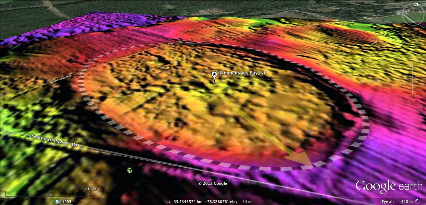
Stephensons Bay, NC
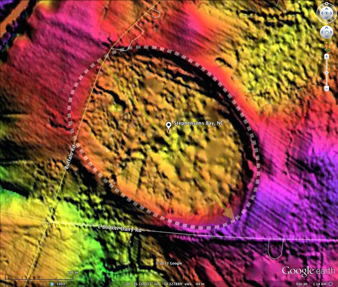
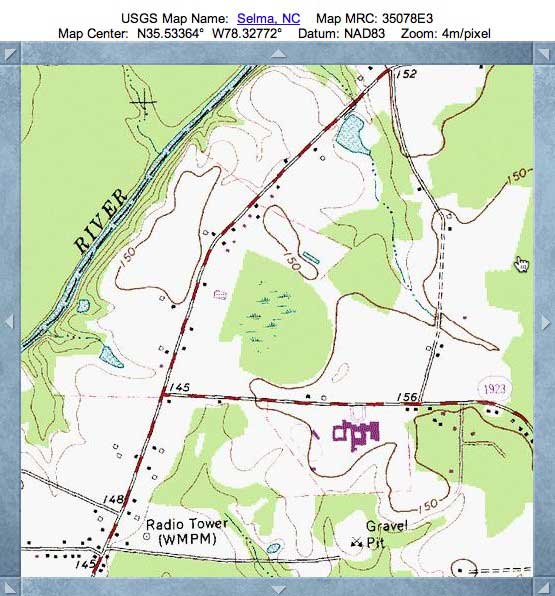
Presented here is a bay in Johnston County, NC, located 3 kilometers north of Smithfield along Buffalo Road. It conforms well to the bayCarolina archetype shape. Here it deviates from the archetype shape on the northwestern end of the bay. However, the LiDAR elevation map suggests that the bay was filled in for farming in that section, effectively leveling the terrain on the northwest side of Buffalo Road.
The bay's name, taken after an historical landowner, was applied during previously geological research at the bay. That research verified that the section of the bay west of Buffalo Road had indeed been resurfaced.
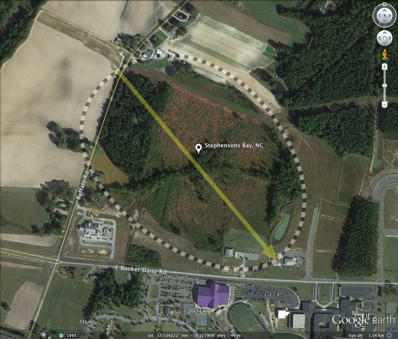
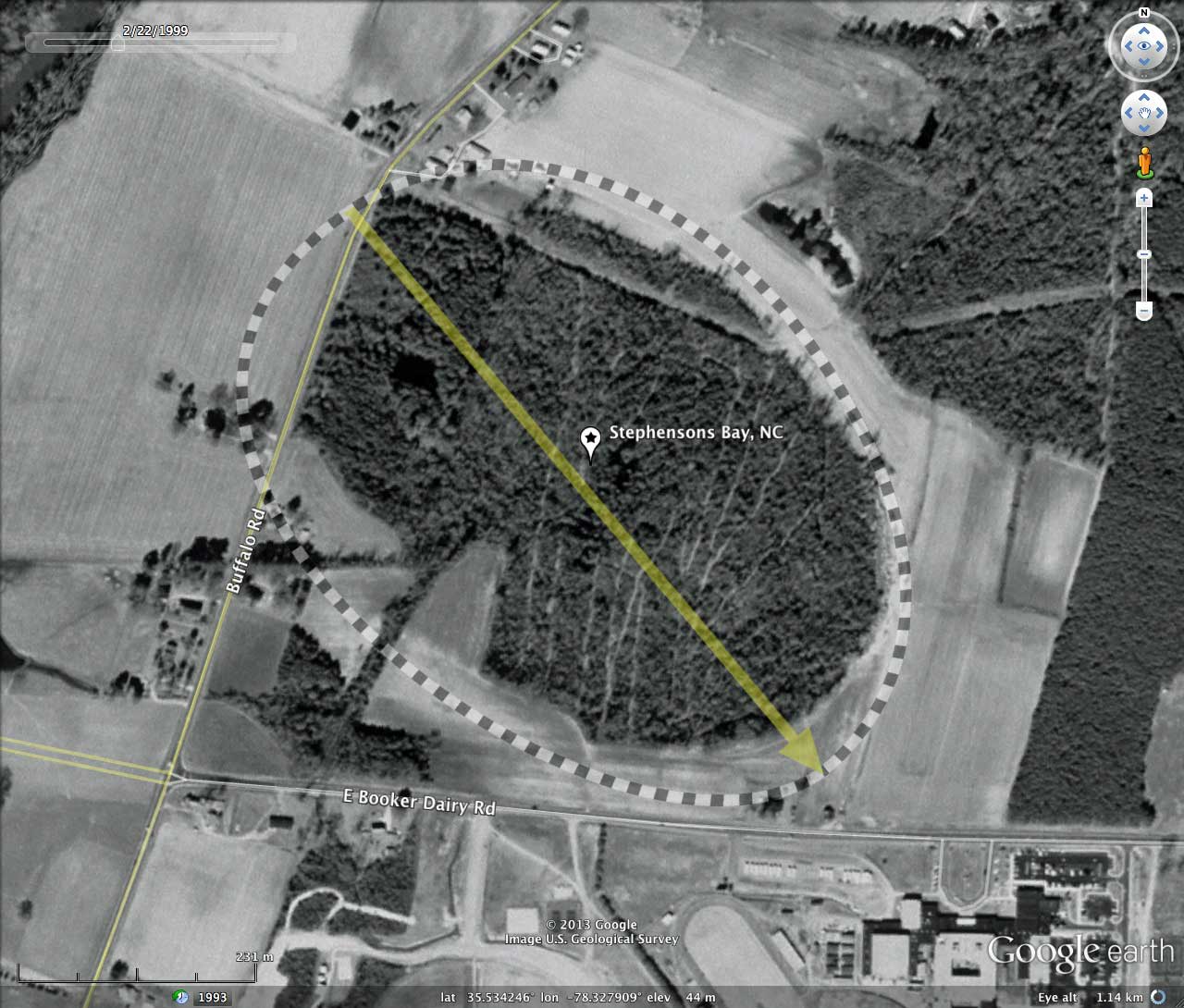
A majority of the bay looks to be in a natural state, although when reviewing the Google Earth Historical Imagery, it can be seen that the bays was clear-cut a few times over the last 20 years. Also visible is the construction of a church within the bay floor between 1999 and 2004. In the last 3 years, a drainage basin has been dredged at the southeastern end of the bay, likely to protect the structure from occasional high water levels in the bay. There is a primary drainage channels which traverses the center of the bay from NE to SW, draining out through the rim on the SW side.
An interesting feature of the bay, visible in the LiDAR, is that the bay seems to bridge and truncate a natural 250 meters-wide N-S drainage channel. That may have been an antecedent channel extant prior to the generation of the Carolina bay and the dam-like rim segments which currently block the channel.
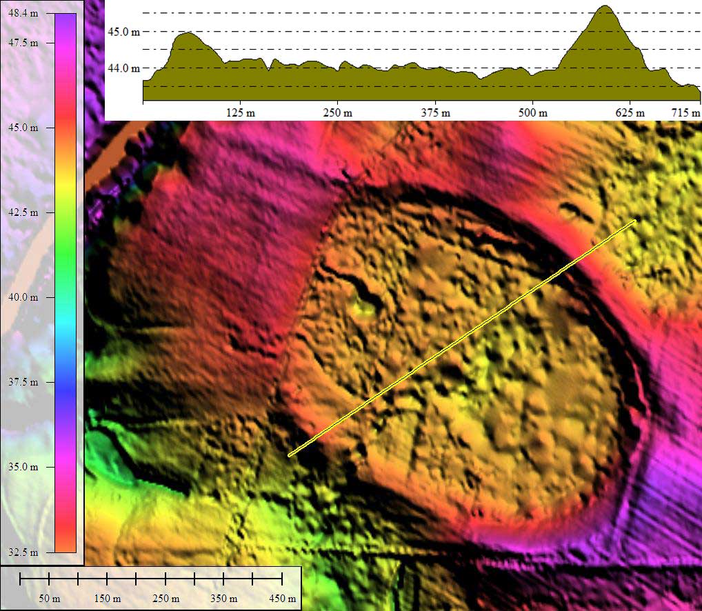
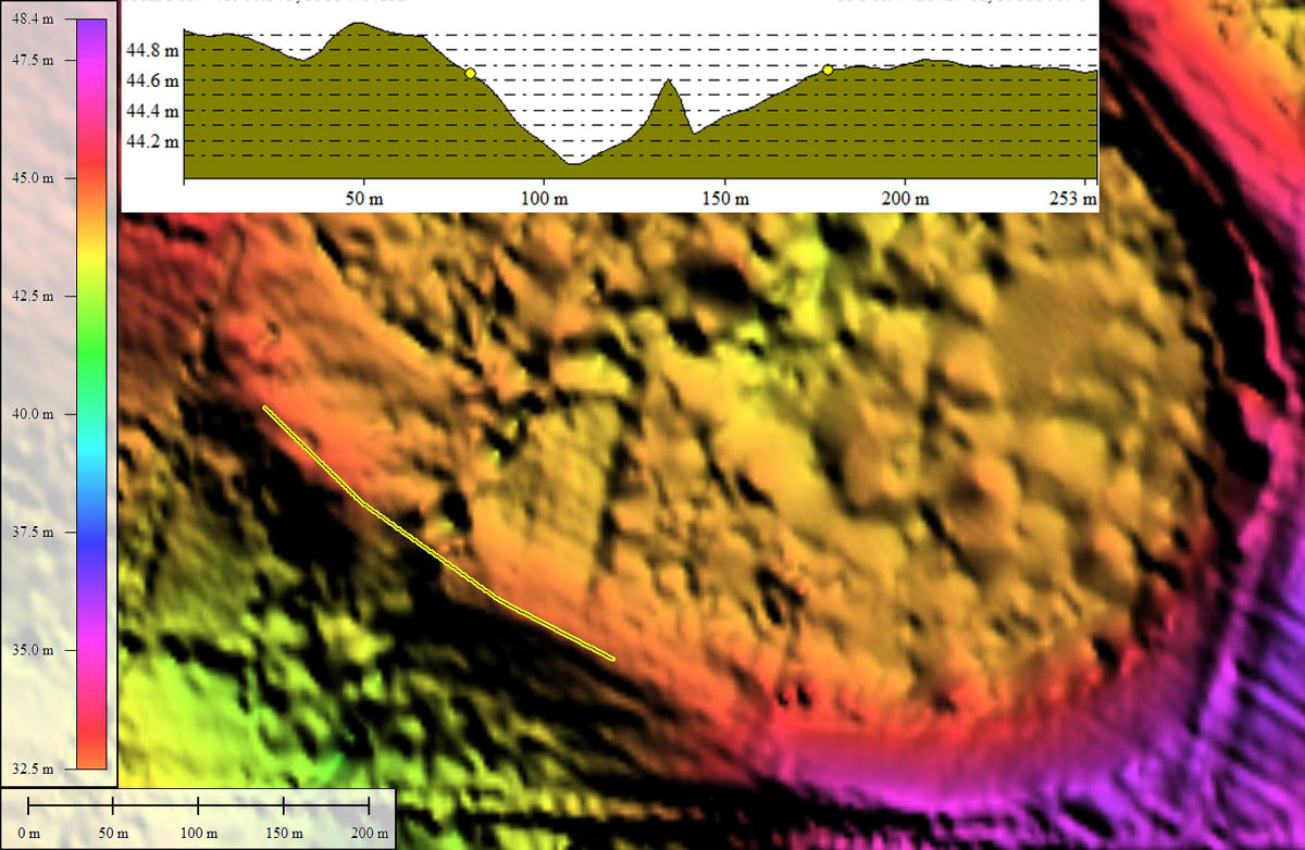
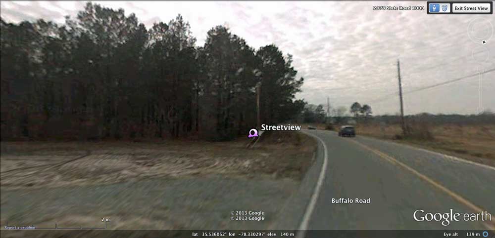
The referenced KMZ file includes placemarks for Streetview Imagery looking south along Buffalo Road as it crosses rim and into Stephensons Bay. The bay floor to west (right) was backfilled for farming, while on the east side the natural bay floor is preserved. Also placemarked is the location of the Elevation profile across deep drainage cut through the southwest rim.
The bay's name, taken after an historical landowner, was applied during previously geological research at the bay. That research verified that the section of the bay west of Buffalo Road had indeed been resurfaced.
A majority of the bay looks to be in a natural state, although when reviewing the Google Earth Historical Imagery, it can be seen that the bays was clear-cut a few times over the last 20 years. Also visible is the construction of a church within the bay floor between 1999 and 2004. In the last 3 years, a drainage basin has been dredged at the southeastern end of the bay, likely to protect the structure from occasional high water levels in the bay. There is a primary drainage channels which traverses the center of the bay from NE to SW, draining out through the rim on the SW side.
An interesting feature of the bay, visible in the LiDAR, is that the bay seems to bridge and truncate a natural 250 meters-wide N-S drainage channel. That may have been an antecedent channel extant prior to the generation of the Carolina bay and the dam-like rim segments which currently block the channel.
The referenced KMZ file includes placemarks for Streetview Imagery looking south along Buffalo Road as it crosses rim and into Stephensons Bay. The bay floor to west (right) was backfilled for farming, while on the east side the natural bay floor is preserved. Also placemarked is the location of the Elevation profile across deep drainage cut through the southwest rim.
- Index #: 142313_1331
- Location: 35.5340090028659,-78.32793419202869
- Major: 0.68 km . . . Minor: 0.49 km
- Eccentricity: 0.689
- Area: 26.45 hectares
- Bearing: 135.48º
- Elevation: 43.85 m
- Archetype: bayCarolina
- Effective Diameter: 580.32 m
Copyright 2018 by Michael Davias