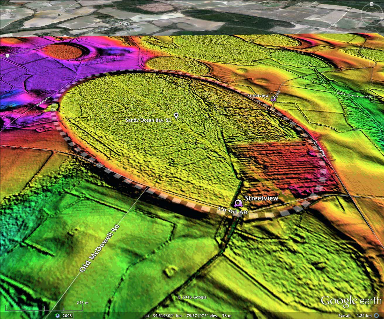
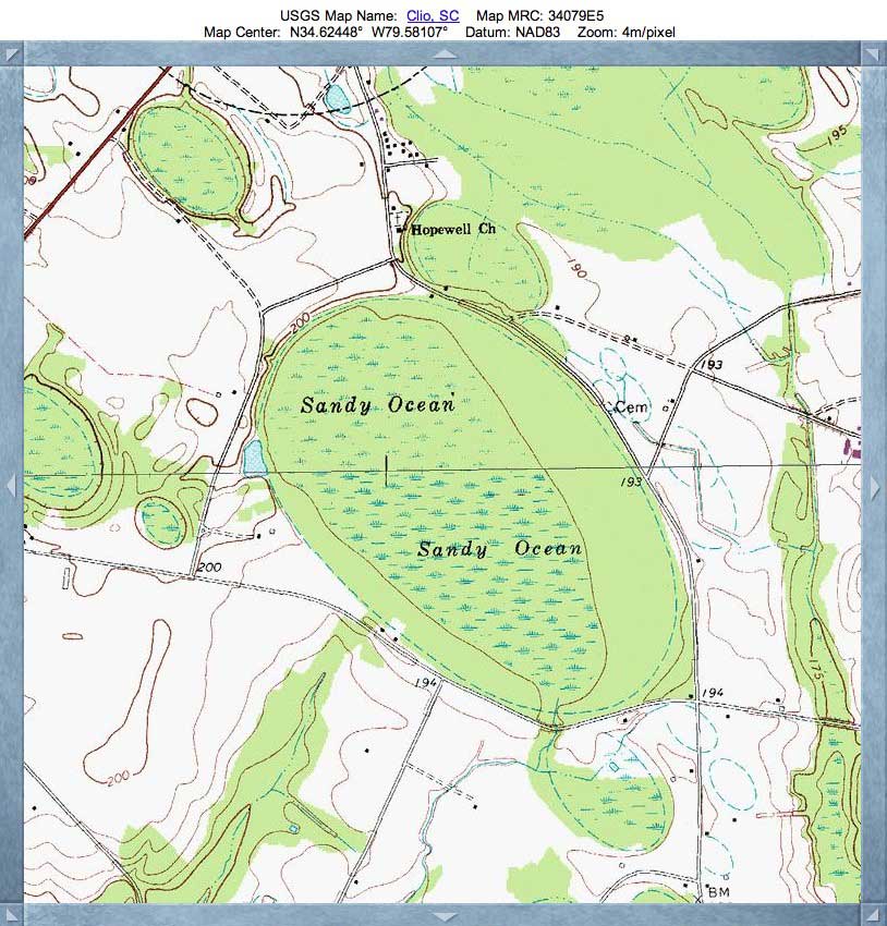
Sandy Ocean Bay, SC
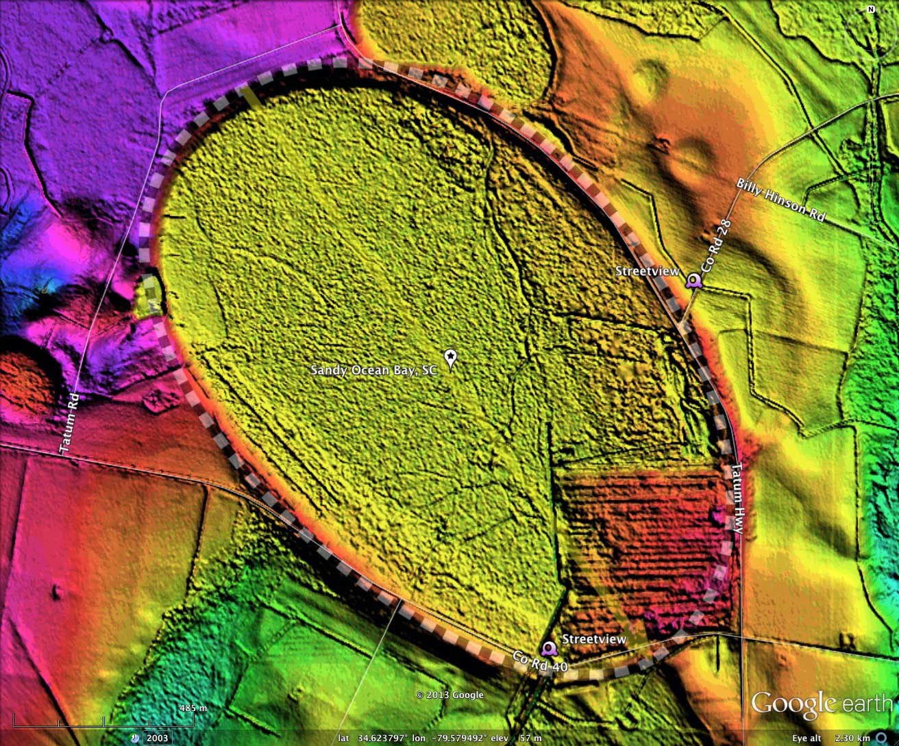
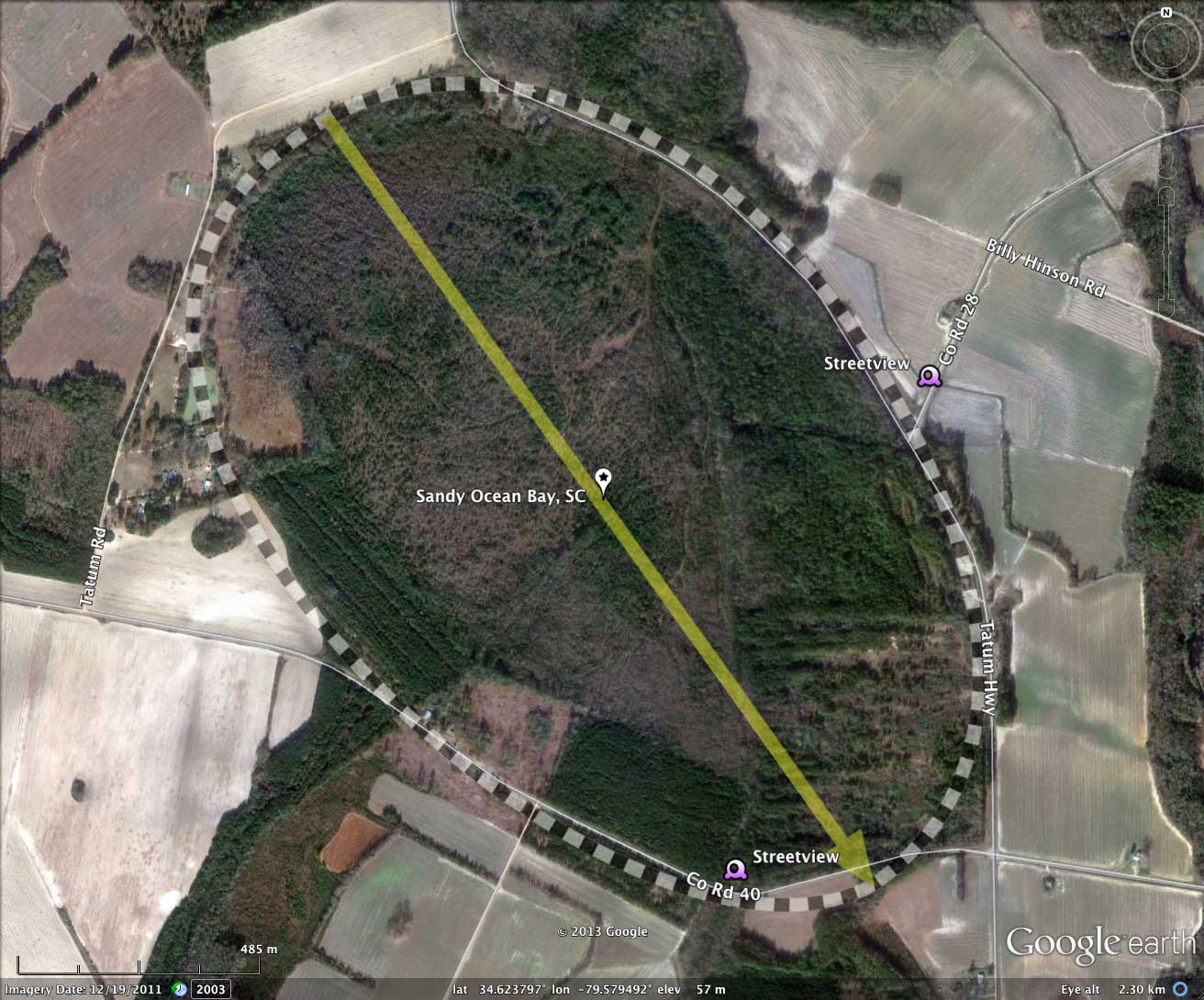
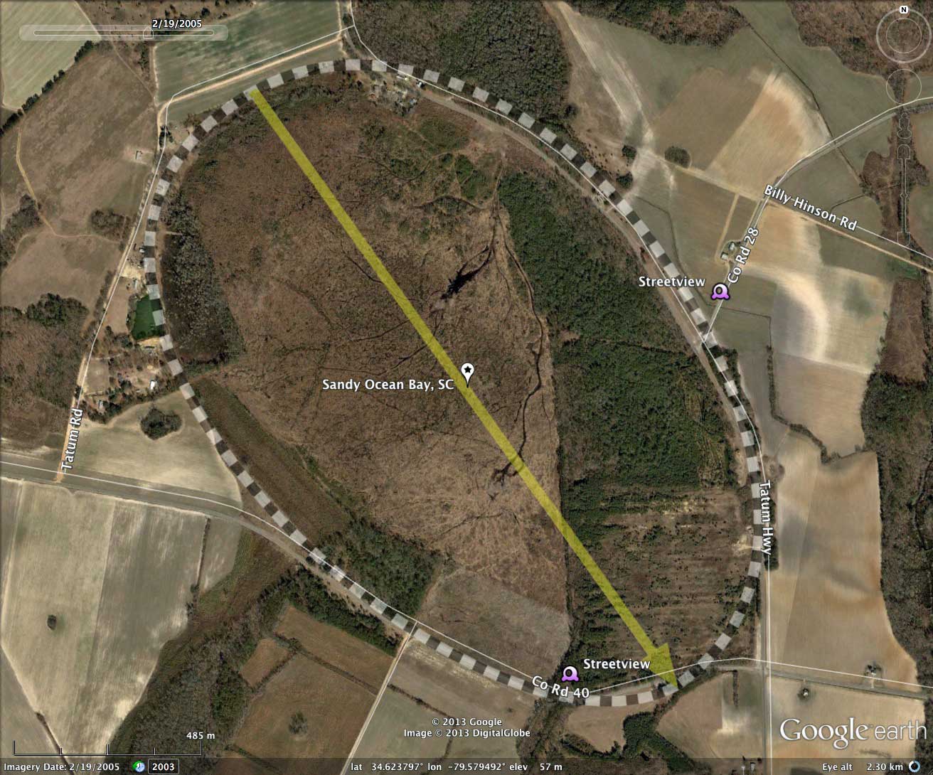
Sandy Ocean Bay is located 9 km east of Bennettesville, SC. Its major axis is 2km - quite a big piece of property. The bay was subjected to a period of ditching and draining to prepare it for farming, but the project was not successful. In the last 10 years, a project has been underway to return it to a more natural state. A doctoral dissertation was presented at NC State by Justin M. Ewing, in entitled Characterization Of Soils In A Drained Carolina Bay Wetland Prior To Restoration.
http://www.openthesis.org/documents/Characterization-soils-in-drained-Carolina-4328.html
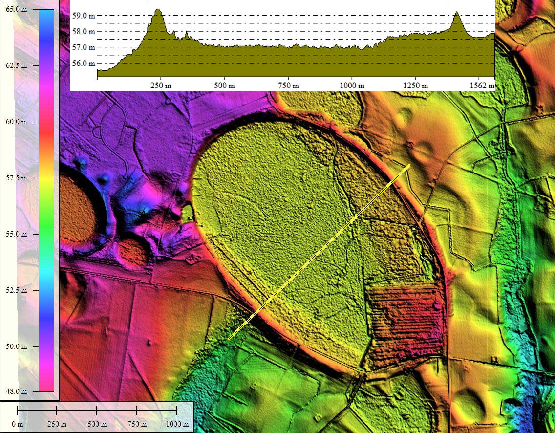
Most enigmatic feature I see attendant to this bay is the over-fit drainage channel which abuts it to the southwest. The juxtaposition suggest to me that the channel evolved to its current width prior to the creation of the bay proper. As with many bays, this presents a bay rim which sits slender and high above an obvious outlet, more like a man-made levee rather than a naturally-generated lake shoreline.
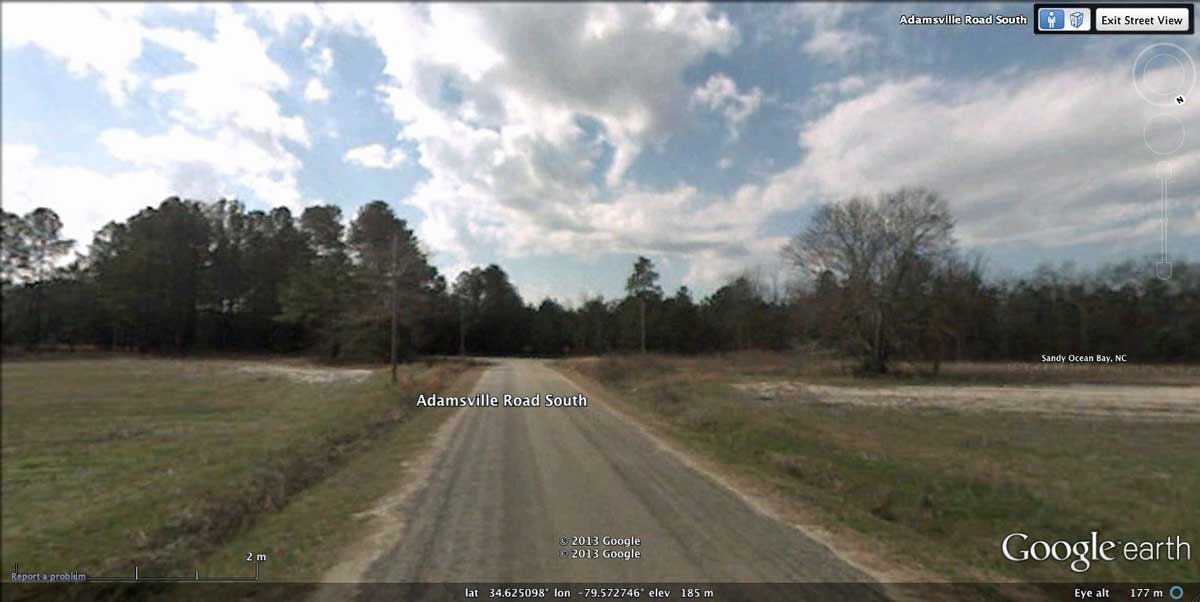
Google Streetview imagery is available across long stretches of County Road 40 and Tatum Highway as they run along the bay rim. You can drop down into Streetview from the camera placemarks on the referenced KMZ file, or directly in your web browser using they link: http://goo.gl/maps/MZsSk which takes you to the northern rim of the bay, where the rim crosses the roadway. As usual, the rims are very subtle, and referencing the KMZ for LiDAR and bay rim overlays can assist you in visualizing the rim details.
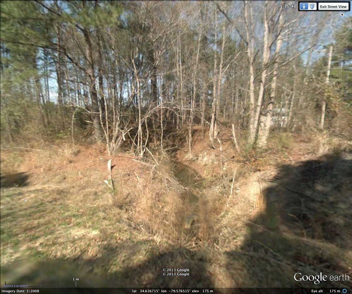
The album and the KMZ reference a Google Streetview of the bay's main drainage ditch crossing through rim of Sandy Ocean Bay along the south side of the bay, taken from County Road 40, as well as one showing County Rd 28 cutting through the white, sandy bay rim as it approaches the bay from the north.
I would like to encourage you to examine the multiple small, yet exquisite bays which set deep into the surrounding landscape. While free-standing rims are seen in the Carolina bays, quite often there is no raised rim, just a "cliff" which drops off into the bay from a higher plateau. Douglas Johnson had noted this dualism in rim structures in his 1942 book.
http://www.openthesis.org/documents/Characterization-soils-in-drained-Carolina-4328.html
Most enigmatic feature I see attendant to this bay is the over-fit drainage channel which abuts it to the southwest. The juxtaposition suggest to me that the channel evolved to its current width prior to the creation of the bay proper. As with many bays, this presents a bay rim which sits slender and high above an obvious outlet, more like a man-made levee rather than a naturally-generated lake shoreline.
Google Streetview imagery is available across long stretches of County Road 40 and Tatum Highway as they run along the bay rim. You can drop down into Streetview from the camera placemarks on the referenced KMZ file, or directly in your web browser using they link: http://goo.gl/maps/MZsSk which takes you to the northern rim of the bay, where the rim crosses the roadway. As usual, the rims are very subtle, and referencing the KMZ for LiDAR and bay rim overlays can assist you in visualizing the rim details.
The album and the KMZ reference a Google Streetview of the bay's main drainage ditch crossing through rim of Sandy Ocean Bay along the south side of the bay, taken from County Road 40, as well as one showing County Rd 28 cutting through the white, sandy bay rim as it approaches the bay from the north.
I would like to encourage you to examine the multiple small, yet exquisite bays which set deep into the surrounding landscape. While free-standing rims are seen in the Carolina bays, quite often there is no raised rim, just a "cliff" which drops off into the bay from a higher plateau. Douglas Johnson had noted this dualism in rim structures in his 1942 book.
- Index #: 138318_4931
- Location: 34.62379716122543,-79.57949252970482
- Major: 1.94 km . . . Minor: 1.26 km
- Eccentricity: 0.76
- Area: 192.12 hectares
- Bearing: 144.59º
- Elevation: 57.1 m
- Archetype: bayCarolina
- Effective Diameter: 1,564.015 m
Copyright 2018 by Michael Davias