Samarcand Bay, NC
Carolina Bays were, at first, considered by geologist to be shoreline features. In fact, there are numerous samples of echeloned oval bays developing in lagoonal settings around the world. As Carolina Bays were identified further and further from the coastline, or on areas of the coastal plain which have not seen indignation over the past 5 million years, other mechanisms for their generation had to be identified.
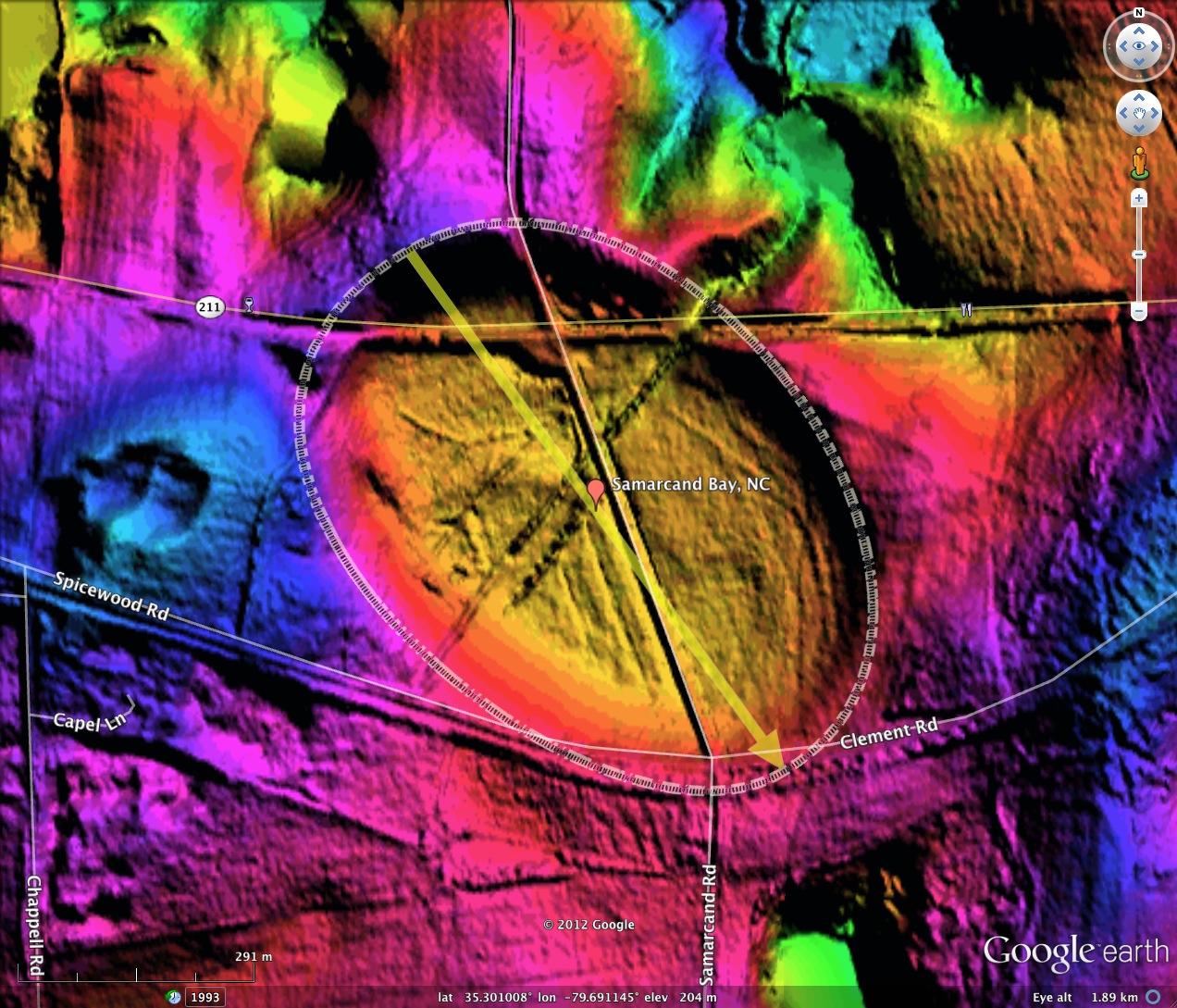
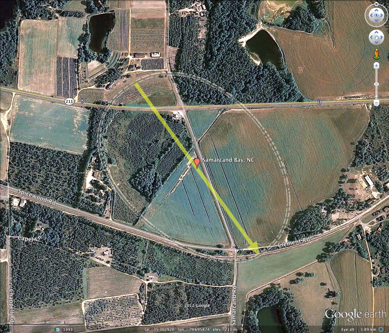
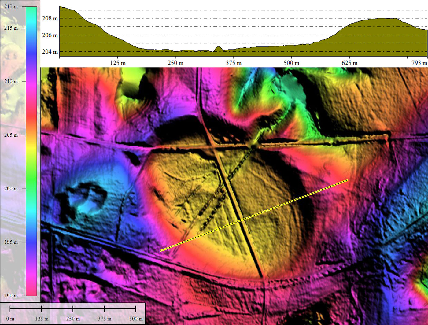
Case in hand: Samarcand Bay, which rests a 200 meters (600 feet) above sea level on an anomalous plateau set in a rugged landscape. The floor of this 3/4 km landform is 4 to 5 meters below the rim, which makes it a bit deeper than others of similar size. This raises a question: "Is this really a Carolina Bay?". A NC Geologist stated to me emphatically that it was not. You be the judge, using the LiDAR as the evidence, along with the attendant orientation (NW/SE) and shape, which is a perfect match with the common bayCarolina Archetype. In the survey, Samarcand bay located miles away from other bays, but is similarly oriented and shaped as other gentle depressions seen 50 kilometers to the south and east.
Samarcand Bay was named by me after a nearby historical location, and the road which passes through the bay. The name might have come from the city of Samarcand, which is the second-largest city in Uzbekistan, and most noted for its central position on the Silk Road between China and the West. Locally, the name was applied to the State Home and Industrial School for Girls, which_was a humane correctional institution for young women established near Eagle Springs by the North Carolina state legislature in 1918_.
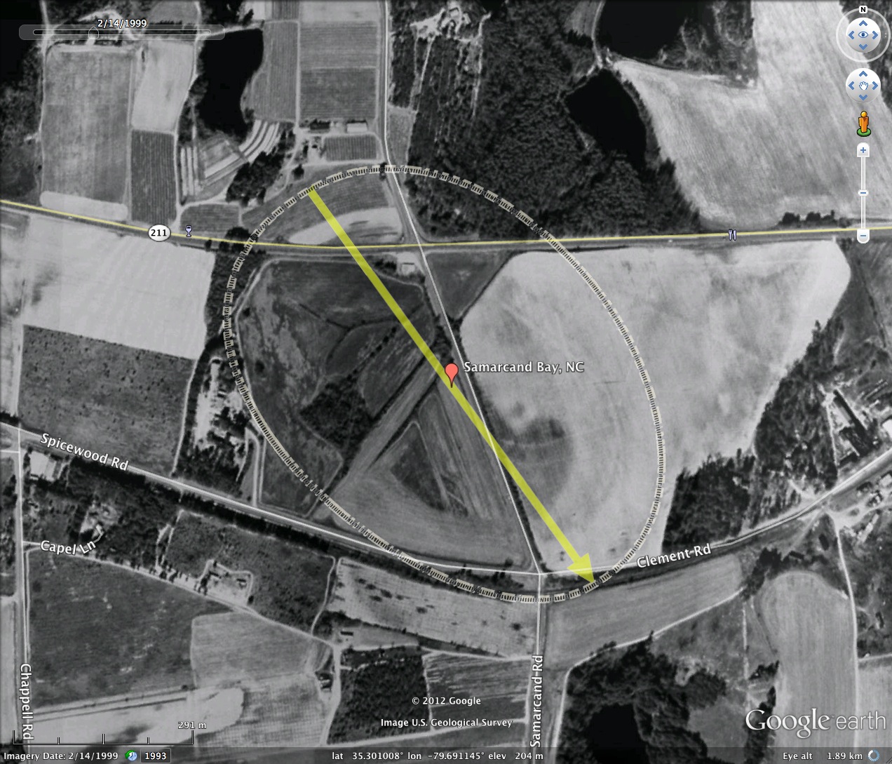
A deep channel was cut across the northeastern rim for drainage, at the rims narrowest point. A network of drainage channels spreads out across the bay floor. The bay has likely been dry for a long time, and is mostly open farmland. Judging by some of the historical Google Earth imagery, the western part of the bay gets quite damp at times.
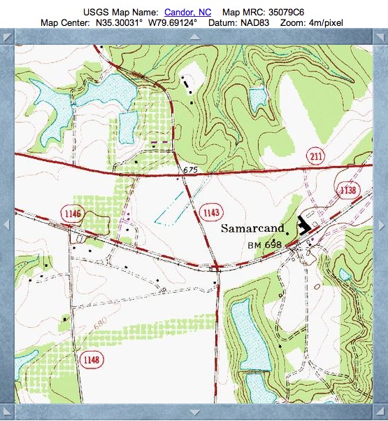
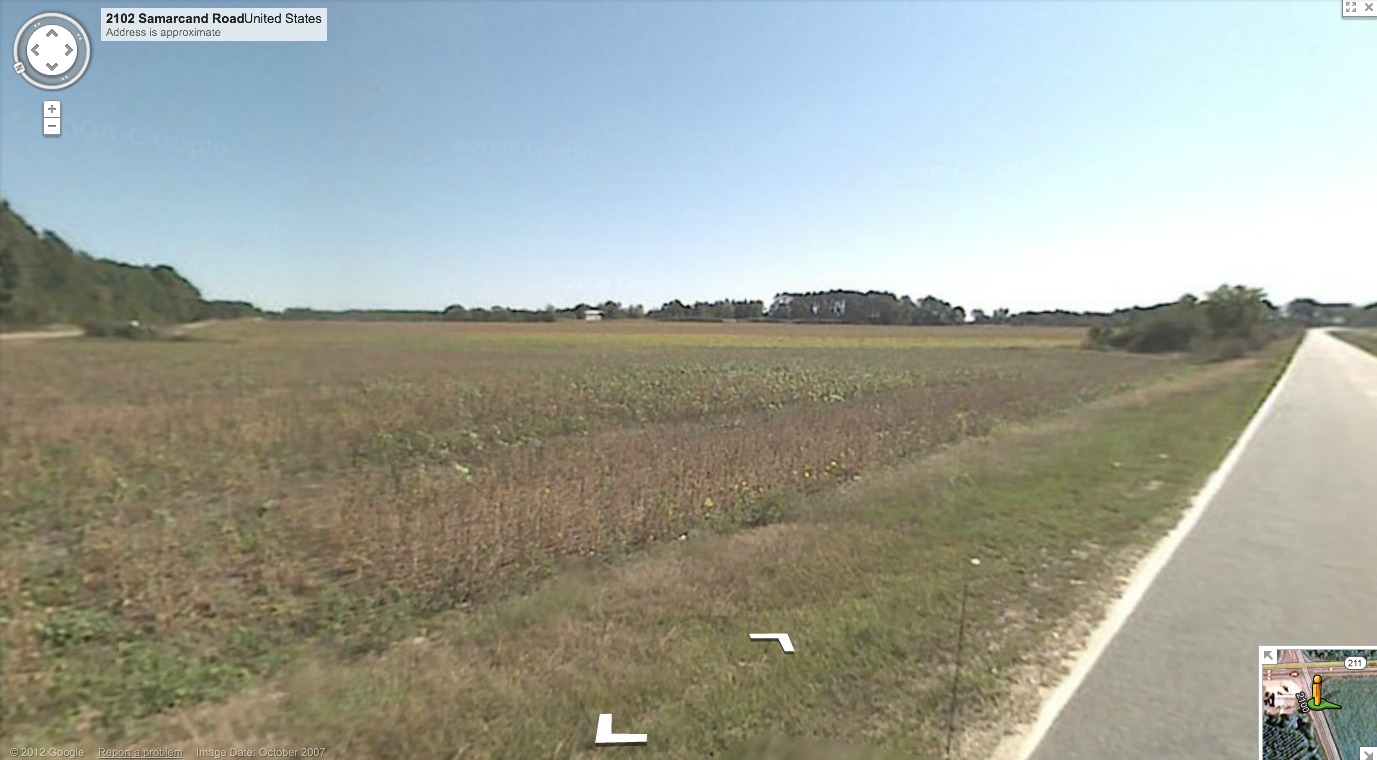
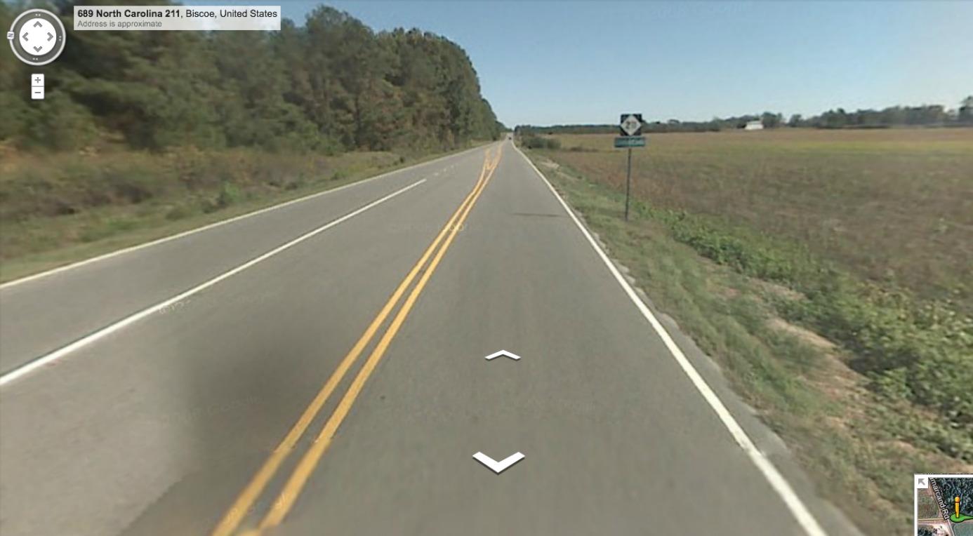
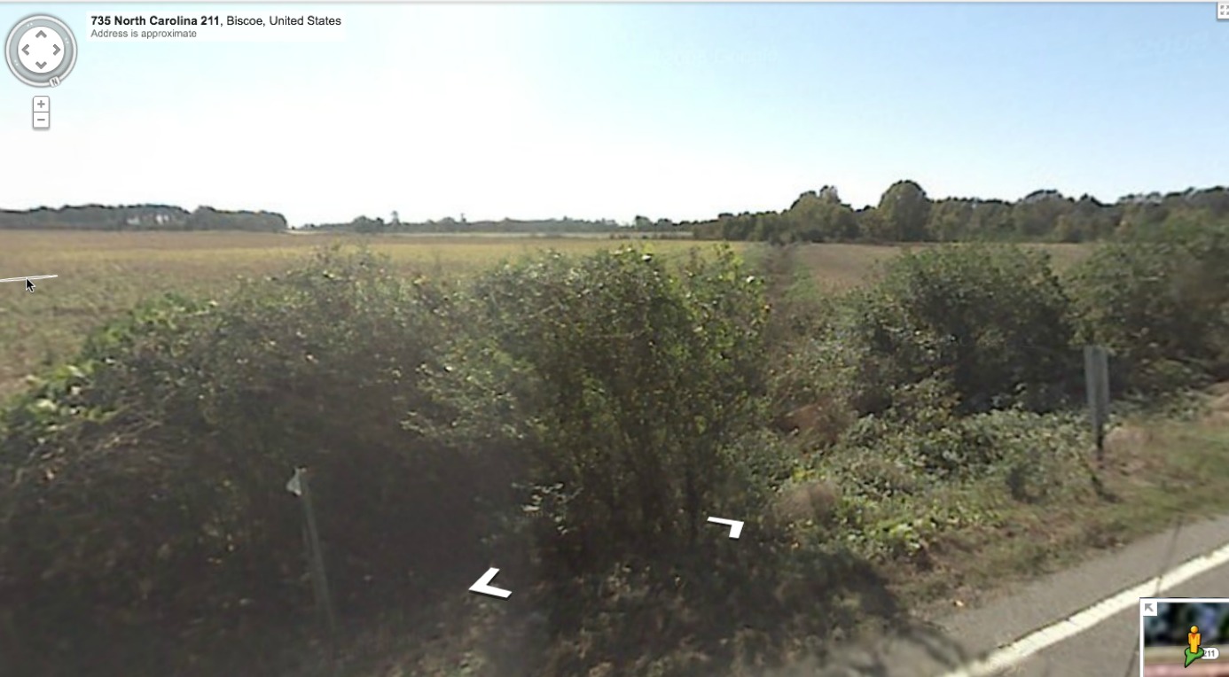
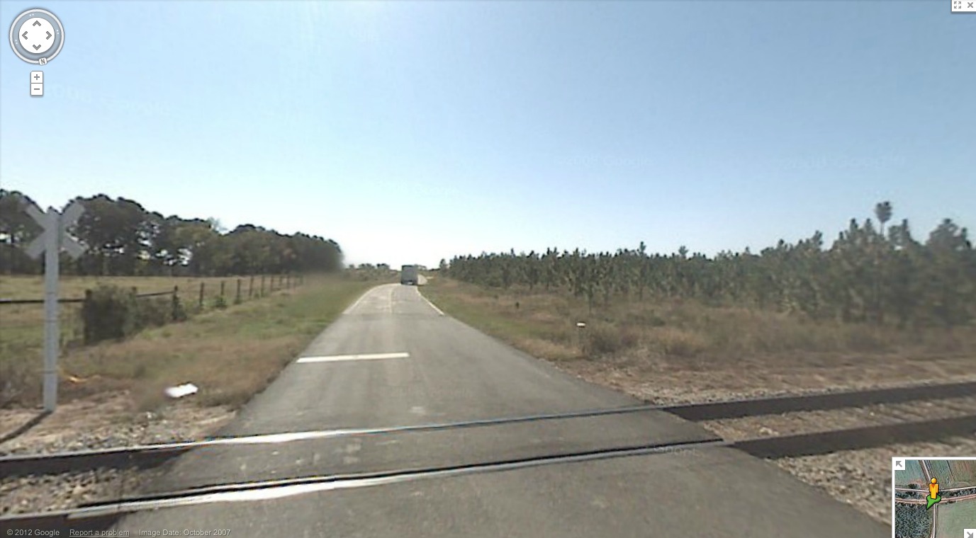
Google's Streetview photography is available along the two roadways which cross within the bay floor. Several images are included in the attached album. #1 looks from the intersection of NC 211 and Samarcand Rd, up towards the norther rim, seen running across the horizon. View #2 is taken from the same spot, but looking east along NC 211 towards the rim in the distance, where a vehicle is beginning to go up a slope. Along that stretch, Streetview #3 looks out southwest across the bay floor along the drainage channel. View #4 is taken from the RR crossing on the southeastern tip, and clearly shows a truck heading down the slight incline into the bay. As usual, these are very subtle features and hard to visualize even when you see them with your own eyes. Here is a link to the Streetview at the intersection, so you can take a look around interactively in your browser: http://goo.gl/maps/qE6OJ
Case in hand: Samarcand Bay, which rests a 200 meters (600 feet) above sea level on an anomalous plateau set in a rugged landscape. The floor of this 3/4 km landform is 4 to 5 meters below the rim, which makes it a bit deeper than others of similar size. This raises a question: "Is this really a Carolina Bay?". A NC Geologist stated to me emphatically that it was not. You be the judge, using the LiDAR as the evidence, along with the attendant orientation (NW/SE) and shape, which is a perfect match with the common bayCarolina Archetype. In the survey, Samarcand bay located miles away from other bays, but is similarly oriented and shaped as other gentle depressions seen 50 kilometers to the south and east.
Samarcand Bay was named by me after a nearby historical location, and the road which passes through the bay. The name might have come from the city of Samarcand, which is the second-largest city in Uzbekistan, and most noted for its central position on the Silk Road between China and the West. Locally, the name was applied to the State Home and Industrial School for Girls, which_was a humane correctional institution for young women established near Eagle Springs by the North Carolina state legislature in 1918_.
A deep channel was cut across the northeastern rim for drainage, at the rims narrowest point. A network of drainage channels spreads out across the bay floor. The bay has likely been dry for a long time, and is mostly open farmland. Judging by some of the historical Google Earth imagery, the western part of the bay gets quite damp at times.
Google's Streetview photography is available along the two roadways which cross within the bay floor. Several images are included in the attached album. #1 looks from the intersection of NC 211 and Samarcand Rd, up towards the norther rim, seen running across the horizon. View #2 is taken from the same spot, but looking east along NC 211 towards the rim in the distance, where a vehicle is beginning to go up a slope. Along that stretch, Streetview #3 looks out southwest across the bay floor along the drainage channel. View #4 is taken from the RR crossing on the southeastern tip, and clearly shows a truck heading down the slight incline into the bay. As usual, these are very subtle features and hard to visualize even when you see them with your own eyes. Here is a link to the Streetview at the intersection, so you can take a look around interactively in your browser: http://goo.gl/maps/qE6OJ
- Index #: 141318_2076
- Location: 35.30092355952175,-79.6910555892951
- Major: 0.8 km . . . Minor: 0.58 km
- Eccentricity: 0.688
- Area: 36.89 hectares
- Bearing: 144.16º
- Elevation: 204.26 m
- Archetype: bayCarolina
- Effective Diameter: 685.344 m
Copyright 2018 by Michael Davias