Tunstall Bay, McIntosh Bay Complex, NC
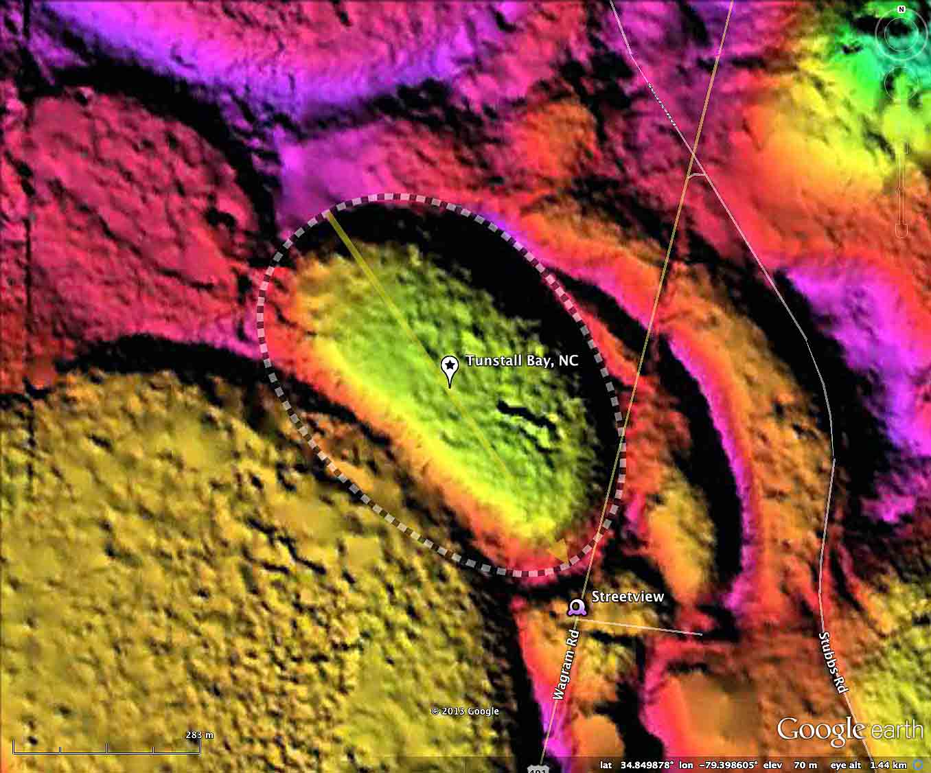
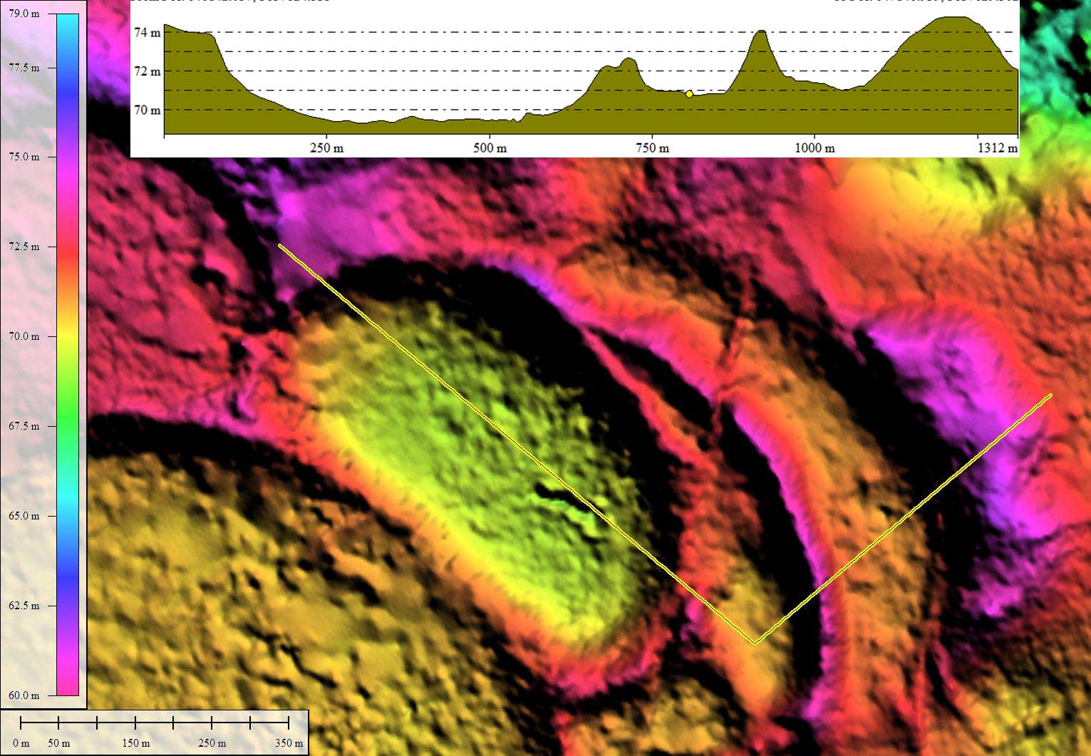
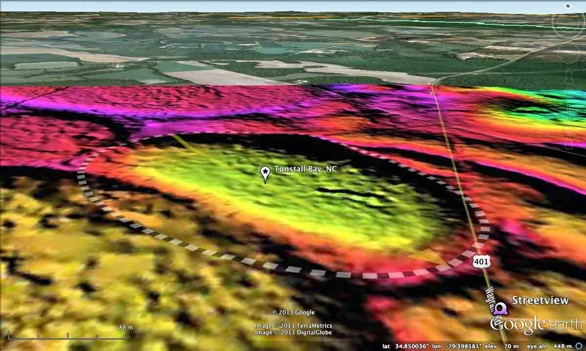
The LiDAR shows that Tunstall Bay's _bay_ archetype shape has been truncated to the southwest by the onlap of Big Cypress Meadow's rim. In many locations, when Carolina bay landforms overlay, there is no intervening rim wall. Continuing to the east, the crisp repeat of the overlapping dynamic is seen as Tunstall's eastern rim truncates another unnamed bay's western rim, which in turn truncates yet another. The four surviving eastern rims are crisply defined with the _bay_ archetype shape, and are symmetrically stacked, like bow waves on a boat. This juxtaposition may be a clue to the energies involved with bay creation.
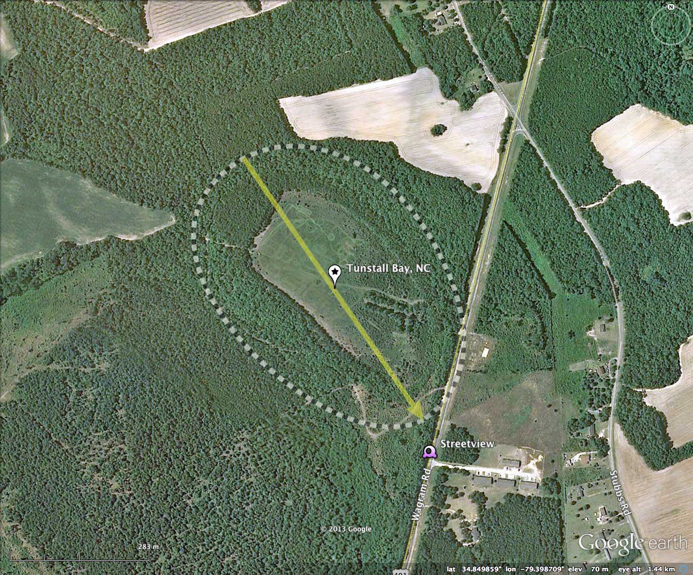
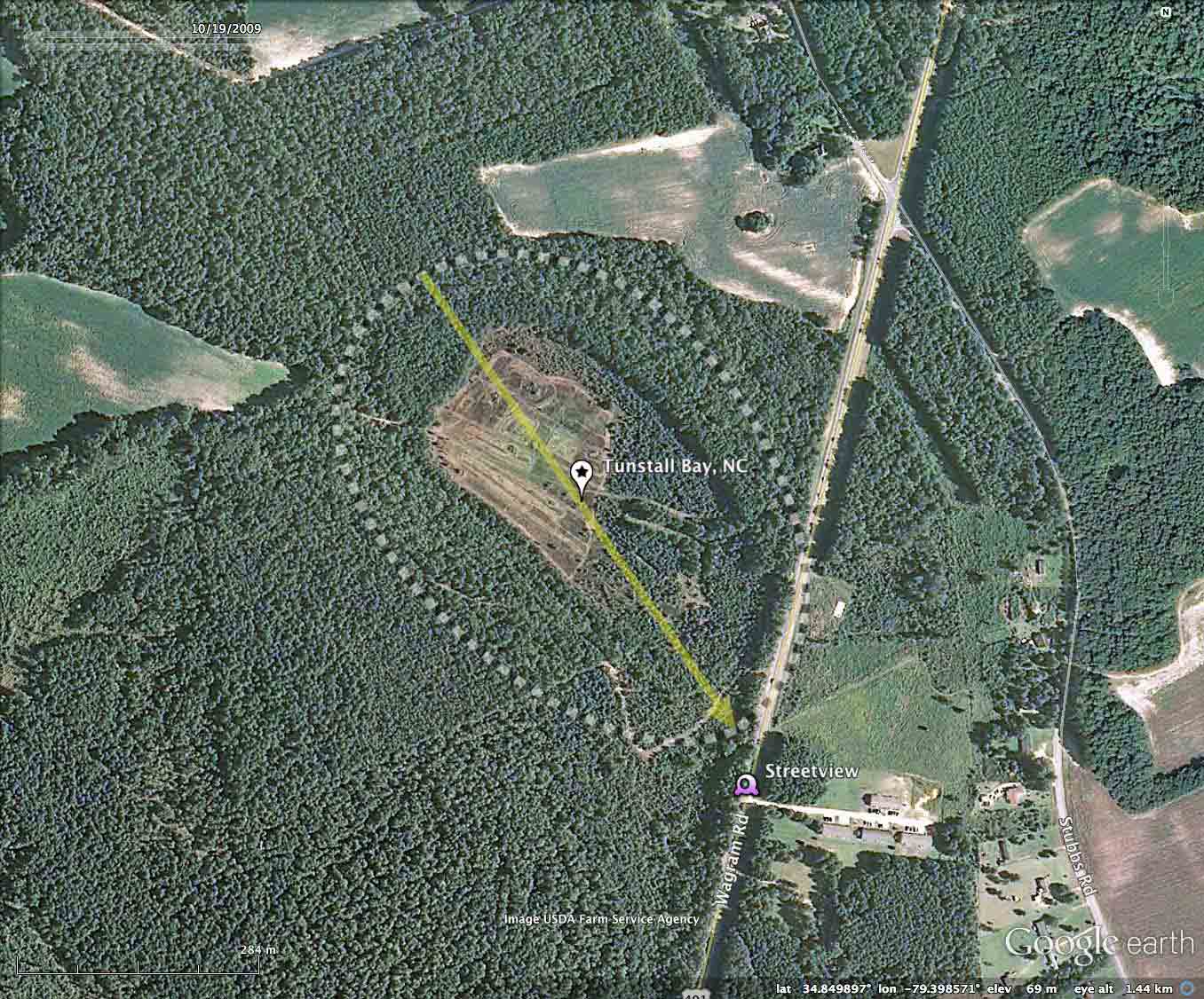
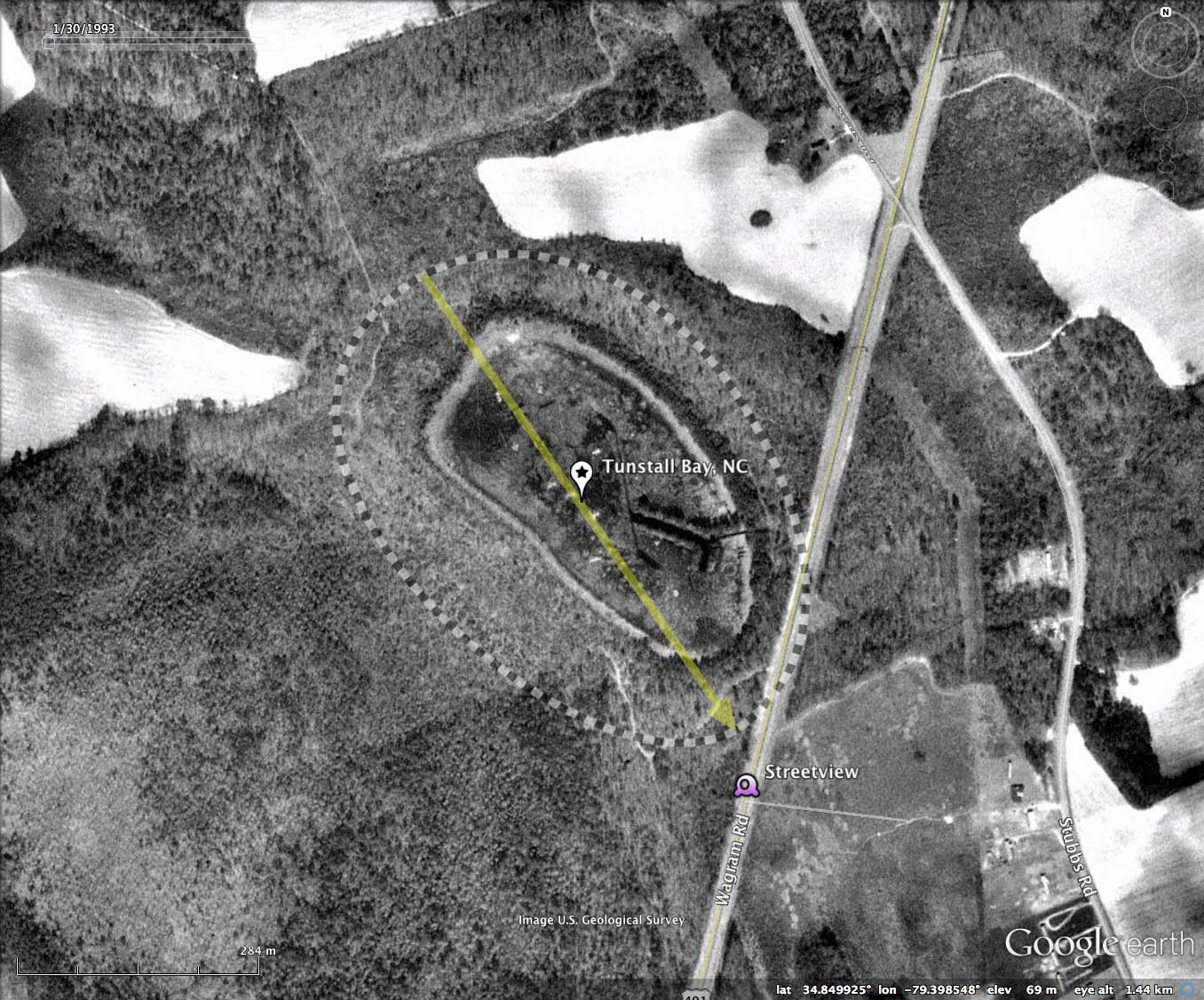
Tunstall has been recognized as an open water "pond", however, the southeastern drought of the last few years has left it quite dry. This can be seen in the Google Earth historical satellite imagery. Extensive tracks of recreational vehicles can be seen looping around its interior, whereas back in 1993 it was water-covered. The bay has not been ditched extensively, but a former owner did dig a channel in the floor of the bay that is visible in the LiDAR, and surrounded by different vegetation in the satellite images, but does not broach the perimeter rim. It has been suggested this was done by a former owner to provide a refuge for fish when the water levels were down. That activity may well have penetrated the bays's clay floor aquitard and accelerated the water loss.
Harry E. LeGrand, Jr. of the North Carolina Natural Heritage Program, executed _An Inventory Of The Significant Natural Areas Of Scotland County, North Carolina_. Among the areas discussed was the McIntosh Complex, and description was offered for Tunstall Bay:
Night is the best time to see amphibians, so one spring evening around 9 P.M. Fauth and I set off in hip boots to Tunstall Bay, an open, grassy wetland near the hamlet of Wagram, North Carolina. As we waded on a moonless, overcast night into a thigh~high open pool, he unraveled the threads of a polyphonic roar around us: southern cricket frogs (gick, gick, gick), southern leopard frogs (chuckle, chuckle), little grass frogs (a high trill). Fauth assured me there were no alligators. “Well, probably not, anyway.” We shined our headlamps straight through crystal water to a pine-needle-lined bottom. Flittering in the water inches from our faces were typical bay dwellers, including hundreds of ornate chorus~frog tadpoles with iridescent bellies and high tail fins like '50s Chevrolets. Young Mabee’s salamanders with extravagant reddish gills undulated powerfully.
The amphibians were feeding on a mind-boggling menagerie of aquatic invertebrates, and vice versa. Hydrophilic beetles and larval caddis flies encased in decayed plant stems zipped through the water. We saw quivering clouds of zooplankton shaped like shrimps and fleas. Fauth carefully avoided picking up a single, long, black-and-tan larva of a dytiscid beetle that skimmed the surface; it feeds on small amphibians, and its vicious pincers can inflict a nasty bite on people. Resting on shoreline twigs we saw sizable Dollmedes spiders, which dive into the water for frogs, then drag them up onto grass blades to devour them.
The Carolina Bay Survey has identified and measured 600 bays in _Octant 139317_. Their location and metrics can be referenced through a Fusion Table spatial visualization.
- Index #: 139317_3959
- Location: 34.849594666994044,-79.39862711788916
- Major: 0.65 km . . . Minor: 0.45 km
- Eccentricity: 0.724
- Area: 23.35 hectares
- Bearing: 145.59º
- Elevation: 69.47 m
- Archetype: bay
- Effective Diameter: 545.253 m