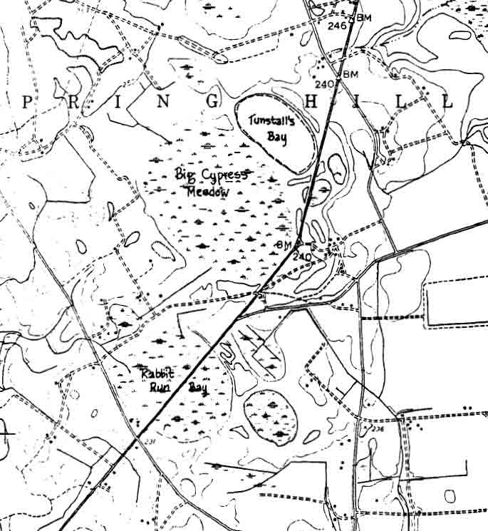
Big Cypress Meadow, McIntosh Bay Complex, NC
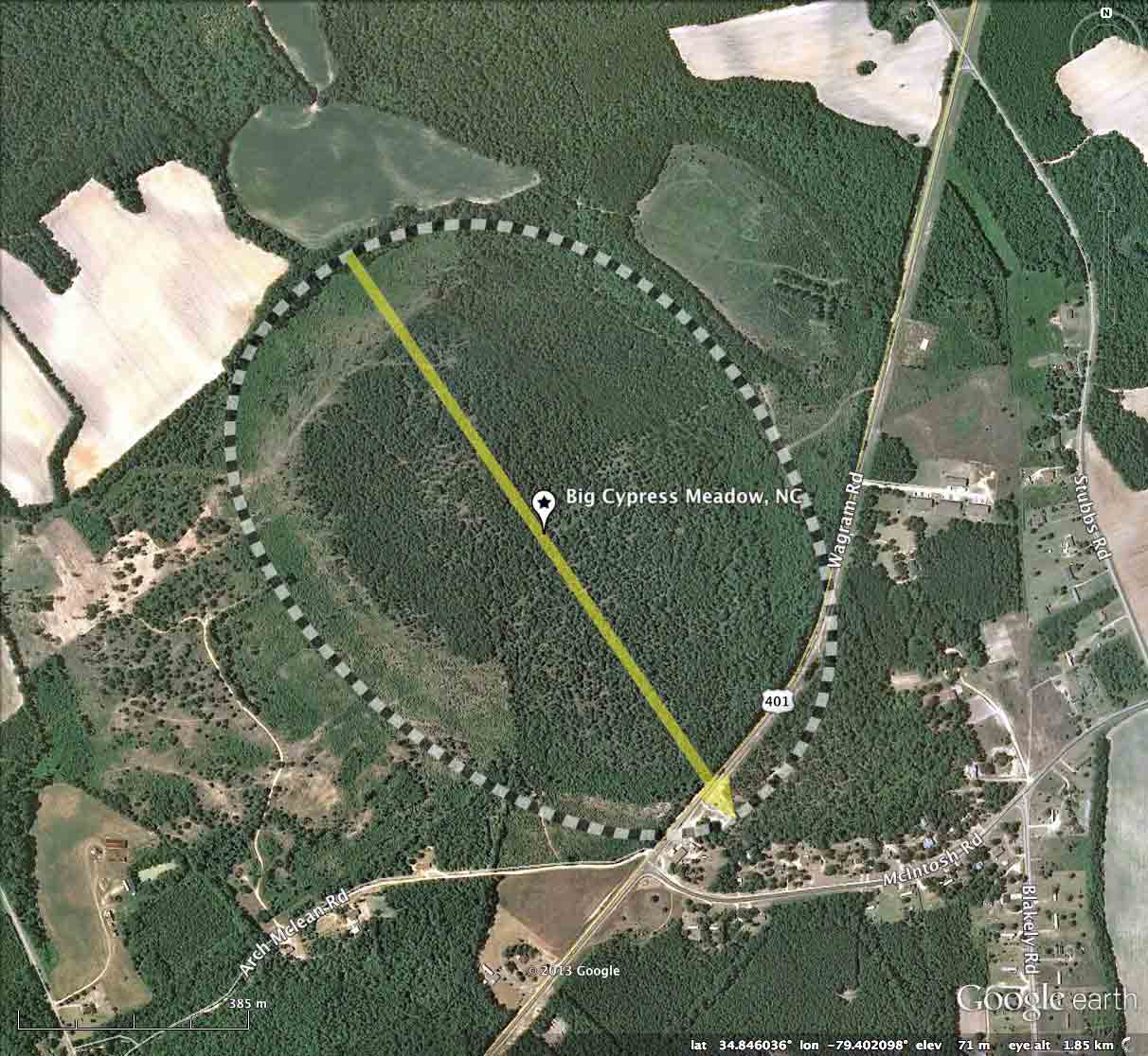
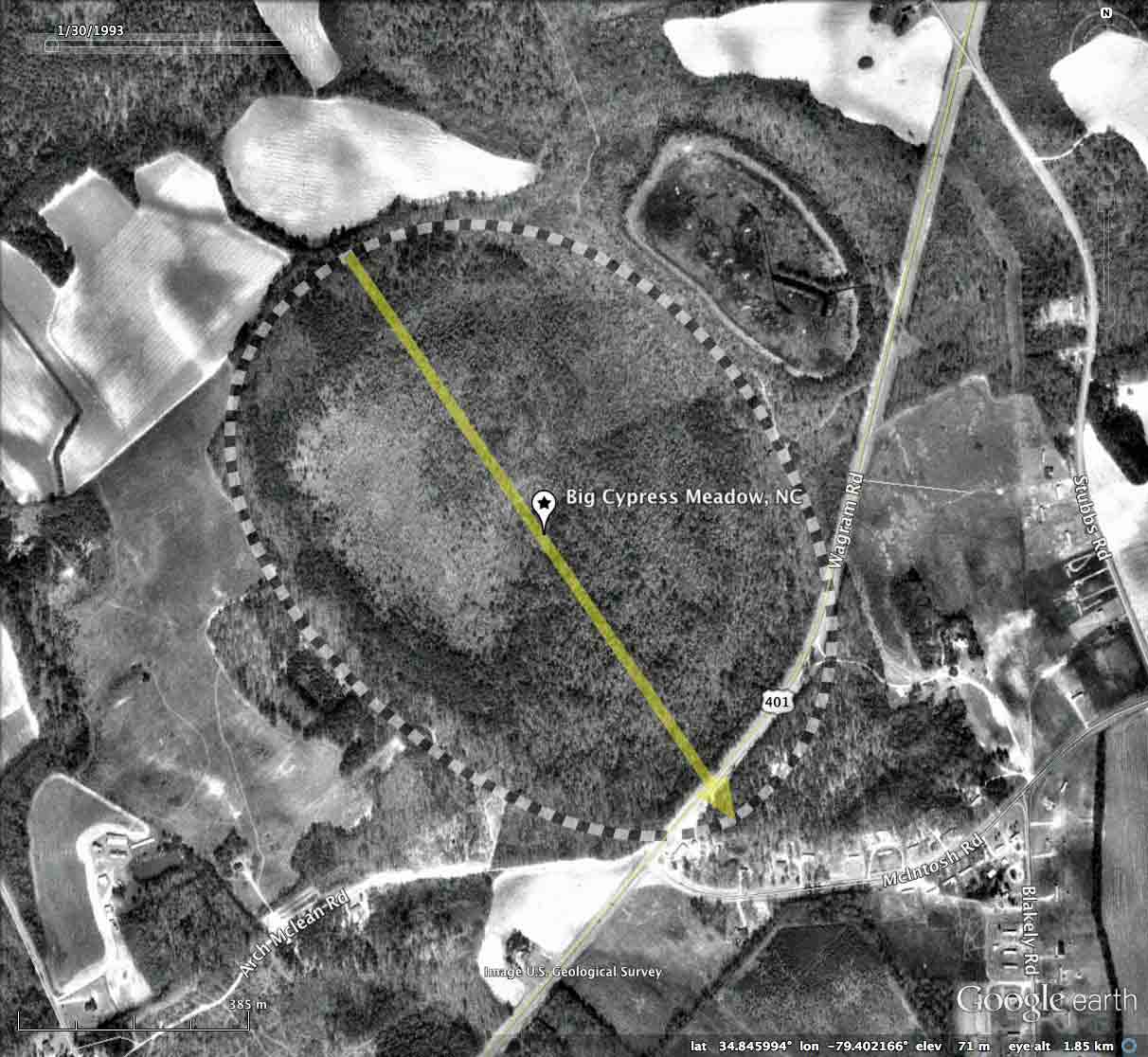
Big Cypress Meadow is the largest of the four bays collectively know in the research community as the McIntosh Bay Complex. Located ~10 kilometers north east of Laurinburg, NC, distributed along US 401 near the intersection with McIntosh Road.
The remaining three bays, Tunstall, Rabbit Run and Backside will be presented in CBoD posts over the next few days.
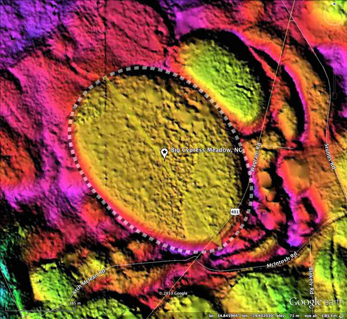
Big Cypress Meadow fits the common bayCarolina archetype shapes; all members of the Complex can be fitted with this shape and have identical alignments (145.59º).
Harry E. LeGrand, Jr. of the North Carolina Natural Heritage Program, executed An Inventory Of The Significant Natural Areas Of Scotland County, North Carolina. Among the areas discussed was the McIntosh Complex, and description was offered for Big Cypress Meadow:
The remaining three bays, Tunstall, Rabbit Run and Backside will be presented in CBoD posts over the next few days.
Big Cypress Meadow fits the common bayCarolina archetype shapes; all members of the Complex can be fitted with this shape and have identical alignments (145.59º).
Harry E. LeGrand, Jr. of the North Carolina Natural Heritage Program, executed An Inventory Of The Significant Natural Areas Of Scotland County, North Carolina. Among the areas discussed was the McIntosh Complex, and description was offered for Big Cypress Meadow:
This is one of the best examples of a Cypress Savanna (Typic variant) in the state. Water is present in the bay for most of the year… Pond-cypress (Taxodium ascendens) dominates the canopy, though some loblolly pine (Pinus taeda) is present. The small tree/shrub layers are poorly represented, so the bay has the aspect of scattered trees over a dense and diverse herb layer, of much diversity. A wide variety of grasses and sedges are present. Of most significance is the once fairly large population of Canby’s dropwort (Oxypolis canbyi), which is restricted to only a handful of Carolina bays or other similar depressions in its range; this is the only known site for it in North Carolina. However, it has seemingly vanished in the past year or two, probably owing to lowered water levels (drought and other factors). …this bay is a very important breeding site for salamanders and frogs.
Harry E. LeGrand, Jr.
I have assembled a PDF with excerpts from LeGrand's paper, along with an excerpt from Timothy Nifong's review The "Clay Subsoil" Carolina Bays of North Carolina. NiFong's map, annotated with applied bay names, is included in the album here. The PDF can be retrieved HERE.
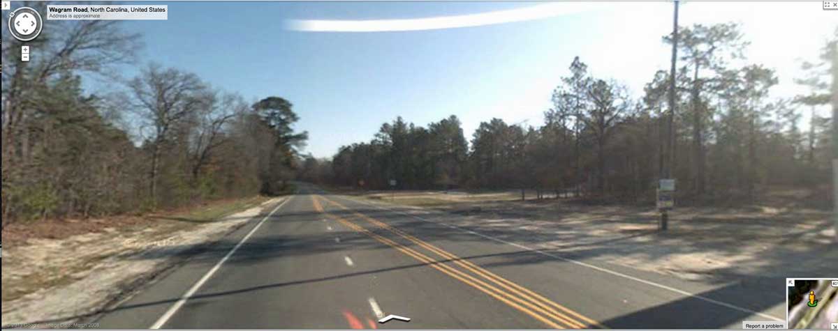
Google Streetview traveling northbound on US 401 as it passes across the rim and down into Big Cypress Meadow. In a photo included in the album here and placemarked in the referenced KMZ file, the roadway passes just inside the rim for a short distance, and exits back out. Note the subtle dip down and back up in the distance, and the rise to the right, where the peak of the rim is under the trees. Browse along US 401 with this LINK.
The Carolina Bay Survey has identified and measured 600 bays in Octant 139317. Their location and metrics can be referenced through a Fusion Table spatial visualization.
- Index #: 139317_3860
- Location: 34.84560806502463,-79.40211172335103
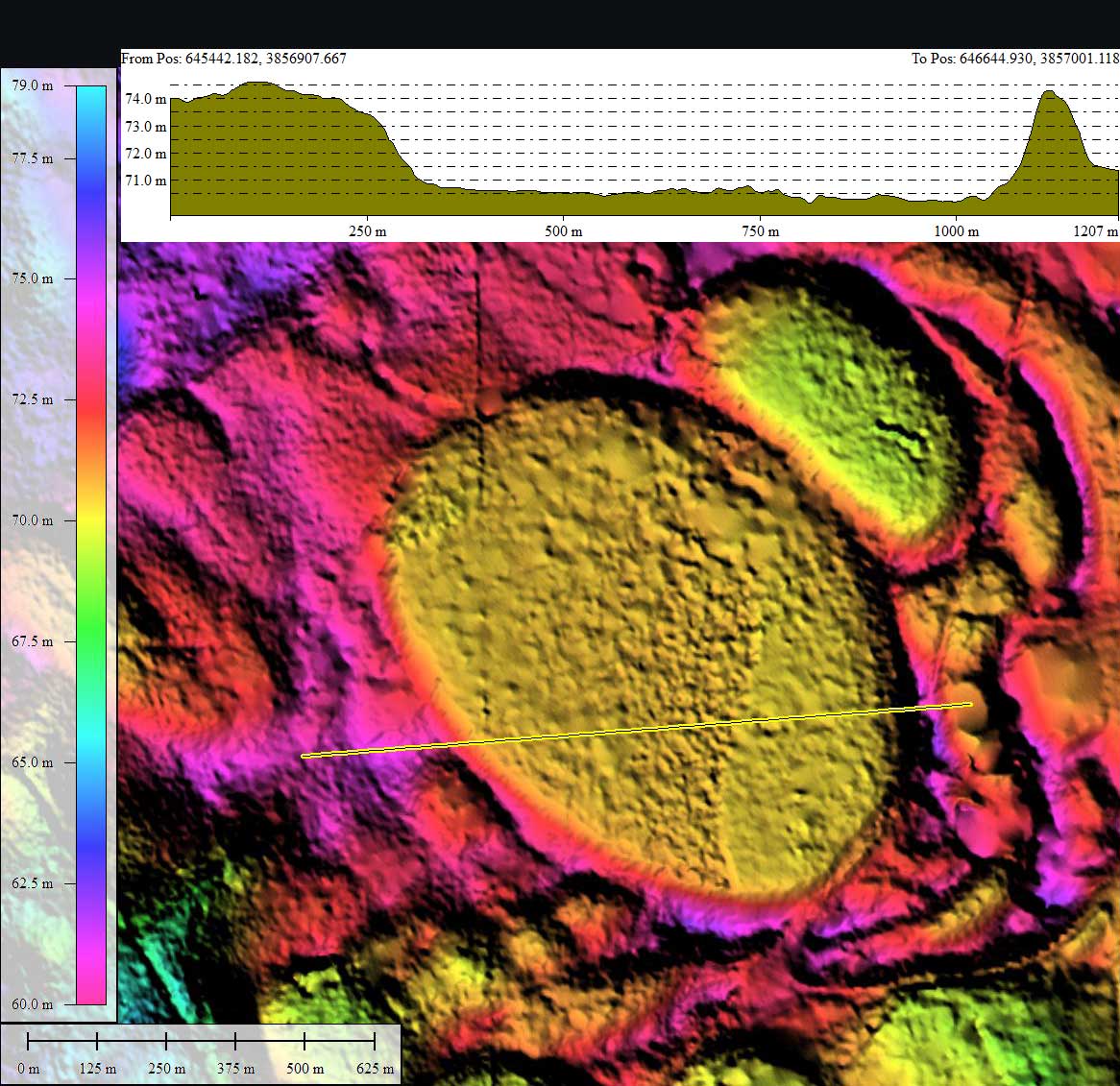
- Major: 1.13 km . . . Minor: 0.83 km
- Eccentricity: 0.677
- Area: 74.89 hectares
- Bearing: 145.59º
- Elevation: 70.74 m
- Archetype: bay
- Effective Diameter: 976.487 m
Copyright 2018 by Michael Davias